Tehama, California

Last updated

City of Tehama
Molino Lodge.jpg
Tehama County Museum
Tehama County California Incorporated and Unincorporated areas Tehama Highlighted.svg
Location in Tehama County and the state of California
Usa edcp relief location map.png
Red pog.svg
City of Tehama
Location in the United States
Coordinates: 40°1′28″N122°7′26″W / 40.02444°N 122.12389°W / 40.02444; -122.12389
Country Flag of the United States.svg  United States
State Flag of California.svg  California
County Tehama
Incorporated July 5, 1906 [1]
Area
[2]
  Total0.79 sq mi (2.06 km2)
  Land0.79 sq mi (2.06 km2)
  Water0.00 sq mi (0.00 km2)  0%
Elevation
210 ft (64 m)
Population
 (2020) [3]
  Total435
  Density469.77/sq mi (181.31/km2)
Time zone UTC-8 (Pacific (PST))
  Summer (DST) UTC-7 (PDT)
ZIP code
96090
Area code 530
FIPS code 06-78106
GNIS feature ID 1659964
Website cityoftehama.us

Tehama (Wintun for "high water") is a city in Tehama County, California, United States. The population was 418 at the 2010 census, down from 432 at the 2000 census.

Contents

Etymology

Tehama is most commonly believed to be derived from the Wintun word for "high water", though there are others definitions that have been proposed such as "low land", "salmon", "mother nature" or "shallow" any of which would be an accurate description of a location where the river is normally shallow enough to ford, where fishermen are a common sight during the salmon run, and winter floods are a regular occurrence.

History

A Nomlaki village of Wintun people once stood on the site of modern-day Tehama on the western bank of the Sacramento River.

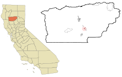
Tehama (pronounced Tuh-HAY-muh) was founded by Robert Hasty Thomes, who arrived in the area that is now Tehama County in the company of Albert G. Toomes, William Chard, and Job Francis Dye. The four men travelled northward from San Francisco, and were each given land grants from the government of Mexico in 1844, with Thomes' portion being Rancho Saucos.

Tehama was one of the earliest California settlements north of Sacramento. Thomes mapped out the city in 1850, with First through Fifth Streets running north–south, and B through I Streets running east–west. First Street no longer exists; it was eroded away by the river. It was the last stop for the riverboats for a few years, and the town thrived on the riverboat traffic. When the boats started going farther up the river, Red Bluff became the center of trade. When Tehama County was formed in 1856, Tehama was established as the County Seat. However, the seat was moved to Red Bluff, by county-wide election, the very next year, although various local stories have circulated about how Red Bluff "stole" its county seat status from Tehama.

Tehama had a reputation of being somewhat more liberal and freewheeling than the rest of the county, being the last town to go "dry" before Prohibition, and a center for bootleggers and gamblers.

Tehama's population peaked in the 1890s, at about 2000 residents, including a sizable Chinese quarter. The city was incorporated in 1906 when plans were being made for an electric railway through the Sacramento Valley, however the railway was never built. A disastrous fire in 1908 combined with the decline of the riverboat traffic, caused the city to gradually lose prominence and population.

Tehama is generally the first area in the county to flood during the rainy season, although flooding is now controlled by releases from Shasta Dam. This gives Tehama a distinctive appearance, since by city ordinance, houses must be raised above flood level, so most homes have high foundations and tall stairways to the front door.

Tehama is home to two parks: Habert Park on C Street, and Belbeck Park, which contains an old brick schoolhouse, now used for the Head Start program. The Tehama County Museum, [4] housed in what was once the Masonic Hall, is located at the corner of C and Third Street.

Geography

Tehama is located at 40°1′28″N122°7′26″W / 40.02444°N 122.12389°W / 40.02444; -122.12389 (40.024337, -122.123783). [5]

According to the United States Census Bureau, the city has a total area of 0.8 square miles (2.1 km2), all of it land.

Demographics

Historical population
CensusPop.Note
1880 328
1910 221
1920 196−11.3%
1930 190−3.1%
1940 175−7.9%
1950 31479.4%
1960 261−16.9%
1970 31721.5%
1980 36515.1%
1990 4019.9%
2000 4327.7%
2010 418−3.2%
2019 (est.)373 [6] −10.8%
U.S. Decennial Census [7]

2010

At the 2010 census Tehama had a population of 418. The population density was 526.3 inhabitants per square mile (203.2/km2). The racial makeup of Tehama was 346 (82.8%) White, 6 (1.4%) African American, 23 (5.5%) Native American, 1 (0.2%) Asian, 0 (0.0%) Pacific Islander, 27 (6.5%) from other races, and 15 (3.6%) from two or more races. Hispanic or Latino of any race were 57 people (13.6%). [8]

The whole population lived in households, no one lived in non-institutionalized group quarters and no one was institutionalized.

There were 165 households, 48 (29.1%) had children under the age of 18 living in them, 92 (55.8%) were opposite-sex married couples living together, 15 (9.1%) had a female householder with no husband present, 11 (6.7%) had a male householder with no wife present. There were 9 (5.5%) unmarried opposite-sex partnerships, and 0 (0%) same-sex married couples or partnerships. 38 households (23.0%) were one person and 21 (12.7%) had someone living alone who was 65 or older. The average household size was 2.53. There were 118 families (71.5% of households); the average family size was 2.98.

The age distribution was 96 people (23.0%) under the age of 18, 24 people (5.7%) aged 18 to 24, 95 people (22.7%) aged 25 to 44, 121 people (28.9%) aged 45 to 64, and 82 people (19.6%) who were 65 or older. The median age was 44.1 years. For every 100 females, there were 101.0 males. For every 100 females age 18 and over, there were 103.8 males.

There were 195 housing units at an average density of 245.5 per square mile, of the occupied units 118 (71.5%) were owner-occupied and 47 (28.5%) were rented. The homeowner vacancy rate was 4.8%; the rental vacancy rate was 11.3%. 281 people (67.2% of the population) lived in owner-occupied housing units and 137 people (32.8%) lived in rental housing units.

2000

At the 2000 census there were 432 people in 179 households, including 124 families, in the city. The population density was 543.3 inhabitants per square mile (209.8/km2). There were 196 housing units at an average density of 246.5 per square mile (95.2/km2). The racial makeup of the city was 79.17% White, 0.69% African American, 3.47% Native American, 0.69% Pacific Islander, 12.27% from other races, and 3.70% from two or more races. Hispanic or Latino of any race were 19.68%. [9]

Of the 179 households 29.1% had children under the age of 18 living with them, 54.7% were married couples living together, 10.1% had a female householder with no husband present, and 30.2% were non-families. 25.7% of households were one person and 14.5% were one person aged 65 or older. The average household size was 2.41 and the average family size was 2.86.

The age distribution was 22.5% under the age of 18, 9.5% from 18 to 24, 23.4% from 25 to 44, 23.8% from 45 to 64, and 20.8% 65 or older. The median age was 41 years. For every 100 females, there were 101.9 males. For every 100 females age 18 and over, there were 97.1 males.

The median income for a household in the city was $27,500, and the median family income was $35,125. Males had a median income of $25,333 versus $21,667 for females. The per capita income for the city was $13,044. About 10.6% of families and 16.6% of the population were below the poverty line, including 33.9% of those under age 18 and 4.5% of those age 65 or over.

Politics

In the state legislature Tehama is in the 4th Senate District, represented by Republican Doug LaMalfa, and in the 2nd Assembly District, represented by Republican Jim Nielsen.

Federally, Tehama is in California's 1st congressional district , represented by Republican Doug LaMalfa. [10]

Tehama is an incorporated city represented by an elected mayor and city council.

Notable people

Related Research Articles

<span class="mw-page-title-main">Glenn County, California</span> County in California, United States

Glenn County is a county located in the U.S. state of California. As of the 2020 census, the population was 28,917. The county seat is Willows. It is located in the Sacramento Valley, in the northern part of the California Central Valley. The Grindstone Rancheria, reservation of the Grindstone Indian Rancheria of Wintun-Wailaki Indians, is located in Glenn County.

<span class="mw-page-title-main">Tehama County, California</span> County in California, United States

Tehama County is a county located in the northern part of the U.S. state of California. As of the 2020 census, the population was 65,829. The county seat and largest city is Red Bluff.

<span class="mw-page-title-main">Hamilton Branch, California</span> Census-designated place in California, United States

Hamilton Branch is a census-designated place (CDP) in Plumas County, California, United States. The population was 587 at the 2000 census.

<span class="mw-page-title-main">Cottonwood, California</span> Census-designated place in the United States

Cottonwood is a census-designated place (CDP) in Shasta County, California, United States. Its population is 6,268 as of the 2020 census, up from 3,316 from the 2010 census. Cottonwood was a stagecoach town where a settlement was established in 1849. The first Post Office was opened in 1852. Cottonwood is equidistant between Redding and Red Bluff, 15 miles (24 km) in either direction. It is 4 miles (6.4 km) south of Anderson.

<span class="mw-page-title-main">Suisun City, California</span> City in California, United States

Suisun City is a city in Solano County, California, United States. The population was 29,518 at the 2020 census.

<span class="mw-page-title-main">Corning, California</span> City in California, United States

Corning is a city in Tehama County, California, that is located about 19 miles (31 km) south of Red Bluff and about 100 miles (160 km) north of Sacramento. The population was 8,244 at the 2020 census, up from 7,663 at the 2010 census.

<span class="mw-page-title-main">Los Molinos, California</span> Census-designated place in California, United States

Los Molinos is a census-designated place (CDP) in Tehama County, California, United States. The population was 2,037 at the 2010 census, up from 1,952 at the 2000 census.

<span class="mw-page-title-main">Manton, California</span> Census-designated place in California, United States

Manton is a census-designated place (CDP) partially in Tehama County, California, United States. It is also in Shasta County. The population in the Tehama County portion was 347 at the 2010 census, down from 372 at the 2000 census.

<span class="mw-page-title-main">Mineral, California</span> Census designated place in California, United States

Mineral is a boundaried but unincorporated forest village in Tehama County, California, United States. It has been part of a much larger census-designated place since 1980, for which the population was 123 at the 2010 census, down from 143 at the 2000 census.

<span class="mw-page-title-main">Red Bluff, California</span> City in California, United States

Red Bluff is a city in and the county seat of Tehama County, California, United States. The population was 14,710 at the 2020 census, up from 14,076 at the 2010 census.

<span class="mw-page-title-main">Losantville, Indiana</span> Town in Indiana, United States

Losantville is a town in Union Township, Randolph County, in the U.S. state of Indiana. The population was 237 at the 2010 census.

<span class="mw-page-title-main">Conway Township, Michigan</span> Civil township in Michigan, United States

Conway Township is a civil township of Livingston County in the U.S. state of Michigan. The population was 3,546 at the 2010 census, an increase of 814 from the 2000 census.

<span class="mw-page-title-main">Rancho Tehama, California</span> Census-designated place in California, United States

Rancho Tehama, also known as the Rancho Tehama Reserve, is an unincorporated community in Tehama County, California, United States. As of the 2020 census, the population of the community and nearby areas was 1,572. The lightly populated rural, remote community has large lots where some residents farm olives, walnuts and almonds.

<span class="mw-page-title-main">Cross Timbers, Missouri</span> City in Missouri, United States

Cross Timbers is a city in Hickory County, Missouri, United States. The population was 119 at the 2020 census.

<span class="mw-page-title-main">Riverlea, Ohio</span> Village in Ohio, United States

Riverlea is a village in Franklin County, Ohio, United States, surrounded by Worthington on its north, south, and east sides, and bordered on the west by the Olentangy River, across which is Columbus. Riverlea was incorporated in 1939, a small community that formed on former farmland. The population was 599 at the 2020 census.

<span class="mw-page-title-main">Wien, Wisconsin</span> Town in Wisconsin, United States

Wien is a town in Marathon County, Wisconsin, United States. It is part of the Wausau, Wisconsin Metropolitan Statistical Area. The population was 825 at the 2010 census. The unincorporated community of Wien is located in the town.

Paskenta is a small unincorporated town in Tehama County, California. Historically, it had greater local importance due to the presence of an active lumber mill. The ZIP Code is 96074. The community is inside area code 530 and the Paskenta CDP. Paskenta sits at an elevation of 725 feet (221 m). The 2010 United States census reported Paskenta's population was 112. Paskenta was originally inhabited by a tribe of Nomlaki people who are now part of the federally-recognized Paskenta Band of Nomlaki Indians.

<span class="mw-page-title-main">Flournoy, California</span> Census-designated place in California, United States

Flournoy is a census-designated place (CDP) in Tehama County, California. Flournoy sits at an elevation of 594 feet (181 m). Flournoy is located in the south-western part of the county approximately halfway between the city of Corning and the town of Paskenta, located on Thomes Creek. The zip code is 96029. The 2010 United States census reported Flournoy's population was 101.

<span class="mw-page-title-main">Lake California, California</span> Census-designated place in California, United States

Lake California is a census-designated place (CDP) in Tehama County, California. Lake California sits at an elevation of 597 feet (182 m). The 2010 United States census reported Lake California's population was 3,054.

Las Flores is a census-designated place (CDP) in Tehama County, California. Las Flores sits at an elevation of 249 feet (76 m). The 2010 United States census reported Las Flores's population was 187.

References

  1. "California Cities by Incorporation Date". California Association of Local Agency Formation Commissions. Archived from the original (Word) on October 17, 2013. Retrieved August 25, 2014.
  2. "2019 U.S. Gazetteer Files". United States Census Bureau. Retrieved July 1, 2020.
  3. "Explore Census Data". data.census.gov. Retrieved May 12, 2023.
  4. "Welcome To The Tehama County Museum On-Line". tco1.tco.net. Archived from the original on February 15, 2001.
  5. "US Gazetteer files: 2010, 2000, and 1990". United States Census Bureau. February 12, 2011. Retrieved April 23, 2011.
  6. "Population and Housing Unit Estimates". United States Census Bureau. May 24, 2020. Retrieved May 27, 2020.
  7. "Census of Population and Housing". Census.gov. Retrieved June 4, 2015.
  8. "2010 Census Interactive Population Search: CA - Tehama city". U.S. Census Bureau. Archived from the original on July 15, 2014. Retrieved July 12, 2014.
  9. "U.S. Census website". United States Census Bureau . Retrieved January 31, 2008.
  10. "California's 1st Congressional District - Representatives & District Map". Civic Impulse, LLC. Retrieved March 1, 2013.
  11. Paúl, María Luisa (February 13, 2022). "Meet the 'Crocodile of Wall Street' rapper accused of laundering billions of dollars in crypto". Washington Post. Retrieved March 4, 2022.