Horsetown, California

Last updated
Horsetown
Clear Creek Diggings
Horsetown Ca Clear Creek BLM.jpg
Clear Creek near Horsetown
LocationClear Creek Road, Reading, California
Coordinates 40°29′40″N122°29′53″W / 40.4944°N 122.4980°W / 40.4944; -122.4980
Built1851
Architect49er mining town
USA California location map.svg
Red pog.svg
Location of Horsetown
Clear Creek Diggings in California
Usa edcp location map.svg
Red pog.svg
Horsetown, California (the United States)

Horsetown was a major historical mining town on the Clear Creek in Reading, California in Shasta County. The town was founded as a tent mining town in 1851 after Major Pierson Barton Reading found gold just east of where the town was founded. Reading's gold find site is called Reading's Bar after the sandbar on Clear Creek. The small mining town was first called Clear Creek Diggings in 1851, it was founded on Clear Creek Road and Clear Creek. As the town grew it was given the name One Horse Town and then it was changed to Horsetown. The gold found here starting a California Gold Rush in the surrounding area. [1] [2]

Contents

History

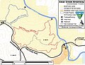
Reading gold discovery was a major part of the California Gold Rush and news of the find started the Northern California 49ers Gold Rush. Reading started to look for gold soon after hearing about the Sutter's Mill gold discovery. Reading worked as John Sutter’s clerk and trapper in 1844. [3] The town was the home to some miners and served the many miners in the mining valley. In 1855, Horsetown covered 36 acres with a population of 1,000, by 1856 it was 2,000. Lots of water is needed for mining gold, so the miners built a small dams along Clear Creek. By October 1849 about 250 men were mining on Clear Creek. The 49er miner, Alexander Andrews at Clear Creek diggings built the Horsetown Bridge near Reading’s bar to cross Clear Creek safely. Andrews wrote about his time Clear Creek diggings. He noted a good day of mining would get a miner about $100 a day in gold in 1853 ($3,987.00 in today's money), but prices of goods were also high. At it peak during the start of the finds in the winter of 1849 miners were finding $200 a day as gold was being found in all the river, creek, or stream in the valley, as there was more water in the winter. Duffy built Duffy’s Ditch that brought water into Horsetown. A dam and water system was built by Nathan Townsend, Townsend sold water to the miners. Townsend sold the system to Enos Taylor and William Harrison Elmore in 1856. A second and much large water system was built in 1855, the Clear Creek Ditch, with 49 miles of flumes. A stagecoach road was built from Stockton & Andrews’ Bridge to Horsetown. The water traveling through a 460-foot hard rock tunnel. To store the winter rainfall a 5-acre earthwork reservoir was built. The water intake for the ditch was near the stagecoach stop at Tower House on the wagon road to Yreka. Most of the former Horsetown water system is now under Whiskeytown Lake built in 1963 with the Whiskeytown Dam 11 miles north of Horsetown. In 1852 Father Florian built the first church in Horsetown in 1852. In 1850, a wagan road was built from Red Bluff and Shasta, with a stop at Briggsville and Horsetown. Shasta County's first Wells Fargo Express offices and telegraph office was in Horsetown. By 1860 most of the gold had run out and the town was not busy anymore. Most of the goods at Townsend came by wagon train from Shasta. [4] [5] In 1868, the town of Horsetown was destroyed by a fire and was not rebuild, the site, Grant Redding, on Clear Creek Road, is now back to oak trees in a rural canyon, 10 miles east of the Redding Municipal Airport. [6]

From Horsetown the gold rush moved out to a number of small mining towns on and north of the Clear Creek including: Briggsville, Muletown, Lower Springs, Texas Springs, Middletown, Piety Hill, Igo, Larkin, Jackass Flat, Ono, Bald Hills, Janesville, and to the north Whiskeytown, Shasta, Tower House, and French Gulch.

Horsetown Clear-Creek Preserve

Horsetown Clear-Creek Preserve is an 27-acre nature preserve run by volunteers as a Nonprofit organization founded in 1988. [7] [8] [9] Horsetown Clear-Creek Preserve has over 200 members. Along the creek the volunteers have day-use spots with hiking trails, picnic tables and in the spring and fall volunteer run interpretive walks and events. The Horsetown Clear-Creek Preserve is also a safe place for Chinook Salmon spawning. [10] [6] [11] [12]

Map Reading's Bar, Clear Creek and Horsetown Clear-Creek Preserve Reading Bar and Clear Creek map.jpg
Map Reading's Bar, Clear Creek and Horsetown Clear-Creek Preserve

See also

Related Research Articles

<span class="mw-page-title-main">Idaho Springs, Colorado</span> City in Colorado, United States

The City of Idaho Springs is the statutory city that is the most populous municipality in Clear Creek County, Colorado, United States. Idaho Springs is a part of the Denver–Aurora–Lakewood, CO Metropolitan Statistical Area. As of the 2020 census it had a population of 1,782. Idaho Springs is located in Clear Creek Canyon, in the mountains upstream from Golden, some 30 miles (50 km) west of Denver.

<span class="mw-page-title-main">Trinity River (California)</span> River in northern California

The Trinity River is a major river in northwestern California in the United States and is the principal tributary of the Klamath River. The Trinity flows for 165 miles (266 km) through the Klamath Mountains and Coast Ranges, with a watershed area of nearly 3,000 square miles (7,800 km2) in Trinity and Humboldt Counties. Designated a National Wild and Scenic River, along most of its course the Trinity flows swiftly through tight canyons and mountain meadows.

<span class="mw-page-title-main">Douglas City, California</span> Place in California, United States

Douglas City is an unincorporated community in Trinity County, California first settled during the California Gold Rush. Douglas City sits at an elevation of 2,152 feet (656 m). The ZIP Code is 96024. The community is inside area code 530. Its population is 868 as of the 2020 census, up from 713 from the 2010 census. For statistical purposes, the United States Census Bureau has defined Douglas City as a census-designated place (CDP). The Whiskeytown–Shasta–Trinity National Recreation Area is nearby.

<span class="mw-page-title-main">Clear Creek (Sacramento River tributary)</span> River in Shasta County, United States

Clear Creek is a tributary of the upper Sacramento River in northern California.

<span class="mw-page-title-main">Dog Town, California</span> Ghost town in California, United States

Dog Town is a gold rush era ghost town in Mono County, California. It is located at 38°10′13″N119°11′51″W, on Dog Creek, near the junction of Clearwater and Virginia Creeks, about 6 miles (10 km) south-southeast of Bridgeport, at an elevation of 7057 feet.

<span class="mw-page-title-main">Shasta, California</span> Census-designated place in California, United States

Shasta is a census-designated place (CDP) in Shasta County, California, United States. Shasta sits at an elevation of 843 feet (257 m). Its population is 1,043 as of the 2020 census, down from 1,771 from the 2010 census.

The Similkameen Gold Rush, also known as the Blackfoot Gold Rush, was a minor gold rush in the Similkameen Country of the Southern Interior of British Columbia, Canada, in 1860. The Similkameen Rush was one of a flurry of small rushes peripheral to the Fraser Canyon Gold Rush, which had drawn tens of thousands of prospectors to the new colony in 1858-1859, among the others being Rock Creek Gold Rush and Big Bend.

You Bet is a small unincorporated community in Nevada County, California. You Bet is located in the Sierra Nevada foothills, 7 miles (11.3 km) east of Grass Valley and 5.5 miles (8.9 km) northeast of Chicago Park.

The Omineca Gold Rush was a gold rush in British Columbia, Canada in the Omineca region of the Northern Interior of the province. Gold was first discovered there in 1861, but the rush didn't begin until late in 1869 with the discovery at Vital Creek. There were several routes to the goldfields: two were from Fort St. James, one of which was a water route through the Stuart and Tachie Rivers to Trembleur Lake to Takla Lake and the other was overland, called the Baldy Mountain route. A third route came in overland from Hazelton on the Skeena River and a fourth route used the Fraser River and crossed over the Giscome Portage to Summit Lake, through McLeod Lake, and up the Finlay River to the Omineca River.

<span class="mw-page-title-main">Whiskeytown, California</span> Unincorporated community in California, United States

Whiskeytown was an unincorporated community in Shasta County, California, United States. Although once a bustling mining town, it was flooded to make way for Whiskeytown Lake in 1962, now part of Whiskeytown–Shasta–Trinity National Recreation Area. All that remains is the relocated store, a few residences, mostly occupied by National Recreation Area personnel, and old mines that are above the water level of the lake. Whiskeytown is registered as a California Historical Landmark.

Alpha was a gold mining town in Nevada County, located about 2 miles southeast of the town of Washington, California and about 15 miles northeast of Nevada City, California. It lay at an elevation of 4120 feet, about 2 miles below the South Yuba River and just west of Scotchman Creek.

Little York is the name of one of the first gold mining towns established in Nevada County, California as well as the name of the township in which it was situated. The town was located on the Lowell Ridge between Steephollow Creek and the Bear River, about 13 miles east of Nevada City, California and about 1 mile southwest of Dutch Flat, California at an elevation of about 2800 feet.

<span class="mw-page-title-main">Whiskeytown Dam</span> Dam in California, United States

Whiskeytown Dam is an earthfill dam on Clear Creek, a tributary of the Sacramento River of northern California in the United States.

Walloupa was a historic mining community in Nevada County, located about 1/2 mile south of You Bet. It was named by its white developers after a Nisenan chief, and should not be confused with the Nisenan village of Walloupa, which was located about 15 miles to the west near Rough and Ready.

<span class="mw-page-title-main">Cottonwood Creek (Sacramento River tributary)</span> River in Shasta County, United States

Cottonwood Creek is a major stream and tributary of the Sacramento River in Northern California. About 68 miles (109 km) long measured to its uppermost tributaries, the creek drains a large rural area bounded by the crest of the Coast Ranges, traversing the northwestern Sacramento Valley before emptying into the Sacramento River near the town of Cottonwood. It defines the boundary of Shasta and Tehama counties for its entire length. Because Cottonwood Creek is the largest undammed tributary of the Sacramento River, it is known for its Chinook salmon and steelhead runs.

Gas Point is a former unincorporated community and former ghost town in Shasta County, California, on Cottonwood Creek. It was also known as Pinckney and Janesville and started as a 1849 California Gold Rush Mining town after gold was found at Reading's Bar.

<span class="mw-page-title-main">Reading's Bar</span> Historical place in Shasta County, United States

Reading's Bar is a historical site in Redding, California in Shasta County. Reading's Bar is a California Historical Landmark No. 32 listed on August 1, 1932. Reading's Bar was named after Major Pierson Barton Reading, who discovered gold on the Clear Creek bar in May 1848, starting a California Gold Rush in the surrounding area. Later he found gold on a sandbar on the Trinity River that stated the Trinity Alps Gold Rush. Reading's gold discovery was a major part of the California Gold Rush and news of the find created a rush of gold prospecting in Northern California, well north of the better-known gold fields of the Sierra Nevada foothills.

<span class="mw-page-title-main">Piety Hill, California</span> Historical place in Shasta County, United States

Piety Hill, California is a historical site on Cloverdale Road in Shasta County, near Igo, California. The city was founded in 1949 as part of the California Gold Rush. Like many Gold Rush camps that became a town, the town grew quickly from a few miners to a town of 1,500. Near Piety Hill was Chinatown of 600 that mined and farmed. The large scale Hardscrabble mine opened in 1853. Mining need lot of water and the Dry Creek Tunnel and Fluming Company both ran a water system, with a two-mile ditch, to the town and mines nearby, built with Chinese labor. In 1866 the Hardscrabble's hydraulic mining run off threatened the town. Many fed to nearby Igo. Hydraulic mining was outlawed in 1884 in the anti-debris act. The town ended in the 1920 when the last two Chinese residents died. The Dry Creek Tunnel and Fluming Company water right were transferred to the Happy Valley Land and Water Company that serves the Happy Valley area. There are no remains of this town. The Piety Hill Loop is 4.1-mile loop trail near near Igo. A historical was place near the form town by the Ono Grange #445, E Clampus Vitus, Trintarianus Chapter # 62 and the Department of the Interior and Bureau of Land Management.

<span class="mw-page-title-main">Tower House Historic District</span> Historical place in Shasta County, United States

Tower House, California was mining town in Shasta County. The mining District of Tower House was placed on the National Register of Historic Places on July 2, 1973, as #73000257 as the Tower House Historic District. The Tower House Historic District is located just west of the Whiskeytown National Recreation Area. The town started as a California Gold Rush camp. The town is named after Levi Tower, who built the Tower House Hotel and helped establish the town.

<span class="mw-page-title-main">Delta, California</span> Historic site in on West bank of Sacramento River, Train Stop

Dog Creek, California was mining town founded in 1855 at the site of the Dog Creek stream near where it flowed into the Sacramento River. Dog Creek was 25 miles north of Redding, California in the Sacramento River Canyon. The US Post Office at Dog Creek closed in 1880 and moved to Slate Creek. Near to Dog Creek was the railroad town of Delta, California, for about two years it was the terminus of the California & Oregon Railroad. The railroad line sold land lots at Delta and they sold quickly from $45 to $185 each. Almost overnight the town had McDowell Store, McDowell saloon, Kimball cafe, Kimball saloon, Stone saloon-hotel, a train engine house, a Train station, railway turntable, Wells Fargo Express Office, Central Hotel, cattle yard, water tower and a corral. A Dog Creek water system was built for city water. The train ride to Reading was 2 hours and 20 minutes, over 39 miles. While the railroad called the new town, Delta, many still called the town Dog Creek, as Dog Creek was just a few miles to the west and the land of Delta was in the area called Dog Creek. The largest home in Dog Creek was the Vollmers Home on the Vollmers Ranch built by J. W. Vollmers and inherted by Shelby and Paul Vollmers. Vollmers Ranch also operated the Vollmers Hotel one mile west of Delta. Vollmers opened gas station till 1945, when I-5 was built on it. Vollmers operations were called Bayles, California as the post office moved there in 1885. Dr. Autenreith operated the Autenreith Ranch and Store quarter of a mile north of Delta. In 1887 the rail line continued up the river and Delta slowly became a ghost town the post office closed in 1954, as the town was gone. March 8, 1899 Delta School opened, replaced with a new one in 1939. In 1926 the toll road in the town heading up Dog Creek, ended as toll road and became Dog Creek Road. The Delta grew to become the Delta Mining District in the Shasta-Trinity National Forest. Placer mining was done on Dog Creek in the 1850s and 1860. The largest operator was the Delta Consolidated Mining Company that ran lode gold mine from the 1890s till the early 1920s. The Delta gold mine operated in the Dog Creek mining district, seven miles west of Delta, on Upper Dog Creek. The Delta Consolidated Mining Company had 6.5 -mile-long narrow-gauge railroad, that ran to the Southern Pacific Railroad. In Delta was the one-room school for all the children in the nearby districts, it is one of the few buildings still standing, but has been enlarged over the years. In 1858 the Simeon and Sarah Southern moved to Dog Creek and opened an inn with J.S. Cameron. Dog Creek joined with Hazel Creek, 14 miles north to form the Sugar Loaf Township. With the combined tax income they were able to hire Simeon (Sims) Southern has Justice of the peace for the Sugar Loaf Township. Sims move north to Hazel Creek and opened the historic Southern Hotel & Stage Station in 1859.

References

  1. Shasta Valley mines, blm.gov
  2. "HORSETOWN". CA State Parks.
  3. "Trinity Alps Gold Rush". CA State Parks.
  4. The Dictionary of Early Shasta County History, Smith, Dottie 1991, Redding
  5. Historic Resource Study, Whiskeytown National Recrea�tion Area, California. Report prepared for United States Department of Interior, National Park Service, Anna Coxe Toogood, 1978, Denver
  6. 1 2 "Gold Discovery at Reading's Bar and Horsetown in 1848". horsetownclearcreekpreserve.org. August 26, 2023.
  7. Exploring Clear Creek Gold Mining Sites youtube.com
  8. Horsetown Clear-Creek Preserve youtube.com
  9. National Public Lands Day - Clear Creek Preserve 2015 youtube.com
  10. "Horsetown-Clear Creek Preserve, located in Redding, CA". horsetownclearcreekpreserve.org.
  11. Horsetown Clear-Creek Preserve outings blm.gov
  12. Horsetown Clear-Creek Preserve greenway blm.gov