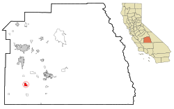
Pixley, California

Last updated
Pixley
Tulare County California Incorporated and Unincorporated areas Pixley Highlighted.svg
Location in Tulare County and the state of California
Usa edcp location map.svg
Red pog.svg
Pixley
Location in the United States
Coordinates: 35°58′13″N119°17′27″W / 35.97028°N 119.29083°W / 35.97028; -119.29083 Coordinates: 35°58′13″N119°17′27″W / 35.97028°N 119.29083°W / 35.97028; -119.29083
Country Flag of the United States.svg  United States
State Flag of California.svg  California
County Tulare
Named for Frank M. Pixley
Area
[1]
  Total3.114 sq mi (8.066 km2)
  Land3.114 sq mi (8.066 km2)
  Water0 sq mi (0 km2)  0%
Elevation
272 ft (83 m)
Population
 (2010)
  Total3,310
  Density1,100/sq mi (410/km2)
Time zone UTC-8 (Pacific (PST))
  Summer (DST) UTC-7 (PDT)
ZIP code
93256
Area code 559
FIPS code 06-57512
GNIS feature ID1652777

Pixley is a census-designated place (CDP) in Tulare County, California, United States. The population was 3,310 at the 2010 census, up from 2,586 at the 2000 census.

Contents

Geography

Pixley is located at 35°58′13″N119°17′27″W / 35.97028°N 119.29083°W / 35.97028; -119.29083 (35.970405, -119.290729). [2]

According to the United States Census Bureau, the CDP has a total area of 3.1 square miles (8.0 km2), all of it land.

Climate

According to the Köppen Climate Classification system, Pixley has a semi-arid climate, abbreviated "BSk" on climate maps. [3]

History

The town began as a real-estate-speculation in 1884. The investors Darwin C. Allen, and William B. Bradbury knew their project would succeed only if the town was connected to the mainline of the Southern Pacific. They contacted Frank Pixley; a man whom they knew was a friend of Leland Stanford. In 1886, Pixley joined with the original investors as a partner in the Pixley Townsite Company. The company purchased additional land in the vicinity. When The Southern Pacific extended its tracks to the Townsite, the town prospered. The terms of sale for the land was 25% down, the rest to be carried back for three years by the owners at 8 percent interest. The partners made a handsome profit. Special railroad fares were offered to people in other areas of California and as far away as Boston in order to bring potential customers to see the new lands and the investment possibilities near Pixley. The first house built in Pixley was for Emma, William Pixley's widow, the late brother of Frank Pixley. Her three sons and daughter lived in the home. Emma bought a quarter section of an adjoining piece of land where she farmed until they moved back to San Francisco. Frank Pixley advertised the town named after him in his biweekly journal The Argonaut . [4]

In the early 1890s, Chris Evans and John Sontag robbed a Southern Pacific Railroad train at Pixley. [5]

In 1933, Pixley was one of the towns in California involved in the San Joaquin cotton strike, a labor action by agricultural workers seeking higher wages. A violent clash between strikers and growers left two workers dead and eight wounded. Five thousand workers gathered in Tulare for the dead strikers' funerals, one of the largest agricultural demonstrations in California's history. Eight cotton growers were indicted in the violence against the workers, but were later acquitted. [6] The strike features in Steinbeck's novel, The Grapes of Wrath, coinciding with the arrival of the Joad family from Oklahoma. [7]

Demographics

2010

The 2010 United States Census [8] reported that Pixley had a population of 3,310. The population density was 1,062.8 inhabitants per square mile (410.3/km2). The racial makeup of Pixley was 1,473 (44.5%) White, 90 (2.7%) African American, 28 (0.8%) Native American, 16 (0.5%) Asian, 0 (0.0%) Pacific Islander, 1,587 (47.9%) from other races, and 116 (3.5%) from two or more races. Hispanic or Latino of any race were 2,675 persons (80.8%).

The Census reported that 3,310 people (100% of the population) lived in households, 0 (0%) lived in non-institutionalized group quarters, and 0 (0%) were institutionalized.

There were 798 households, out of which 498 (62.4%) had children under the age of 18 living in them, 482 (60.4%) were opposite-sex married couples living together, 116 (14.5%) had a female householder with no husband present, 91 (11.4%) had a male householder with no wife present. There were 85 (10.7%) unmarried opposite-sex partnerships, and 5 (0.6%) same-sex married couples or partnerships. 81 households (10.2%) were made up of individuals, and 38 (4.8%) had someone living alone who was 65 years of age or older. The average household size was 4.15. There were 689 families (86.3% of all households); the average family size was 4.34.

The population was spread out, with 1,267 people (38.3%) under the age of 18, 404 people (12.2%) aged 18 to 24, 869 people (26.3%) aged 25 to 44, 562 people (17.0%) aged 45 to 64, and 208 people (6.3%) who were 65 years of age or older. The median age was 24.7 years. For every 100 females, there were 107.3 males. For every 100 females age 18 and over, there were 105.9 males.

There were 875 housing units at an average density of 280.9 per square mile (108.5/km2), of which 433 (54.3%) were owner-occupied, and 365 (45.7%) were occupied by renters. The homeowner vacancy rate was 1.6%; the rental vacancy rate was 9.2%. 1,691 people (51.1% of the population) lived in owner-occupied housing units and 1,619 people (48.9%) lived in rental housing units.

2000

As of the census [9] of 2000, there were 2,586 people, 651 households, and 557 families residing in the CDP. The population density was 833.7 inhabitants per square mile (321.9/km2). There were 723 housing units at an average density of 233.1 per square mile (90.0/km2). The racial makeup of the CDP was 32.87% White, 4.22% African American, 1.74% Native American, 0.19% Asian, 0.08% Pacific Islander, 56.34% from other races, and 4.56% from two or more races. Hispanic or Latino of any race were 68.17% of the population.

There were 651 households, out of which 54.1% had children under the age of 18 living with them, 57.8% were married couples living together, 18.0% had a female householder with no husband present, and 14.3% were non-families. 11.1% of all households were made up of individuals, and 5.7% had someone living alone who was 65 years of age or older. The average household size was 3.96 and the average family size was 4.21.

In the CDP, the population was spread out, with 39.9% under the age of 18, 12.8% from 18 to 24, 25.3% from 25 to 44, 14.7% from 45 to 64, and 7.3% who were 65 years of age or older. The median age was 24 years. For every 100 females, there were 113.5 males. For every 100 females age 18 and over, there were 108.7 males.

The median income for a household in the CDP was $23,304, and the median income for a family was $23,750. Males had a median income of $25,855 versus $20,000 for females. The per capita income for the CDP was $8,674. About 42.7% of families and 43.2% of the population were below the poverty line, including 53.0% of those under age 18 and 32.0% of those age 65 or over.

Politics

In the state legislature Pixley is located in the 16th Senate District, represented by Democrat Dean Florez, and in the 30th Assembly District, represented by Republican Danny Gilmore.

In the United States House of Representatives, Pixley is in California's 21st congressional district , represented by Democrat Jim Costa [10]

Notable residents

Related Research Articles

<span class="mw-page-title-main">Tonalea, Arizona</span> CDP in Coconino County, Arizona

Tonalea is a census-designated place (CDP) in Coconino County, Arizona, United States. The population was 549 at the 2010 census. It has also been known as Red Lake.

<span class="mw-page-title-main">Bayview, Humboldt County, California</span> Census-designated place in California, United States

Bayview is a census-designated place (CDP) located adjacent to the City of Eureka in Humboldt County, California, United States. Its population is 2,619 as of the 2020 census, up from 2,510 from the 2010 census. Many locals consider this area as part of "Pine Hill."

<span class="mw-page-title-main">Derby Acres, California</span> Census-designated place in California, United States

Derby Acres is a census-designated place (CDP) in Kern County, California, United States. Derby Acres is located 5.5 miles (8.9 km) north-northwest of Fellows, at an elevation of 1,375 feet (419 m). The population was 322 at the 2010 census, down from 376 at the 2000 census. The town is on State Route 33 at the northern extremity of the Midway-Sunset Oil Field, about five miles (8 km)five miles southeast of McKittrick.

<span class="mw-page-title-main">Rosedale, California</span> Census-designated place in California, United States

Rosedale is a census-designated place (CDP) in Kern County, California, United States. The population was 14,058 at the 2010 census, up from 8,445 at the 2000 census. Formerly a country town 10 miles (16 km) west of Bakersfield, it is now surrounded by suburban housing and currently has the highest household income in Kern County, according to Census estimates.

<span class="mw-page-title-main">South Taft, California</span> Census-designated place in California, United States

South Taft is a census-designated place (CDP) in Kern County, California, United States. South Taft is located 0.5 miles (0.8 km) south of Taft, at an elevation of 1,017 feet (310 m). The population was 2,169 at the 2010 census, up from 1,898 at the time of the 2000 census.

<span class="mw-page-title-main">Valley Acres, California</span> Census-designated place in California, United States

Valley Acres is a census-designated place (CDP) in Kern County, California, United States. Valley Acres is located 5.2 miles (8.4 km) north-northeast of Taft, at an elevation of 420 feet (128.02 m). The population was 527 at the 2010 census, up from 512 at the 2000 census.

<span class="mw-page-title-main">Cherry Valley, California</span> Census-designated place in California, United States

Cherry Valley is a census-designated place (CDP) in Riverside County, California, United States. The population was 6,362 at the 2010 census, up from 5,891 at the 2000 census. It is situated at the most northwestern point of the San Gorgonio Pass.

<span class="mw-page-title-main">Cutler, California</span> Census-designated place in California, United States

Cutler is a community and census-designated place (CDP) in Tulare County, California, United States. The population was 5,000 at the 2010 census, up from 4,491 at the 2000 census. The population as of 2019 was 5,214.

<span class="mw-page-title-main">Ducor, California</span> Census-designated place in California, United States

Ducor is a census-designated place (CDP) in Tulare County, California, United States. The population was 612 at the 2010 census, up from 504 at the 2000 census. Ducor is an abbreviation of an earlier name, Dutch Corners, which was given because several early settler families were German. The word "Dutch" in this case derives from German deutsch "German".

<span class="mw-page-title-main">Ivanhoe, California</span> Census designated place in California, United States

Ivanhoe is a census-designated place (CDP) in Tulare County, California, United States. The population was 4,495 at the 2010 census, up from 4,474 at the 2000 census.

<span class="mw-page-title-main">Orosi, California</span> Census-designated place in California, United States

Orosi is a census-designated place (CDP) in Tulare County, California, United States. The population was 8,770 at the 2010 census, up from 7,318 at the 2000 census.

<span class="mw-page-title-main">Poplar-Cotton Center, California</span> Census-designated place in California, United States

Poplar-Cotton Center is a census-designated place (CDP) in Tulare County, California, United States. The population was 2,470 at the 2010 census, up from 1,496 at the 2000 census.

<span class="mw-page-title-main">Richgrove, California</span> Census-designated place in California, United States

Richgrove is a census-designated place (CDP) in Tulare County, California, United States. The population was 2,882 at the 2010 census, up from 2,723 at the 2000 census.

<span class="mw-page-title-main">Tipton, California</span> Census-designated place in California, United States

Tipton is a census-designated place (CDP) in Tulare County, California, United States. The population was 2,543 at the 2010 census, up from 1,790 at the 2000 census.

<span class="mw-page-title-main">Traver, California</span> Census-designated place in California, United States

Traver is a census-designated place (CDP) in Tulare County, California, United States. The population was 713 at the 2010 census, down from 732 at the 2000 census.

<span class="mw-page-title-main">Summerside, Ohio</span> Census-designated place in Ohio, United States

Summerside is a census-designated place (CDP) in Union Township, Clermont County, Ohio, United States. Its population was 4,941 as of the 2020 census.

Justice is a census-designated place (CDP) in Rogers County, Oklahoma, United States. The population was 1,311 at the 2000 census.

<span class="mw-page-title-main">Turley, Oklahoma</span> CDP in Oklahoma, United States

Turley is a census-designated place (CDP) in Tulsa County, Oklahoma, United States. The population was 2,756 at the 2010 census, a loss of 14.7 percent from the figure of 3,231 recorded in 2000.

<span class="mw-page-title-main">Parkville, Pennsylvania</span> CDP in Pennsylvania, United States

Parkville is a census-designated place (CDP) in York County, Pennsylvania, United States. The population was 6,706 at the 2010 census.

<span class="mw-page-title-main">Taft Southwest, Texas</span> CDP in Texas, United States

Taft Southwest is a census-designated place (CDP) in San Patricio County, Texas, United States. The population was 1,460 at the 2010 census.

References

  1. "2010 Census U.S. Gazetteer Files – Places – California". United States Census Bureau.
  2. "US Gazetteer files: 2010, 2000, and 1990". United States Census Bureau. 2011-02-12. Retrieved 2011-04-23.
  3. Climate Summary for Pixley, California
  4. John L Levinsohn, "Frank Morrison Pixley of The Argonaut" The Book Club of San Francisco, San Francisco, California, 1989.
  5. "Sontag and Evans". eshomvalley.com. Retrieved November 29, 2012.
  6. Endangered Dreams, Kevin Starr, Oxford University Press, 1996, pp. 74-83
  7. Steinbeck, John. (1939). The Grapes of Wrath. Viking Press, New York City. ISBN   9780141394886
  8. "2010 Census Interactive Population Search: CA - Pixley CDP". U.S. Census Bureau. Archived from the original on July 15, 2014. Retrieved July 12, 2014.
  9. "U.S. Census website". United States Census Bureau . Retrieved 2008-01-31.
  10. "California's 21st Congressional District - Representatives & District Map". Civic Impulse, LLC. Retrieved October 6, 2014.