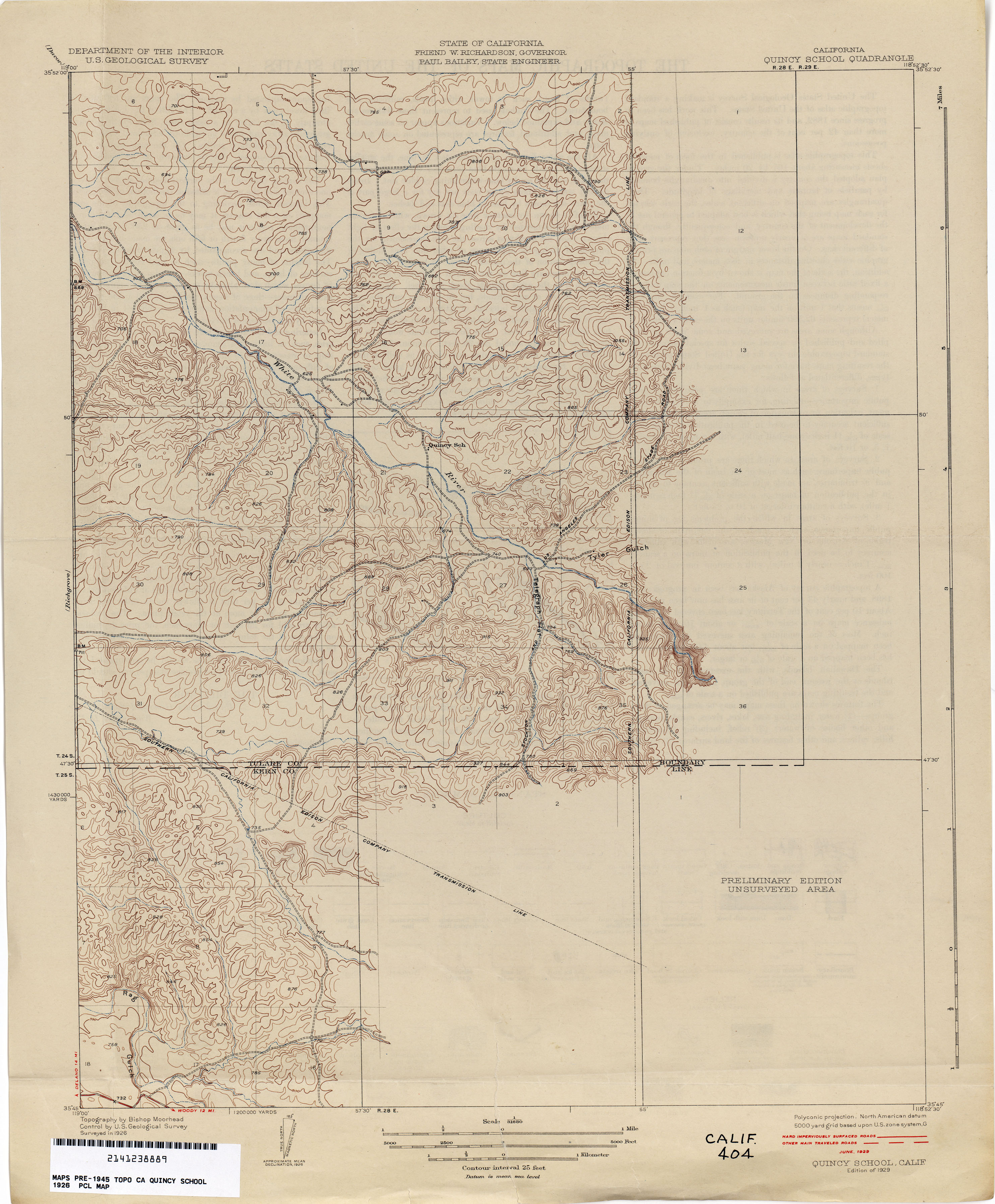
Stickneys Ferry

Last updated

Stickneys Ferry was a settlement established in what became Tulare County. The ferry proper was where the Stockton - Los Angeles Stagecoach Road crossed the White River. The settlement was on Telegraph Flat, just below the confluence of the White River and Tyler Gulch, about 4.66 miles west of Tailholt. [1]

It would have been established after Robert S. Williamson's 1853-4 report of his expedition for the Pacific Railroad Surveys, which does not mention it, and before the 1857 production of Britton and Rey's Map of California, which does. [2] [3] The ferry transported passengers and cargo travelling on what became the Stockton - Los Angeles Road across the White River. [2] This crossing was on the Butterfield Overland Mail route, south of Fountain Springs and north of Mountain House at Willow Springs in Kern County and was probably founded sometime between 1854 and 1856 to ferry supplies to prospectors involved in the Kern River Gold Rush.

Related Research Articles

<span class="mw-page-title-main">Jawbone–Butterbredt Area of Critical Environmental Concern</span>

The Jawbone–Butterbredt Area of Critical Environmental Concern (ACEC), is located in the Mojave Desert and Southern Sierra Nevada, northwest of California City and California State Route 14, in Kern County, California.

<span class="mw-page-title-main">Elizabeth Lake (Los Angeles County, California)</span> Intermittent lake in Elizabeth Lake, California

Elizabeth Lake is a natural sag pond that lies directly on the San Andreas Fault in the northern Sierra Pelona Mountains, in northwestern Los Angeles County, southern California.

<span class="mw-page-title-main">Laws, California</span> Unincorporated community in California, United States

Laws is an unincorporated community in Inyo County, California. Laws is located 4 miles (6.4 km) northeast of Bishop on U.S. Route 6, towards the Nevada state line.

<span class="mw-page-title-main">Havilah, California</span> Unincorporated community in California, United States

Havilah is an unincorporated community in Kern County, California. It is located in the mountains between Walker Basin and the Kern River Valley, 5 miles (8.0 km) south-southwest of Bodfish at an elevation of 3,136 feet (956 m).

The Western Pacific Railroad (1862–1870) was formed in 1862 to build a railroad from Sacramento, California, to the San Francisco Bay, the westernmost portion of the First transcontinental railroad. After the completion of the railroad from Sacramento to Alameda Terminal on September 6, 1869, and then the Oakland Pier on November 8, 1869, which was the Pacific coast terminus of the transcontinental railroad, the Western Pacific Railroad was absorbed in 1870 into the Central Pacific Railroad.

<span class="mw-page-title-main">Butterfield Overland Mail in California</span> Historic route by state

The Butterfield Overland Mail in California was created by the United States Congress on March 3, 1857, and operated until June 30, 1861. Subsequently, other stage lines operated along the Butterfield Overland Mail in route in Alta California until the Southern Pacific Railroad arrived in Yuma, Arizona in 1877.

<span class="mw-page-title-main">Southern Emigrant Trail</span> 19th-century immigrant route in the United States

Southern Emigrant Trail, also known as the Gila Trail, the Kearny Trail, Southern Trail and the Butterfield Stage Trail, was a major land route for immigration into California from the eastern United States that followed the Santa Fe Trail to New Mexico during the California Gold Rush. Unlike the more northern routes, pioneer wagons could travel year round, mountain passes not being blocked by snows; however, it had the disadvantage of summer heat and lack of water in the desert regions through which it passed in New Mexico Territory and the Colorado Desert of California. Subsequently, it was a route of travel and commerce between the eastern United States and California. Many herds of cattle and sheep were driven along this route and it was followed by the San Antonio-San Diego Mail Line in 1857–1858 and then the Butterfield Overland Mail from 1858 to 1861.

Fountain Springs was a settlement established in Tulare County, California, before 1855, at the junction of the Stockton–Los Angeles Road and the road to the Kern River gold mines. From 1858 to 1861, Fountain Springs was a station on the Butterfield Overland Mail route, 14 miles (23 km) southeast of Tule River Station and 12 miles (19 km) north of Mountain House. The site of the settlement was 1+12 miles (2.4 km) northwest of the California Historical Landmark No. 648 on the southwest corner of County Roads J22 and M 109 in Tulare County.

Gordon's Ferry is both a geographical location and a historic site in Bakersfield, California. It is located where China Grade Loop crosses the Kern River and meets with Alfred Harrell Highway in Northeast Bakersfield. It is named after a ferry that used to cross the river near the existing bridge. It was one of the only eastern crossings, until 1877, when the Jewett Avenue bridge was constructed farther west. It is California Historical Landmark #137.

The Stockton–Los Angeles Road, also known as the Millerton Road, Stockton–Mariposa Road, Stockton–Fort Miller Road or the Stockton–Visalia Road, was established about 1853 following the discovery of gold on the Kern River in Old Tulare County. This route between Stockton and Los Angeles followed by the Stockton–Los Angeles Road is described in "Itinerary XXI. From Fort Yuma to Benicia, California", in The Prairie Traveler: A Hand-book for Overland Expeditions by Randolph Barnes Marcy. The Itinerary was derived from the report of Lieutenant R. S. Williamson on his topographical survey party in 1853, that was in search of a railroad route through the interior of California.

Corral Hollow, formed by Corral Hollow Creek, is a canyon partially located in Alameda County, with parts in San Joaquin County, 6.5 miles (10.5 km) southwest of Tracy, California. Corral Hollow Creek, formerly El Arroyo de los Buenos Ayres, from its source 1.9 miles (3.1 km) north of Mount Boardman, flows north 1.89 miles where it turns to flow west-northwest 8.5 miles (13.7 km) then turns abruptly east in the vicinity of Tesla to flow 5 miles (8.0 km) east where it turns again in a northeasterly direction for 6 miles (9.7 km) to the Delta-Mendota Canal in the San Joaquin Valley.

San Francisquito Pass is a mountain pass in the Sierra Pelona Mountains, located northeast of Green Valley and Santa Clarita, in northern Los Angeles County, California.

Lone Tree Creek, formerly Dry Creek, a stream and tributary to the San Joaquin River, flowing in San Joaquin County and Stanislaus County, central California.

Tejon Creek, originally in Spanish Arroyo de Tejon, is a stream in Kern County, California. Its headwaters are located on the western slopes of the Tehachapi Mountains, and it flows northwest into the southern San Joaquin Valley.

The Old Tejon Pass is a mountain pass in the Tehachapi Mountains linking Southern and Central California.

Posey Creek Station of the Butterfield Overland Mail 1st Division was located on Posey or Poso Creek, in the southeastern San Joaquin Valley, in present-day Kern County, California.

<span class="mw-page-title-main">Vallecito, San Diego County, California</span> Former settlement in the United States

Vallecito, in San Diego County, California, is an oasis of cienegas and salt grass along Vallecito Creek and a former Kumeyaay settlement on the edge of the Colorado Desert in the Vallecito Valley. Its Spanish name is translated as "little valley". Vallecito was located at the apex of the gap in the Carrizo Badlands created by Carrizo Creek and its wash in its lower reach, to which Vallecito Creek is a tributary. The springs of Vallecito, like many in the vicinity, are a product of the faults that run along the base of the Peninsular Ranges to the west.

Bradshaw's Ferry was a ferry at the crossing point on the Colorado River, of the Bradshaw Trail at Olive City and later at Mineral City and Ehrenburg, between what was then San Diego County, California, and Arizona County, New Mexico Territory. The ferry connected the Bradshaw Trail to the road to the gold placers of La Paz, the first big strike of the Colorado River Gold Rush. From 1863, the La Paz - Wikenburg Road connected the Bradshaw Trail to the new mining boom town settlements in the interior of Arizona Territory.

Lane's Crossing was a ford below the Lower Narrows of the Mojave River in San Bernardino County, California, United States. "Lane's", a ranch and store for travelers at this crossing on the Mormon Road, was established by "Captain" Aaron G. Lane the first pioneer settler on the Mojave River.

<span class="mw-page-title-main">Venice–Inglewood Line</span> Historic rail route in California

The Venice–Inglewood Line is a former Pacific Electric interurban railway line in Los Angeles County, California. Service was very sparse, providing a suburban route between Venice and Inglewood.

References

  1. The location of the Stockton - Los Angeles Road and the crossing can be seen on the 1926 QUINCY SCHOOL, CA, Topographic Map,
  2. 1 2 Reports of explorations and surveys, to ascertain the most practicable and economical route for a railroad from the Mississippi River to the Pacific Ocean. The Internet Archive. Washington D. C.: A.O.P. Nicholson. 1855.{{cite book}}: CS1 maint: others (link)
  3. Britton & Rey's Map Of The State Of California. Compiled from the U.S. Land & Coast Surveys, the several Military, Scientific & Rail Road Explorations, the State & County Boundary Surveys made under the Order of the Surveyor General of California, & from Private Surveys. By George H. Goddard, C.E.. From David Rumsey Historical Map Collection website accessed, February 7, 2013.

35°48′53″N118°55′42″W / 35.8147°N 118.9283°W / 35.8147; -118.9283