Kennedy Meadows (CDP), California

Last updated
Kennedy Meadows (CDP)
Tulare County California Incorporated and Unincorporated areas Kennedy Meadows Highlighted 0638076.svg
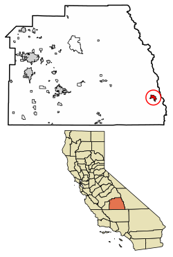
Location of Kennedy Meadows in Tulare County, California.
USA California location map.svg
Red pog.svg
Kennedy Meadows (CDP)
Position in California.
Usa edcp location map.svg
Red pog.svg
Kennedy Meadows (CDP)
Kennedy Meadows (CDP) (the United States)
Coordinates: 36°00′28″N118°06′36″W / 36.00778°N 118.11000°W / 36.00778; -118.11000 Coordinates: 36°00′28″N118°06′36″W / 36.00778°N 118.11000°W / 36.00778; -118.11000
Country Flag of the United States.svg  United States
State Flag of California.svg  California
County Tulare
Area
[1]
  Total5.823 sq mi (15.081 km2)
  Land5.823 sq mi (15.081 km2)
  Water0 sq mi (0 km2)  0%
Elevation
[2]
6,214 ft (1,894 m)
Population
 (2010)
  Total28
  Density4.8/sq mi (1.9/km2)
Time zone UTC-8 (Pacific (PST))
  Summer (DST) UTC-7 (PDT)
GNIS feature ID2585427
U.S. Geological Survey Geographic Names Information System: Kennedy Meadows (CDP), California

Kennedy Meadows refers to a census-designated place (CDP) in Tulare County, California, United States part of the Springville-Johnsondale CCD, and consists of the community surrounding Kennedy Meadows. [2] The CDP is located to the south-east of the Kennedy Meadows Campground. The 2010 United States census reported Kennedy Meadows's population of permanent residents at 28. [2] The census definition of the area may not precisely correspond to local understanding of the area with the same name.

Contents

The Kennedy Meadows area is at approximately 6200 feet elevation. The most common access route is by the steep Sherman Pass Road from U.S. Route 395 near Pearsonville. Other routes are possible but much slower.

Kennedy Meadows sits on the Pacific Crest Trail, 703 miles (1,131 km) from the trail's southern terminus. The Pacific Crest Trail Data Book uses Kennedy Meadows as the dividing point between the dry Southern California section and the high passes of the Sierra Nevada. [3]

Geography

According to the United States Census Bureau, the Kennedy Meadows CDP covers an area of 5.8 sq mi (15 km2), and is geographically located at the coordinates of 36°00'28.0"N 118°06'36.0"W and an altitude of 6,214 ft (1,894 m).

Demographics

Historical population
CensusPop.
U.S. Decennial Census [4]

At the 2010 census Kennedy Meadows had a population of 28. The population density was 4.8 people per square mile (1.9/km2). The racial makeup of Kennedy Meadows was 25 (89.3%) White, 1 (3.6%) Native American, and 2 (7.1%) from other races. Hispanic or Latino of any race were 3 people (10.7%). [5]

The whole population lived in households, no one lived in non-institutionalized group quarters and no one was institutionalized. There were 15 households, 1 (6.7%) had children under the age of 18 living in them, 9 (60.0%) were opposite-sex married couples living together, and 1 (6.7%) had a female householder with no husband present. There were no unmarried opposite-sex partnerships, and no same-sex married couples or partnerships. 5 households (33.3%) were one person and 3 (20.0%) had someone living alone who was 65 or older. The average household size was 1.87. There were 10 families (66.7% of households); the average family size was 2.30.

The age distribution was 3 people (10.7%) under the age of 18, 0 people (0%) aged 18 to 24, 0 people (0%) aged 25 to 44, 13 people (46.4%) aged 45 to 64, and 12 people (42.9%) who were 65 or older. The median age was 61.0 years. For every 100 females, there were 115.4 males. For every 100 females age 18 and over, there were 108.3 males.

There were 103 housing units at an average density of 17.7 per square mile, of the occupied units 12 (80.0%) were owner-occupied and 3 (20.0%) were rented. The homeowner vacancy rate was 7.7%; the rental vacancy rate was 0%. 20 people (71.4% of the population) lived in owner-occupied housing units and 8 people (28.6%) lived in rental housing units.

Related Research Articles

Forest Meadows, California census-designated place in California, United States

Forest Meadows is a census-designated place (CDP) in Calaveras County, California, United States. The population was 1,249 at the 2010 census, up from 1,197 at the 2000 census.

Dixon Lane-Meadow Creek, California Census-designated place in California, United States

Dixon Lane-Meadow Creek is a census-designated place (CDP) in Inyo County, California, United States. The population was 2,645 at the 2010 census, down from 2,702 at the 2000 census.

Meadow Vista, California census-designated place in California, United States

Meadow Vista is a census-designated place (CDP) in Placer County, California, United States. It is part of the Sacramento–Arden-Arcade–Roseville Metropolitan Statistical Area. The population was 3,217 at the 2010 census, up from 3,096 at the 2000 census.

Meadow Valley, California census-designated place in California, United States

Meadow Valley is a census-designated place (CDP) in Plumas County, California, United States. The population was 464 at the 2010 census, down from 575 at the 2000 census.

Crest, California census-designated place in California, United States

Crest is an unincorporated community in San Diego County, California. The Crest census-designated place (CDP) had a population of 2,593 at the 2010 census, down from 2,716 at the 2000 census.

Hidden Meadows, California Census designated place in California, United States

Hidden Meadows is a census-designated place (CDP) near Escondido in San Diego County, California. The population was 3,485 at the 2010 census, up from 3,463 at the 2000 census.

Kennedy, California census-designated place in California, United States

Kennedy is a census-designated place (CDP) in San Joaquin County, California, United States. The population was 3,254 at the 2010 census, down from 3,275 at the 2000 census.

Butte Meadows, California census-designated place in California, United States

Butte Meadows is a census-designated place in Butte County, California, 5 miles off State Route 32 on Humboldt Rd. The area is about 45 minutes or 33 miles (53 km) east of Chico on SR32. Its elevation is listed at 4,340 feet (1,323 m) above sea level: certain to get snow in winter of any year. The area code is Area code 530. The area is just over one mile (1.6 km) from the Tehama County line. The post office that served Butte Meadows moved back and forth across the county line several times from 1878 to 1888. Butte Meadows' population was 40 at the 2010 census.

Cassel, California census-designated place in California, United States

Cassel is a census-designated place (CDP) in Shasta County, California. Cassel sits at an elevation of 3,176 feet (968 m). The 2010 United States census reported Cassel's population was 207. The ZIP Code is 96016. The community is inside area code 530.

Swall Meadows, California Census-designated place in California, United States

Swall Meadows is a census-designated place in southern Mono County, California. The community is residential, including second homes and a volunteer fire department, but no commercial development. Geographically, it sits partway up the Sherwin Grade below the Wheeler Crest of the eastern Sierra Nevada, at an elevation range of approximately 6,000 to 7,000 feet. It is in pinon-juniper/subalpine zone habitat, with views south along the Sierra Crest of Mt. Tom, and east across Owens Valley to the White Mountains toward Nevada. It is accessed from "old 395", or Lower Rock Creek Road. Swall Meadows is approximately 20 miles (32 km) north of Bishop and 25 miles (40 km) south of Mammoth Lakes. It is also well known in the area as an important deer migration route for the Round Valley mule deer population, which cherish the grazing in the meadow and apple falls from the old orchard trees. The ZIP Code is 93514. The community is inside area code 760. The population was 220 as of the 2010 census.

Mount Laguna, California census-designated place in California, United States

Mount Laguna is a small census-designated place (CDP) in San Diego County, California. It is approximately 6000 ft above sea level in a forest of Jeffrey pine, east of San Diego in the Laguna Mountains on the eastern edge of the Cleveland National Forest. The hamlet sits at the high point of a scenic drive on Sunrise Highway from Interstate 8 to Highway 79. Mount Laguna consists of a small general store, rustic lodge and cabins, local restaurant, rural post office, and campgrounds adjacent to the Pacific Crest Trail. The Laguna Mountain Recreation Area surrounds the village, and the visitor's center for the pine-covered area is located here. The mountain backcountry of San Diego County is high enough to receive snowfall in winter months, and the Mount Laguna region offers locally-unique winter recreation in the form of snow play, sledding, and cross country skiing for several days after larger storms. The population was 57 at the 2010 census.

Auburn Lake Trails, California census-designated place in California, United States

Auburn Lake Trails is a census-designated place in El Dorado County, California. It lies at an elevation of 1916 feet. It is a gated community with 23 miles (37 km) of horse trails. As of the 2010 census, the population was 3,426.

Paradise, Mono County, California Census-designated place in California, United States

Paradise is a census-designated place that is the southernmost community in Mono County, California. Located in the southwest part of the county, Paradise functions as a bedroom community for workers in Bishop and Mammoth Lakes, and as a home for retirees. Geographically, it sits near the bottom of the Sherwin Grade, which divides Round Valley in Inyo County from Long Valley in Mono County. Neighboring communities include Wheeler Crest to the west, Swall Meadows and Pinon Ranch to the north. The population was 153 at the 2010 census.

Hartland, California census-designated place in California, United States

Hartland is a census-designated place (CDP) in Tulare County, California. Hartland sits at an elevation of 4,475 feet (1,364 m). The 2010 United States census reported Hartland's population was 30.

Panorama Heights, California census-designated place in California, United States

Panorama Heights is a census-designated place (CDP) in Tulare County, California. Panorama Heights sits at an elevation of 5,043 feet (1,537 m). The 2010 United States census reported Panorama Heights's population was 41.

Patterson Tract, California census-designated place in California, United States

Patterson Tract is a census-designated place (CDP) in Tulare County, California. Patterson Tract sits at an elevation of 328 feet (100 m). The 2010 United States census reported Patterson Tract's population was 1,752.

Plainview, California census-designated place in California, United States

Plainview is a census-designated place (CDP) in Tulare County, California. Plainview sits at an elevation of 354 feet (108 m). The 2010 United States census reported Plainview's population was 945.

Rodriguez Camp, California census-designated place in California, United States

Rodriguez Camp is a census-designated place (CDP) in Tulare County, California. Rodriguez Camp sits at an elevation of 456 feet (139 m). The 2010 United States census reported Rodriguez Camp's population was 156.

Sugarloaf Saw Mill, California census-designated place in California, United States

Sugarloaf Saw Mill is a census-designated place (CDP) in Tulare County, California. Sugarloaf Saw Mill sits at an elevation of 5,440 feet (1,660 m). The 2010 United States census reported Sugarloaf Saw Mill's population was 18.

West Goshen, California census-designated place in California, United States

West Goshen is a census-designated place (CDP) in Tulare County, California. West Goshen sits at an elevation of 272 feet (83 m). The 2010 United States census reported West Goshen's population was 511.

References

  1. U.S. Census Archived 2012-07-14 at WebCite
  2. 1 2 3 U.S. Geological Survey Geographic Names Information System: Kennedy Meadows (CDP), California
  3. Go, Benedict. (2013). Pacific Crest Trail data book : mileages, landmarks, facilities, resupply data, and essential trail information for the entire Pacific Crest Trail, from Mexico to Canada (5th ed.). Birmingham, AL: Wilderness Press. ISBN   978-0-89997-745-4. OCLC   823831364.
  4. "Census of Population and Housing". Census.gov. Retrieved June 4, 2016.
  5. "2010 Census Interactive Population Search: CA - Kennedy Meadows CDP". U.S. Census Bureau. Archived from the original on July 15, 2014. Retrieved July 12, 2014.