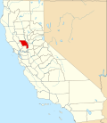
El Macero, California

Last updated
El Macero
California Locator Map with US.PNG
Red pog.svg
El Macero
Location in California
Usa edcp location map.svg
Red pog.svg
El Macero
El Macero (the United States)
Coordinates: 38°32′49″N121°41′39″W / 38.54694°N 121.69417°W / 38.54694; -121.69417
Country Flag of the United States.svg  United States
State Flag of California.svg  California
County Yolo County
Elevation
[1]
11 m (36 ft)

El Macero is an unincorporated community and census-designated place (CDP) [2] just outside the city limits of Davis, California, United States, in Yolo County. Until 2006 it had a separate ZIP Code, 95618. In 2006, eastern and southern parts of Davis were added to the 95618 zone. Formerly, a separate post office served El Macero; this is now closed. El Macero was named for Bruce Mace, on whose land it was built. The community is in area code 530. It lies at an elevation of 36 feet (11 m). A golf course is in the community.

El Macero corresponds to Yolo County census tract 104.01, block group 1, at the 2010 census, which had a population of 619. The racial makeup of El Macero was 533 (86.1%) White, 0 (0%) African American, 0 (0%) Native American, 64 (10.3%) Asian, 0 (0%) Pacific Islander, 0 (0%) from other races, and 22 (3.6%) from two or more races. Hispanic or Latino of any race were 37 persons (6.0%). [3]

Related Research Articles

Davis, California City in California, United States

Davis, known prior to 1907 as Davisville, is a city in the U.S. state of California and the most populous city in Yolo County. It had a population of 65,622 in 2010, not including the on-campus population of the University of California, Davis, which was over 9,400 in 2016. As of 2019, there were 38,369 students enrolled at the university.

Winters, California City in California, United States

Winters is a city in rural Yolo County, and the western Sacramento Valley, in northern California.

Yolo County, California County in California, United States

Yolo County, officially the County of Yolo, is a county located in the northern portion of the U.S. state of California. As of the 2010 census, the population was 200,849. Its county seat is Woodland.

Dunnigan, California census-designated place in California, United States

Dunnigan is a census-designated place in Yolo County, California on Interstate 5. The population was 1,416 at the 2010 census. Dunnigan's ZIP code is 95937 and its area code 530. It lies at an elevation of 69 feet.

El Nido, Merced County, California Census designated place in California, United States

El Nido is a census-designated place in Merced County, California. It is located 15 miles (24 km) west-southwest of Le Grand, at an elevation of 141 feet, and a population of 160 The population was 330 at the 2010 census.

Clarksburg, California census-designated place in California, United States

Clarksburg is a census-designated place in Yolo County, California. It is located on the Sacramento River, in the extreme southeastern corner of the county. It lies at an elevation of 10 feet in ZIP code 95612 and area codes 916 and 279.

Columbia, New Jersey Census-designated place in New Jersey, United States

Columbia is an unincorporated community and census-designated place (CDP) located within Knowlton Township in Warren County, New Jersey, United States, that was created as part of the 2010 United States Census. As of the 2010 Census, the CDP's population was 229. The area is served as United States Postal Service ZIP Code 07832.

Madison, California census-designated place in California, United States

Madisonis a census-designated place (CDP) in Yolo County, California. Madison's ZIP Code is 95653 and its area code 530. It is located 10.5 miles (17 km) west of Woodland, at an elevation of 151 feet. The 2010 United States census reported Madison's population was 503.

Rumsey, California Census-designated place in California, United States

Rumsey is an unincorporated community and census-designated place (CDP) in Yolo County, California. It is located 18 miles (29 km) northwest of Esparto, in the Capay Valley, in the northwestern part of the county. Rumsey's ZIP Code is 95679 and its area code 530. It lies at an elevation of 420 feet.

Yolo, California Unincorporated community and census-designated place in California, United States

Yolo is an unincorporated community and census-designated place in Yolo County, California. It is located 4.9 miles northwest of the county seat, Woodland. Yolo's ZIP Code is 95697 and its area code 530. It lies at an elevation of 82 feet. The population was 452 at the 2010 census.

Brooks, California Census-designated place in California, United States

Brooks is an unincorporated community and census-designated place (CDP) in Yolo County, California, located in the Capay Valley in the northwest of the county. Brooks' ZIP Code is 95606 and its area code 530. The Yocha Dehe Wintun Nation is headquartered in Brooks. The town is home to a large casino Cache Creek Casino Resort. It lies at an elevation of 341 feet.

Guinda, California census-designated place in California, United States

Guinda is a census-designated place in Yolo County, California. It is located in the Capay Valley, in the northwestern portion of the county, 13 miles (21 km) northwest of Esparto. Guinda's ZIP Code is 95637 and the town is in area code 530. It lies at an elevation of 361 feet.

Knights Landing, California census-designated place in California, United States

Knights Landing is a census-designated place in Yolo County, California, United States founded by William Knight. It is located on the Sacramento River in the northeastern portion of the county. Knights Landing's ZIP Code is 95645 and its area code 530. It lies at an elevation of 36 feet. The 2010 census reported that Knights Landing had a population of 995.

Asbury, New Jersey Census-designated place in New Jersey, United States

Asbury is an unincorporated community and census-designated place (CDP) located within Franklin Township in Warren County, New Jersey, United States, that was created as part of the 2010 United States Census. As of the 2010 Census, the CDP's population was 273.

Rio Rico, Arizona Census-designated place in Arizona, United States

Rio Rico is a census-designated place (CDP) in Santa Cruz County, Arizona, United States. The population was 18,962 at the 2010 census. The Rio Rico CDP replaced the former CDP's of Rio Rico Northwest, Rio Rico Northeast, Rio Rico Southwest, and Rio Rico Southeast.

Tancred, California Census-designated place in California, United States

Tancred is an unincorporated community and census-designated place (CDP) in Yolo County, California. It lies at an elevation of 299 feet.

Leisure Village West, New Jersey Census-designated place in New Jersey, United States

Leisure Village West is an unincorporated community and census-designated place (CDP) located within Manchester Township, in Ocean County, New Jersey, United States. Until the 2000 Census, the CDP had been part of the Leisure Village West-Pine Lake Park CDP, which was split for the 2010 enumeration into separate CDPs for Leisure Village West and Pine Lake Park. As of the 2010 United States Census, the CDP's population was 3,493. Leisure Village West is one of several active adult communities bearing similar names. Leisure Village and Leisure Village East are the other two communities nearby.

Monument Hills, California census-designated place in California, United States

Monument Hills is a census-designated place in Yolo County, California. Monument Hills sits at an elevation of 135 feet. The 2010 United States census reported Monument Hills's population was 1,542.

Byram Center, New Jersey Census-designated place in New Jersey, United States

Byram Center is an unincorporated community and census-designated place (CDP) located in Byram Township, in Sussex County, New Jersey, United States. As of the 2010 United States Census, the CDP's population was 90.

Ross Corner, New Jersey Census-designated place in New Jersey, United States

Ross Corner is an unincorporated community and census-designated place (CDP) located in Frankford Township, in Sussex County, New Jersey, United States. As of the 2010 United States Census, the CDP's population was 13.

References

  1. U.S. Geological Survey Geographic Names Information System: El Macero, California
  2. "2020 U.S. Gazetteer Files – California". United States Census Bureau. Retrieved April 2, 2021.
  3. "2010 Census P.L. 94-171 Summary File Data". United States Census Bureau.