Diablo Grande, California

Last updated • 4 min readFrom Wikipedia, The Free Encyclopedia
Diablo Grande
Stanislaus County California Incorporated and Unincorporated areas Diablo Grande Highlighted 0619155.svg
Location of Diablo Grande in Stanislaus County, California.
USA California location map.svg
Red pog.svg
Diablo Grande
Position in California.
Usa edcp location map.svg
Red pog.svg
Diablo Grande
Diablo Grande (the United States)
Coordinates: 37°23′51″N121°16′46″W / 37.39750°N 121.27944°W / 37.39750; -121.27944 Coordinates: 37°23′51″N121°16′46″W / 37.39750°N 121.27944°W / 37.39750; -121.27944
CountryFlag of the United States.svg  United States
State Flag of California.svg  California
County Stanislaus
Area
[1]
  Total4.31 sq mi (11.16 km2)
  Land4.30 sq mi (11.13 km2)
  Water0.01 sq mi (0.02 km2)  0.01%
Elevation
[2]
1,535 ft (468 m)
Population
 (2020)
  Total1,669
  Density388.32/sq mi (149.93/km2)
Time zone UTC-8 (Pacific (PST))
  Summer (DST) UTC-7 (PDT)
ZIP code
95363
Area code(s) 209
GNIS feature ID2582995
Website www.diablogrande.com
U.S. Geological Survey Geographic Names Information System: Diablo Grande, California

Diablo Grande is a census-designated place (CDP) in Stanislaus County, California. [2] It is a gated bedroom community nestled in the Diablo Range, whence it gets its name. Diablo Grande sits at an elevation of 1,535 feet (468 m). [2] It is about 9 miles (14 km) southwest of Patterson. The 2010 United States census reported Diablo Grande's population was 826. The 2018 estimated population was 1,200.

Contents

Background

A gated community and golf resort developed by Don Panoz, in May 1990, the Patterson city council received preliminary plans for Diablo Grande. [3] The project was later approved in the fall of 1993. [4] By 1999, the Stanislaus County superior court had rejected Diablo Grande's second environmental impact report with the argument that it had failed to properly protect the surrounding environment and there was no answer to where water would come from due to the area not containing adequate on-site water. [5] In response to these claims, Diablo Grande created the Western Hills Water District to serve the community. Water transfers from former agriculture land to the community were arranged and 12,000 acres have been preserved for wildlife. [4] [6]

Developer Donald Panoz envisioned Diablo Grande to consist of 5,000 to 10,000 homes, a resort hotel and spa, six golf courses, an equestrian center, vineyards, a winery and commercial properties, including a high-tech research park. [7] [8] [9] After investing $120 million into Diablo Grande and the financial crisis of 2007–08 occurring, the investors of the community filed for chapter 11 bankruptcy on March 10, 2008. [6] [7] There were more than $54 million in unpaid debts and 70 out of the 350 homes built faced foreclosure. [7]

In October 2008, World International LLC purchased Diablo Grande for $20 million. [10] The California Department of Health temporarily suspended new building permits in January 2009 when water tests showed Trihalomethane levels at 0.103 milligrams per liter vs. the state standard of 0.080 milligrams per liter. [11]

Diablo Grande's Legends golf course, designed by Jack Nicklaus and Gene Sarazen, was closed in March 2014 due to the drought in California. [12]

In May 2017, the Stanislaus County Board of Supervisors approved a revised plan for the community. [13] An additional 1,000 single-family homes could be built by reducing the number of condos and townhouses and eliminating apartments. [13] Also, instead of building homes spread along the hillsides, residential areas will be grouped together, leaving more open terrain and walking trails. [13] The revised plan brings the total number of housing units to 2,354. [13]

By the fall of 2019, it was announced that the remaining golf course at Diablo Grande would close in October. [14] It was also revealed that World International has outstanding tax bills on about half of its 340 parcels at Diablo Grande, totaling more than $6 million, and is looking for a new owner. [15]

On May 7, 2020, World International, LLC sold substantially all of its property within the Phase 1 development area of the District to Angel’s Crossing, LLC. [16]

On August 19, 2020 at 3:00 PM Pacific Time, due to the SCU Lightning Complex fires of 2020, the California Department of Forestry and Fire Prevention issued an evacuation order of Diablo Grande. [17] The evacuation order was lifted on August 20, 2020 at 2:00 PM. [18] [19] [20]

Geography

According to the United States Census Bureau, the CDP covers an area of 5.1 square miles (13.2 km2), 99.99% of it land and 0.01% of it water.

Demographics

Historical population
CensusPop.
2020 1,669
U.S. Decennial Census [21]

The 2010 United States Census [22] reported that Diablo Grande had a population of 826. The population density was 161.5 inhabitants per square mile (62.4/km2). The racial makeup of Diablo Grande was 510 (61.7%) White, 77 (9.3%) African American, 3 (0.4%) Native American, 70 (8.5%) Asian, 6 (0.7%) Pacific Islander, 77 (9.3%) from other races, and 83 (10.0%) from two or more races. Hispanic or Latino of any race were 254 persons (30.8%).

The census reported that 826 people (100% of the population) lived in households, 0 (0%) lived in non-institutionalized group quarters, and 0 (0%) were institutionalized.

There were 307 households, out of which 107 (34.9%) had children under the age of 18 living in them, 192 (62.5%) were opposite-sex married couples living together, 25 (8.1%) had a female householder with no husband present, 14 (4.6%) had a male householder with no wife present. There were 18 (5.9%) unmarried opposite-sex partnerships, and 6 (2.0%) same-sex married couples or partnerships. 54 households (17.6%) were made up of individuals, and 5 (1.6%) had someone living alone who was 65 years of age or older. The average household size was 2.69. There were 231 families (75.2% of all households); the average family size was 3.09.

The population was spread out, with 217 people (26.3%) under the age of 18, 47 people (5.7%) aged 18 to 24, 249 people (30.1%) aged 25 to 44, 249 people (30.1%) aged 45 to 64, and 64 people (7.7%) who were 65 years of age or older. The median age was 37.9 years. For every 100 females, there were 110.7 males. For every 100 females age 18 and over, there were 107.1 males.

There were 422 housing units at an average density of 82.5 per square mile (31.9/km2), of which 241 (78.5%) were owner-occupied, and 66 (21.5%) were occupied by renters. The homeowner vacancy rate was 10.6%; the rental vacancy rate was 16.0%. 615 people (74.5% of the population) lived in owner-occupied housing units and 211 people (25.5%) lived in rental housing units.

Related Research Articles

Alpine County, California County in California, United States

Alpine County is a county in the eastern part of California located within the Sierra Nevada on the state border with Nevada. As of the 2020 Census, the population was 1,204, making it California's least populous county. The county seat and largest community is Markleeville.

Stanislaus County, California County in California, United States

Stanislaus County is a county located in the San Joaquin Valley of the U.S. state of California. As of the 2020 census, the population was 552,878. The county seat is Modesto.

La Quinta, California American city in California, United States

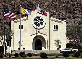
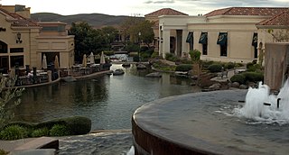
La Quinta is a desert resort city in Riverside County, California, United States. Located between Indian Wells and Indio, it is one of the nine cities of the Coachella Valley. The population was 37,467 at the 2010 census, up from 23,694 at the 2000 census. The Robb Report credits La Quinta as the leading golf destination in the US. Among those destinations is the La Quinta Resort and Club, a resort dating to 1926, where director Frank Capra wrote the screenplay for Lost Horizon. The Tom Fazio-designed golf course at The Quarry at La Quinta is ranked among the top 100 golf courses in the United States. In January 2008, the Arnold Palmer Classic Course at the city's SilverRock Golf Resort became one of the four host golf courses for the annual Bob Hope Chrysler Classic PGA golf tournament.

San Diego Country Estates, California Census-designated place in California, United States

San Diego Country Estates, commonly referred to as the Estates, is a valley resort populace composed of several neighborhoods associated with the unincorporated community of Ramona, California. The Estates are a census-designated place in North County, a region of the San Diego metropolitan area. The Estates is just east of the North County city of Poway and southeast of Ramona; 38 miles (61 km) northeast of San Diego and 46 miles (74 km) from the regional center of Carlsbad. San Diego Country Estates had a population of 10,109 at the 2010 census, up from 9,262 at the 2000 census.

Ripon, California City in the state of California, United States

Ripon is a city located in San Joaquin County, California. The population was 14,297 at the 2010 census. Ripon was originally known as Stanislaus City, but was renamed for Ripon, Wisconsin, in 1876.

Ceres, California City in the state of California, United States

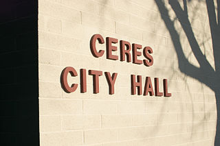
Ceres is a city in Stanislaus County, California. Its population was 49,302 at the 2020 U.S. Census, up from 45,417 at the 2010 U.S. Census. It is part of the Modesto metropolitan statistical area.

Del Rio, California Census-designated place in California, United States

Del Rio is a census-designated place (CDP) in Stanislaus County, California, United States that is located around the Del Rio Country Club. The population was 1,270 at the 2010 census, up from 1,168 at the 2000 census. It is part of the Modesto Metropolitan Statistical Area.

Modesto, California City in the state of California, United States

Modesto is the county seat and largest city of Stanislaus County, California, United States. With a population of 218,464 at the 2020 census, it is the 19th largest city in the state of California and forms part of the Sacramento-Stockton-Modesto Combined Statistical Area.

Patterson, California City in the state of California, United States

Patterson is a city in Stanislaus County, California, United States, located off Interstate 5. It is 27 miles (43 km) southeast of Tracy and is part of the Modesto Metropolitan Statistical Area. Patterson is known as the "Apricot Capital of the World"; the town holds an annual Apricot Fiesta to celebrate with many drinks, food, desserts and games. The population was 20,413 at the 2010 Census.

Riverbank, California City in the state of California, United States

Riverbank is a city in Stanislaus County, California, United States. The population was 22,678 at the 2010 census, up from 15,826 at the 2000 census. Incorporated on August 23, 1922, Riverbank's official slogan is "City of Action." It is part of the Modesto Metropolitan Statistical Area.

Salida, California Census-designated place in California, United States

Salida is a census-designated place (CDP) in Stanislaus County, California, in the United States. As of the 2010 census, the CDP population was 13,722. It is part of the Modesto Metropolitan Statistical Area. Cultivation of almonds has historically been a significant activity in the vicinity, including a major Blue Diamond processing facility nearby. The plant is involved exclusively in processing whole brown almond kernels with a "dry" process involving no water, heat or chemicals. Salida is within the East Stanislaus Resource Conservation District which comprises 984 square miles (2,550 km2) of land area and attends to a variety of environmental conservation and best management agricultural practices.

Turlock, California City in the state of California, United States

Turlock is a city in Stanislaus County, California, United States. Its estimated 2019 population of 73,631 made it the second-largest city in Stanislaus County after Modesto.

Murder of Laci Peterson Highly publicized 2002 murder of an American woman in California

Laci Denise Peterson was an American woman who was the subject of a highly publicized murder case after she disappeared while eight months pregnant with her first child. She was reportedly last seen alive on December 24, 2002.

Blackhawk, California Unincorporated community in California, United States

Blackhawk is an unincorporated planned community and census-designated place located in Contra Costa County, California, United States, east of Danville and Oakland. As of the 2010 census it had a population of 9,354. Governed by county rules/regulations and a homeowner association (HOA), Blackhawk has a country club, two golf courses, sports complex, restaurants, and the adjacent Blackhawk Plaza. 24-hour security plus additional law enforcement contracted through the Contra Costa County Sheriff's Office is provided by HOA dues. The area is covered by the San Ramon Valley Fire Protection District. The ZIP code is 94506. The community is inside area code 925. Blackhawk is known for its uniform architecture and suburban lifestyle, with the median household income being $167,875 and median home price of $1,117,500.

Don Panoz

Donald Panoz was an American entrepreneur who founded various pharmaceutical companies.

Berry Creek, California Census-designated place in California, United States

Berry Creek is a census-designated place about 25 miles (40 km) northeast of Oroville, California in hilly terrain at 2,000 feet (610 m) above mean sea level. The community is located along the Oroville-Quincy Highway on the shore of Madrone Lake. The community is home to Berry Creek Elementary School (K-8), 2 small mountain churches, 1 mini mart w/ gas, 1 small community park. Berry Creek is home to the annual Berry Festival which is held during August.

The Vintage is a golf resort in the Hunter Valley New South Wales, Australia a two-hour drive from Sydney. It has an 18-hole Championship golf course designed by world-renowned golfer and course designer Greg Norman.

Stanislaus County Sheriffs Department County law enforcement agency in California, US

The Stanislaus County Sheriff's Department (SCSD) is an American law enforcement agency that is charged with law enforcement duties within the boundaries of Stanislaus County, California. As of the 2020 United States census, the county was inhabited by just under 552,880 people.

Adam Gray American politician

Adam C. Gray is an American politician currently serving in the California State Assembly. He is a Democrat representing the 21st Assembly district, encompassing all of Merced County and portions of Stanislaus County. He is a candidate in the 2022 election for California's 13th congressional district.

Wood Colony is an unincorporated area in Stanislaus County, California, United States, located to the west of Modesto. It has been designated as a "Community of Interest" by Stanislaus County's Local Area Formation Commission (LAFCO).

References

  1. "2020 U.S. Gazetteer Files". United States Census Bureau. Retrieved October 30, 2021.
  2. 1 2 3 U.S. Geological Survey Geographic Names Information System: Diablo Grande, California
  3. Swift, Ron (May 15, 2015). "Patterson's Past: Diablo Grande". Golden State Newspapers. Retrieved April 19, 2016.
  4. 1 2 Shigley, Paul; Sokoloff, Larry (November 1, 2006). "Planning's Good, Bad And Ugly Updated". cp-dr.com. California Planning & Development Report. Retrieved April 19, 2016.
  5. "Second Diablo Grande EIR Rejected by Superior Court". cp-dr.com. California Planning & Development Report. August 1, 1999. Retrieved April 19, 2016.
  6. 1 2 Moran, Tim (March 28, 2008). "Diablo Grande working on finances". Modesto Bee. Retrieved May 11, 2016.
  7. 1 2 3 Hollis, Robert (July 20, 2008). "Diablo Grande project has a devil of a time". SFGate. Retrieved April 19, 2016.
  8. Carlson, Ken (February 28, 2008). "Low bids might sink Diablo Grande resort sale". Modesto Bee. Retrieved May 11, 2016.
  9. Moran, Tim (October 23, 2006). "Entrepreneur Donald Panoz Soon to Add Hotel and Spa to DiabloGrande, a Planned Resort Community Near Patterson, California / October2006". hotel-online.com. The Modesto Bee. Retrieved April 19, 2016.
  10. Carlson, Ken (November 13, 2014). "Diablo Grande developer buys additional parcels, reshaping vision for community". The Modesto Bee. Retrieved April 19, 2016.
  11. "Diablo Grande shows split personality: New owner talks to residents but hasn't contacted county". The Modesto Bee. January 3, 2009. Retrieved April 19, 2016.
  12. Stapley, Garth (March 21, 2014). "Diablo Grande's Legends golf course falls victim to the drought". modbee. Retrieved April 19, 2016.
  13. 1 2 3 4 Carlson, Ken (May 18, 2017). "Diablo Grande's amended plan calls for 1,000 additional single-family homes Read more here: https://www.modbee.com/news/article151421052.html#storylink=cpy". Modesto Bee. Retrieved March 27, 2020.{{cite web}}: External link in |title= (help)
  14. "Diablo Grande course closure announced". The West Side Index & Gustine Press-Standard. October 3, 2019. Retrieved March 27, 2020.
  15. Carlson, Ken (September 24, 2019). "Diablo Grande's golf course to close next month. Will the resort change hands?". Modesto Bee. Retrieved March 27, 2020.
  16. "Archived copy" (PDF). Archived from the original (PDF) on 2022-01-01. Retrieved 2020-07-24.{{cite web}}: CS1 maint: archived copy as title (link)
  17. @CAL_FIRE (August 19, 2020). "#SCULightningComplex, For Immediate Release, Evacuation Order for Stanislaus County" (Tweet) via Twitter.
  18. @calfireSCU (August 20, 2020). "=#SCULightningComplex, Evacuation Warning, Stanislaus County" (Tweet) via Twitter.
  19. "Diablo Grande mandatory evacuation order lifted". Patterson Irrigator. August 20, 2020.
  20. "Canyon wildfire puts Diablo residents on evacuation notice". The West Side Index and Gustine Press-Standard. August 20, 2020.
  21. "Census of Population and Housing". Census.gov. Retrieved June 4, 2016.
  22. "2010 Census Interactive Population Search: CA - Diablo Grande CDP". U.S. Census Bureau. Archived from the original on July 15, 2014. Retrieved July 12, 2014.