Oakdale is a city in the San Joaquin Valley and Stanislaus County, California, United States. As of 2020 census, its population was 23,181. It goes by the slogan "Cowboy Capital of the World."
Oakdale was used as a film location for the United Artists film Bound For Glory starring David Carradine.[4] Oakdale doubled as a dusty 'Texas' town using railroad scenes for the film. Oakdale was nominated for an award for having the most almond trees per capita per square mile in the state of California.
In June 2020, the town was taken by a false rumor that Black Lives Matters protestors intended to invade the town from the Bay Area. The owner of a local bar, the H-B Saloon, hired an out-of-town militia, gunmen dressed in camouflage, to patrol the town while store windows were boarded up. The false rumor started on the local Facebook group for the town. A 2025 New York Times report on the town noted that the town had become a news desert, as local news outlets had for the most part disappeared while inhabitants increasingly relied on social media for information about their area.[5]
According to the United States Census Bureau, the city has a total area of 6.3 square miles (16.2km2), of which 6.2 square miles (16.1km2) is land and 0.039 square miles (0.1km2) (0.62%) is water.[2]
The National Weather Service has maintained a cooperative weather station at Woodward Dam for many years. In January, average temperatures are a maximum of 52.4°F (11.3°C) and a minimum of 35.1°F (1.7°C). In July, average temperatures are a maximum of 102.8°F (39.3°C) and a minimum of 58.4°F (14.7°C). The record high temperature was 114°F (46°C) on July 18, 1925. The record low temperature was 12°F (−11°C) on December 11, 1932. Annually, there are an average of 84.6 days with highs of 90°F (32°C) or higher and an average of 30.8 days with lows of 32°F (0°C) or lower.
Average annual rainfall is 13.33 inches (339mm). There are an average of 44 days annually with measurable precipitation. The wettest year was 1958 with 22.15 inches (563mm) and the driest year was 1947 with 7.99 inches (203mm). The most rainfall in one month was 8.63 inches (219mm) in January 1911. The most rainfall in 24 hours was 5.7 inches (140mm) on April 3, 1958. The record snowfall was 1.5 inches (3.8cm) in January 1930.[6]
Climate data for Oakdale, California (Woodward Dam, 1906-1967)
The census reported that 99.3% of the population lived in households, 0.2% lived in non-institutionalized group quarters, and 0.6% were institutionalized.[8]
There were 8,192 households, out of which 38.5% included children under the age of 18, 50.6% were married-couple households, 7.3% were cohabiting couple households, 26.7% had a female householder with no partner present, and 15.4% had a male householder with no partner present. 22.2% of households were one person, and 11.8% were one person aged 65 or older. The average household size was 2.81.[8] There were 5,910 families (72.1% of all households).[9]
The age distribution was 26.2% under the age of 18, 8.1% aged 18 to 24, 25.9% aged 25 to 44, 23.4% aged 45 to 64, and 16.4% who were 65years of age or older. The median age was 36.9years. For every 100 females, there were 93.8 males.[8]
There were 8,428 housing units at an average density of 1,353.9 unitsper square mile (522.7 units/km2), of which 8,192 (97.2%) were occupied. Of these, 63.0% were owner-occupied, and 37.0% were occupied by renters.[8]
In 2023, the US Census Bureau estimated that the median household income was $86,478, and the per capita income was $36,849. About 10.0% of families and 13.5% of the population were below the poverty line.[10]
2010
At the 2010 census Oakdale had a population of 20,675. The population density was 3,392.6 inhabitants per square mile (1,309.9/km2). The racial makeup of Oakdale was 16,558 (80.1%) White, 163 (0.8%) African American, 210 (1.0%) Native American, 463 (2.2%) Asian, 37 (0.2%) Pacific Islander, 2,386 (11.5%) from other races, and 858 (4.1%) from two or more races. Hispanic or Latino of any race were 5,398 persons (26.1%).[11]
The census reported that 20,488 people (99.1% of the population) lived in households, 75 (0.4%) lived in non-institutionalized group quarters, and 112 (0.5%) were institutionalized.
There were 7,288 households, 3,016 (41.4%) had children under the age of 18 living in them, 3,853 (52.9%) were opposite-sex married couples living together, 1,009 (13.8%) had a female householder with no husband present, 436 (6.0%) had a male householder with no wife present. There were 517 (7.1%) unmarried opposite-sex partnerships, and 36 (0.5%) same-sex married couples or partnerships. 1,573 households (21.6%) were one person and 694 (9.5%) had someone living alone who was 65 or older. The average household size was 2.81. There were 5,298 families (72.7% of households); the average family size was 3.28.
The age distribution was 5,766 people (27.9%) under the age of 18, 1,837 people (8.9%) aged 18 to 24, 5,436 people (26.3%) aged 25 to 44, 5,083 people (24.6%) aged 45 to 64, and 2,553 people (12.3%) who were 65 or older. The median age was 34.9 years. For every 100 females, there were 95.4 males. For every 100 females age 18 and over, there were 90.8 males.
There were 7,822 housing units at an average density of 1,283.5 per square mile, of the occupied units 4,454 (61.1%) were owner-occupied and 2,834 (38.9%) were rented. The homeowner vacancy rate was 2.7%; the rental vacancy rate was 7.7%. 12,342 people (59.7% of the population) lived in owner-occupied housing units and 8,146 people (39.4%) lived in rental housing units.
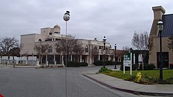
Victorian era First National Bank of Oakdale building in downtown Oakdale.Looking north down Yosemite Avenue toward downtown Oakdale.
Environment
Soil characteristics
Historically the area has been used for orchards and other agricultural uses. Some of the common soil types found in Oakdale are Delhi sand, Oakdale sandy loam, Hanford sandy loam, and Tujunga loamy sand. Oakdale is generally on level ground at an elevation of approximately 190 feet (58m) above mean sea level.[12] Drainage is generally to the northwest towards the Stanislaus River.
Beacon Service Station, 1590 East F Street, Oakdale. This release was a fuel leak caused by an underground tank failure in 1985. Approximately 2,000 gallons of product was released into the environment. The groundwater has been contaminated with reported benzene concentrations as high as 1790 parts per billion. Soil remediation began as early as 1989.
Chevron Service Station, 346 East F Street, Oakdale. An unknown quantity of gasoline was released. The release was discovered on May 25, 1987, through a site inspection. Groundwater is contaminated and cleanup work ensued.
Cruse Brothers, 663 South Yosemite Avenue, Oakdale. Diesel fuel contamination was discovered on November 11, 1988, during the removal of a 30-year-old steel 500-gallon tank. The Central Valley Regional Water Quality Control Board sent an Enforcement Action Letter on January 23, 1989.
The Oakdale economy centers on agriculture, food manufacturing, and tourism.
Oakdale was the home to the Oakdale Hershey Plant, a satellite plant of Hershey Chocolate, that closed in January 2008 and moved to Mexico. It opened in May 1965, operated the Hershey's Oakdale Visitor Center and Shop in town, and employed about 575 local people. The plant was purchased by Sconza Chocolates,[18] which began production in October 2008.
Many other large food manufacturing operations are nearby, including a ConAgra FoodsHunt's plant, which is one of the largest tomato processing plants in the world. Cattle ranching is common in the surrounding areas, adding to the diversity and character of the local economy.
Bruce Coslet - professional football player and coach, born in Oakdale and attended Oakdale High School, winning 16 varsity letters before graduating and playing at University of the Pacific.[20]
The Oakdale Museum is located in the oldest home in Oakdale and focuses on the families and businesses of the area. Exhibits include historic photographs, furniture, home goods, clothing, yearbooks, and more. The museum is also a research center for people interested in finding out about family from the area.
The Oakdale Cheese & Specialties is owned and operated by Dutch immigrants Walter and Lenneke Bulk. Cheesemaking has been in Walter's family for 4 generations. They specialize in Gouda and offer a variety of choices.
The Stanislaus River offers areas for rafting, kayaking, swimming, fishing, camping and hiking.
The Sierra Dinner Train is located just south of the main intersection (Yosemite & F). Operating on the 3rd oldest rail line in North America, Sierra Railroad, the train has been featured in dozens of film productions. Sierra Dinner Train meanders through open-countryside and offers a unique, year-round venue for dining and family excursions.
↑ Benziger, Jeff (February 6, 2017). "Hollywood in the 209". 209 Magazine. Retrieved August 25, 2021. David Carradine of Kung Fu TV show fame came to Oakdale to ride the rails atop a moving boxcar as Woody Guthrie in the 1976 movie Bound for Glory. Also on the set in south Oakdale was Randy Quaid, best known as Cousin Eddie in National Lampoon's Christmas Vacation. Kennedy Road in Knights Ferry doubled as the New Mexico border where Carradine hitchhiked in the film.
This page is based on this Wikipedia article Text is available under the CC BY-SA 4.0 license; additional terms may apply. Images, videos and audio are available under their respective licenses.