Ripon, California

Last updated

Ripon, California
Almond Capital of the World
Ripon.jpg
Motto: 
"The Jewel of the Valley"
San Joaquin County California Incorporated and Unincorporated areas Ripon Highlighted.svg
Location in San Joaquin County and the state of California
Usa edcp relief location map.png
Red pog.svg
Ripon
Location in the United States
Coordinates: 37°44′26″N121°7′42″W / 37.74056°N 121.12833°W / 37.74056; -121.12833
Country Flag of the United States (23px).png  United States
State Flag of California.svg  California
County San Joaquin
Incorporated November 27, 1945 [1]
Government
   Mayor Daniel De Graaf [2]
   State Senate Susan Eggman (D) [3]
   Assembly Damon Connolly (D) [3]
   U. S. Congress Mark DeSaulnier (D) [4]
Area
[5]
  Total5.52 sq mi (14.29 km2)
  Land5.33 sq mi (13.79 km2)
  Water0.19 sq mi (0.50 km2)  3.47%
Elevation
69 ft (21 m)
Population
 (2020) [6]
  Total16,013
  Density3,077.18/sq mi (1,188.20/km2)
Time zone UTC-8 (PST)
  Summer (DST) UTC-7 (PDT)
ZIP code
95366
Area code 209
FIPS code 06-61026
GNIS feature ID0277615
Website City website

Ripon is a city located in San Joaquin County, California. The population was 14,297 at the 2010 census. Ripon was originally known as Stanislaus City, but was renamed for Ripon, Wisconsin, in 1876.

Contents

History

Ripon, on the site previously known as Murphy's Ferry, Stanislaus City, and Stanislaus Station, was renamed for Ripon, Wisconsin, [7] which was named for a city in North Yorkshire, England. Ripon's economy is largely agriculture based, known especially for its high production of almonds. In 1998, great expansion began for the city. Areas north of the Golden State (99) Freeway were slated for housing divisions, and huge swaths of agricultural land were slated for development. In 2003, the Jack Tone Road intersection was rebuilt, thus beginning a gigantic commercial development for two truck stops—Loves and the Flying J—that year. The next couple of years saw the addition of numerous restaurants and a shopping center.

Geography

Ripon is located at 37°44′26″N121°07′42″W / 37.7405°N 121.1282°W / 37.7405; -121.1282 (37.740478, -121.128224). [8]

According to the United States Census Bureau, the city has a total area of 5.5 square miles (14.2 km2), of which 5.3 square miles (13.7 km2) is land and 0.2 square miles (0.5 km2), comprising 3.47%, is water.

Demographics

Historical population
CensusPop.Note
1950 1,550
1960 1,89422.2%
1970 2,67941.4%
1980 3,50931.0%
1990 7,455112.5%
2000 10,14636.1%
2010 14,29740.9%
2019 (est.)16,386 [9] 14.6%
U.S. Decennial Census [10]

The 2010 United States Census [11] reported that Ripon had a population of 14,297. The population density was 2,601.8 inhabitants per square mile (1,004.6/km2). The racial makeup of Ripon was 11,392 (79.7%) White, 221 (1.5%) African American, 125 (0.9%) Native American, 599 (4.2%) Asian, 36 (0.3%) Pacific Islander, 1,208 (8.4%) from other races, and 716 (5.0%) from two or more races. Hispanic or Latino of any race were 3,177 persons (22.2%).

The census reported that 14,207 people (99.4% of the population) lived in households, 0 (0%) lived in non-institutionalized group quarters, and 90 (0.6%) were institutionalized.

There were 4,855 households, out of which 2,057 (42.4%) had children under the age of 18 living in them, 3,099 (63.8%) were opposite-sex married couples living together, 472 (9.7%) had a female householder with no husband present, 227 (4.7%) had a male householder with no wife present. There were 193 (4.0%) unmarried opposite-sex partnerships, and 20 (0.4%) same-sex married couples or partnerships. 896 households (18.5%) were made up of individuals, and 437 (9.0%) had someone living alone who was 65 years of age or older. The average household size was 2.93. There were 3,798 families (78.2% of all households); the average family size was 3.34.

The population was spread out, with 4,119 people (28.8%) under the age of 18, 1,210 people (8.5%) aged 18 to 24, 3,469 people (24.3%) aged 25 to 44, 3,811 people (26.7%) aged 45 to 64, and 1,688 people (11.8%) who were 65 years of age or older. The median age was 37.1 years. For every 100 females, there were 95.8 males. For every 100 females age 18 and over, there were 92.3 males.

There were 5,129 housing units at an average density of 933.4 per square mile (360.4/km2), of which 3,530 (72.7%) were owner-occupied, and 1,325 (27.3%) were occupied by renters. The homeowner vacancy rate was 1.6%; the rental vacancy rate was 7.4%. 10,574 people (74.0% of the population) lived in owner-occupied housing units and 3,633 people (25.4%) lived in rental housing units.

Transportation

Ripon station is an Altamont Corridor Express commuter rail station planned to be constructed for service starting in 2023. [12]

Education

Students are served by five K–8 elementary schools (self-contained at all grade levels), and one high school by Ripon Unified School District, located in the Central Valley. All schools have Academic Performance Index (API) scores above 700. Three of the elementary schools have API scores above 800.

Schools

Notable people

Related Research Articles

<span class="mw-page-title-main">San Joaquin County, California</span> County in California, United States

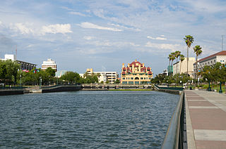
San Joaquin County, officially the County of San Joaquin, is a county located in the U.S. state of California. As of the 2020 census, the population was 779,233. The county seat is Stockton.

<span class="mw-page-title-main">Stanislaus County, California</span> County in California, United States

Stanislaus County is a county located in the San Joaquin Valley of the U.S. state of California. As of 2023, its estimated population is 564,404. The county seat is Modesto.

<span class="mw-page-title-main">Biggs, California</span> City in California, United States

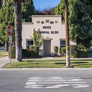
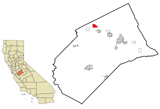
Biggs is a city in Butte County, California, United States. The population was 1,707 at the 2010 census, down from 1,793 at the 2000 census. The 2018 population estimate is 1,724.

<span class="mw-page-title-main">Tamalpais-Homestead Valley, California</span> Census-designated place in California, United States

Tamalpais-Homestead Valley is a census-designated place (CDP) in Marin County, California, United States. The population was 11,492 at the 2020 census.

<span class="mw-page-title-main">Boronda, California</span> Census-designated place in California, United States

Boronda is an unincorporated community and census-designated place (CDP) in Monterey County, California, United States. The population was 1,760 at the 2020 census. Boronda is located directly west of Salinas and is named after José Eusebio Boronda, a Californio ranchero, and located on the lands of his Rancho Rincón del Sanjón.

<span class="mw-page-title-main">Sand City, California</span> City in California, United States

Sand City is a city in Monterey County, California, United States, located on the shores of Monterey Bay, and surrounded on most sides by the larger city of Seaside. Sand City is located 2 miles (3 km) northeast of Monterey, at an elevation of 72 feet. The population was 325 at the 2020 census. The city is predominantly a business community, and has a number of larger retail stores. The West End area of Sand City, once an industrial area, hosts a growing artists' colony. Every August, the artists of Sand City and neighboring areas hold a street fair called the "West End Celebration".

<span class="mw-page-title-main">La Riviera, California</span> Census-designated place in California, United States

La Riviera is a census-designated place (CDP) in Sacramento County, California, United States. It is part of the Sacramento–Arden-Arcade–Roseville Metropolitan Statistical Area. The population was 10,802 at the 2010 census, up from 10,273 at the 2000 census. La Riviera is a primarily residential neighborhood located between the American River on the North side and Highway 50 on the southern border.

<span class="mw-page-title-main">Lathrop, California</span> City in the United States

Lathrop is a city located 10 miles (16 km) south of Stockton in San Joaquin County, California, United States. The 2020 census reported that Lathrop's population was 28,701. The city is located in Northern California at the intersection of Interstate 5 and California State Route 120, in the San Joaquin Valley.

<span class="mw-page-title-main">Manteca, California</span> City in California, United States

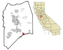
Manteca is a city in San Joaquin County, California. The city had a population of 83,498 as of the 2020 Census. It is part of the Stockton-Lodi, CA Metropolitan Statistical Area.

<span class="mw-page-title-main">Stanford, California</span> Census-designated place in Santa Clara County, California, US

Stanford is a census-designated place (CDP) in the northwest corner of Santa Clara County, California, United States. It is the home of Stanford University. The population was 21,150 at the 2020 census.

<span class="mw-page-title-main">Del Rio, California</span> Census-designated place in California, United States

Del Rio is a census-designated place (CDP) in Stanislaus County, California, United States that is located around the Del Rio Country Club. The population was 1,270 at the 2010 census, up from 1,168 at the 2000 census. It is part of the Modesto Metropolitan Statistical Area.

<span class="mw-page-title-main">Newman, California</span> City in California, United States

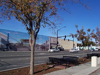
Newman is a city in Stanislaus County, California, located in the San Joaquin Valley region of the greater Central Valley. The city had a population of 10,224 at the 2010 census, up from 7,093 at the 2000 census. Founded in 1888 by Simon Newman, the city is a largely agricultural community, known for its annual Fall Festival.

<span class="mw-page-title-main">Oakdale, California</span> City in California, United States

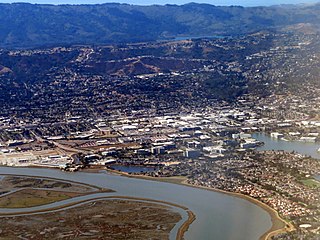
Oakdale is a city in the San Joaquin Valley and Stanislaus County, California. It is part of the Modesto Metropolitan Statistical Area.

<span class="mw-page-title-main">Patterson, California</span> City in California, United States

Patterson is a city in Stanislaus County, California, United States, located off Interstate 5. It is 27 miles (43 km) southeast of Tracy and is part of the Modesto Metropolitan Statistical Area. Patterson is known as the "Apricot Capital of the World"; the town holds an annual Apricot Fiesta to celebrate with many drinks, food, desserts and games. The population was 20,413 at the 2010 Census.

<span class="mw-page-title-main">Riverbank, California</span> City in California, United States

Riverbank is a city in Stanislaus County, California, United States. The population was 24,623 at the 2020 census, up from 15,826 at the 2000 census. Incorporated on August 23, 1922, Riverbank's official slogan is "City of Action." It is part of the Modesto Metropolitan Statistical Area.

<span class="mw-page-title-main">Riverdale Park, California</span> Census-designated place in California, United States

Riverdale Park is a census-designated place (CDP) in Stanislaus County, California, United States. The population was 1,128 at the 2010 census, up from 1,094 at the 2000 census. It is part of the Modesto Metropolitan Statistical Area.

<span class="mw-page-title-main">Salida, California</span> Census-designated place in California, United States

Salida is a census-designated place (CDP) in Stanislaus County, California, in the United States. As of the 2010 census, the CDP population was 13,722. It is part of the Modesto Metropolitan Statistical Area. Cultivation of almonds has historically been a significant activity in the vicinity, including a major Blue Diamond processing facility nearby. The plant is involved exclusively in processing whole brown almond kernels with a "dry" process involving no water, heat or chemicals. Salida is within the East Stanislaus Resource Conservation District which comprises 984 square miles (2,550 km2) of land area and attends to a variety of environmental conservation and best management agricultural practices.

<span class="mw-page-title-main">Waterford, California</span> City in California, United States

Waterford is the eighth largest city in Stanislaus County, California, United States. The population was 9,120 at the 2020 census, up from 8,456 as of the 2010 census. Waterford is part of the Modesto Metropolitan Statistical Area.

<span class="mw-page-title-main">West Modesto, California</span> Census-designated place in California, United States

West Modesto is a census-designated place (CDP) in Stanislaus County, California, United States. The population was 5,682 at the 2010 census, down from 6,096 at the 2000 census. It is part of the Modesto Metropolitan Statistical Area.

<span class="mw-page-title-main">Woodlake, California</span> City in California, United States

Woodlake is a city in the San Joaquin Valley in Tulare County, California, United States. The population was 7,419 at the 2020 census, up from 7,279 at the 2010 census. In 1912, the city of Woodlake was founded by Gilbert F. Stevenson.

References

  1. "California Cities by Incorporation Date". California Association of Local Agency Formation Commissions. Archived from the original (Word) on February 21, 2013. Retrieved August 25, 2014.
  2. "Manteca Bulletin". Manteca Bulletin. Retrieved March 29, 2021.
  3. 1 2 "Statewide Database". UC Regents. Retrieved December 30, 2014.
  4. "California's 10th Congressional District - Representatives & District Map". Civic Impulse, LLC. Retrieved March 12, 2013.
  5. "2019 U.S. Gazetteer Files". United States Census Bureau. Retrieved July 1, 2020.
  6. "Explore Census Data". data.census.gov. Retrieved May 11, 2023.
  7. "Story of the History of Ripon". Archived from the original on September 9, 2004. Retrieved August 27, 2004.
  8. "US Gazetteer files: 2010, 2000, and 1990". United States Census Bureau. February 12, 2011. Retrieved April 23, 2011.
  9. "Population and Housing Unit Estimates". United States Census Bureau. May 24, 2020. Retrieved May 27, 2020.
  10. "Census of Population and Housing". Census.gov. Retrieved June 4, 2015.
  11. "2010 Census Interactive Population Search: CA - Ripon city". U.S. Census Bureau. Archived from the original on July 15, 2014. Retrieved July 12, 2014.
  12. Holland, John (April 27, 2018). "Expanded train service coming to Modesto, Merced; what it means for commuters". Modesto Bee. Retrieved April 28, 2018.
  13. Ripon Christian School
  14. Harvest High School
  15. "Spartan Women in Sport: Gay MacLellan, '83 MA Kinesiology – Washington Square: The Stories of San Jose State University". blogs.sjsu.edu. Retrieved December 12, 2023.
  16. ABC30. "Walter Hawkins, gospel singer, dies at 61 in Ripon | ABC30 Fresno | abc30.com". ABC30 Fresno. Retrieved December 12, 2023.{{cite web}}: CS1 maint: numeric names: authors list (link)
  17. "Kim Johnston Ulrich - Actress". TV Insider. August 7, 2023. Retrieved December 12, 2023.