Shackelford, California

Last updated

Shackelford
Nickname: 
Little Mexico[ citation needed ]
Stanislaus County California Incorporated and Unincorporated areas Shackelford Highlighted.svg
Location in Stanislaus County and the state of California
Usa edcp location map.svg
Red pog.svg
Shackelford
Location in the United States
Coordinates: 37°36′54″N120°59′27″W / 37.61500°N 120.99083°W / 37.61500; -120.99083
Country Flag of the United States (23px).png  United States
State Flag of California.svg  California
County Stanislaus
City Modesto
Area
[1]
  Total0.682 sq mi (1.765 km2)
  Land0.672 sq mi (1.739 km2)
  Water0.010 sq mi (0.026 km2)  1.47%
Elevation
85 ft (26 m)
Population
 (2010)
  Total3,371
  Density4,900/sq mi (1,900/km2)
Time zone UTC-8 (Pacific (PST))
  Summer (DST) UTC-7 (PDT)
ZIP code
95351
Area code 209
FIPS code 06-71084
GNIS feature ID1853416

Shackelford is a southern neighbourhood of the city of Modesto in Stanislaus County, California, United States, which was officially annexed on June 1, 2012. [2] The population was 3,371 at the 2010 census, down from 5,170 at the 2000 census. It is part of the Modesto Metropolitan Statistical Area. Prior to its annexation, the neighbourhood was a census-designated place (CDP).

Contents

History

In 1916, the Lion Bridge which was built over the Tuolumne River to improve the access between the cities of Modesto and Ceres. [3] It was constructed at the cost of $111,000. [3]

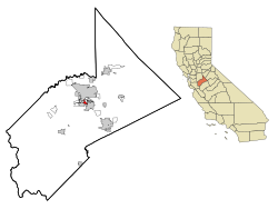
The city of Modesto finally annexed the "Shackelford annexation area" in 2012, regarding the event as "the culmination of a multi-year effort". [4] The area is bordered by California State Route 99 on the north, Crows Landing Road on the west, Main Street on the east, and Hatch Road on the south

Geography

Shackelford is located at 37°36′54″N120°59′27″W / 37.61500°N 120.99083°W / 37.61500; -120.99083 (37.615082, -120.990969) [5] in South Modesto. According to the United States Census Bureau, the CDP has a total area of 0.7 square miles (1.8 km2), of which 0.7 square miles (1.8 km2) is land and 1.47% is water.

Demographics

2010

The 2010 United States Census [6] reported that Shackelford had a population of 3,371. The population density was 4,945.7 inhabitants per square mile (1,909.5/km2). The racial makeup of Shackelford was 1,560 (46.3%) White, 27 (0.8%) African American, 63 (1.9%) Native American, 59 (1.8%) Asian, 1 (0.0%) Pacific Islander, 1,496 (44.4%) from other races, and 165 (4.9%) from two or more races. Hispanic or Latino of any race were 2,685 persons (79.6%).

The Census reported that 3,371 people (100% of the population) lived in households, 0 (0%) lived in non-institutionalized group quarters, and 0 (0%) were institutionalized.

There were 898 households, out of which 499 (55.6%) had children under the age of 18 living in them, 376 (41.9%) were opposite-sex married couples living together, 215 (23.9%) had a female householder with no husband present, 112 (12.5%) had a male householder with no wife present. There were 119 (13.3%) unmarried opposite-sex partnerships, and 8 (0.9%) same-sex married couples or partnerships. 139 households (15.5%) were made up of individuals, and 46 (5.1%) had someone living alone who was 65 years of age or older. The average household size was 3.75. There were 703 families (78.3% of all households); the average family size was 4.06.

The population was spread out, with 1,175 people (34.9%) under the age of 18, 363 people (10.8%) aged 18 to 24, 1,002 people (29.7%) aged 25 to 44, 611 people (18.1%) aged 45 to 64, and 220 people (6.5%) who were 65 years of age or older. The median age was 27.4 years. For every 100 females, there were 103.9 males. For every 100 females age 18 and over, there were 105.0 males.

There were 1,059 housing units at an average density of 1,553.7 per square mile (599.9/km2), of which 336 (37.4%) were owner-occupied, and 562 (62.6%) were occupied by renters. The homeowner vacancy rate was 2.0%; the rental vacancy rate was 13.4%. 1,299 people (38.5% of the population) lived in owner-occupied housing units and 2,072 people (61.5%) lived in rental housing units.

2000

As of the census [7] of 2000, there were 5,170 people, 1,363 households, and 1,053 families residing in the CDP. The population density was 6,106.4 inhabitants per square mile (2,357.7/km2). There were 1,454 housing units at an average density of 1,717.3 per square mile (663.1/km2). The racial makeup of the CDP was 50.14% White, 1.41% African American, 2.13% Native American, 0.95% Asian, 0.14% Pacific Islander, 38.63% from other races, and 6.62% from two or more races. Hispanic or Latino of any race were 68.12% of the population.

There were 1,363 households, out of which 49.5% had children under the age of 18 living with them, 49.3% were married couples living together, 18.0% had a female householder with no husband present, and 22.7% were non-families. 15.1% of all households were made up of individuals, and 5.8% had someone living alone who was 65 years of age or older. The average household size was 3.79 and the average family size was 4.25.

In the CDP, the population was spread out, with 37.6% under the age of 18, 11.6% from 18 to 24, 28.4% from 25 to 44, 15.4% from 45 to 64, and 7.0% who were 65 years of age or older. The median age was 26 years. For every 100 females, there were 108.8 males. For every 100 females age 18 and over, there were 104.8 males.

The median income for a household in the CDP was $23,289, and the median income for a family was $24,541. Males had a median income of $23,365 versus $15,903 for females. The per capita income for the CDP was $7,250. About 33.6% of families and 36.1% of the population were below the poverty line, including 39.1% of those under age 18 and 13.9% of those age 65 or over.

Politics

In the state legislature Shackelford is located in the 12th Senate District, represented by Republican Anthony Cannella, and in the 26th Assembly District, represented by Republican Greg Aghazarian.

In the United States House of Representatives, Shackelford is in California's 10th congressional district , represented by Democrat Mark DeSaulnier. [8]

Related Research Articles

<span class="mw-page-title-main">Redway, California</span> Census-designated place in California, United States

Redway is a census-designated place (CDP) in Humboldt County, California, United States. Redway is located 2.25 miles (3.6 km) northwest of Garberville, at an elevation of 538 feet (164 m). The population was 1,225 at the 2010 census, up from 1,188 at the 2000 census. Redway is also home to Redway Elementary School, with grades K–6.

<span class="mw-page-title-main">Dustin Acres, California</span> Census-designated place in California, United States

Dustin Acres is a census-designated place (CDP) in Kern County, California, United States. Dustin Acres is located 6.5 miles (10 km) north-northeast of Taft, at an elevation of 384 feet (117 m). The population was 652 at the 2010 census, up from 585 at the 2000 census.

<span class="mw-page-title-main">Tamalpais-Homestead Valley, California</span> Census-designated place in California, United States

Tamalpais-Homestead Valley is a census-designated place (CDP) in Marin County, California, United States. The population was 11,492 at the 2020 census.

<span class="mw-page-title-main">San Antonio Heights, California</span> Census-designated place in California, United States

San Antonio Heights is a census-designated place (CDP) in the San Bernardino County, California. It is in the northern Pomona Valley and the foothills of the San Gabriel Mountains. The population was 3,371 at the 2010 census, up from 3,122 at the 2000 census.

<span class="mw-page-title-main">Taft Mosswood, California</span> Census-designated place in California, United States

Taft Mosswood is a census-designated place (CDP) in San Joaquin County, California, United States. The population was 1,530 at the 2010 census, up from 1,388 at the 2000 census. It comprises an unincorporated "island" within the City of Stockton.

<span class="mw-page-title-main">Fruitdale, San Jose</span> Place in California, United States

Fruitdale is a district of San Jose, California, located in West San Jose, though some portions are still unincorporated as a census-designated place. The population of the CDP was 935 at the 2010 census.

Bret Harte is a census-designated place (CDP) in Stanislaus County, California, United States. The population was 5,152 at the 2010 census, down from 5,161 at the 2000 census. It is part of the Modesto Metropolitan Statistical Area. It is named for the American poet and short story writer, Bret Harte, best known for his writings about the California Gold Rush.

<span class="mw-page-title-main">Bystrom, California</span> Census-designated place in California, United States

Bystrom is a census-designated place (CDP) in Stanislaus County, California, United States. The population was 4,008 at the 2010 census, down from 4,518 at the 2000 census. It is part of the Modesto Metropolitan Statistical Area.

<span class="mw-page-title-main">East Oakdale, California</span> Census-designated place in California, United States

East Oakdale is an unincorporated census-designated place (CDP) on the Stanislaus River, located east of the city of Oakdale in Stanislaus County, California.

<span class="mw-page-title-main">Empire, California</span> Census-designated place in California, United States

Empire is a census-designated place (CDP) in Stanislaus County, California, United States. The population was 4,189 at the 2010 census, up from 3,903 at the 2000 census. It is part of the Modesto Metropolitan Statistical Area. Influenced by the Mexican culture, Empire is agriculturally active, and is home to the new Empire Community Park.

<span class="mw-page-title-main">Riverdale Park, California</span> Census-designated place in California, United States

Riverdale Park is a census-designated place (CDP) in Stanislaus County, California, United States. The population was 1,128 at the 2010 census, up from 1,094 at the 2000 census. It is part of the Modesto Metropolitan Statistical Area.

<span class="mw-page-title-main">Salida, California</span> Census-designated place in California, United States

Salida is a census-designated place (CDP) in Stanislaus County, California, in the United States. As of the 2010 census, the CDP population was 13,722. It is part of the Modesto Metropolitan Statistical Area. Cultivation of almonds has historically been a significant activity in the vicinity, including a major Blue Diamond processing facility nearby. The plant is involved exclusively in processing whole brown almond kernels with a "dry" process involving no water, heat or chemicals. Salida is within the East Stanislaus Resource Conservation District which comprises 984 square miles (2,550 km2) of land area and attends to a variety of environmental conservation and best management agricultural practices.

<span class="mw-page-title-main">West Modesto, California</span> Census-designated place in California, United States

West Modesto is a census-designated place (CDP) in Stanislaus County, California, United States. The population was 5,682 at the 2010 census, down from 6,096 at the 2000 census. It is part of the Modesto Metropolitan Statistical Area.

<span class="mw-page-title-main">Monroe, Maine</span> Town in the state of Maine, United States

Monroe is a town in Waldo County, Maine, United States named for President James Monroe. The population was 931 at the 2020 census.

<span class="mw-page-title-main">Baywood, New York</span> Hamlet and census-designated place in New York, United States

Baywood is a hamlet and census-designated place (CDP) in the Town of Islip in Suffolk County, on Long Island, in New York, United States. The population was 7,350 at the 2010 census.

<span class="mw-page-title-main">Sherwood, Hamilton County, Ohio</span> Census-designated place in Ohio, United States

Sherwood is a census-designated place (CDP) in Hamilton County, Ohio, United States. The population was 3,633 at the 2020 census.

<span class="mw-page-title-main">Oakland, Lawrence County, Pennsylvania</span> Census-designated place in Pennsylvania, United States

Oakland is an unincorporated area and census-designated place (CDP) in Lawrence County, Pennsylvania, United States. The population was 1,569 at the 2010 census.

<span class="mw-page-title-main">Piney View, West Virginia</span> Census-designated place in West Virginia, United States

Piney View is a census-designated place (CDP) in Raleigh County, West Virginia, United States. The population was 989 at the 2010 census.

Lower Red Lake is an unorganized territory in Beltrami County, Minnesota, United States.The territory is located on the Red Lake Indian Reservation, and the town of Red Lake is located in the area. The population of the Lower Red Lake territory was 5,790 at the 2010 census.

Norfolk is a hamlet in St. Lawrence County, New York, United States. The population was 1,327 at the 2010 census.

References

  1. "2010 Census U.S. Gazetteer Files – Places – California". United States Census Bureau.
  2. "Archived copy". www.modbee.com. Archived from the original on January 29, 2013. Retrieved February 3, 2022.{{cite web}}: CS1 maint: archived copy as title (link)
  3. 1 2 Osborn, B. J. (December 2003). Modesto: An Informal History. iUniverse. ISBN   9780595302802 . Retrieved March 10, 2013.
  4. "LAFCO Application No. 2011-07 - Shackelford Change of Organization to the City of Modesto" (PDF). LAFCO. Retrieved April 29, 2013.
  5. "US Gazetteer files: 2010, 2000, and 1990". United States Census Bureau. February 12, 2011. Retrieved April 23, 2011.
  6. "2010 Census Interactive Population Search: CA - Shackelford CDP". U.S. Census Bureau. Archived from the original on July 15, 2014. Retrieved July 12, 2014.
  7. "U.S. Census website". United States Census Bureau . Retrieved January 31, 2008.
  8. "California's 10th Congressional District - Representatives & District Map". Civic Impulse, LLC. Retrieved September 28, 2014.