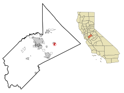
Hickman, California

Last updated

Hickman
Stanislaus County California Incorporated and Unincorporated areas Hickman Highlighted.svg
Location in Stanislaus County and the state of California
Coordinates: 37°37′27″N120°45′28″W / 37.62417°N 120.75778°W / 37.62417; -120.75778
Country Flag of the United States.svg  United States
State Flag of California.svg  California
County Stanislaus
Area
[1]
  Total1.085 sq mi (2.809 km2)
  Land1.076 sq mi (2.787 km2)
  Water0.009 sq mi (0.022 km2)  0.79%
Elevation
177 ft (54 m)
Population
 (2020) [2]
  Total604
  Density560/sq mi (220/km2)
Time zone UTC-8 (Pacific (PST))
  Summer (DST) UTC-7 (PDT)
ZIP code
95323
Area code 209
FIPS code 06-33504
GNIS feature ID1656069
Hickman Almond Blossoms in Spring HickmanAlmondBlossomsInSpring.jpg
Hickman Almond Blossoms in Spring
Hickman Almond Orchard in the Spring HickmanAlmondOrchardInSpring.jpg
Hickman Almond Orchard in the Spring

Hickman is a census-designated place (CDP) in Stanislaus County, California, United States. The population was 641 at the 2010 census, up from 457 at the 2000 census. It is part of the Modesto Metropolitan Statistical Area. Its history dates back to the goldrush era, and was once was a stop on a rail line (the old train stop still stands). KLOC broadcasts from three radio towers in Hickman.

Contents

History

The first major settler of Hickman was Charles Dallas in either 1849 or 1850, and early maps even referred to the area as "Dallas". Dallas' daughter Mary married Louis McLean Hickman on February 1, 1860. [3] Hickman served as mayor of nearby Stockton, California in 1869. [3] In the 1860s Hickman owned a hardware store and 11,000 acre ranch where he grew grain, hay, olives, figs, oranges, grapes and other fruits. [3] The advent of the railroad in 1891 led to large brick grain storage buildings. [3] Hickman was re-named in 1891 by the Southern Pacific for Louis Hickman. [4]

Local life

Hickman social life revolves around its school. Hickman Charter school district is a K-8 school district. After 8th grade, students can commute to one of the many local schools. Hickman Charter School has more students than native population and has attendance from students as far as Berkeley, California.

Commerce

Hickman is a country town, and the most obvious form of income is agriculture. Almond orchards are plentiful, and there are several dairies. Foster Farms operates a dairy as well as several poultry farms, and there is a wholesale nursery raising trees, especially decorative trees like redwoods. A large rooster farm reputedly sells fighting cocks (although using such birds in fighting is illegal). There are also other forms of industry, including a multi-national mining equipment company, large nursery, [5] a welding shop, two country stores, a cabinet maker, a music education company and Hickman Hat Rack Co.

Hydroelectric Dam on the Canal

Hickman has an unusual hydro-electric dam on one of its irrigation canals. [6]

Geography

Hickman is located at 37°37′27″N120°45′28″W / 37.62417°N 120.75778°W / 37.62417; -120.75778 (37.624065, -120.757817). [7]

According to the United States Census Bureau, the CDP has a total area of 1.1 square miles (2.8 km2), 99.21% of it land and 0.79% of it water.

Charles Dallas, first major settler of Hickman CharlesDallas.jpg
Charles Dallas, first major settler of Hickman

Demographics

Historical population
CensusPop.Note
U.S. Decennial Census [8]

2010

The 2010 United States Census [9] reported that Hickman had a population of 641. The population density was 591.0 inhabitants per square mile (228.2/km2). The racial makeup of Hickman was 503 (78.5%) White, 1 (0.2%) African American, 15 (2.3%) Native American, 4 (0.6%) Asian, 0 (0.0%) Pacific Islander, 98 (15.3%) from other races, and 20 (3.1%) from two or more races. Hispanic or Latino of any race were 180 persons (28.1%).

The Census reported that 641 people (100% of the population) lived in households, 0 (0%) lived in non-institutionalized group quarters, and 0 (0%) were institutionalized.

There were 193 households, out of which 84 (43.5%) had children under the age of 18 living in them, 119 (61.7%) were opposite-sex married couples living together, 22 (11.4%) had a female householder with no husband present, 19 (9.8%) had a male householder with no wife present. There were 8 (4.1%) unmarried opposite-sex partnerships, and 2 (1.0%) same-sex married couples or partnerships. 23 households (11.9%) were made up of individuals, and 9 (4.7%) had someone living alone who was 65 years of age or older. The average household size was 3.32. There were 160 families (82.9% of all households); the average family size was 3.64.

The population was spread out, with 176 people (27.5%) under the age of 18, 64 people (10.0%) aged 18 to 24, 158 people (24.6%) aged 25 to 44, 174 people (27.1%) aged 45 to 64, and 69 people (10.8%) who were 65 years of age or older. The median age was 35.2 years. For every 100 females, there were 104.1 males. For every 100 females age 18 and over, there were 101.3 males.

There were 203 housing units at an average density of 187.2 per square mile (72.3/km2), of which 141 (73.1%) were owner-occupied, and 52 (26.9%) were occupied by renters. The homeowner vacancy rate was 2.7%; the rental vacancy rate was 3.7%. 459 people (71.6% of the population) lived in owner-occupied housing units and 182 people (28.4%) lived in rental housing units.

2000

As of the census [10] of 2000, there were 457 people, 139 households, and 116 families residing in the CDP. The population density was 360.3 inhabitants per square mile (139.1/km2). There were 148 housing units at an average density of 116.7 per square mile (45.1/km2). The racial makeup of the CDP was 84.46% White, 1.53% Native American, 0.22% Asian, 9.19% from other races, and 4.60% from two or more races. Hispanic or Latino of any race were 18.38% of the population.

There were 139 households, out of which 38.8% had children under the age of 18 living with them, 67.6% were married couples living together, 11.5% had a female householder with no husband present, and 16.5% were non-families. 12.9% of all households were made up of individuals, and 2.9% had someone living alone who was 65 years of age or older. The average household size was 3.29 and the average family size was 3.55.

In the CDP, the population was spread out, with 30.4% under the age of 18, 9.8% from 18 to 24, 29.1% from 25 to 44, 19.5% from 45 to 64, and 11.2% who were 65 years of age or older. The median age was 34 years. For every 100 females, there were 109.6 males. For every 100 females age 18 and over, there were 101.3 males.

The median income for a household in the CDP was $33,333, and the median income for a family was $34,583. Males had a median income of $41,250 versus $21,618 for females. The per capita income for the CDP was $16,693. About 13.3% of families and 21.1% of the population were below the poverty line, including 40.4% of those under age 18 and 9.8% of those age 65 or over.

Government

In the California State Legislature, Hickman is in the 8th Senate District , represented by Democrat Angelique Ashby, and the 12th Assembly District , represented by Democrat Damon Connolly. [11]

In the United States House of Representatives, Hickman is in California's 10th congressional district , represented by Democrat Mark DeSaulnier. [12]

Related Research Articles

<span class="mw-page-title-main">Tanaina, Alaska</span> CDP in Alaska, United States

Tanaina is a census-designated place (CDP) in the Matanuska-Susitna Borough in the U.S. state of Alaska. Located 4 miles north from Wasilla, it is part of the Anchorage, Alaska Metropolitan Statistical Area. At the 2020 census the population was 8,817, up from 8,197 in 2010. Tanaina is the sixth-most populated CDP in Alaska.

<span class="mw-page-title-main">Laton, California</span> Census-designated place in California, United States

Laton is a census-designated place (CDP) in Fresno County, California, United States. The population was 1,824 at the 2010 census, up from 1,236 at the 2000 census. Laton is located 23 miles (37 km) south-southeast of Fresno, at an elevation of 259 feet.

<span class="mw-page-title-main">Raisin City, California</span> Census-designated place in California, United States

Raisin City is a census-designated place (CDP) in Fresno County, California, United States. The population was 380 at the 2010 census, up from 165 at the 2000 census. Raisin City is located 13 miles (21 km) south-southwest of downtown Fresno, at an elevation of 236 feet.

<span class="mw-page-title-main">Redway, California</span> Census-designated place in California, United States

Redway is a census-designated place (CDP) in Humboldt County, California, United States. Redway is located 2.25 miles (3.6 km) northwest of Garberville, at an elevation of 538 feet (164 m). The population was 1,225 at the 2010 census, up from 1,188 at the 2000 census. Redway is also home to Redway Elementary School, with grades K–6.

<span class="mw-page-title-main">Westhaven-Moonstone, California</span> Census-designated place in California, United States

Westhaven-Moonstone is a census-designated place (CDP) located in Humboldt County, California, United States. As of the 2010 census the population was 1,205, up from 1,044 at the 2000 census.

<span class="mw-page-title-main">Wilkerson, California</span> Census-designated place in California, United States

Wilkerson is a census-designated place (CDP) in Inyo County, California, United States. The population was 563 at the 2010 census, up from 562 at the 2000 census.

<span class="mw-page-title-main">Dustin Acres, California</span> Census-designated place in California, United States

Dustin Acres is a census-designated place (CDP) in Kern County, California, United States. Dustin Acres is located 6.5 miles (10 km) north-northeast of Taft, at an elevation of 384 feet (117 m). The population was 652 at the 2010 census, up from 585 at the 2000 census.

<span class="mw-page-title-main">Desert View Highlands, California</span> Census designated place in California, United States

Desert View Highlands is a census-designated place (CDP) in Los Angeles County, California, United States. The population was 2,360 at the 2010 census, up from 2,337 at the 2000 census. It is surrounded by the City of Palmdale.

<span class="mw-page-title-main">East San Gabriel, California</span> Census-designated place in California, United States

East San Gabriel is a census-designated place (CDP) in Los Angeles County, California, United States. The population was 14,874 at the 2010 census, up from 14,512 at the 2000 census.

<span class="mw-page-title-main">Mayflower Village, California</span> Census-designated place in California, United States

Mayflower Village is a census-designated place (CDP) in the San Gabriel Valley, in Los Angeles County, California, United States. The population was 5,515 at the 2010 census, up from 5,081 at the 2000 census. The ZIP Codes serving the community are 91006, which is served by Arcadia and 91016, which is served by Monrovia.

<span class="mw-page-title-main">North El Monte, California</span> Census-designated place in California, United States

North El Monte is a census-designated place (CDP) in the San Gabriel Valley, in Los Angeles County, California, United States. The population was 3,723 at the 2010 census, up from 3,703 at the 2000 census.

<span class="mw-page-title-main">North Auburn, California</span> Census-designated place in California, United States

North Auburn is a census-designated place (CDP) in Placer County, California, United States. It is part of the Sacramento–Arden-Arcade–Roseville Metropolitan Statistical Area. The population was 13,452 at the 2020 census.

<span class="mw-page-title-main">Lakeview, California</span> Census-designated place in California, United States

Lakeview is a census-designated place (CDP) in Riverside County, California, United States. The population was 2,104 at the 2010 census, up from 1,619 at the 2000 census. The community is named for nearby Mystic Lake.

<span class="mw-page-title-main">Mira Monte, California</span> Rural community in Ventura County, California, United States

Mira Monte is a rural community in Ventura County, California, United States. Mira Monte is located in between the communities of Oak View, Meiners Oaks, and southwest of the City of Ojai, California. For statistical purposes, the United States Census Bureau has defined Mira Monte as a census-designated place (CDP). The census definition of the area may not precisely correspond to local understanding of the area with the same name. According to the 2020 census, the population of Mira Monte is 6,618, down from 6,845 at the 2010 census.

<span class="mw-page-title-main">Kensington, Connecticut</span> Census-designated place in Connecticut, United States

Kensington is a census-designated place (CDP) and section of the town of Berlin in Hartford County, Connecticut, United States. The Berlin town offices are located in Kensington. The population was 8,459 at the 2010 census.

<span class="mw-page-title-main">Del Monte Forest, California</span> Census-designated place in California, United States

Del Monte Forest is a census-designated place (CDP) in Monterey County, California, United States. As of the 2020 census, the CDP had a total population of 4,204, down from 4,514 at the 2010 census. The census area includes the separate well-known community of Pebble Beach.

<span class="mw-page-title-main">Edgewood, Ohio</span> Census-designated place in Ohio, United States

Edgewood is a census-designated place (CDP) in Ashtabula County, Ohio, United States. The population was 4,185 at the 2020 census.

<span class="mw-page-title-main">India Hook, South Carolina</span> CDP in South Carolina, United States

India Hook is a census-designated place (CDP) in York County, South Carolina, United States. The majority of India Hook is annexed into the city of Rock Hill, but as of 2010 India Hook is still considered to be a CDP. It is one of the three communities located on Lake Wylie.

<span class="mw-page-title-main">Bohners Lake, Wisconsin</span> CDP in Wisconsin, United States

Bohners Lake is a census-designated place (CDP) in Racine County, Wisconsin, United States. Its first syllable is pronounced as in "bone". The population of the CDP was 2,374 at the 2020 census. It is politically part of the Town of Burlington, together with Browns Lake, Wisconsin. There has been discussion of incorporating Bohners Lake as a village to prevent annexation by the City of Burlington. It was named for Antony Bohner, a French immigrant who established a resort on the lake of the same name.

<span class="mw-page-title-main">Boothbay Harbor (CDP), Maine</span> Census-designated place in Maine, United States

Boothbay Harbor is a census-designated place (CDP) comprising the densely populated center of the town of Boothbay Harbor in Lincoln County, Maine, United States. The population was 1,086 at the 2010 census, down from 1,237 at the 2000 census.

References

  1. "2010 Census Gazetteer Files - Places - California". United States Census Bureau . Retrieved March 26, 2015.
  2. "Explore Census Data". data.census.gov. Retrieved June 13, 2023.
  3. 1 2 3 4 Jeff Benziger "Images of America Waterford" Arcadia Publishing 2011
  4. Gudde, Erwin Gustav (1998). California place names : the origin and etymology of current geographical names . Bright, William, 1928-2006. (4th ed., rev. and enl. ed.). Berkeley: University of California Press. p.  165. ISBN   0520213165. OCLC   37854320.
  5. http://www.frantznursery.com/ | title=Frantz Nursery
  6. url=https://www.researchgate.net/publication/255544968_Turlock_harnesses_power_in_its_irrigation_canal_Hickman_CA_two_500kW_generators | title=report of hydroelectric dam in TID
  7. "US Gazetteer files: 2010, 2000, and 1990". United States Census Bureau. February 12, 2011. Retrieved April 23, 2011.
  8. "Census of Population and Housing". Census.gov. Retrieved June 4, 2016.
  9. "2010 Census Interactive Population Search: CA - Hickman CDP". U.S. Census Bureau. Archived from the original on July 15, 2014. Retrieved July 12, 2014.
  10. "U.S. Census website". United States Census Bureau . Retrieved January 31, 2008.
  11. "Statewide Database". Regents of the University of California. Archived from the original on February 1, 2015. Retrieved March 26, 2015.
  12. "California's 10th Congressional District - Representatives & District Map". Civic Impulse, LLC. Retrieved September 28, 2014.