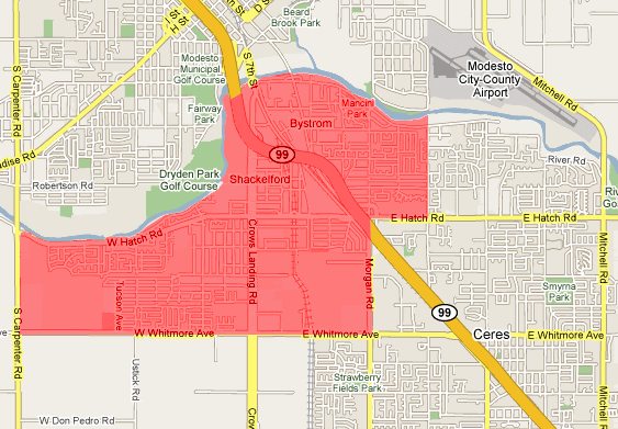
South Modesto

Last updated

South Modesto is the term that refers to the areas south of the Tuolumne River, in Modesto. The region consists of the census-designated places of Bret Harte, Shackelford, and Bystrom; as well as the county "islands" amidst them. The area is highly influenced by its residents of Mexican descent, hence the supermarkets, businesses, and nickname "Little Mexico". With the remodel of the regionally known flea market "El Rematito", [1] South Modesto has attracted more residents from other towns.

Tuolumne River watercourse in the United States of America

The Tuolumne River flows for 149 miles (240 km) through Central California, from the high Sierra Nevada to join the San Joaquin River in the Central Valley. Originating at over 8,000 feet (2,400 m) above sea level in Yosemite National Park, the Tuolumne drains a rugged watershed of 1,958 square miles (5,070 km2), carving a series of canyons through the western slope of the Sierra. While the upper Tuolumne is a fast-flowing mountain stream, the lower river crosses a broad, fertile and extensively cultivated alluvial plain. Like most other central California rivers, the Tuolumne is dammed multiple times for irrigation and the generation of hydroelectricity.

Modesto, California City in California

Modesto, officially the City of Modesto, is the county seat and largest city of Stanislaus County, California, United States. With a population of approximately 201,165 at the 2010 census, it is the 18th largest city in the state of California and forms part of the Modesto–Merced combined Statistical Area. The Modesto Census County Division, which includes the cities of Ceres and Riverbank, had a population of 312,842 as of 2010.

Bret Harte, California census-designated place in California, United States

Bret Harte is a census-designated place (CDP) in Stanislaus County, California, United States. The population was 5,152 at the 2010 census, down from 5,161 at the 2000 census. It is part of the Modesto Metropolitan Statistical Area. It is named for the American poet and short story writer, Bret Harte, best known for his writings about the California Gold Rush.

Contents

History

In 1917, the city of Modesto built a two lane bridge connecting the city on the north bank to the then undeveloped south bank of the Tuolumne River. This was done to create a road link to areas south of the river (particularly Ceres) and for development south of the river.

In 1918, the Modesto Tallow Company opened along a then-lonely Crows Landing Road. The tallow company was a rendering plant that processed dead animal carcasses and fleshy leftovers (meats, fats, bones) from area restaurants and butchers to make tallow, an important ingredient in animal feed, tooth paste, soap, and glue, among other household products. Since then, the Modesto Tallow Company has ceased operation and has been torn down.

Leftovers uneaten edible remains of a meal after the meal is over

Leftovers are the uneaten edible remains of a meal after everyone has finished eating. Food scraps that are not directly edible are not regarded as leftovers, but rather as waste material. Some only use "leftovers" to refer to extra food that constitutes a meal by itself, not just portions of the original.

Related Research Articles

Stanislaus County, California County in California, United States

Stanislaus County is a county located in the Central Valley of the U.S. state of California. As of the 2010 census, the population was 514,453. The county seat is Modesto.

Puerto Vallarta Place in Jalisco, Mexico

Puerto Vallarta is a Mexican beach resort city situated on the Pacific Ocean's Bahía de Banderas. PV or simply Vallarta is the second largest urban agglomeration in the state after the Guadalajara Metropolitan Area. The City of Puerto Vallarta is the government seat of the Municipality of Puerto Vallarta which comprises the city as well as population centers outside of the city extending from Boca de Tomatlán to the Nayarit border . The city is located at 20°40′N105°16′W. The municipality has an area of 1,300.7 square kilometres (502.19 sq mi). To the north it borders the southwest part of the state of Nayarit. To the east it borders the municipality of Mascota and San Sebastián del Oeste, and to the south it borders the municipalities of Talpa de Allende and Cabo Corrientes.

Imperial Valley valley in southern California

The Imperial Valley lies in the California counties of Imperial and Riverside. It is located in southeastern Southern California, and is the site of an urban area largely centered on the city of El Centro. The Valley is bordered by the Colorado River to the east and, in part, the Salton Sea to the west. Farther west lies the San Diego and Imperial County border. To the north is the Coachella Valley region of Riverside County, which together with Imperial Valley form the Salton Trough, or the Cahuilla Basin, also the county line of Imperial and Riverside counties, and to the south the international boundary with the U.S. state of California and Baja California.

Kansas City metropolitan area Metropolitan area in the United States

The Kansas City metropolitan area is a 14 county metropolitan area anchored by Kansas City, Missouri and straddling the border between the U.S. states of Missouri and Kansas. With a population of 2,104,509, it ranks as the second largest metropolitan area centered in Missouri. Alongside Kansas City, the area includes a number of other cities and suburbs, the largest being Overland Park, Kansas; Kansas City, Kansas; Olathe, Kansas; and Independence, Missouri; each over 100,000 in population. The Mid-America Regional Council (MARC) serves as the Council of Governments and the Metropolitan Planning Organization for the area.

Tehuantepec City & Municipality in Oaxaca, Mexico

Tehuantepec is a city and municipality in the southeast of the Mexican state of Oaxaca. It is part of the Tehuantepec District in the west of the Istmo Region. The area was important in pre Hispanic period as part of a trade route that connected Central America with what is now the center of Mexico. Later it became a secondary capital of the Zapotec dominion, before it was conquered by the Spanish in the early 16th century.

Area code 209 area codes in the United States

Area code 209 is the California telephone area code that was split from area code 415 on October 26, 1957. It covers Stockton, Modesto, Turlock, Merced, Winton, Atwater, Livingston, Manteca, Ripon, Tracy, Lodi, Galt, Sonora, Los Banos, San Andreas, Mariposa, and Yosemite, the northern San Joaquin Valley, and the Sierra Foothills.

Dry Creek is a stream in Stanislaus County, California, that is a tributary to the Tuolumne River.

Zumpango Municipality in State of Mexico, Mexico

Zumpango is a municipality located to northeastern part of the state of Mexico in Zumpango Region. It lies directly north of the Mexico City within the Greater Mexico City urban area. This area is under rapid development large scale housing projects; however, transportation and other infrastructure have not kept up with the growing population. The city of Zumpango lies near Lake Zumpango, the last of the five interconnected lakes which covered much of the Valley of Mexico in the pre Hispanic period. The name Zumpango is derived from the Nahuatl word “Tzompanco” which means string of scalps.

Tallow, County Waterford Town in Munster, Ireland

Tallow is a town in County Waterford, Ireland. Tallow is in the province of Munster near the border between County Cork and County Waterford and situated on a small hill just south of the River Bride.

La Grange, California Unincorporated community in California, United States

La Grange is a small unincorporated community in rural Stanislaus County, California, United States. Its altitude is 249 feet (76 m). As of 2008 it has a population of 345. It is located at 37°39′49″N120°27′49″W along the Tuolumne River, and is near the La Grange Dam and the New Don Pedro Dam.

Lerma, State of Mexico Town & Municipality in State of Mexico, Mexico

Lerma is a city and municipality located just east of Toluca and 54 km west of Mexico City in State of Mexico, Mexico. The city was founded in the early colonial period and named after the Duke of Lerma in Spain. The municipal area saw two battles of the Mexican War of Independence, the Battle of Monte de las Cruces and the Battle of Lerma. For a time after independence, the city was the capital of Mexico State before it was moved to Toluca. The municipality is in one of the most densely populated areas of Mexico and is growing. Much of this growth is occurring near the Toluca-Mexico City highway and on the floodplains of the Lerma River. The latter has caused significant problems with flooding when the river overflows its banks during the rainy season. The Nahuatl name for the area is Cacamilhuacan, which translates to “crows in the field.” In the early colonial period, the area was called Santa Clara Cacamilhuacan. The municipality has both an Aztec glyph with a crow reflecting its Nahuatl name and a Spanish coat of arms.

The Tuolumne River Regional Park is a large urban park under development along a seven-mile (11 km) stretch of the Tuolumne River between the cities of Ceres, California and Modesto, California consisting of 500 acres(.78 mi2, 2.02 km2) of public grounds in Stanislaus County, California.

Tecolotlán Town and municipality in Jalisco, Mexico

Tecolotlán is a town and municipality, in Jalisco in central-western Mexico. The municipality covers an area of 795.55 km².

Turlock Lake State Recreation Area

Turlock Lake State Recreation Area is regional park and recreation area at Turlock Reservoir in Stanislaus County, central California.

La Grange Dam

The La Grange Dam is a masonry-gravity diversion dam on the Tuolumne River near La Grange, California. The dam was completed in 1883 by the Turlock Irrigation District and Modesto Irrigation District in an effort to divert water into their canal systems for local farmers.

Tuolumne City is a former settlement on the Tuolumne River, originally in Tuolumne County, during the California Gold Rush.

The Modesto Irrigation District (MID) is a special-purpose district that provides irrigation and drinking water, and electrical service, to customers in the San Joaquin Valley within Stanislaus County, California.

El Pueblo is a neighborhood in Wichita, Kansas, United States. A mixed commercial and residential area on the east bank of the Little Arkansas River, it is the cultural and historical center of the city’s Hispanic community.

References

  1. Planners to rule on El Rematito market., Retrieved January 19, 2011.

South Modesto at City-data.com Map of South Modesto