Summerland, California

Last updated

Summerland, California
Summerlandca.jpg
Summerland, as seen from the top of Ortega Hill, 2006
Santa Barbara County California Incorporated and Unincorporated areas Summerland Highlighted.svg
Location in Santa Barbara County and the state of California
Coordinates: 34°25′17″N119°35′45″W / 34.42139°N 119.59583°W / 34.42139; -119.59583
Country Flag of the United States (23px).png  United States
State Flag of California.svg  California
County Santa Barbara
Government
   State senator Monique Limón (D) [1]
   Assemblymember Gregg Hart (D) [1]
   U. S. rep. Salud Carbajal (D) [2]
Area
[3]
  Total1.990 sq mi (5.152 km2)
  Land1.983 sq mi (5.135 km2)
  Water0.007 sq mi (0.017 km2)  0.33%
Elevation
[4]
121 ft (37 m)
Population
  Total1,448
  Density730/sq mi (280/km2)
Time zone UTC-8 (Pacific)
  Summer (DST) UTC-7 (PDT)
ZIP code
93067
Area code 805
FIPS code 06-75714
GNIS feature ID 1656637

Summerland is a census designated place (CDP) in Santa Barbara County, California. The population was 1,448 at the 2010 census, down from 1,545 at the 2000 census.

Contents

The town includes a school and a Presbyterian Church. There are many small businesses.

History

Tar from natural oil seeps in the Summerland area was used for sealing their ocean-going tomols by the Chumash people and for the Mission Santa Barbara as waterproofing for the roof.

In 1883, spiritualist and real estate speculator H.L. Williams founded the town of Summerland. In 1888 he divided his land tract, on a moderately sloping hill facing the ocean, into numerous parcels. He promoted the tiny lots – 25 x 60 – to fellow Spiritualists, who bought them in quantity and moved to the area. The spiritual center of the town was a Spiritualist Church, with séance room, demolished when Highway 101 was put through in the 1950s. [5]

Oil wells just off the coast, before 1906 Oil wells just offshore at Summerland, California, c.1915.jpg
Oil wells just off the coast, before 1906
The same view in 2009 SummerlandOilFieldToday1.jpg
The same view in 2009

In the 1890s, oil development began in the coastal area of Summerland, at the Summerland Oil Field. Numerous wooden oil derricks were built on the beach, and on piers stretching into the ocean. The world's first offshore oil well, drilled into the sea floor, was at this location. Production at this beach area peaked before 1910, although most of the rigs remained into the 1920s. [6] Peak production from the onshore portion of the Summerland Field did not occur until 1930; the last oil was pumped from the nearshore region in 1940. [7]

In 1957, Standard Oil Co. of California (now Chevron) found the large Summerland Offshore Oil Field, several miles offshore, which was shut down in the 1990s. [8] In January 1969, a blowout at the Dos Cuadras Field, about five miles offshore, caused the Santa Barbara Oil Spill, a formative event for the modern environmental movement. [9]

In August 2015, Summerland's beach was closed for several days by County of Santa Barbara health officials due to large amounts of oil washed onshore. [10] Local residents suspect the petroleum source is a leaking capped oil well ("the Becker wellhead") in the tidal area below Lookout Park. [11]

Geography

Summerland is located at 34°25′17″N119°35′45″W / 34.42139°N 119.59583°W / 34.42139; -119.59583 (34.421395, -119.595969). [12] It is on the coast directly east at Ortega Ridge Road at the unincorporated community of Montecito and west-northwest of the city of Carpinteria. Summerland has a significantly higher population density than the surrounding area. U.S. Route 101 goes through Summerland.

According to the United States Census Bureau, Summerland has a total area of 2.0 square miles (5.2 km2), of which, 2.0 square miles (5.1 km2) of it is land and 0.33% is water.

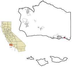
The community is built on a set of coastal bluffs right next to the ocean. Surrounding it and Montecito are the cities of Carpinteria and Santa Barbara.

Climate

This region experiences warm (but not hot) and dry summers, with no average monthly temperatures above 71.6 °F. According to the Köppen Climate Classification system, Summerland has a warm-summer Mediterranean climate, abbreviated "Csb" on climate maps. [13]

Demographics

2010

At the 2010 census Summerland had a population of 1,448. The population density was 727.9 inhabitants per square mile (281.0/km2). The racial makeup of Summerland was 1,295 (89.4%) White, 3 (0.2%) African American, 7 (0.5%) Native American, 41 (2.8%) Asian, 6 (0.4%) Pacific Islander, 51 (3.5%) from other races, and 45 (3.1%) from two or more races. Hispanic or Latino of any race were 192 people (13.3%). [14]

The whole population lived in households, no one lived in non-institutionalized group quarters and no one was institutionalized.

There were 687 households, 128 (18.6%) had children under the age of 18 living in them, 270 (39.3%) were opposite-sex married couples living together, 55 (8.0%) had a female householder with no husband present, 23 (3.3%) had a male householder with no wife present. There were 54 (7.9%) unmarried opposite-sex partnerships, and 9 (1.3%) same-sex married couples or partnerships. 230 households (33.5%) were one person and 62 (9.0%) had someone living alone who was 65 or older. The average household size was 2.11. There were 348 families (50.7% of households); the average family size was 2.68.

The age distribution was 211 people (14.6%) under the age of 18, 119 people (8.2%) aged 18 to 24, 315 people (21.8%) aged 25 to 44, 546 people (37.7%) aged 45 to 64, and 257 people (17.7%) who were 65 or older. The median age was 49.2 years. For every 100 females, there were 92.0 males. For every 100 females age 18 and over, there were 88.6 males.

There were 823 housing units at an average density of 413.7 per square mile, of the occupied units 362 (52.7%) were owner-occupied and 325 (47.3%) were rented. The homeowner vacancy rate was 3.2%; the rental vacancy rate was 9.7%. 790 people (54.6% of the population) lived in owner-occupied housing units and 658 people (45.4%) lived in rental housing units.

2000

At the 2000 census there were 1,545 people in 715 households, including 368 families, in the CDP. The population density was 764.7 inhabitants per square mile (295.3/km2). There were 784 housing units at an average density of 388.0 per square mile (149.8/km2). The racial makeup of the CDP was 91.78% White, 0.45% African American, 0.26% Native American, 2.39% Asian, 0.13% Pacific Islander, 2.27% from other races, and 2.72% from two or more races. Hispanic or Latino of any race were 7.44%. [15]

Of the 715 households 17.9% had children under the age of 18 living with them, 42.2% were married couples living together, 7.4% had a female householder with no husband present, and 48.5% were non-families. 33.1% of households were one person and 5.5% were one person aged 65 or older. The average household size was 2.16 and the average family size was 2.70.

The age distribution was 14.6% under the age of 18, 6.7% from 18 to 24, 34.2% from 25 to 44, 32.9% from 45 to 64, and 11.7% 65 or older. The median age was 42 years. For every 100 females, there were 93.9 males. For every 100 females age 18 and over, there were 91.9 males.

The median household income was $53,964 and the median family income was $75,625. Males had a median income of $50,469 versus $41,042 for females. The per capita income for the CDP was $41,668. About 4.5% of families and 9.5% of the population were below the poverty line, including 7.5% of those under age 18 and none of those age 65 or over.

Notable residents

Notes

  1. 1 2 "Statewide Database". UC Regents. Archived from the original on February 1, 2015. Retrieved December 8, 2014.
  2. "California's 24th Congressional District - Representatives & District Map". Civic Impulse, LLC. Retrieved September 29, 2014.
  3. "2010 Census U.S. Gazetteer Files – Places – California". United States Census Bureau.
  4. "Summerland". Geographic Names Information System . United States Geological Survey, United States Department of the Interior . Retrieved March 15, 2015.
  5. Baker, p. 62-63
  6. Rintoul, pp. 13-15
  7. California Department of Conservation, Division of Oil, Gas, and Geothermal Resources, p. 681
  8. California Department of Conservation, Division of Oil, Gas, and Geothermal Resources, p. 679
  9. Polakovic, Gary (January 28, 1999). "Legacy of an Offshore Disaster". Los Angeles Times. Retrieved September 4, 2021.
  10. "Santa Barbara County Health officials close (Another) oil-covered beach". Los Angeles Times . August 22, 2015.
  11. "Group Steps in to Try to Cap off at Least One Persistent Summerland Beach Oil Leak". September 5, 2015.
  12. "US Gazetteer files: 2010, 2000, and 1990". United States Census Bureau. February 12, 2011. Retrieved April 23, 2011.
  13. Climate Summary for Summerland, California
  14. "2010 Census Interactive Population Search: CA - Summerland CDP". U.S. Census Bureau. Archived from the original on July 15, 2014. Retrieved July 12, 2014.
  15. "U.S. Census website". United States Census Bureau . Retrieved January 31, 2008.
  16. Autry, Greg. "Julian Ritter's Life and Art Review - An unknown Artist of worldwide acclaim". Splash Magazines - Los Angeles. Retrieved January 7, 2018.

Related Research Articles

<span class="mw-page-title-main">Derby Acres, California</span> Census-designated place in California, United States

Derby Acres is a census-designated place (CDP) in Kern County, California, United States. Derby Acres is located 5.5 miles (8.9 km) north-northwest of Fellows, at an elevation of 1,375 feet (419 m). The population was 322 at the 2010 census, down from 376 at the 2000 census. The town is on State Route 33 at the northern extremity of the Midway-Sunset Oil Field, about five miles (8 km)five miles southeast of McKittrick.

<span class="mw-page-title-main">Fellows, California</span> Census-designated place in California, United States

Fellows is a census-designated place (CDP) in Kern County, California, United States. Fellows is located 5 miles (8 km) west-northwest of Taft, at an elevation of 1,316 feet (401 m). The population was 106 at the 2010 census, down from 153 at the 2000 census. Fellows is surrounded on all sides by the enormous Midway-Sunset Oil Field, the third-largest oil field in the United States, and the oil and gas industry accounts for much of the area's economic activity.

<span class="mw-page-title-main">Ford City, California</span> Census-designated place in California, United States

Ford City is a census-designated place (CDP) in Kern County, California, United States. Ford City is located 1 mile (1.61 km) north of Taft, at an elevation of 892 feet (272 m). The population was 4,348 at the 2020 census, up from 4,278 at the 2010 census. It is immediately north of Taft, between the huge Midway-Sunset Oil Field to the southwest, and the almost exhausted Buena Vista Oil Field to the northeast. State Route 119 passes east of town from its junction with SR 33 to the south.

<span class="mw-page-title-main">Lost Hills, California</span> Census-designated place in California, United States

Lost Hills is a census-designated place (CDP) in Kern County, California, United States. Lost Hills is located 42 miles (68 km) west-northwest of Bakersfield, at an elevation of 305 feet (93 m). The population was 2,412 at the 2010 census, up from 1,938 at the 2000 census.

<span class="mw-page-title-main">McKittrick, California</span> Place in California, United States

McKittrick is an unincorporated community in Kern County, California, United States. McKittrick is 14 miles (23 km) northwest of Taft, at an elevation of 1,056 feet (322 m). The population was 115 at the 2010 census, down from 160 at the 2000 census.For statistical purposes, the United States Census Bureau has defined McKittrick as a census-designated place (CDP).

<span class="mw-page-title-main">Oildale, California</span> Census-designated place in California, United States

Oildale is a census-designated place (CDP) in Kern County, California, United States. Oildale is located 3.5 miles (5.6 km) north-northwest of downtown Bakersfield, at an elevation of 469 feet (143 m). The population was 32,684 at the 2010 census, up from 27,885 at the 2000 census. In the 2020 census, Oildale's population was 35,520. It is an unincorporated suburban town just north of Bakersfield across the Kern River, west of the Kern River Oil Field, and east of Highway 99.

<span class="mw-page-title-main">South Taft, California</span> Census-designated place in California, United States

South Taft is a census-designated place (CDP) in Kern County, California, United States. South Taft is located 0.5 miles (0.8 km) south of Taft, at an elevation of 1,017 feet (310 m). The population was 2,169 at the 2010 census, up from 1,898 at the time of the 2000 census.

<span class="mw-page-title-main">Tupman, California</span> Census-designated place in California, United States

Tupman is a census-designated place (CDP) in Kern County, California, United States. Tupman is located 20 miles (32 km) west-southwest of Bakersfield, at an elevation of 331 feet (101 m). The population was 161 at the 2010 census, down from 227 at the 2000 census.

<span class="mw-page-title-main">Valley Acres, California</span> Census-designated place in California, United States

Valley Acres is a census-designated place (CDP) in Kern County, California, United States. Valley Acres is located 5.2 miles (8.4 km) north-northeast of Taft, at an elevation of 420 feet (128.02 m). The population was 527 at the 2010 census, up from 512 at the 2000 census.

<span class="mw-page-title-main">Carpinteria, California</span> City in California, United States

Carpinteria is a small seaside city in southeastern Santa Barbara County, California. Located on the Central Coast of California, it had a population of 13,264 at the 2020 census. Carpinteria is a popular surf destination; the city embraced the slogan "World's Safest Beach" in 1912, which it still uses today.

<span class="mw-page-title-main">Los Alamos, California</span> Place in California, United States

Los Alamos is an unincorporated community in Santa Barbara County, California, United States. Located in the Los Alamos Valley, the town of Los Alamos is considered to be a part of the Santa Ynez Valley community. Los Alamos is also connected to other cities Vandenberg SFB, Lompoc, Buellton, Solvang, and other Santa Barbara County cities. It is 140 miles northwest of Los Angeles and 281 miles (452 km) south of San Francisco. The population was 1,890 at the 2010 census, up from 1,372 at the 2000 census. For statistical purposes, the United States Census Bureau has defined Los Alamos as a census-designated place (CDP).

<span class="mw-page-title-main">Mission Canyon, California</span> Census designated place in California, United States

Mission Canyon is a census-designated place and an unincorporated suburb of Santa Barbara, California, in Santa Barbara County, United States. The population was 2,381 at the 2010 census, down from 2,610 at the 2000 census.

<span class="mw-page-title-main">Orcutt, California</span> Place in California, United States

Orcutt is an unincorporated town in Santa Barbara County, California, United States. Located in the Santa Maria Valley, Orcutt is named for William Warren Orcutt, the manager of the Geological, Land and Engineering Departments of the Union Oil Company.

<span class="mw-page-title-main">Santa Ynez, California</span> Census-designated place in California, United States

Santa Ynez is a census-designated place (CDP) in the Santa Ynez Valley of Santa Barbara County, California.

<span class="mw-page-title-main">Toro Canyon, California</span> Census-designated place in California, United States

Toro Canyon is a census-designated place (CDP) in Santa Barbara County, California, United States. The population was 1,835 at the 2020 census, up from 1,508 at the 2010 census.

<span class="mw-page-title-main">Vandenberg Village, California</span> Census-designated place in California, United States

Vandenberg Village is a census-designated place (CDP) in the unincorporated area of Santa Barbara County, California, United States. The population was 6,497 at the 2010 census, up from 5,802 at the 2000 census.

<span class="mw-page-title-main">Cutler, California</span> Census-designated place in California, United States

Cutler is a community and census-designated place (CDP) in Tulare County, California, United States. The population was 5,000 at the 2010 census, up from 4,491 at the 2000 census. The population as of 2019 was 5,214.

<span class="mw-page-title-main">Traver, California</span> Census-designated place in California, United States

Traver is a census-designated place (CDP) in Tulare County, California, United States. The population was 713 at the 2010 census, down from 732 at the 2000 census.

<span class="mw-page-title-main">Cuyama, California</span> Census-designated place in California, United States

Cuyama is a census-designated place in Santa Barbara County. California. It is located in the Cuyama Valley, near the Carrizo Plain. The Cuyama River runs adjacent to the town, flowing west towards the Pacific Ocean. Cuyama is surrounded by many apricot, peach, and plum orchards. The ZIP Code is 93254, and the community is inside area code 805. The population was 57 at the 2010 census. The name "Cuyama" comes from an Indian village named Kuyam.

<span class="mw-page-title-main">New Cuyama, California</span> Census-designated place in California, United States

New Cuyama is a census-designated place in the Cuyama Valley, Santa Barbara County, California. It was named after the Chumash word for "clams", most likely due to the millions of petrified prehistoric clamshell fossils that are found in the surrounding areas. The town is home to the majority of the utility infrastructure for its residents, including nearby neighbor Cuyama, California. New Cuyama is located very close to the intersection points for Santa Barbara, San Luis Obispo, Ventura and Kern counties. The town is served by Highway 166 and the public-use New Cuyama Airport. The population was 542 at the 2020 census.

References