State Route 1 (SR 1) is a major north–south state highway that runs along most of the Pacific coastline of the U.S. state of California. At 656 miles (1,056 km), it is the longest state route in California, and the second-longest in the US after Montana Highway 200. SR 1 has several portions designated as either Pacific Coast Highway (PCH), Cabrillo Highway, Shoreline Highway, or Coast Highway. Its southern terminus is at Interstate 5 (I-5) near Dana Point in Orange County and its northern terminus is at U.S. Route 101 (US 101) near Leggett in Mendocino County. SR 1 also at times runs concurrently with US 101, most notably through a 54-mile (87 km) stretch in Ventura and Santa Barbara counties, and across the Golden Gate Bridge.

Santa Barbara County, officially the County of Santa Barbara, is a county located in Southern California. As of the 2020 census, the population was 448,229. The county seat is Santa Barbara, and the largest city is Santa Maria.

Goleta is a city in southern Santa Barbara County, California, United States. It was incorporated as a city in 2002, after a long period as the largest unincorporated populated area in the county. As of the 2000 census, the census-designated place (CDP) had a total population of 55,204. A significant portion of the census territory of 2000 did not include the newer portions of the city. The population of Goleta was 32,690 at the 2020 census. It is known for being close to the University of California, Santa Barbara (UCSB), campus.

Santa Barbara is a coastal city in Santa Barbara County, California, of which it is also the county seat. Situated on a south-facing section of coastline, the longest such section on the West Coast of the United States excepting Alaska, the city lies between the steeply rising Santa Ynez Mountains and the Pacific Ocean. Santa Barbara's climate is often described as Mediterranean, and the city has been dubbed "The American Riviera". According to the 2020 U.S. Census, the city's population was 88,665.

Año Nuevo State Park is a state park of California, United States, encompassing Año Nuevo Island and Año Nuevo Point, which are known for their pinniped rookeries. Located in San Mateo County, the low, rocky, windswept point juts out into the Pacific Ocean about 55 miles (89 km) south of San Francisco and the Golden Gate. Año Nuevo State Natural Reserve, formerly a separate unit of the California state park system, was merged into Año Nuevo State Park in October 2008. The coastal geographic center, or coastal-midpoint of California is located at the Northern end of this park at N 37°09′58″, W 122°21'40", as the absolute geographic center of California falls at N 37°09′58″, W 119°26′58″W.

Gaviota State Park is a state park of California, United States. It is located in southern Santa Barbara County, California, about 33 miles (53 km) west of the city of Santa Barbara. One of three state parks along the Gaviota Coast, it extends from the Pacific coast to the crest of the Santa Ynez Mountains, and is adjacent to Los Padres National Forest. The 2,787-acre (1,128 ha) park was established in 1953.

Hollister Ranch is a 14,400-acre (58 km2) gated residential community amidst a working cattle ranch on the Gaviota Coast in Santa Barbara County, California. The dramatic bluffs, isolated beaches and terraced grasslands are within the last undeveloped stretch of Southern California coastline. The fallow and fertile fields, mountains and valleys include some of the oldest known human settlements in the new world, the last native population of which was the Chumash. The Spanish Portolà expedition, the first European land explorers of California, traveled along its coast in 1769. It became part of the extensive Spanish land grant known as Rancho Nuestra Señora del Refugio, operated by the family of José Francisco Ortega from 1794.

State Route 154 is a state highway in the U.S. state of California that runs from Los Olivos to Santa Barbara, crossing the San Marcos Pass in the Santa Ynez Mountains. Before U.S. Route 101 was built through the Gaviota Pass, SR 154 was the main throughway to Santa Barbara and the tri city area including use as a stagecoach route in early years. After being replaced by US 101 as the primary route between the Santa Ynez Valley and Santa Barbara, SR 154 now serves as a scenic bypass.

El Capitán State Beach is a protected beach in the state park system of California. The most easterly of three state parks along the Gaviota Coast, it is located about 20 miles (32 km) west of downtown Santa Barbara, in Santa Barbara County. The beach is named for José Francisco Ortega, who retired from the Spanish Army in 1795 with the rank of captain and received the Rancho Nuestra Señora del Refugio as a land grant.

State Route 166 is a state highway in the U.S. state of California. It connects the Central Coast to the southern San Joaquin Valley, running from State Route 1 in Guadalupe and through Santa Maria in Santa Barbara County to State Route 99 in Mettler in Kern County.

U.S. Route 101 (US 101) is a major north–south United States Numbered Highway, stretching from Los Angeles, California, to Tumwater, Washington. The California portion of US 101 is one of the last remaining and longest U.S. Routes still active in the state, and the longest highway of any kind in California. US 101 was also one of the original national routes established in 1926. Significant portions of US 101 between the Los Angeles area and the San Francisco Bay Area follow El Camino Real, the commemorative route connecting the former Alta California's 21 missions.
The Rancho Nuestra Señora del Refugio was a 74,000-acre (300 km2) Spanish land grant to José Francisco Ortega in 1794 and is the only land grant made under Spanish and confirmed by USA in 1866 to Jose Maria Ortega under the US Supreme Court rule in what is today Santa Barbara County, California. A Mexican title was granted to Antonio Maria Ortega in 1834 by Mexican Governor José Figueroa. The grant extended along the Pacific coast from Cojo Canyon east of Point Conception, past Arroyo Hondo and Tajiguas Canyon, to Refugio Canyon, including what is now Gaviota Coast.

Sweeney Ridge, is a 1,200-acre (5 km2) hilly hiking area of ridges and ravines between San Bruno and Pacifica, California, about a 25-minute drive south from San Francisco. The ridge's 1,200-foot-high summit, covered with coastal scrub and grassland, slopes down to San Francisco Bay on the east and to the Pacific Ocean on the west. The ridge is part of the Golden Gate National Recreation Area. Historically, the ridge is the location of the San Francisco Bay Discovery Site, commemorating the Portolá expedition's first sighting of San Francisco Bay on November 4, 1769.
Rancho Dos Pueblos was a 15,535-acre (62.87 km2) Mexican land grant in present day Santa Barbara County, California given in 1842 by Governor Juan Alvarado to Nicolas A. Den. The rancho stretched along the Pacific coast to the northwest of today's city of Santa Barbara, from Fairview Avenue in Goleta to the southeastern boundary of today's El Capitan State Beach. A 500-acre parcel was bought by Colin Powys Campbell in 1919. That parcel is now owned by University of California, Santa Barbara which purchased it from the Devereux Foundation in 2007, following the closure of the campus it had established there in 1945.
Deinandra increscens is a species of flowering plant in the family Asteraceae known by the common name grassland tarweed. It is endemic to California, where it has been found primarily in Monterey, San Luis Obispo and Santa Barbara Counties. A few isolated populations have been reported from Kern and Merced Counties, but these are from urban areas and probably represent cultivated specimens.
Naples State Marine Conservation Area (SMCA) is a marine protected area that protects Naples Reef which is about three-quarters of a mile offshore along the middle of the pristine and rural Gaviota Coast in Santa Barbara County on California’s south coast. The SMCA covers 2.58 square miles. The MPAs protects marine life by limiting the removal of wildlife from within its borders.

This timeline of the Portolá expedition tracks the progress during 1769 and 1770 of the first European exploration-by-land of north-western coastal areas in what became Las Californias, a province of Spanish colonial New Spain. Later, the region was administratively-split into Baja and Alta. The first section of the march was on the Baja California peninsula, and the northern section of the expedition's trail was in today's US state of California.

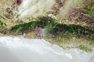
The Sherpa Fire was a wildfire that burned in the Santa Ynez Mountains along the Gaviota Coast in the southwestern part of Santa Barbara County, California in June 2016. In a matter of hours the fire spread to over 1,400 acres (570 ha) as the fire was propelled by downslope sundowner winds. This offshore northerly wind contrasts with the more typical onshore flow and sent the fire down the canyons towards the ocean with gusts of over 35 miles per hour (56 km/h). The wildfire resulted in evacuations at two state beach campgrounds and some residences together with intermittent interruption of traffic on a state transportation route.

Naples is an unincorporated area in Santa Barbara County, California, United States on the south portion of the Gaviota Coast. Also known as Dos Pueblos Ranch, it is located on U.S. Highway 101 5.9 miles (9.5 km) west-northwest of Isla Vista.
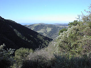
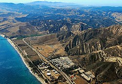
The Gaviota Coast in Santa Barbara County, California is a rural coastline along the Santa Barbara Channel roughly bounded by Goleta Point on the south and the north boundary of the county on the north. This last undeveloped stretch of Southern California coastline consists of dramatic bluffs, isolated beaches and terraced grasslands.


