Bodfish, California

Last updated

Bodfish
Bodfish and Lake Isabella California.JPG
View of Bodfish from Caliente-Bodfish Road in the hills west of town
Kern County California Incorporated and Unincorporated areas Bodfish Highlighted.svg
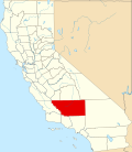
Location in Kern County and the state of California
Usa edcp location map.svg
Red pog.svg
Bodfish
Location in the United States
Coordinates: 35°35′17″N118°29′31″W / 35.58806°N 118.49194°W / 35.58806; -118.49194
Country Flag of the United States (23px).png  United States
State Flag of California.svg  California
County Kern
Government
   State senator Melissa Hurtado (D) [1]
   Assemblymember Evan Low (D) [1]
   U. S. rep. Jay Obernolte (R) [2]
Area
[3]
  Total8.23 sq mi (21.31 km2)
  Land8.21 sq mi (21.27 km2)
  Water0.01 sq mi (0.03 km2)  0.15%
Elevation
[4]
2,687 ft (819 m)
Population
 (2020)
  Total2,008
  Density244.46/sq mi (94.39/km2)
Time zone UTC-8 (PST)
  Summer (DST) UTC-7 (PDT)
ZIP code
93205
Area codes 442/760
FIPS code 06-07274
GNIS feature ID1660353
U.S. Geological Survey Geographic Names Information System: Bodfish, California

Bodfish is a census-designated place (CDP) in the southern Kern River Valley of the Southern Sierra Nevada, in Kern County, California.

Contents

Bodfish is located 32 miles (51 km) east-northeast of Bakersfield, [5] at an elevation of 2,687 feet (819 m). [4]

The population was 1,956 at the 2010 census, up from 1,823 at the 2000 census.

History

Guide sign along Lake Isabella Boulevard at the east extent of Bodfish Bodfish California guide sign.JPG
Guide sign along Lake Isabella Boulevard at the east extent of Bodfish

The place was named for George Homer Bodfish, who settled nearby in 1867. [5]

The Bodfish post office first opened in 1892, closed in 1895, and re-opened in 1906. [5] The Vaughn post office was moved to Bodfish in 1906. [5]

Demographics

Historical population
CensusPop.Note
2020 2,008
U.S. Decennial Census [6]
1850–1870 [7] [8] 1880-1890 [9]
1900 [10] 1910 [11] 1920 [12]
1930 [13] 1940 [14] 1950 [15]
1960 [16] 1970 [17] 1980 [18]
1990 [19] 2000 [20] 2010 [21]

2010

At the 2010 census Bodfish had a population of 1,956. The population density was 245.0 inhabitants per square mile (94.6/km2). The racial makeup of Bodfish was 1,758 (89.9%) White, 4 (0.2%) African American, 50 (2.6%) Native American, 13 (0.7%) Asian, 3 (0.2%) Pacific Islander, 49 (2.5%) from other races, and 79 (4.0%) from two or more races. Hispanic or Latino of any race were 189 people (9.7%). [22]

The whole population lived in households, no one lived in non-institutionalized group quarters and no one was institutionalized.

There were 881 households, 200 (22.7%) had children under the age of 18 living in them, 361 (41.0%) were opposite-sex married couples living together, 103 (11.7%) had a female householder with no husband present, 58 (6.6%) had a male householder with no wife present. There were 76 (8.6%) unmarried opposite-sex partnerships, and 4 (0.5%) same-sex married couples or partnerships. 295 households (33.5%) were one person and 156 (17.7%) had someone living alone who was 65 or older. The average household size was 2.22. There were 522 families (59.3% of households); the average family size was 2.77.

The age distribution was 379 people (19.4%) under the age of 18, 134 people (6.9%) aged 18 to 24, 329 people (16.8%) aged 25 to 44, 623 people (31.9%) aged 45 to 64, and 491 people (25.1%) who were 65 or older. The median age was 50.1 years. For every 100 females, there were 102.7 males. For every 100 females age 18 and over, there were 105.1 males.

There were 1,184 housing units at an average density of 148.3 per square mile, of the occupied units 660 (74.9%) were owner-occupied and 221 (25.1%) were rented. The homeowner vacancy rate was 3.5%; the rental vacancy rate was 11.0%. 1,366 people (69.8% of the population) lived in owner-occupied housing units and 590 people (30.2%) lived in rental housing units.

2000

At the 2000 census there were 1,823 people, 840 households, and 535 families living in the CDP. The population density was 229.0 inhabitants per square mile (88.4/km2). There were 1,188 housing units at an average density of 149.2 per square mile (57.6/km2). The racial makeup of the CDP was 91.28% White, 0.16% Black or African American, 2.25% Native American, 0.60% Asian, 0.05% Pacific Islander, 1.59% from other races, and 4.06% from two or more races. 5.43% of the population were Hispanic or Latino of any race. [23] Of the 840 households 19.4% had children under the age of 18 living with them, 49.3% were married couples living together, 10.5% had a female householder with no husband present, and 36.3% were non-families. 29.6% of households were one person and 17.6% were one person aged 65 or older. The average household size was 2.17 and the average family size was 2.64.

The age distribution was 19.1% under the age of 18, 4.7% from 18 to 24, 19.3% from 25 to 44, 27.4% from 45 to 64, and 29.5% 65 or older. The median age was 50 years. For every 100 females, there were 98.6 males. For every 100 females age 18 and over, there were 96.8 males.

The median household income was $22,368 and the median family income was $29,375. Males had a median income of $22,308 versus $14,926 for females. The per capita income for the CDP was $12,735. About 9.9% of families and 15.9% of the population were below the poverty line, including 19.7% of those under age 18 and 9.0% of those age 65 or over.

Related Research Articles

<span class="mw-page-title-main">Bowles, California</span> Census-designated place in California, United States

Bowles is a census-designated place (CDP) in Fresno County, California, United States. The population was 166 at the 2010 census, down from 182 at the 2000 census. Bowles is located 11 miles (18 km) south of downtown Fresno, at an elevation of 279 feet.

<span class="mw-page-title-main">Cantua Creek, California</span> Census-designated place in California, United States

Cantua Creek is a census-designated place (CDP) in Fresno County, California, United States. As of the 2010 census, the population was 466, down from the 655 reported at the 2000 census. Cantua Creek is located 11 miles (18 km) south-southwest of Tranquillity, at an elevation of 295 feet.

<span class="mw-page-title-main">Caruthers, California</span> Census-designated place in California, United States

Caruthers is a census-designated place (CDP) in Fresno County, California, United States. The population was 2,497 at the 2010 census, up from 2,103 at the 2000 census. Caruthers is located 15 miles (24 km) south of downtown Fresno, at an elevation of 246 feet.

<span class="mw-page-title-main">Cartago, California</span> Census-designated place in California, United States

Cartago is a census-designated place in Inyo County, California, United States. Cartago is located on the west side of Owens Lake 3 miles (4.8 km) north-northwest of Olancha. The population was 92 at the 2010 census, down from 109 at the 2000 census.

<span class="mw-page-title-main">Citrus, California</span> Census-designated place in California, United States

Citrus is a census-designated place (CDP) in Los Angeles County, California, United States. It is located in the San Gabriel Valley between Azusa to the north and west, Glendora to the east, and Covina to the south. The population was 10,866 at the 2010 census, up from 10,581 at the 2000 census. Citrus is named after Citrus Avenue, which passes through the community.

<span class="mw-page-title-main">Belden, California</span> Census-designated place in California, United States

Belden is a census-designated place (CDP) in Plumas County, California, United States. Belden is located on the Feather River Route and the North Fork Feather River, 7 miles (11.3 km) southwest of Caribou. The population was 22 at the 2010 census, down from 26 in 2000.

<span class="mw-page-title-main">Blairsden, California</span> Census-designated place in California, United States

Blairsden is a census-designated place (CDP) in Plumas County, California, United States. Blairsden is located 20 miles (32.2 km) east-southeast of Quincy. It is located on the Feather River Route. The population was 39 at the 2010 census, down from 50 at the 2000 census.

<span class="mw-page-title-main">Bucks Lake, California</span> Census-designated place in California, United States

Bucks Lake is a census-designated place (CDP) in Plumas County, California, United States. Bucks Lake is located on the south shore of the lake of the same name, 13 miles (20.9 km) west-southwest of Quincy. The population was 22 at the 2020 census, up from 10 at the 2010 census.

<span class="mw-page-title-main">C-Road, California</span> Census-designated place in California, United States

C-Road is a census-designated place (CDP) in Plumas County, California, United States. The population was 150 at the 2010 census, down from 152 at the 2000 census.

<span class="mw-page-title-main">Canyondam, California</span> Census-designated place in California, United States

Canyondam is a census-designated place (CDP) in Plumas County, United States. Canyondam is located near the dam that forms Lake Almanor, 6.25 miles (10.1 km) east-southeast of Almanor. The population was 31 as of the 2010 census, down from 37 as of the 2000 census. On August 6, 2021, the community was destroyed in the Dixie Fire.

<span class="mw-page-title-main">Big River, California</span> Census-designated place in California, United States

Big River is a census-designated place (CDP) in San Bernardino County, California, United States. The population was 1,084 at the 2020 census, down from 1,327 at the 2010 census.

<span class="mw-page-title-main">Camp Pendleton Mainside, California</span> Census-designated place in California, United States

Camp Pendleton Mainside is a census-designated place (CDP) in San Diego County, California, located at the southeast corner of the Marine Corps Base Camp Pendleton. Per the 2020 census, the population was 9,683. It was formerly known as Camp Pendleton North, but its name was changed for the 2020 Census. Along with Camp Pendleton South, it is one of two CDPs located on the base.

<span class="mw-page-title-main">Camp Pendleton South, California</span> Census-designated place in California, United States

Camp Pendleton South is a census-designated place (CDP) in San Diego County, California, located at the southwest corner of the Marine Corps Base Camp Pendleton. The population was 10,616 at the 2010 census, up from 8,854 at the 2000 census. Much of the population are residents of Camp Pendleton barracks situated in the area, as well as housing communities for married Marine and Navy personnel and their families. It, along with Camp Pendleton Mainside CDP, is one of two CDPs on the base.

<span class="mw-page-title-main">August, California</span> Census-designated place in California, United States

August is a census-designated place (CDP) in San Joaquin County, California, United States. The population was 8,628 at the 2020 census, up from 8,390 at the 2010 census.

<span class="mw-page-title-main">Country Club, California</span> Census-designated place in California, United States

Country Club is a census-designated place (CDP) in San Joaquin County, California, United States. The population was 9,379 at the 2010 census, down from 9,462 at the 2000 census. It comprises an unincorporated "island" within the City of Stockton.

<span class="mw-page-title-main">Highlands-Baywood Park, California</span> Unincorporated community in California, United States

Highlands-Baywood Park is an unincorporated community and former census designated place (CDP) in in San Mateo County, California, United States. The population was 4,027 at the 2010 census.

<span class="mw-page-title-main">Corralitos, California</span> Census-designated place in California, United States

Corralitos is a census-designated place (CDP) in Santa Cruz County, California, United States. It is a rural area known for its agriculture of apples and strawberries, and its notable Corralitos Market and Sausage Co. Moreover, its location near the Pacific Ocean optimizes viticulture.

<span class="mw-page-title-main">Carrick, California</span> Census-designated place in California

Carrick is a census-designated place (CDP) in Siskiyou County, California, United States. Its population is 143 as of the 2020 census, up from 131 from the 2010 census. Carrick is located just outside the town of Weed, uses Weed in its mailing addresses and is generally viewed by locals as a neighborhood of Weed, though located outside of the city proper. On September 15, 2014, Carrick was under mandatory evacuation order due to a forest fire.

<span class="mw-page-title-main">Waipiʻo Acres, Hawaii</span> Census-designated place in Hawaii, United States

Waipiʻo Acres is a census-designated place (CDP) in Honolulu County, Hawaiʻi, United States. The population was 5,531 at the 2020 census.

<span class="mw-page-title-main">China Lake Acres, California</span> Census-designated place in California, United States

China Lake Acres is a census-designated place (CDP) in Kern County, California, United States. The population was 1,876 at the 2010 census, up from 1,761 at the 2000 census.

References

  1. 1 2 "Statewide Database". Regents of the University of California. Archived from the original on February 1, 2015. Retrieved April 6, 2015.
  2. "California's 23rd Congressional District - Representatives & District Map". Civic Impulse, LLC.
  3. "2020 U.S. Gazetteer Files". United States Census Bureau. Retrieved October 30, 2021.
  4. 1 2 U.S. Geological Survey Geographic Names Information System: Bodfish, California
  5. 1 2 3 4 Durham, David L. (1998). California's Geographic Names: A Gazetteer of Historic and Modern Names of the State. Clovis, Calif.: Word Dancer Press. p. 1005. ISBN   1-884995-14-4.
  6. "Decennial Census by Decade". United States Census Bureau .
  7. "1870 Census of Population - Population of Civil Divisions less than Counties - California - Almeda County to Sutter County" (PDF). United States Census Bureau .
  8. "1870 Census of Population - Population of Civil Divisions less than Counties - California - Tehama County to Yuba County" (PDF). United States Census Bureau .
  9. "1890 Census of Population - Population of California by Minor Civil Divisions" (PDF). United States Census Bureau .
  10. "1900 Census of Population - Population of California by Counties and Minor Civil Divisions" (PDF). United States Census Bureau .
  11. "1910 Census of Population - Supplement for California" (PDF). United States Census Bureau .
  12. "1920 Census of Population - Number of Inhabitants - California" (PDF). United States Census Bureau .
  13. "1930 Census of Population - Number and Distribution of Inhabitants - California" (PDF). United States Census Bureau .
  14. "1940 Census of Population - Number of Inhabitants - California" (PDF). United States Census Bureau .
  15. "1950 Census of Population - Number of Inhabitants - California" (PDF). United States Census Bureau .
  16. "1960 Census of Population - General population Characteristics - California" (PDF). United States Census Bureau .
  17. "1970 Census of Population - Number of Inhabitants - California" (PDF). United States Census Bureau .
  18. "1980 Census of Population - Number of Inhabitants - California" (PDF). United States Census Bureau .
  19. "1990 Census of Population - Population and Housing Unit Counts - California" (PDF). United States Census Bureau .
  20. "2000 Census of Population - Population and Housing Unit Counts - California" (PDF). United States Census Bureau .
  21. "2010 Census of Population - Population and Housing Unit Counts - California" (PDF). United States Census Bureau .
  22. "2010 Census Interactive Population Search: CA - Bodfish CDP". U.S. Census Bureau. Archived from the original on July 15, 2014. Retrieved July 12, 2014.
  23. "U.S. Census website". United States Census Bureau . Retrieved January 31, 2008.