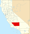
Aerial Acres, California

Last updated

Aerial Acres
California Locator Map with US.PNG
Red pog.svg
Aerial Acres
Location in California
Usa edcp location map.svg
Red pog.svg
Aerial Acres
Aerial Acres (the United States)
Coordinates: 35°05′16″N117°47′31″W / 35.08778°N 117.79194°W / 35.08778; -117.79194
Country United States
State California
County Kern County
Elevation
[1]
2,428 ft (740 m)
ZIP Code
93523

Aerial Acres is an unincorporated community in Kern County, California. [1]

It is located 5.5 miles (9 km) east-southeast of Castle Butte, [2] near the Clay Mine Road exit off State Highway 58 in Edwards, [3] [4] at an elevation of 2,428 feet (740 m). [1] The US Post Office recognizes the community name in Zip Code 93523, which is shared with Edwards and North Edwards. [5]

Aerial Acres was described in the 1990s as "a small group of homes and trailers". [4] According to a 1997 profile of the community in The Bakersfield Californian , there were about 300 residents, half being retirees, the other half working at either U.S. Borax or Edwards Air Force Base. The article described the community as being founded by happenstance in the 1950s after it was discovered that a well dug for a sheep ranch was actually 100 feet west of the ranch property line. Since there was a water source, a developer bought a half-square mile lot and subdivided it, and it was named "Aerial Acres" because it sits 300 feet above North Edwards. [6] Phone service was established in 1966. [7]

Related Research Articles

<span class="mw-page-title-main">Kern County, California</span> County in California, United States

Kern County is a county located in the U.S. state of California. As of the 2020 census, the population was 909,235. Its county seat is Bakersfield.

<span class="mw-page-title-main">North Edwards, California</span> Census-designated place in California, United States

North Edwards is a census-designated place (CDP) in Kern County, California. Situated in the Mojave Desert, North Edwards is located about 7.2 miles (11.6 km) north-east of Edwards Air Force Base, at an elevation of 2,293 feet (699 m). As of the 2010 census it had a population of 1,058.

<span class="mw-page-title-main">Kern River</span> Wild And Scenic River in California, United States

The Kern River, previously Rio de San Felipe, later La Porciuncula, is an Endangered, Wild and Scenic river in the U.S. state of California, approximately 165 miles (270 km) long. It drains an area of the southern Sierra Nevada mountains northeast of Bakersfield. Fed by snowmelt near Mount Whitney, the river passes through scenic canyons in the mountains and is a popular destination for whitewater rafting and kayaking. It is the southernmost major river system in the Sierra Nevada, and is the only major river in the Sierra that drains in a southerly direction.

<span class="mw-page-title-main">Grapevine, California</span> Unincorporated community in California, United States

Grapevine is an unincorporated community in Kern County, California, United States, at the southern end of the San Joaquin Valley. The small village is directly adjacent to Interstate 5 and consists mainly of travelers' and roadside services. At an elevation of 1,499 feet (457 m), the community is located at the foot of a grade known as the Grapevine that lies in Grapevine Canyon through the Tejon Pass.

Edwards is an unincorporated community in Kern County, California.

<span class="mw-page-title-main">Caliente, California</span> Unincorporated community in California, United States

Caliente is an unincorporated community in Kern County, California. It is located 22 miles (35 km) east-southeast of Bakersfield, at an elevation of 1,312 feet (400 m).

<span class="mw-page-title-main">Famoso, California</span> Unincorporated community in California, United States

Famoso is an unincorporated community in Kern County, California. It is located on Poso Creek 5.5 miles (8.9 km) south-southeast of McFarland, at an elevation of 427 feet (130 m). Famoso is located at the junction of State Route 99 and the eastern terminus of State Route 46. The town is famous for its nut groves and especially the race track - Auto Club Famoso Raceway.

Sheep Ranch is an unincorporated community in Calaveras County, California. It lies at an elevation of 2359 feet.

<span class="mw-page-title-main">Havilah, California</span> Unincorporated community in California, United States

Havilah is an unincorporated community in Kern County, California. It is located in the mountains between Walker Basin and the Kern River Valley, 5 miles (8.0 km) south-southwest of Bodfish at an elevation of 3,136 feet (956 m).

<span class="mw-page-title-main">South Lake, Kern County, California</span> Unincorporated community in California, United States

South Lake is an unincorporated community in the Kern River Valley, in Kern County, California. It is located 4.5 miles (7.2 km) west-southwest of Weldon, at an elevation of 2,887 feet (880 m).

<span class="mw-page-title-main">Edison, California</span> Unincorporated community in California, United States

Edison is an unincorporated community in the Tehachapi mountains of Kern County, California. It is located 7.5 miles (12 km) east-southeast of downtown Bakersfield, at an elevation of 568 feet (173 m).

Woody is an unincorporated community in Kern County, California, in the United States. It is located in the foothills of the Greenhorn Mountains, 25 miles (40 km) north-northeast of Bakersfield at an elevation of 1,654 feet (504 m).

Cawelo is an unincorporated community in Kern County, California. It is located on the Southern Pacific Railroad at an elevation of 427 feet (130 m). Cawelo is approximately 2 miles (3 km) east of Shafter-Minter Field, 6.5 miles (10 km) east of central Shafter, and 13 miles (21 km) northwest of Bakersfield. Its ZIP Code is 93263.

<span class="mw-page-title-main">Fuller Acres, California</span> Census-designated place in California, United States

Fuller Acres is a census-designated place in Kern County, California. It is located 7.25 miles (12 km) southeast of downtown Bakersfield, at an elevation of 420 feet (128.02 m). The population was 991 at the 2010 census.

Glennville is an unincorporated community in Kern County, California.

<span class="mw-page-title-main">Muroc, California</span> Former settlement in California, United States

Muroc is a former settlement in Kern County, California in the Mojave Desert.

Reefer City is a ghost town in Kern County, California. It was located 3.25 miles (5.2 km) south-southwest of Mojave, at an elevation of 2762 feet. Reefer City still appeared on maps as late as 1947.

<span class="mw-page-title-main">Scovern Hot Springs</span> Former settlement in California, United States

Scovern Hot Springs is a thermal spring system, and former settlement in the Kern River Valley of the Southern Sierra Nevada, in Kern County, California.

Ranchita is an unincorporated community in San Diego County, California. Ranchita is 9 miles (14 km) southwest of Borrego Springs. Ranchita has a ZIP code of 92066. A notable feature is the Rancheti, an 11-foot-tall, 300-pound fiberglass Yeti statue erected by local real estate broker Joe Rauh on Montezuma Valley Road in December 2007. The statue was featured on the March 4, 2016 installment of Zippy.

<span class="mw-page-title-main">Bakersfield National Cemetery</span> Veterans cemetery in Kern County, California

Bakersfield National Cemetery is a United States National Cemetery located at 30338 East Bear Mountain Blvd, Arvin, California, in Kern County. It is approximately 20 miles (32 km) east of Bakersfield. It is isolated from urban development by oak studded rolling hills in the Tehachapi Mountains. Administered by the United States Department of Veterans Affairs, the cemetery has space to accommodate caskets and cremated remains on 500 acres of land.

References

  1. 1 2 3 U.S. Geological Survey Geographic Names Information System: Aerial Acres, California.
  2. Durham, David L. (1998). California's Geographic Names: A Gazetteer of Historic and Modern Names of the State. Clovis, Calif.: Word Dancer Press. p. 991. ISBN   1-884995-14-4.
  3. Curtis Darling, Kern County Place Names, second edition (2003), p. 1: "a desert town at Clay Mine Road and Sequoia".
  4. 1 2 Mitchell, James. R. (1996). Gem Trails of Southern California, Gem Guides Book Company, p. 90.
  5. UnitedStatesZipCodes.org, Retrieved December 12, 2023.
  6. Kehe, Andy (October 5, 1997). "God's little acres", The Bakersfield Californian , pp. F10, F16.
  7. "Aerial Acres Hails Phone Installation", The Bakersfield Californian, July 6, 1966. p. 17.