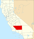
East Niles, California

Last updated

East Niles is a census-designated place (CDP) in Kern County, California. [1] The CDP is within the Bakersfield's census county division, [2] and borders the city of Bakersfield to the north and the southwest, Bakersfield Country Club to the northwest, Hillcrest and Potomac Park to the west, and Fairfax to the south. [1]

Details

As listed in the Geographic Names Information System, its elevation is 576 feet. [3]

Its population was 28,390 at the 2020 census, the first census it was included in. [1]

Related Research Articles

<span class="mw-page-title-main">Lake of the Woods, California</span> Census-designated place in California, United States

Lake of the Woods is an unincorporated area and census-designated place (CDP) in southwestern Kern County, California. As of the 2020 census, the population was 790.

<span class="mw-page-title-main">Tupman, California</span> Census-designated place in California, United States

Tupman is a census-designated place (CDP) in Kern County, California, United States. Tupman is located 20 miles (32 km) west-southwest of Bakersfield, at an elevation of 331 feet (101 m). The population was 161 at the 2010 census, down from 227 at the 2000 census.

<span class="mw-page-title-main">Weedpatch, California</span> Census-designated place in California, United States

Weedpatch is an unincorporated community and census-designated place (CDP) in Kern County, California, United States. Weedpatch is 10 miles (16 km) south-southeast of Bakersfield. It is considered to be one of the poorest areas in Kern County. As of the 2010 census it had a population of 2,658.

Greenfield is a census-designated place in Kern County, California. It is located 7 miles (11 km) south of Bakersfield, at an elevation of 351 feet. The population was 3,991 at the 2010 census.

Orange Blossom is a census-designated place (CDP) in Stanislaus County, California, United States. It is located along Orange Blossom Road in the northern part of the county, on the north side of the Stanislaus River. It is bordered to the east by Knights Ferry and to the west by East Oakdale, and it is 7 miles (11 km) east of Oakdale, the nearest city. Orange Blossom was first listed as a CDP prior to the 2020 census.

Marshallville is an unincorporated community and census-designated place (CDP) located in Upper Township, Cape May County, in the U.S. state of New Jersey. It is on the northern edge of the county, bordered to the north, across the Tuckahoe River, by Corbin City in Atlantic County. It is bordered to the east by the unincorporated community of Tuckahoe.

Forsgate is a golf course community and census-designated place (CDP) located in Monroe Township, Middlesex County, in the U.S. state of New Jersey. It consists of Forsgate Country Club and its associated housing developments. It is in the northwestern part of the township, bordered to the south across Forsgate Drive by Rossmoor, to the east by the Hightstown Industrial Track rail line, to the north by a branch rail line connecting Jamesburg and Monmouth Junction, and to the west by the New Jersey Turnpike at Exit 8A. It is 13 miles (21 km) south of New Brunswick and 19 miles (31 km) northeast of Trenton.

Rainbow Lakes is a census-designated place (CDP) located in Parsippany-Troy Hills, Morris County, in the U.S. state of New Jersey. It is in the western part of the township and consists of housing built around Rainbow Lake, plus a zone of commercial buildings to the east of the lakes. It is bordered to the east by Parsippany proper, to the north by the borough of Mountain Lakes, and to the west by Denville Township. The northern edge of the CDP is formed by U.S. Route 46 and the NJ Transit Montclair-Boonton Line, and Interstate 80 forms the southern edge. It is 21 miles (34 km) northwest of Newark and 30 miles (48 km) west of the George Washington Bridge over the Hudson River.

Bedminster is an unincorporated community and census-designated place (CDP) comprising the primary community in Bedminster Township, Somerset County, in the U.S. state of New Jersey. It was first listed as a CDP prior to the 2020 census.

Olde Stockdale is a neighborhood and census-designated place in Kern County, California. The population was 568 at the 2020 census.

Benton Park is a census-designated place (CDP) in Kern County, California. Although it is designated by the census as its own place, it is functionally a neighborhood of Bakersfield.

Casa Loma is a census-designated place (CDP) in Kern County, California. Although it is designated by the census as its own place, it is functionally a neighborhood of Bakersfield.

Choctaw Valley is the name of multiple neighborhoods and a census-designated place (CDP) in Kern County, California.

Rivergrove is a census-designated place (CDP) in Kern County, California. Although it is designated by the census as its own place, it is functionally a neighborhood of Bakersfield.

Cottonwood is a census-designated place (CDP) in Kern County, California. The CDP is within the Bakersfield's census county division, and borders the city of Bakersfield on every side except the west, where it abuts Casa Loma.

Fairfax is a census-designated place (CDP) in Kern County, California. The CDP is within the Bakersfield's census county division, and borders the city of Bakersfield to the west and East Niles, California to the north.

Goodmanville is a census-designated place (CDP) in Kern County, California. Goodmanville is within the Bakersfield's census county division, and is across the Alfred Harrell Highway from the city of Bakersfield.

La Cresta is a census-designated place (CDP) in Kern County, California. The CDP is within Bakersfield's census county division, and is surrounded by the city of Bakersfield on most sides, but borders East Bakersfield to the southeast.

Potomac Park is a census-designated place (CDP) in Kern County, California. The CDP is within the Bakersfield's census county division, and borders the city of Bakersfield to the west and south, East Bakersfield and Hillcrest to the north, and East Niles, California to the east. As listed in the Geographic Names Information System, its elevation is 404 feet.

Old Stine is a census-designated place (CDP) in Kern County, California. The CDP is within the Bakersfield's census county division, and surrounded by the city of Bakersfield on all sides except for the east, where it borders Benton Park. As listed in the Geographic Names Information System, its elevation is 390 feet.

References

  1. 1 2 3 "East Niles CDP, California". Explore Census Data. U.S. Census Bureau . Retrieved 2023-12-21.
  2. "Bakersfield CCD, Kern County, California". Explore Census Data. U.S. Census Bureau . Retrieved 2023-12-21.
  3. "East Niles Census Designated Place". Geographic Names Information System. U.S. Geological Survey . Retrieved 2023-12-20.