Cottonwood, Kern County, California

Last updated
Cottonwood, California
California Locator Map with US.PNG
Red pog.svg
Cottonwood, California
Location in California
Usa edcp location map.svg
Red pog.svg
Cottonwood, California
Cottonwood, California (the United States)
Coordinates: 35°20′44.12″N118°59′9.08″W / 35.3455889°N 118.9858556°W / 35.3455889; -118.9858556
Country United States
State California
County Kern County
Area
[1]
  Total0.463 sq mi (1.20 km2)
  Land0.463 sq mi (1.20 km2)
  Water0 sq mi (0 km2)
Elevation
[2]
387 ft (118 m)
Population
 (2020)
  Total3,971
  Density8,600/sq mi (3,300/km2)
Time zone UTC-8 (Pacific)
  Summer (DST) UTC-7 (PDT)
GNIS feature ID2804112 [2]

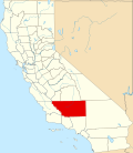
Cottonwood is an unincorporated community and census-designated place (CDP) in Kern County, California. [3] The CDP is within the Bakersfield's census county division, [4] and borders the city of Bakersfield on every side except the west, where it abuts Casa Loma. [3]

Contents

Details

As listed in the Geographic Names Information System, its elevation is 387 feet. [2]

Its population was 3,971 at the 2020 census, the first census it was included in. [3]

Demographics

Historical population
CensusPop.Note
2020 3,971
U.S. Decennial Census [5]
1850–1870 [6] [7] 1880-1890 [8]
1900 [9] 1910 [10] 1920 [11]
1930 [12] 1940 [13] 1950 [14]
1960 [15] 1970 [16] 1980 [17]
1990 [18] 2000 [19] 2010 [20]
2020 [21]

Cottonwood first appeared as a census designated place in the 2020 U.S. Census. [22]

2020 Census

Cottonwood CDP, California – Racial and ethnic composition
Note: the US Census treats Hispanic/Latino as an ethnic category. This table excludes Latinos from the racial categories and assigns them to a separate category. Hispanics/Latinos may be of any race.
Race / Ethnicity (NH = Non-Hispanic)Pop 2020 [21] % 2020
White alone (NH)1724.33%
Black or African American alone (NH)57914.58%
Native American or Alaska Native alone (NH)110.28%
Asian alone (NH)120.30%
Pacific Islander alone (NH)00.00%
Other race alone (NH)70.18%
Mixed race or Multiracial (NH)761.91%
Hispanic or Latino (any race)3,11478.42%
Total3,971100.00%

Related Research Articles

<span class="mw-page-title-main">Bodfish, California</span> Census-designated place in California, United States

Bodfish is a census-designated place (CDP) in the southern Kern River Valley of the Southern Sierra Nevada, in Kern County, California.

<span class="mw-page-title-main">Almanor, California</span> Census-designated place in California, United States

Almanor is a census-designated place (CDP) in Plumas County, California, United States. The population was 0 at the 2010 Census, but as of 2020, the population was reported as 3. Almanor is located 7 miles (11.3 km) south-southeast of Chester.

<span class="mw-page-title-main">Cottonwood, California</span> Census-designated place in the United States

Cottonwood is a census-designated place (CDP) in Shasta County, California, United States. Its population is 6,268 as of the 2020 census, up from 3,316 from the 2010 census. Cottonwood was a stagecoach town where a settlement was established in 1849. The first Post Office was opened in 1852. Cottonwood is equidistant between Redding and Red Bluff, 15 miles (24 km) in either direction. It is 4 miles (6.4 km) south of Anderson.

East Bakersfield is an unincorporated community and census-designated place (CDP) in Kern County, California.

<span class="mw-page-title-main">Edison, California</span> Unincorporated community in California, United States

Edison is an unincorporated community and census designated place (CDP) in the Tehachapi mountains of Kern County, California. It is located 7.5 miles (12 km) east-southeast of downtown Bakersfield, at an elevation of 571 feet (174 m).

Alta Sierra is an unincorporated community and census-designated place (CDP) in Kern County, California.

Di Giorgio is an unincorporated community and census designated place (CDP) in Kern County, California. It is located 6.5 miles (10 km) south of Edison, at an elevation of 495 feet (151 m).

Bonadelle Ranchos is an unincorporated community and census-designated place (CDP) in Madera County, California, United States. It lies at an elevation of 338 feet (103 m). As of the 2020 census, it had a population of 5,497. Prior to 2020, the community was part of the Bonadelle Ranchos-Madera Ranchos CDP.

Amador Pines is an unincorporated community and census-designated place (CDP) in Amador County, California, United States. It is located along California State Route 88, bordered to the south by Buckhorn and to the west by Lockwood. The Census Bureau first designated it as a CDP prior to the 2020 census for statistical purposes.

Cedar Flat is a census-designated place (CDP) in eastern Placer County, California, United States. It is located on the northwest shore of Lake Tahoe, between Carnelian Bay to the northeast and Dollar Point to the southwest. It was first listed as a CDP prior to the 2020 census.

Bakersfield Country Club is an unincorporated community and census designated place (CDP) in Kern County. It bears the name of the Bakersfield Country Club which is included in its geography. As of the 2020 U.S. Census, the population was 1,715.

<span class="mw-page-title-main">El Adobe, California</span> Census-designated place in California

El Adobe is an unincorporated community and census-designated place in Kern County, California. The population was 391 at the 2020 census. El Adobe is 9 miles south of Bakersfield.

Benton Park is a census-designated place (CDP) in Kern County, California. Although it is designated by the census as its own place, it is functionally a neighborhood of Bakersfield.

Casa Loma is an unincorporated community and census-designated place (CDP) in Kern County, California. Although it is designated by the census as its own place, it is functionally a neighborhood of Bakersfield.


Choctaw Valley is an unincorporated community and census-designated place (CDP) in Kern County, California. It is also the name of neighborhoods in the cities of Bakersfield and Rivergrove.

East Niles is an unincorporated community and census-designated place (CDP) in Kern County, California. The CDP is within the Bakersfield's census county division, and borders the city of Bakersfield to the north and the southwest, Bakersfield Country Club to the northwest, Hillcrest and Potomac Park to the west, and Fairfax to the south.

Fairfax is an Unincorporated community and census-designated place (CDP) in Kern County, California. The CDP is within the Bakersfield's census county division, and borders the city of Bakersfield to the west and East Niles, California to the north.

Mountain Meadows is an unincorporated community and census designated place (CDP) in Kern County, California, United States. Per the 2020 census, the population was 303.

Stebbins is an unincorporated community and census designated place (CDP) in Kern County, California, United States. Per the 2020 census, the population was 1,423.

Tarina is an unincorporated community and census designated place (CDP) in Kern County, California, United States. Per the 2020 census, the population was 18.

References

  1. "2020 U.S. Gazetteer Files - California". United States Census Bureau . Retrieved March 23, 2024.
  2. 1 2 3 "Cottonwood Census Designated Place". Geographic Names Information System . United States Geological Survey, United States Department of the Interior.
  3. 1 2 3 "Cottonwood CDP (Kern County), California". Explore Census Data. U.S. Census Bureau . Retrieved 2023-12-21.
  4. "Bakersfield CCD, Kern County, California". Explore Census Data. U.S. Census Bureau . Retrieved 2023-12-21.
  5. "Decennial Census by Decade". United States Census Bureau .
  6. "1870 Census of Population - Population of Civil Divisions less than Counties - California - Almeda County to Sutter County" (PDF). United States Census Bureau .
  7. "1870 Census of Population - Population of Civil Divisions less than Counties - California - Tehama County to Yuba County" (PDF). United States Census Bureau .
  8. "1890 Census of Population - Population of California by Minor Civil Divisions" (PDF). United States Census Bureau .
  9. "1900 Census of Population - Population of California by Counties and Minor Civil Divisions" (PDF). United States Census Bureau .
  10. "1910 Census of Population - Supplement for California" (PDF). United States Census Bureau .
  11. "1920 Census of Population - Number of Inhabitants - California" (PDF). United States Census Bureau .
  12. "1930 Census of Population - Number and Distribution of Inhabitants - California" (PDF). United States Census Bureau .
  13. "1940 Census of Population - Number of Inhabitants - California" (PDF). United States Census Bureau .
  14. "1950 Census of Population - Number of Inhabitants - California" (PDF). United States Census Bureau .
  15. "1960 Census of Population - General population Characteristics - California" (PDF). United States Census Bureau .
  16. "1970 Census of Population - Number of Inhabitants - California" (PDF). United States Census Bureau .
  17. "1980 Census of Population - Number of Inhabitants - California" (PDF). United States Census Bureau .
  18. "1990 Census of Population - Population and Housing Unit Counts - California" (PDF). United States Census Bureau .
  19. "2000 Census of Population - Population and Housing Unit Counts - California" (PDF). United States Census Bureau .
  20. "2010 Census of Population - Population and Housing Unit Counts - California" (PDF). United States Census Bureau .
  21. 1 2 "P2: Hispanic or Latino, and Not Hispanic or Latino by Race – 2020: DEC Redistricting Data (PL 94-171) – Cottonwood CDP (Kern County), California". United States Census Bureau.
  22. "2020 Geography Changes". United States Census Bureau.