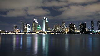
Southern California is a geographic and cultural region that generally comprises the southern portion of the U.S. state of California. It includes the Los Angeles metropolitan area, the second most populous urban agglomeration in the United States. The region generally contains ten of California's 58 counties: Imperial, Kern, Los Angeles, Orange, Riverside, San Bernardino, San Diego, Santa Barbara, San Luis Obispo and Ventura counties. The Colorado Desert and the Colorado River are located on southern California's eastern border with Arizona, and San Bernardino County shares a border with Nevada to the northeast. Southern California's southern border with Baja California is part of the Mexico–United States border.

Kern County is located in the U.S. state of California. As of the 2010 census, the population was 839,631. Its county seat is Bakersfield.

Keyesville is an unincorporated community in Kern County, California. It is located 2 miles (3.2 km) west of Lake Isabella and the Kern River Valley, at an elevation of 2,848 feet (868 m). Keyesville, founded in 1854 is named for Richard M. Keyes, whose discovery of gold in 1853 started the Kern River Gold Rush.

Caliente is an unincorporated community in Kern County, California. It is located 22 miles (35 km) east-southeast of Bakersfield, at an elevation of 1,312 feet (400 m).

Willow Springs is a village located around a set of former springs in Kern County, California, United States. It is located 7.5 miles (12 km) west of Rosamond, at an elevation of 2,523 feet (769 m).

Havilah is an unincorporated community in Kern County, California. It is located in the mountains between Walker Basin and the Kern River Valley, 5 miles (8.0 km) south-southwest of Bodfish at an elevation of 3,136 feet (956 m).

Bealville is an unincorporated community in Kern County, California. It is located on the Union Pacific Railroad 1.25 miles (2 km) south of Caliente, at an elevation of 1,811 feet (552 m). The area was named after Edward Fitzgerald Beale, who owned the adjacent Rancho El Tejon.

Actis is an unincorporated community in Kern County, California. It is located 6.5 miles (10 km) north of Rosamond, at an elevation of 2,562 feet (781 m). It is situated between Mojave and Rosamond at Backus Road and California State Route 14.

Aerial Acres is a fly-in unincorporated community in Kern County, California. It is located 5.5 miles (9 km) east-southeast of Castle Butte, at an elevation of 2,428 feet (740 m). It was noted as "a desert town at Clay Mine Road and Sequoia in Peerless Valley, California.

Alta Sierra is an unincorporated community in the Kern County, California.

Fruitvale is an unincorporated community in Kern County, California. It is located 4.5 miles (7.2 km) west of Bakersfield, at an elevation of 397 feet.

Gold Town or OarVille is a former settlement in Kern County, California. It was located 9.5 miles (15 km) north of Rosamond, at an elevation of 2713 feet.

Loraine is an unincorporated community in Kern County, California. It is located on the east bank of the mouth of Indian Creek where it enters Caliente Creek, 12 miles (19.3 km) north of Tehachapi, at an elevation of 2,671 feet (814 m).

Mayfair is an unincorporated community in Kern County, California. It is located 5.5 miles (9 km) east-southeast of downtown Bakersfield, at an elevation of 436 feet.

Meridian is an unincorporated community in Kern County, California. It is located 4.5 miles (7.2 km) northeast of Mettler, at an elevation of 433 feet (132 m).

Oil City is an unincorporated community in Kern County, California, about 5 miles (8 km) northeast of Bakersfield, adjacent to the Kern River Oil Field.

Reward is an unincorporated community in western Kern County, California.

Sageland is an unincorporated community in Kern County, California. It is located near Kelso Creek 3.5 miles (5.6 km) west-northwest at the base of the Piute Mountains, at an elevation of 4,026 feet (1,227 m).

Twin Oaks is an unincorporated community in Kern County, California. It is located 1.5 miles (2.4 km) east-northeast of Loraine, at an elevation of 2,825 feet (861 m).

Desert Spring is a former settlement in Kern County, California in the Fremont Valley, south of Red Rock Canyon State Park. It was located 1.5 miles (2.4 km) northeast of Cantil. About .8 miles north of California State Route 58 on Bellville Road at the railroad tracks.


