Inyo County is a county in the eastern central part of the U.S. state of California, located between the Sierra Nevada and the state of Nevada. In the 2020 census, the population was 19,016. The county seat is Independence. Inyo County is on the east side of the Sierra Nevada and southeast of Yosemite National Park in Central California. It contains the Owens River Valley; it is flanked to the west by the Sierra Nevada and to the east by the White Mountains and the Inyo Mountains. With an area of 10,192 square miles (26,400 km2), Inyo is the second-largest county by area in California, after San Bernardino County. Almost one-half of that area is within Death Valley National Park. However, with a population density of 1.8 people per square mile, it also has the second-lowest population density in California, after Alpine County.

The Central Valley is a broad, elongated, flat valley that dominates the interior of California. It is 40–60 mi (60–100 km) wide and runs approximately 450 mi (720 km) from north-northwest to south-southeast, inland from and parallel to the Pacific coast of the state. It covers approximately 18,000 sq mi (47,000 km2), about 11% of California's land area. The valley is bounded by the Coast Ranges to the west and the Sierra Nevada to the east.

Owens Valley is an arid valley of the Owens River in eastern California in the United States. It is located to the east of the Sierra Nevada, west of the White Mountains and Inyo Mountains, and is within the northern end of the Mojave Desert. It sits on the west edge of the Great Basin. The mountain peaks on the West side reach above 14,000 feet (4,300 m) in elevation, while the floor of the Owens Valley is about 4,000 feet (1,200 m), making the valley the deepest in the United States. The Sierra Nevada casts the valley in a rain shadow, which makes Owens Valley "the Land of Little Rain". The bed of Owens Lake, now a predominantly dry endorheic alkali flat, sits on the southern end of the valley.

The Governor Edmund G. Brown California Aqueduct is a system of canals, tunnels, and pipelines that conveys water collected from the Sierra Nevada Mountains and valleys of Northern and Central California to Southern California. Named after California Governor Edmund Gerald "Pat" Brown Sr., the over 400-mile (640 km) aqueduct is the principal feature of the California State Water Project.

The San Bernardino Mountains are a high and rugged mountain range in Southern California in the United States. Situated north and northeast of San Bernardino and spanning two California counties, the range tops out at 11,503 feet (3,506 m) at San Gorgonio Mountain – the tallest peak in Southern California. The San Bernardinos form a significant region of wilderness and are popular for hiking and skiing.

The Colorado River Aqueduct, or CRA, is a 242 mi (389 km) water conveyance in Southern California in the United States, operated by the Metropolitan Water District of Southern California (MWD). The aqueduct impounds water from the Colorado River at Lake Havasu on the California-Arizona border, west across the Mojave and Colorado deserts to the east side of the Santa Ana Mountains. It is one of the primary sources of drinking water for Southern California.

The Owens River is a river in eastern California in the United States, approximately 183 miles (295 km) long. It drains into and through the Owens Valley, an arid basin between the eastern slope of the Sierra Nevada and the western faces of the Inyo and White Mountains. The river terminates at the endorheic Owens Lake south of Lone Pine, at the bottom of a 2,600 sq mi (6,700 km2) watershed.

Pyramid Lake is a reservoir formed by Pyramid Dam on Piru Creek in the eastern San Emigdio Mountains, near Castaic, Southern California. It is a part of the West Branch California Aqueduct, which is a part of the California State Water Project. Its water is fed by the system after being pumped up from the San Joaquin Valley and through the Tehachapi Mountains.

The California State Water Project, commonly known as the SWP, is a state water management project in the U.S. state of California under the supervision of the California Department of Water Resources. The SWP is one of the largest public water and power utilities in the world, providing drinking water for more than 27 million people and generating an average of 6,500 GWh of hydroelectricity annually. However, as it is the largest single consumer of power in the state itself, it has a net usage of 5,100 GWh.

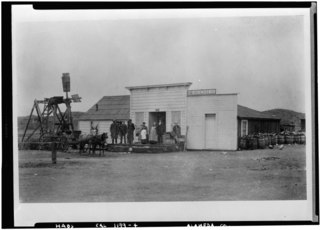
Laws is an unincorporated community in Inyo County, California. Laws is located 4 miles (6.4 km) northeast of Bishop on U.S. Route 6, towards the Nevada state line.

The Sierra Pelona, also known as the Sierra Pelona Ridge or the Sierra Pelona Mountains, is a mountain ridge in the Transverse Ranges in Southern California. Located in northwest Los Angeles County, the ridge is bordered on the north by the San Andreas fault and lies within and is surrounded by the Angeles National Forest.

Silverwood Lake is a large reservoir in San Bernardino County, California, United States, located on the West Fork Mojave River, a tributary of the Mojave River in the San Bernardino Mountains. It was created in 1971 as part of the State Water Project by the construction of the Cedar Springs Dam as a forebay on the 444 mi (715 km) long California Aqueduct, and has a capacity of 73,000 acre⋅ft (90,000,000 m3).

U.S. Route 395 (US 395) is a United States Numbered Highway, stretching from Hesperia, California to the Canadian border in Laurier, Washington. The California portion of US 395 is a 557-mile (896 km) route which traverses from Interstate 15 (I-15) in Hesperia, north to the Oregon state line in Modoc County near Goose Lake. The route clips into Nevada, serving the cities Carson City and Reno, before returning to California.

The Iron Mountains are a mountain range in eastern San Bernardino County, California. The southern end of the range extends into Riverside County north of Granite Pass.

Monolith is an unincorporated community in the Tehachapi Valley, in Kern County, California.

El Cinco is one of the 18 barrios of the municipality of San Juan, Puerto Rico and a former barrio of the dissolved municipality of Río Piedras. As of the 2020 United States Census, it had a population of 5,610 and a land area of 1.34 square miles (3.5 km2) resulting in a population density of 4,625.4/sq mi (1,785.9/km2).

Salt Spring, originally, Aguaje de la Brea, a spring in the Antelope Plain on the southeast end of Pyramid Hills, 0.6 miles south of Emigrant Hill and 1.5 miles north of Wagon Wheel Mountain in the Pyramid Hills of Kern County, California. Its location appears on a 1914 USGS Topographic map of Lost Hills. Salt Spring is located just east of the Pyramid Hills and the Devils Den Oil Field, 3 miles southwest of Devils Den, close by the south side of Kecks Road, 0.23 miles east of the California Aqueduct, enclosed by a fence.

The Ward Valley (California) is a lengthy almost true N-S trending valley of far eastern San Bernardino County, California.

Baldy Cinco, elevation 13,379 feet, is a mountain in Hinsdale and Mineral counties in southern Colorado. The mountain, a thirteener, is located on the Continental Divide in the San Juan Mountains. Different areas of the slopes of Baldy Cinco lie in the Rio Grande National Forest, the La Garita Wilderness, and the Gunnison National Forest. The mountain is located just north of Snow Mesa and east northeast of Spring Creek Pass.