Lebec, California

Last updated
Lebec, California
Lebec, California.JPG
Lebec as seen from I-5 southbound in 2021
Kern County California Incorporated and Unincorporated areas Lebec Highlighted 0640956.svg
Location of Lebec in Kern County, California
USA California Southern location map.svg
Red pog.svg
Lebec
Location in Southern California
USA California location map.svg
Red pog.svg
Lebec
Location in California
Usa edcp location map.svg
Red pog.svg
Lebec
Location in the United States
Coordinates: 34°50′32.43″N118°51′56.01″W / 34.8423417°N 118.8655583°W / 34.8423417; -118.8655583
Country Flag of the United States (23px).png  United States
State Flag of California.svg  California
County Kern
Government
   County supervisor David Couch
   Senate Jean Fuller (R)
   Assembly Vince Fong (R)
   U. S. Congress Kevin McCarthy (R)
Area
[1]
  Total15.329 sq mi (39.702 km2)
  Land15.329 sq mi (39.701 km2)
  Water0 sq mi (0.001 km2)  0.002%
Elevation
3,481 ft (1,061 m)
Population
 (2020)
  Total1,239
  Density81/sq mi (31/km2)
Time zone UTC−8 (PST)
  Summer (DST) UTC−7 (PDT)
ZIP Code
93243
Area code 661
FIPS code 06-40956
A distinctive residential house in Lebec Lebec-California-House.jpg
A distinctive residential house in Lebec

Lebec is an unincorporated community and census-designated place in southwestern Kern County, California. As of the 2010 census, the population was 1,468. [2]

Contents

Geography

Lebec is located in Castac Valley between the San Emigdio and Tehachapi Mountains. The community is one of the Mountain Communities of the Tejon Pass.

Lebec is 40 miles (64 km) south of Bakersfield. [3]

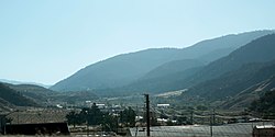
According to the United States Census Bureau, Lebec has an area of 15.3 square miles (40 km2). The community, which is near Tejon Pass, lies at an elevation of 3,481 feet (1,061 m). [4]

History

Lebec is named in honor of Peter Lebeck or Lebecque, a French trapper killed by a grizzly bear in 1837 in the area that later became Fort Tejon. He was memorialized in an epitaph at the site, found carved in a bare spot on an old oak tree. [4] The epitaph read PETER LEBECK / KILLED BY A X BEAR / OCTR 17 / 1837. The bark of the oak tree eventually grew over the carving. A group from Bakersfield, called the Foxtail Rangers, removed the bark in the late 19th century and found the inscription in reverse on its underside. The piece is now displayed in the museum at Fort Tejon State Historic Park. [5]

Lieutenant R.S. Williamson camped at the same oak grove in 1853 while on a mid-1850s mapping mission for a practicable railway route from the Mississippi River to the Pacific Ocean.[ citation needed ] Geologist William P. Blake accompanied Williamson's party.[ citation needed ] The area was garrisoned by the United States Army a year later, on August 10, 1854, as Fort Tejon, the first military fort in the California interior.[ citation needed ] The fort suffered extensive damage during the 1857 Fort Tejon earthquake. [6]

The first post office opened in 1895, having been transferred there from Tejon. [4]

The Lebec Hotel was a large Spanish Colonial Revival-style hotel located on the Ridge Route in the community. It was built in 1921, and was popular with Hollywood executives and movie stars before World War II. It closed in 1968, and was demolished in 1971. [7]

Demographics

Historical population
CensusPop.Note
2000 1,224
2010 1,46819.9%
2020 1,239−15.6%
U.S. Decennial Census [8]

2010

The 2010 United States Census [9] reported that 1,468 people, 533 households, and 372 families resided in the CDP. The population density was 95.8 inhabitants per square mile (37.0/km2). There were 594 housing units at an average density of 38.8 per square mile (15.0/km2). The racial makeup of the CDP was 78.5% White, 1.0% African American, 3.1% Native American, 1.2% Asian, 10.1% from other races, and 6.2% from two or more races. 26.9% of the population was Hispanic or Latino of any race.

Lebec Post Office Lebec California post office.JPG
Lebec Post Office

The Census reported that 100% of the population lived in households.

There were 533 households, out of which 33.6% had children under the age of 18 living in them, 54.0% were opposite-sex married couples living together, 9.9% had a female householder with no husband present, and 5.8% had a male householder with no wife present. 5.3% of households were unmarried opposite-sex partnerships and 0.6% were same-sex married couples or partnerships. 25.1% of households were made up of individuals, and 8.3% had someone living alone who was 65 years of age or older. The average household size was 2.75.

The population was spread out, with 26.1% under the age of 18, 8.0% aged 18 to 24, 20.6% aged 25 to 44, 31.8% aged 45 to 64, and 13.5% who were 65 years of age or older. The median age was 40.6 years. For every 100 females there were 108.2 males. For every 100 females age 18 and over, there were 109.1 males.

There were 594 housing units of which 71.1% were owner-occupied and 28.9% were occupied by renters. The homeowner vacancy rate was 2.8%; the rental vacancy rate was 7.1%. 70.4% of the population lived in owner-occupied housing units and 29.6% lived in rental housing units.

2000

In the 2000 census, the population of the CDP was 1,224 and the racial makeup was 79 percent Caucasian (1,019 people). There were only three African Americans. There were 256 Hispanics or Latinos of any race (20 percent of all residents). Other residents included 16 American Indians or Alaska natives and four Asians. [10]

The median age for Lebec residents was 36 years, almost the same as the 35 years for the nation as a whole.

Lebec also had slightly more veterans than its share, 169, or 19 percent, compared to 13 percent around the country.

Fifty-nine percent of Lebec adults were employed. On average, they traveled 27 minutes to get to their jobs, about the same as most Americans.

Lebec households had a lower median income than the nation as a whole — $46,857, compared to $50,046. Family income was $40,972.

There were just 100 people (or 8 percent) below the poverty level in Lebec in 2000—significantly less than the nation as a whole, which was 12 percent in 2000. When calculated by families, though, the poverty rate in Lebec was only 1.4 percent.

Of the 516 housing units, 319 were occupied by owners and 127 by renters, about the same 7:3 ratio as the rest of the country. Sixty housing units (12 percent) were vacant.

2000 figuresLebecCaliforniaUnited States
Median age36.133.335.3
White79.3%59.5%75.1%
African-American0.2%6.7%12.3%
Hispanic/Latino19.9%32.4%12.5%
Family income$40,972$53,025$50,046
Poverty families1.4%10.6%9.2%
Med. home value$163,600$211,500$119,600
High school diploma72.1%76.8%80.4%
College degree11.8%28.6%24.4%

Transportation

Interstate 5 is the only highway passing through the community. Local traffic drives on Lebec Road, Peace Valley Road, Frazier Mountain Park Road and adjoining streets.

A section of the 1915 Ridge Route in Lebec, California, abandoned when U.S. 99 (later upgraded to I-5) was constructed over the Tejon Pass in order to make the travel straighter and safer. Dead-Man's Curve in Lebec, California, 2010.jpg
A section of the 1915 Ridge Route in Lebec, California, abandoned when U.S. 99 (later upgraded to I-5) was constructed over the Tejon Pass in order to make the travel straighter and safer.

Kern Transit provides bus service Thursdays and Saturdays during the summer months to Frazier Park, Gorman, Lake of the Woods, Pinon Pines, and Pine Mountain Club.

Kern Transit provides weekday service from the Flying J gas station via their Route 130 bus to the Santa Clarita Station Metrolink and the McBean Regional Transit Center, which includes many connecting bus routes, including to North Hollywood Station and Downtown Los Angeles. [11]

Water district

Lebec is served by the Lebec County Water District [12] which was established in 1967 and began operation on April 21, 1969. In October 2011 the district approved a five-year contract with Applied Process Technology to manage the district. [13]

The district serves 836 people, and in May 2012 The New York Times reported that individual sampling of the district's water showed two contaminants above legal limits alpha particle activity and Combined Uranium (picoCuries per liter). Two contaminants lead (total) and uranium-228  — were below legal limits but above "health guidelines". [14]

In 2011–2012 a committee of the Kern County grand jury investigated complaints about the installation and connection of a private 12-inch line to the district's water supply, by which a developer hoped to bring water to a hotel then planned for construction. The committee's report claimed that the water line was laid without proper approval and that the "subsequent opening of the hotel created a water shortage that lasted for at least five days." [13] It was later determined that two men affiliated with the district's governance, along with the hotel developers, constructed the water line across Cuddy Creek without a permit from California Department of Fish and Game which was obtained after the fact. [15]

The Grand Jury committee also investigated "a number of complaints" alleging that the board violated the California Open Meetings Law, a.k.a. Brown Act, that it exceeded its authority and that it engaged in "unprofessional conduct". The committee submitted its report in April 2012, finding, among other things, "frequent bickering" among governing board members and the public, "highly irregular" actions at a board meeting in December 2011, including the approval of a "seemingly pre-designated slate" of officers. The committee report stated that the water district "is not operating in a manner that serves the best interests of the public" and recommended "formal training ... and conduct themselves accordingly or resign from the board." [13]

The water district board replied that "the Grand Jury's findings are substantially incorrect" and that the report was "filled with opinion, unsubstantiated with actual facts". [13] [16]

The board voted on January 14, 2014, to open each meeting with a prayer "prior to the Pledge of Allegiance at all future meetings", [17] and president Michael Hightower opened the subsequent meeting, on February 11, "with a call to stand for a minute of silence. He asked that all—including 'atheists or agnostics, with their powers of positive thinking' and those that are faith-based, 'with their prayers,'—to focus on the much-needed resource of rain." [15]

Businesses

Lebec is the home of the Tejon Ranch Company. This ranch has been seen in movies such as The Kid Ranger (1936), Pals of Silver Sage (1940) and Wild Bill (1995). [18]

Climate

This region experiences warm to hot, dry summers and mild to cool winters, with occasional snowfall. No average monthly temperatures are above 71.6 °F. According to the Köppen climate classification system, Lebec has a warm-summer Mediterranean climate, abbreviated "Csa" on climate maps. [19]

Climate data for Lebec, California (1991–2020 normals, extremes 2000–2022)
MonthJanFebMarAprMayJunJulAugSepOctNovDecYear
Record high °F (°C)73
(23)
77
(25)
85
(29)
90
(32)
101
(38)
103
(39)
109
(43)
103
(39)
102
(39)
95
(35)
83
(28)
78
(26)
109
(43)
Mean maximum °F (°C)66.7
(19.3)
70.1
(21.2)
74.8
(23.8)
81.8
(27.7)
86.0
(30.0)
95.1
(35.1)
98.7
(37.1)
96.9
(36.1)
95.1
(35.1)
85.5
(29.7)
77.7
(25.4)
67.4
(19.7)
100.0
(37.8)
Mean daily maximum °F (°C)54.3
(12.4)
56.1
(13.4)
59.3
(15.2)
64.6
(18.1)
71.7
(22.1)
79.8
(26.6)
87.3
(30.7)
87.6
(30.9)
82.0
(27.8)
72.8
(22.7)
62.3
(16.8)
54.0
(12.2)
69.3
(20.7)
Daily mean °F (°C)44.4
(6.9)
45.7
(7.6)
47.7
(8.7)
52.1
(11.2)
59.2
(15.1)
66.8
(19.3)
73.5
(23.1)
73.7
(23.2)
67.7
(19.8)
59.5
(15.3)
50.7
(10.4)
44.1
(6.7)
57.1
(13.9)
Mean daily minimum °F (°C)34.5
(1.4)
34.8
(1.6)
36.5
(2.5)
40.0
(4.4)
46.8
(8.2)
55.2
(12.9)
59.7
(15.4)
59.8
(15.4)
53.4
(11.9)
46.2
(7.9)
39.1
(3.9)
34.1
(1.2)
45.0
(7.2)
Mean minimum °F (°C)22.9
(−5.1)
23.3
(−4.8)
25.5
(−3.6)
30.1
(−1.1)
37.0
(2.8)
41.3
(5.2)
52.5
(11.4)
49.6
(9.8)
43.1
(6.2)
36.1
(2.3)
27.4
(−2.6)
21.2
(−6.0)
18.5
(−7.5)
Record low °F (°C)8
(−13)
12
(−11)
12
(−11)
15
(−9)
26
(−3)
23
(−5)
34
(1)
34
(1)
34
(1)
24
(−4)
15
(−9)
12
(−11)
8
(−13)
Average precipitation inches (mm)2.65
(67)
2.99
(76)
2.18
(55)
1.05
(27)
0.49
(12)
0.13
(3.3)
0.16
(4.1)
0.06
(1.5)
0.17
(4.3)
0.61
(15)
0.82
(21)
1.92
(49)
13.23
(335.2)
Average snowfall inches (cm)0.8
(2.0)
1.4
(3.6)
0.2
(0.51)
0.0
(0.0)
0.0
(0.0)
0.0
(0.0)
0.0
(0.0)
0.0
(0.0)
0.0
(0.0)
0.0
(0.0)
0.0
(0.0)
0.6
(1.5)
3.0
(7.6)
Average precipitation days (≥ 0.01 in)6.26.75.03.82.60.60.50.20.62.03.55.937.6
Average snowy days (≥ 0.1 in)0.40.30.20.00.00.00.00.00.00.00.00.21.1
Source 1: NOAA [20]
Source 2: National Weather Service (mean maxima/minima 20062020, average high/mean/low 20002022) [21]

See also

Related Research Articles

<span class="mw-page-title-main">Kern County, California</span> County in California, United States

Kern County is a county located in the U.S. state of California. As of the 2020 census, the population was 909,235. Its county seat is Bakersfield.

<span class="mw-page-title-main">Boron, California</span> Census-designated place in California, United States

Boron is a census-designated place (CDP) in Kern County, California, United States. Boron is 15 miles (24 km) southwest of Red Rock Mountain at an elevation of 2,467 feet (752 m). The population was 2,086 at the 2020 census, up from 2,025 at the 2000 census. Boron is named after the element boron and is the site of the world's largest source of the boron compound boric acid.

<span class="mw-page-title-main">Frazier Park, California</span> Unincorporated community in California, United States

Frazier Park is an unincorporated community and census-designated place in Kern County, California. It is 5 miles (8 km) west of Lebec, at an elevation of 4,639 feet (1,414 m). It is one of the Mountain Communities of the Tejon Pass. The population was 2,592 in the 2020 census, down from 2,691 in 2010.

<span class="mw-page-title-main">Lake of the Woods, California</span> Census-designated place in California, United States

Lake of the Woods is an unincorporated area and census-designated place (CDP) in southwestern Kern County, California. As of the 2020 census, the population was 790.

<span class="mw-page-title-main">Lamont, California</span> Census-designated place in California, United States

Lamont is a census-designated place (CDP) in Kern County, California, United States. Lamont is located 9 miles (14 km) south-southeast of downtown Bakersfield, at an elevation of 404 feet (123 m). The population was 15,120 at the 2010 census, up from 13,296 at the 2000 census.

<span class="mw-page-title-main">North Edwards, California</span> Census-designated place in California, United States

North Edwards is a census-designated place (CDP) in Kern County, California. Situated in the Mojave Desert, North Edwards is located about 7.2 miles (11.6 km) north-east of Edwards Air Force Base, at an elevation of 2,293 feet (699 m). As of the 2010 census it had a population of 1,058.

<span class="mw-page-title-main">Pine Mountain Club, California</span> Census-designated place in California, United States

Pine Mountain Club is an unincorporated community in southwestern Kern County, California. As of the 2010 census it had a population of 2,315. For statistical purposes, the United States Census Bureau has defined Pine Mountain Club as a census-designated place (CDP). It is one of the Mountain Communities of the Tejon Pass.

<span class="mw-page-title-main">Rosamond, California</span> Unincorporated community in Kern County, California

Rosamond is an unincorporated community in Kern County, California, US, near the Los Angeles county line. Rosamond is part of Greater Los Angeles and is located in the Mojave Desert just north of Lancaster and Palmdale, two of the largest cities in Antelope Valley. As of the 2010 Census, Rosamond's population was 18,150. For statistical purposes, the United States Census Bureau has defined Rosamond as a census-designated place (CDP).

<span class="mw-page-title-main">Cabazon, California</span> Place in California, United States

Cabazon is an unincorporated community in Riverside County, California, United States. Cabazon is on the Pacific Crest Trail. In the 21st century, the area has become a tourist stop, due to the Morongo Casino, Resort & Spa and Desert Hills Premium Outlets. The population was 2,535 during the 2010 Census. For statistical purposes, the United States Census Bureau has defined Cabazon as a census-designated place (CDP).

<span class="mw-page-title-main">Laughlin, Nevada</span> Unincorporated community in the state of Nevada, United States

Laughlin is an unincorporated community in Clark County, Nevada, United States. Laughlin lies 90 miles (140 km) south of Las Vegas, in the far southern tip of Nevada. As a resort town, it is known for its gaming and water recreation. As of the 2020 census, the population was 8,658. For statistical purposes, the United States Census Bureau has defined Laughlin as a census-designated place (CDP). It is located on the Colorado River, downstream from the Davis Dam and Lake Mohave, and directly across from the much larger Bullhead City, Arizona. The nearby communities of Bullhead City, Arizona; Needles, California; Fort Mohave, Arizona; and Mohave Valley, Arizona, bring the area's total population to about 100,000. Laughlin is also 286 miles (460 km) northeast of Los Angeles.

<span class="mw-page-title-main">Gorman, California</span> Unincorporated community in California, United States

Gorman is an unincorporated community in northwestern Los Angeles County, California, United States. It is located in Peace Valley south of the Tejon Pass, which links Southern California with the San Joaquin Valley and Northern California. Due to this location, the area has served as a historic travel stop dating back to the indigenous peoples of California. Tens of thousands of motorists travel through Gorman daily on the Golden State Freeway since the highway's completion in the mid-20th Century.

<span class="mw-page-title-main">Grapevine, California</span> Unincorporated community in California, United States

Grapevine is an unincorporated community in Kern County, California, United States, at the southern end of the San Joaquin Valley. The small village is directly adjacent to Interstate 5 and consists mainly of travelers and roadside services. At an elevation of 1,499 feet (457 m), the community is located at the foot of a grade known as the Grapevine that lies in Grapevine Canyon through the Tejon Pass.

<span class="mw-page-title-main">Fort Tejon</span> United States historic place

Fort Tejon in California is a former United States Army outpost which was intermittently active from June 24, 1854, until September 11, 1864. It is located in the Grapevine Canyon between the San Emigdio Mountains and Tehachapi Mountains. It is in the area of Tejon Pass along Interstate 5 in Kern County, California, the main route through the mountain ranges separating the Central Valley from the Los Angeles Basin and Southern California. The fort's location protected the San Joaquin Valley from the south and west.

<span class="mw-page-title-main">Calpella, California</span> Census-designated place in California, United States

Calpella is an unincorporated community and census-designated place (CDP) in Mendocino County, California, United States. It is located on the Russian River, 6 miles (10 km) north of Ukiah. It is situated within the Ukiah Valley, at the intersection of U.S. Route 101 and State Route 20. The population was 799 at the 2020 census, up from 679 in 2010. The small town is the site of the Mendocino Redwood Company mill and offices, which controls ten percent of the private land in the county.

<span class="mw-page-title-main">Wheeler Ridge, California</span> Unincorporated community in California, United States

Wheeler Ridge is an unincorporated community in the southwestern San Joaquin Valley, within Kern County, California. It is at the junction of the valley floor and the Wheeler Ridge landform of the Tehachapi Mountains.

The El Tejon Unified School District serves kindergarten-through-12th-grade students in the Mountain Communities of the Tejon Pass, which include Frazier Park, Lebec, and Pine Mountain Club in the southern mountains of Kern County, California. Lockwood Valley is part of the district even though it is within Ventura County, and Gorman students are accepted into the high school by special permit.

<span class="mw-page-title-main">Mountain Communities of the Tejon Pass</span> Communities in Kern, Los Angeles and Ventura counties, California

The Mountain Communities of the Tejon Pass, or the Frazier Mountain Communities, in the San Emigdio Mountains is a region of California that includes Lebec, Frazier Park, Lake of the Woods, Pinon Pines, and Pine Mountain Club, in Kern County, Gorman in Los Angeles County and Lockwood Valley within Kern and Ventura counties. They are all within or near the Tejon Pass, which links Southern California with the San Joaquin Valley. Also sometimes included within the communities are Cuddy Valley, Grapevine, Neenach and New Cuyama.

The Mountain Enterprise is a weekly newspaper published since 1966, circulating in the Mountain Communities of the Tejon Pass east and west of the Grapevine section of the Interstate 5 in the San Emigdio Mountains region of California, midway between Los Angeles and Bakersfield. Its sister publication is The New Mountain Pioneer, published monthly.

Tejon Mountain Village is a proposed residential, commercial, and recreational development of pristine, rugged property in the Tehachapi Mountains owned by the Tejon Ranch Company in Lebec, southern Kern County, California. The development includes the largest conservation and land-use agreement in California history. It was approved by the county's Board of Supervisors in October 2009. Opponents launched a legal challenge that was denied in state district court in April 2012.

<span class="mw-page-title-main">Peter Lebeck</span> Early settler of Kern County, California

Peter Lebeck was an early settler of Kern County, California. The only certain information known about him is that he was killed by a bear, probably a California grizzly, and buried underneath a valley oak in 1837. The tree he was buried under is known as the Peter Lebeck Oak. He is attested only by his grave marker, now at Fort Tejon, but the unknown circumstances of his identity and death have cemented his position in the culture of the San Joaquin Valley. He represents the earliest known victim of a bear attack in California.

References

  1. U.S. Census; Archived 2012-07-02 at the Wayback Machine
  2. "Geographic Identifiers: 2010 Demographic Profile Data (G001): Lebec CDP, California". U.S. Census Bureau, American Factfinder. Retrieved January 25, 2019.[ dead link ]
  3. "Google Maps".
  4. 1 2 3 Durham, David L. (1998). California's Geographic Names: A Gazetteer of Historic and Modern Names of the State. Clovis, Calif.: Word Dancer Press. p. 1060. ISBN   1-884995-14-4.
  5. "Bark from the Lebec Oak". SCVHistory.com. Retrieved 2013-10-18.
  6. "Fort Tejon Earthquake". Southern California Earthquake Data Center. Archived from the original on 2013-10-18. Retrieved 2013-10-18.
  7. Ridge Route.com: The Lebec Hotel . with images.
  8. "Census of Population and Housing". Census.gov. Retrieved June 4, 2016.
  9. "2010 Census Interactive Population Search: CA – Lebec CDP". U.S. Census Bureau. Archived from the original on July 15, 2014. Retrieved July 12, 2014.
  10. "U.S. Census website". United States Census Bureau . Retrieved 2008-01-31.
  11. "Kern Transit | Routes & Schedules".
  12. Lebec County Water District official website,
  13. 1 2 3 4 "Lebec County Water District Twelve Inch Line," The Mountain Enterprise website
  14. "Toxic Waters: Lebec County Water District," The New York Times, May 16, 2012
  15. 1 2 Gary Meyer, "Lebec Water District Opens With Silent Prayer," The Mountain Enterprise, February 21, 2014, page 4
  16. Additional information is at Patric Hedlund, "'I didn't read the grand jury report,' says Lebec water board president," The Mountain Enterprise, June 21, 2013
  17. Gary Meyer, "LCWD Appoints New Director, Votes to Start Meetings With Prayer," The Mountain Enterprise, January 17, 2014, page 4
  18. Schneider, Jerry L. (2015). Western Filming Locations Book 2. CP Entertainment Books. Page 5. ISBN   9780692561577.
  19. Climate Summary for Lebec, California
  20. "U.S. Climate Normals Quick Access – Station: Lebec, CA". National Oceanic and Atmospheric Administration. Retrieved May 27, 2023.
  21. "NOAA Online Weather Data – NWS Hanford". National Weather Service. Retrieved May 27, 2023.