Castac Valley

Last updated
Castac Valley
Muir Woods National Monument Road Trip (33983009688).jpg
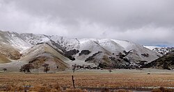
Southwestern slopes of the Tehachapi Mountains in Castac Valley
Relief map of California.png
Red pog.svg
Castac Valley
Coordinates: 34°50′12″N118°51′50″W / 34.83653°N 118.86399°W / 34.83653; -118.86399
Location Kern County, California
Range Transverse Ranges
Formed by San Andreas Fault
Elevation883 m (2,897 ft)
[1]

Castac Valley is a valley located within the Transverse Ranges in southern Kern County, California. [1] The unincorporated community of Lebec is located within the western portion of the valley.

Contents

Geography

Castac Valley is located between the eastern slopes of the San Emigdio Mountains and the southwestern tip of the Tehachapi Mountains. Castac Valley is connected to Cuddy Canyon to the west, Peace Valley via Tejon Pass to the south, and Grapevine Canyon to the north. The eastern portion of the valley is dominated by Castac Lake, a shallow endorheic lake.

Castac Valley is part of the San Andreas Rift System.

See also

References

  1. 1 2 "Castac Valley - Geographic Names Information System". edits.nationalmap.gov. Retrieved 2022-01-20.