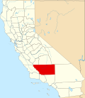
Fairfax, Kern County, California

Last updated

Fairfax is a census-designated place (CDP) in Kern County, California. [1] The CDP is within the Bakersfield's census county division, [2] and borders the city of Bakersfield to the west and East Niles, California to the north. [1]

Details

As listed in the Geographic Names Information System, its elevation is 413 feet. [3]

Its population was 28,390 at the 2020 census, the first census it was included in. [1]

Related Research Articles

<span class="mw-page-title-main">Lake Isabella, California</span> Census-designated place in California, United States

Lake Isabella is a census-designated place (CDP) in the southern Sierra Nevada, in Kern County, California, United States. It is named after the Lake Isabella reservoir and located at its southwestern edge, 6 miles (9.7 km) south of Wofford Heights in the Kern River Valley.

<span class="mw-page-title-main">Lake of the Woods, California</span> Census-designated place in California, United States

Lake of the Woods is an unincorporated area and census-designated place (CDP) in southwestern Kern County, California. As of the 2020 census, the population was 790.

<span class="mw-page-title-main">Mojave, California</span> Unincorporated community in California, United States

Mojave is an unincorporated community in Kern County, California, United States. Mojave is located 50 miles (80 km) east of Bakersfield, and 100 miles (161 km) north of Los Angeles, at an elevation of 2,762 feet (842 m). The town is located in the western region of the Mojave Desert, below and east of Oak Creek Pass and the Tehachapi Mountains. Mojave is on the Pacific Crest Trail.

<span class="mw-page-title-main">North Edwards, California</span> Census-designated place in California, United States

North Edwards is a census-designated place (CDP) in Kern County, California. Situated in the Mojave Desert, North Edwards is located about 7.2 miles (11.6 km) north-east of Edwards Air Force Base, at an elevation of 2,293 feet (699 m). As of the 2010 census it had a population of 1,058.

<span class="mw-page-title-main">Weedpatch, California</span> Census-designated place in California, United States

Weedpatch is an unincorporated community and census-designated place (CDP) in Kern County, California, United States. Weedpatch is 10 miles (16 km) south-southeast of Bakersfield. It is considered to be one of the poorest areas in Kern County. As of the 2010 census it had a population of 2,658.

<span class="mw-page-title-main">Vineyard, California</span> Census-designated place in California, United States

Vineyard is a census-designated place (CDP) in Sacramento County, California, United States. It is part of the Sacramento–Arden-Arcade–Roseville Metropolitan Statistical Area. The population was 24,836 at the 2010 census, up from 10,109 at the 2000 census. Along with more than doubling its population in just one decade, Vineyard also grew to become one of Greater Sacramento's most racially diverse suburbs.

<span class="mw-page-title-main">Blue Diamond, Nevada</span> Census-designated place in Clark County, Nevada, United States

Blue Diamond is a census-designated place (CDP) in Clark County, Nevada, United States. The population was 268 at the 2020 census.

<span class="mw-page-title-main">Havilah, California</span> Unincorporated community in California, United States

Havilah is an unincorporated community in Kern County, California. It is located in the mountains between Walker Basin and the Kern River Valley, 5 miles (8.0 km) south-southwest of Bodfish at an elevation of 3,136 feet (956 m).

Fairfax is the primary village and a census-designated place (CDP) in the town of Fairfax, Franklin County, Vermont, United States. As of the 2020 census it had a population of 865, out of 5,014 in the entire town of Fairfax.

Olde Stockdale is a neighborhood and census-designated place in Kern County, California. The population was 568 at the 2020 census.

Benton Park is a census-designated place (CDP) in Kern County, California. Although it is designated by the census as its own place, it is functionally a neighborhood of Bakersfield.

Casa Loma is a census-designated place (CDP) in Kern County, California. Although it is designated by the census as its own place, it is functionally a neighborhood of Bakersfield.

Choctaw Valley is the name of multiple neighborhoods and a census-designated place (CDP) in Kern County, California.

Rivergrove is a census-designated place (CDP) in Kern County, California. Although it is designated by the census as its own place, it is functionally a neighborhood of Bakersfield.

East Niles is a census-designated place (CDP) in Kern County, California. The CDP is within the Bakersfield's census county division, and borders the city of Bakersfield to the north and the southwest, Bakersfield Country Club to the northwest, Hillcrest and Potomac Park to the west, and Fairfax to the south.

Cottonwood is a census-designated place (CDP) in Kern County, California. The CDP is within the Bakersfield's census county division, and borders the city of Bakersfield on every side except the west, where it abuts Casa Loma.

Goodmanville is a census-designated place (CDP) in Kern County, California. Goodmanville is within the Bakersfield's census county division, and is across the Alfred Harrell Highway from the city of Bakersfield.

La Cresta is a census-designated place (CDP) in Kern County, California. The CDP is within Bakersfield's census county division, and is surrounded by the city of Bakersfield on most sides, but borders East Bakersfield to the southeast.

Potomac Park is a census-designated place (CDP) in Kern County, California. The CDP is within the Bakersfield's census county division, and borders the city of Bakersfield to the west and south, East Bakersfield and Hillcrest to the north, and East Niles, California to the east. As listed in the Geographic Names Information System, its elevation is 404 feet.

Old Stine is a census-designated place (CDP) in Kern County, California. The CDP is within the Bakersfield's census county division, and surrounded by the city of Bakersfield on all sides except for the east, where it borders Benton Park. As listed in the Geographic Names Information System, its elevation is 390 feet.

References

  1. 1 2 3 "Fairfax CDP, California". Explore Census Data. U.S. Census Bureau . Retrieved 2023-12-21.
  2. "Bakersfield CCD, Kern County, California". Explore Census Data. U.S. Census Bureau . Retrieved 2023-12-21.
  3. "Fairfax Census Designated Place". Geographic Names Information System. U.S. Geological Survey . Retrieved 2023-12-21.

35°20′49″N118°56′02″W / 35.34694°N 118.93389°W / 35.34694; -118.93389