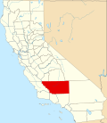
Alta Sierra, Kern County, California

Last updated
Alta Sierra
California Locator Map with US.PNG
Red pog.svg
Alta Sierra
Location in California
Usa edcp location map.svg
Red pog.svg
Alta Sierra
Alta Sierra (the United States)
Coordinates: 35°43′45″N118°32′58″W / 35.72917°N 118.54944°W / 35.72917; -118.54944 Coordinates: 35°43′45″N118°32′58″W / 35.72917°N 118.54944°W / 35.72917; -118.54944
Country United States
State California
County Kern County
Elevation
[1]
5,718 ft (1,743 m)

Alta Sierra is an unincorporated community in the Kern County, California. [1]

It is located 8.5 miles (14 km) east of Glennville, [2] at an elevation of 5,718 feet (1,743 m) in the Greenhorn Mountains/Sierra Nevada foothills. [1]

Related Research Articles

Southern California American geographic and cultural region

Southern California is a geographic and cultural region that generally comprises the southern portion of the U.S. state of California. It includes the Los Angeles metropolitan area, the second most populous urban agglomeration in the United States. The region generally contains ten of California's 58 counties: Imperial, Kern, Los Angeles, Orange, Riverside, San Bernardino, San Diego, Santa Barbara, San Luis Obispo and Ventura counties.

Kern County, California County in California, United States

Kern County is a county located in the U.S. state of California. As of the 2020 census, the population was 909,235. Its county seat is Bakersfield.

Kernville, California Census-designated place in California, United States

Kernville is a census-designated place (CDP) in the southern Sierra Nevada, in Kern County, California, United States. Kernville is located 42 miles (68 km) northeast of Bakersfield, at an elevation of 2,667 feet (813 m). The population was 1,395 at the 2010 census, down from 1,736 at the 2000 census.

Ridgecrest, California City in California, United States

Ridgecrest is a city in Kern County, California, United States, along U.S. Route 395 in the Indian Wells Valley in northeastern Kern County, adjacent to the Naval Air Weapons Station China Lake. It was incorporated as a city in 1963. The population was 27,959 at the 2020 census, up slightly from 27,616 at the 2010 census.

Alta Sierra, California Census-designated place in Nevada County, California, U.S.

Alta Sierra is a census-designated place (CDP) in Nevada County, California, United States. The population was 6,911 at the 2010 census, up from 6,522 at the 2000 census.

Wheeler Ridge, California Unincorporated community in California, United States

Wheeler Ridge is an unincorporated community in the southwestern San Joaquin Valley, within Kern County, California. It is at the junction of the valley floor and the Wheeler Ridge landform of the Tehachapi Mountains.

Elizabeth Lake (Los Angeles County, California) Intermittent lake in Elizabeth Lake, California

Elizabeth Lake is a natural sag pond that lies directly on the San Andreas Fault in the northern Sierra Pelona Mountains, in northwestern Los Angeles County, southern California. The lake has been dry since 2013 because of prolonged drought.

Alta is a small unincorporated community and census-designated place (CDP) in Placer County, California, United States, about 30 miles (48 km) northeast of Auburn. The village is located off Interstate 80 and along the historical First Transcontinental Railroad. The ZIP code is 95701 and the area code 530. One of the few buildings other than private residences is the Alta-Dutch Flat Grammar School serving kindergarten through eighth grade students. The high school that serves Alta is named Colfax high School. Colfax High School is 11 miles southwest in the incorporated town of Colfax. The population of Alta was 615 at the 2020 census.

Havilah, California Unincorporated community in California, United States

Havilah is an unincorporated community in Kern County, California. It is located in the mountains between Walker Basin and the Kern River Valley, 5 miles (8.0 km) south-southwest of Bodfish at an elevation of 3,136 feet (956 m).

Bright Star Wilderness Protected wilderness area in California, United States

Bright Star Wilderness is a 8,190-acre (3,314 ha) wilderness area in Kern County in the U.S. state of California.

Kernville (former town), California Former settlement in California, United States

Kernville is a former settlement in the Kern River Valley of the Sierra Nevada, in Kern County, California.

Cinco is an unincorporated community in Kern County, California.

Monolith, California Unincorporated community in California, United States

Monolith is an unincorporated community in the Tehachapi Valley, in Kern County, California.

Reward, Kern County, California Unincorporated community in California, United States

Reward is an unincorporated community in western Kern County, California.

Scovern Hot Springs, California Former settlement in California, United States

Scovern Hot Springs is a thermal spring system, and former settlement in the Kern River Valley of the Southern Sierra Nevada, in Kern County, California.

Shirley Meadows is an unincorporated community in Kern County, California. It is located 1.25 miles (2 km) south-southwest of Alta Sierra, at an elevation of 6,552 ft (1,997 m).

Canebrake Ecological Reserve Ecological reserve in the South Fork Valley of Kern County, California

Canebrake Ecological Reserve is a 6,700-acre (27 km2) nature reserve in the South Fork Valley of Kern County, 20 miles (32 km) east of Lake Isabella, California. It is located in the Southern Sierra Nevada region.

Lyons Station Stagecoach Stop Historical site in Newhall, Santa Clarita, California

The Lyons Station Stagecoach Stop,, was a tavern and stagecoach stop near the southwest corner of Newhall Avenue and Sierra Highway, by Eternal Valley Cemetery. The site is located in the present day Newhall section of Santa Clarita, in Los Angeles County, California.

Mud Spring, formerly called Aquaje Lodoso, is a spring and historic site in the western Antelope Valley, within northern Los Angeles County, southern California.

The French Fire was a wildfire that burned 26,535 acres (10,738 ha) near Shirley Meadows west of Lake Isabella in Kern County, California in the United States during the 2021 California wildfire season. The fire was initially reported on Wednesday, August 18, 2021, and ended around October 24, 2021. The fire threatened the communities of Shirley Meadows, Alta Sierra and Wofford Heights. The fire is currently 99% contained and has also reportedly destroyed some 17 structures, including 9 residences. The cause of the fire remains under investigation.

References

  1. 1 2 3 U.S. Geological Survey Geographic Names Information System: Alta Sierra, Kern County, California
  2. Durham, David L. (1998). California's Geographic Names: A Gazetteer of Historic and Modern Names of the State. Clovis, Calif.: Word Dancer Press. p. 992. ISBN   1-884995-14-4.