Goodmanville, California

Last updated
Goodmanville, California
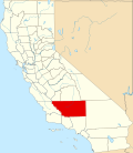
California Locator Map with US.PNG
Red pog.svg
Goodmanville, California
Location in California
Usa edcp location map.svg
Red pog.svg
Goodmanville, California
Goodmanville, California (the United States)
Coordinates: 35°20′37.12″N118°56′37.39″W / 35.3436444°N 118.9437194°W / 35.3436444; -118.9437194
Country United States
State California
County Kern County
Area
[1]
  Total0.677 sq mi (1.75 km2)
  Land0.677 sq mi (1.75 km2)
  Water0 sq mi (0 km2)
Elevation
[2]
541 ft (165 m)
Population
 (2020)
  Total121
  Density180/sq mi (69/km2)
Time zone UTC-8 (Pacific)
  Summer (DST) UTC-7 (PDT)
GNIS feature ID2804408 [2]

Goodmanville is an unincorporated community and census-designated place (CDP) in Kern County, California. [3] Goodmanville is within the Bakersfield's census county division, [4] and is across the Alfred Harrell Highway from the city of Bakersfield. [3] Its population was 121 at the 2020 census. [3]

Contents

Details

As listed in the Geographic Names Information System, its elevation is 541 feet. [2]

Demographics

Historical population
CensusPop.Note
2020 121
U.S. Decennial Census [5]
1850–1870 [6] [7] 1880-1890 [8]
1900 [9] 1910 [10] 1920 [11]
1930 [12] 1940 [13] 1950 [14]
1960 [15] 1970 [16] 1980 [17]
1990 [18] 2000 [19] 2010 [20]
2020 [21]

Goodmanville first appeared as a census designated place in the 2020 U.S. Census. [22]

2020 Census

Goodmanville CDP, California – Racial and ethnic composition
Note: the US Census treats Hispanic/Latino as an ethnic category. This table excludes Latinos from the racial categories and assigns them to a separate category. Hispanics/Latinos may be of any race.
Race / Ethnicity (NH = Non-Hispanic)Pop 2020 [21] % 2020
White alone (NH)9880.99%
Black or African American alone (NH)10.83%
Native American or Alaska Native alone (NH)10.83%
Asian alone (NH)43.31%
Pacific Islander alone (NH)00.00%
Other race alone (NH)00.00%
Mixed race or Multiracial (NH)32.48%
Hispanic or Latino (any race)1411.57%
Total121100.00%

Related Research Articles

<span class="mw-page-title-main">Tupman, California</span> Census-designated place in California, United States

Tupman is a census-designated place (CDP) in Kern County, California, United States. Tupman is located 20 miles (32 km) west-southwest of Bakersfield, at an elevation of 331 feet (101 m). The population was 161 at the 2010 census, down from 227 at the 2000 census.

<span class="mw-page-title-main">Weedpatch, California</span> Census-designated place in California, United States

Weedpatch is an unincorporated community and census-designated place (CDP) in Kern County, California, United States. Weedpatch is 10 miles (16 km) south-southeast of Bakersfield. It is considered to be one of the poorest areas in Kern County. As of the 2010 census it had a population of 2,658.

East Bakersfield is an unincorporated community and census-designated place (CDP) in Kern County, California.

<span class="mw-page-title-main">Edison, California</span> Unincorporated community in California, United States

Edison is an unincorporated community and census designated place (CDP) in the Tehachapi mountains of Kern County, California. It is located 7.5 miles (12 km) east-southeast of downtown Bakersfield, at an elevation of 571 feet (174 m).

Alta Sierra is an unincorporated community and census-designated place (CDP) in Kern County, California.

Wautec is an unincorporated community and census-designated place (CDP) in Humboldt County, California, United States. It is located within the Yurok Indian Reservation, in the valley of the Klamath River 20 miles (32 km) northeast (downstream) of Weitchpec.

Bakersfield Country Club is an unincorporated community and census designated place (CDP) in Kern County. It bears the name of the Bakersfield Country Club which is included in its geography. As of the 2020 U.S. Census, the population was 1,715.

<span class="mw-page-title-main">El Adobe, California</span> Census-designated place in California

El Adobe is an unincorporated community and census-designated place in Kern County, California. The population was 391 at the 2020 census. El Adobe is 9 miles south of Bakersfield.

Olde Stockdale is an unincorporated community and census-designated place (CDP) in Kern County, California. The population was 568 at the 2020 census.

Benton Park is a census-designated place (CDP) in Kern County, California. Although it is designated by the census as its own place, it is functionally a neighborhood of Bakersfield.

Casa Loma is an unincorporated community and census-designated place (CDP) in Kern County, California. Although it is designated by the census as its own place, it is functionally a neighborhood of Bakersfield.


Choctaw Valley is an unincorporated community and census-designated place (CDP) in Kern County, California. It is also the name of neighborhoods in the cities of Bakersfield and Rivergrove.

Rivergrove is a census-designated place (CDP) in Kern County, California. Although it is designated by the census as its own place, it is functionally a neighborhood of Bakersfield.

East Niles is an unincorporated community and census-designated place (CDP) in Kern County, California. The CDP is within the Bakersfield's census county division, and borders the city of Bakersfield to the north and the southwest, Bakersfield Country Club to the northwest, Hillcrest and Potomac Park to the west, and Fairfax to the south.

Cottonwood is an unincorporated community and census-designated place (CDP) in Kern County, California. The CDP is within the Bakersfield's census county division, and borders the city of Bakersfield on every side except the west, where it abuts Casa Loma.

Fairfax is an unincorporated community and census-designated place (CDP) in Kern County, California. The CDP is within the Bakersfield's census county division, and borders the city of Bakersfield to the west and East Niles, California to the north.

La Cresta is a census-designated place (CDP) in Kern County, California. The CDP is within Bakersfield's census county division, and is surrounded by the city of Bakersfield on most sides, but borders East Bakersfield to the southeast. Its population was 8,787 at the 2020 census.

Potomac Park is an unincorporated community and census-designated place (CDP) in Kern County, California. The CDP is within the Bakersfield's census county division, and borders the city of Bakersfield to the west and south, East Bakersfield and Hillcrest to the north, and East Niles, California to the east. As listed in the Geographic Names Information System, its elevation is 404 feet.


Old Stine is a census-designated place (CDP) in Kern County, California. The CDP is within Bakersfield's census county division, and surrounded by the city of Bakersfield on all sides except for the east, where it borders Benton Park. As listed in the Geographic Names Information System, its elevation is 390 feet.

Lakeside is an unincorporated community and census designated place (CDP) in Kern County, California, United States. Per the 2020 census, the population was 843.

References

  1. "2020 U.S. Gazetteer Files - California". United States Census Bureau . Retrieved March 23, 2024.
  2. 1 2 3 "Goodmanville Census Designated Place". Geographic Names Information System . United States Geological Survey, United States Department of the Interior.
  3. 1 2 3 "Goodmanville CDP, California". Explore Census Data. U.S. Census Bureau . Retrieved 2023-12-21.
  4. "Bakersfield CCD, Kern County, California". Explore Census Data. U.S. Census Bureau . Retrieved 2023-12-21.
  5. "Decennial Census by Decade". US Census Bureau.
  6. "1870 Census of Population - Population of Civil Divisions less than Counties - California - Almeda County to Sutter County" (PDF). United States Census Bureau .
  7. "1870 Census of Population - Population of Civil Divisions less than Counties - California - Tehama County to Yuba County" (PDF). United States Census Bureau .
  8. "1890 Census of Population - Population of California by Minor Civil Divisions" (PDF). United States Census Bureau .
  9. "1900 Census of Population - Population of California by Counties and Minor Civil Divisions" (PDF). United States Census Bureau .
  10. "1910 Census of Population - Supplement for California" (PDF). United States Census Bureau .
  11. "1920 Census of Population - Number of Inhabitants - California" (PDF). United States Census Bureau .
  12. "1930 Census of Population - Number and Distribution of Inhabitants - California" (PDF). United States Census Bureau .
  13. "1940 Census of Population - Number of Inhabitants - California" (PDF). United States Census Bureau .
  14. "1950 Census of Population - Number of Inhabitants - California" (PDF). United States Census Bureau .
  15. "1960 Census of Population - General population Characteristics - California" (PDF). United States Census Bureau .
  16. "1970 Census of Population - Number of Inhabitants - California" (PDF). United States Census Bureau .
  17. "1980 Census of Population - Number of Inhabitants - California" (PDF). United States Census Bureau .
  18. "1990 Census of Population - Population and Housing Unit Counts - California" (PDF). United States Census Bureau .
  19. "2000 Census of Population - Population and Housing Unit Counts - California" (PDF). United States Census Bureau .
  20. "2010 Census of Population - Population and Housing Unit Counts - California" (PDF). United States Census Bureau .
  21. 1 2 "P2: Hispanic or Latino, and Not Hispanic or Latino by Race – 2020: DEC Redistricting Data (PL 94-171) – Goodmanville CDP, California". United States Census Bureau.
  22. "2020 Geography Changes". United States Census Bureau.