Golden Hills, California

Last updated
Golden Hills
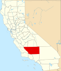
Kern County California Incorporated and Unincorporated areas Golden Hills Highlighted.svg
Location in Kern County and the state of California
Usa edcp location map.svg
Red pog.svg
Golden Hills
Location in the United States
Coordinates: 35°08′33″N118°29′25″W / 35.14250°N 118.49028°W / 35.14250; -118.49028 Coordinates: 35°08′33″N118°29′25″W / 35.14250°N 118.49028°W / 35.14250; -118.49028
Country Flag of the United States.svg  United States
State Flag of California.svg  California
County Kern
Government
   Senate Shannon Grove (R)
   Assembly Vince Fong (R)
   U. S. Congress Kevin McCarthy (R)
Area
[1]
  Total12.266 sq mi (31.771 km2)
  Land12.249 sq mi (31.726 km2)
  Water0.017 sq mi (0.045 km2)  0.14%
Elevation
[2]
3,917 ft (1,194 m)
Population
 (2010)
  Total8,656
  Density710/sq mi (270/km2)
Time zone UTC-8 (PST)
  Summer (DST) UTC-7 (PDT)
ZIP code
93561
Area code 661
FIPS code 06-30282
GNIS feature ID1867025

Golden Hills is a census-designated place (CDP) in the Tehachapi Mountains, in Kern County, California, United States. The population was 8,656 at the 2010 census, up from 7,434 at the 2000 census. Golden Hills adjoins the city of Tehachapi on the west.

Contents

Geography

Golden Hills is located at 35°08′33″N118°29′25″W / 35.14250°N 118.49028°W / 35.14250; -118.49028 . [2]

According to the United States Census Bureau, the CDP has a total area of 12.3 square miles (32 km2), of which 0.017 square miles (0.044 km2) or 0.14% is water.

Demographics

Historical population
CensusPop.
U.S. Decennial Census [3]

2010

At the 2010 census Golden Hills had a population of 8,656. The population density was 705.7 inhabitants per square mile (272.5/km2). The racial makeup of Golden Hills was 7,235 (83.6%) White, 129 (1.5%) African American, 124 (1.4%) Native American, 120 (1.4%) Asian, 15 (0.2%) Pacific Islander, 670 (7.7%) from other races, and 363 (4.2%) from two or more races. Hispanic or Latino of any race were 1,674 persons (19.3%). [4]

The whole population lived in households, no one lived in non-institutionalized group quarters and no one was institutionalized.

There were 3,216 households, 1,173 (36.5%) had children under the age of 18 living in them, 1,887 (58.7%) were opposite-sex married couples living together, 339 (10.5%) had a female householder with no husband present, 144 (4.5%) had a male householder with no wife present. There were 188 (5.8%) unmarried opposite-sex partnerships, and 15 (0.5%) same-sex married couples or partnerships. 672 households (20.9%) were one person and 247 (7.7%) had someone living alone who was 65 or older. The average household size was 2.69. There were 2,370 families (73.7% of households); the average family size was 3.11.

The age distribution was 2,245 people (25.9%) under the age of 18, 819 people (9.5%) aged 18 to 24, 1,872 people (21.6%) aged 25 to 44, 2,648 people (30.6%) aged 45 to 64, and 1,072 people (12.4%) who were 65 or older. The median age was 38.6 years. For every 100 females, there were 99.9 males. For every 100 females age 18 and over, there were 98.4 males.

There were 3,522 housing units at an average density of 287.1 per square mile, of the occupied units 2,204 (68.5%) were owner-occupied and 1,012 (31.5%) were rented. The homeowner vacancy rate was 2.3%; the rental vacancy rate was 9.5%. 5,836 people (67.4% of the population) lived in owner-occupied housing units and 2,820 people (32.6%) lived in rental housing units.

2000

As of the census of 2000, [5] there were 7,434 people, 2,547 households, and 2,019 families living in the CDP. The population density was 604.4 inhabitants per square mile (233.4/km2). There were 2,841 housing units at an average density of 231.0 per square mile (89.2/km2). The racial makeup of the CDP was 83.24% White, 1.30% Black or African American, 0.85% Native American, 1.44% Asian, 0.08% Pacific Islander, 7.88% from other races, and 5.21% from two or more races. 16.52% of the population were Hispanic or Latino of any race.

Of the 2,547 households 46.0% had children under the age of 18 living with them, 65.1% were married couples living together, 9.4% had a female householder with no husband present, and 20.7% were non-families. 17.9% of households were one person and 6.1% were one person aged 65 or older. The average household size was 2.92 and the average family size was 3.30.

The age distribution was 33.8% under the age of 18, 7.4% from 18 to 24, 27.9% from 25 to 44, 21.5% from 45 to 64, and 9.4% 65 or older. The median age was 34 years. For every 100 females, there were 100.5 males. For every 100 females age 18 and over, there were 96.1 males.

The median household income was $48,047 and the median family income was $55,906. Males had a median income of $47,833 versus $29,815 for females. The per capita income for the CDP was $19,333. About 6.5% of families and 7.8% of the population were below the poverty line, including 8.5% of those under age 18 and 12.4% of those age 65 or over.

Related Research Articles

<span class="mw-page-title-main">Bayview, Humboldt County, California</span> Census-designated place in California, United States

Bayview is a census-designated place (CDP) located adjacent to the City of Eureka in Humboldt County, California, United States. Its population is 2,619 as of the 2020 census, up from 2,510 from the 2010 census. Many locals consider this area as part of "Pine Hill."

<span class="mw-page-title-main">Pine Hills, California</span> Census-designated place in California, United States

Pine Hills is a census-designated place (CDP) in Humboldt County, California, United States, adjacent to Eureka. The population was 3,131 at the 2010 census, up from 3,108 at the 2000 census. Pine Hills includes areas like Ridgewood and areas as far south as the small neighborhood of Elk River. An area near this artificial census construct is called Pine Hill by Local government agencies and officials. Pine Hill is a much smaller area than "Pine Hills" and as defined by local agencies is actually within an adjacent CDP named Bayview.

<span class="mw-page-title-main">Lost Hills, California</span> Census-designated place in California, United States

Lost Hills is a census-designated place (CDP) in Kern County, California, United States. Lost Hills is located 42 miles (68 km) west-northwest of Bakersfield, at an elevation of 305 feet (93 m). The population was 2,412 at the 2010 census, up from 1,938 at the 2000 census. About 75% of the population is engaged in agricultural positions.

<span class="mw-page-title-main">North El Monte, California</span> Census-designated place in California, United States

North El Monte is a census-designated place (CDP) in the San Gabriel Valley, in Los Angeles County, California, United States. The population was 3,723 at the 2010 census, up from 3,703 at the 2000 census.

<span class="mw-page-title-main">Tamalpais-Homestead Valley, California</span> Census-designated place in California, United States

Tamalpais-Homestead Valley is a census-designated place (CDP) in Marin County, California, United States. The population was 11,492 at the 2020 census.

<span class="mw-page-title-main">Las Lomas, California</span> Census-designated place in California, United States

Las Lomas is an unincorporated community and census-designated place (CDP) in Monterey County, California, United States. Las Lomas is located 7 miles (11 km) north-northwest of Prunedale. The elevation is 43 feet (13 m). The population was 3,046 at the 2020 census.

<span class="mw-page-title-main">El Cerrito, Riverside County, California</span> Census-designated place in Riverside County, California, United States

El Cerrito is a census-designated place (CDP) in Riverside County, California, United States. It is an unincorporated area mostly surrounded by the city of Corona. The population was 5,100 at the 2010 census, up from 4,590 at the 2000 census.

<span class="mw-page-title-main">Granite Hills, California</span> Census-designated place in California, United States

Granite Hills is a census-designated place in San Diego County, California. The name is also applied to a neighborhood within the city limits of El Cajon in the eastern part of that city. The population of the CDP, which does not include the people living within the city of El Cajon, was 3,035 at the 2010 census, down from 3,246 at the 2000 census.

<span class="mw-page-title-main">Aptos Hills-Larkin Valley, California</span> Census-designated place in California, United States

Aptos Hills-Larkin Valley is an unincorporated community in Santa Cruz County, California, United States. It is identified as one of several small communities with a combined population of 24,402 forming the unincorporated town of Aptos by the local Chamber of Commerce along with:

<span class="mw-page-title-main">Golden Gate, Florida</span> Census-designated place in Florida

Golden Gate is a community and census-designated place (CDP) in Collier County, Florida, United States. Golden Gate's boundaries coincide with a 2 by 2 miles square of significantly higher density development than surrounding areas. The population was 23,961 as recorded in the 2010 census. It is part of the Naples–Marco Island Metropolitan Statistical Area.

<span class="mw-page-title-main">Brownlee Park, Michigan</span> Census-designated place & unincorporated community in Michigan, United States

Brownlee Park is a census-designated place (CDP) in Calhoun County in the U.S. state of Michigan.The population was 2,108 at the 2010 census. The CDP is immediately east of the city of Battle Creek and is part of the Battle Creek Metropolitan Statistical Area.

<span class="mw-page-title-main">Strandquist, Minnesota</span> City in Minnesota, United States

Strandquist is a city in Lincoln Township of Marshall County, Minnesota, United States. The population was 70 at the 2020 census.

<span class="mw-page-title-main">Golden Triangle, New Jersey</span> Census-designated place in New Jersey, United States

Golden Triangle is an unincorporated community and census-designated place (CDP) located within Cherry Hill Township, in Camden County, New Jersey, United States. As of the 2010 United States Census, the CDP's population was 4,145.

<span class="mw-page-title-main">Society Hill, Middlesex County, New Jersey</span> Census-designated place in New Jersey, United States

Society Hill is an unincorporated community and census-designated place (CDP) located within Piscataway Township, in Middlesex County, New Jersey, United States. As of the 2010 United States Census, the CDP's population was 3,829.

<span class="mw-page-title-main">Shark River Hills, New Jersey</span> Census-designated place in New Jersey, United States

Shark River Hills is an unincorporated community and census-designated place (CDP) within Neptune Township, in Monmouth County, New Jersey, United States. As of the 2010 United States Census, the CDP's population was 3,697.

<span class="mw-page-title-main">Bunker Hill, Oregon</span> CDP in Oregon, United States

Bunker Hill is a census-designated place (CDP) in Coos County, Oregon, United States. As of the 2010 census the population was 1,444.

<span class="mw-page-title-main">Orchard Hills, Pennsylvania</span> Census-designated place in Pennsylvania, United States

Orchard Hills is a census-designated place (CDP) in Armstrong County, Pennsylvania, United States. The population was 1,952 at the 2010 census.

<span class="mw-page-title-main">Hiller, Pennsylvania</span> Census-designated place in Pennsylvania, United States

Hiller is an unincorporated community and census-designated place in Fayette County, Pennsylvania, United States. As of the 2010 census, it had a population of 1,155, down from 1,234 at the 2000 census. It is located in Luzerne Township.

<span class="mw-page-title-main">Red Hill, South Carolina</span> Census-designated place in South Carolina, United States

Red Hill is a census-designated place (CDP) in Horry County, South Carolina, United States. The population was 13,223 at the 2010 census, up from 10,509 at the 2000 census.

<span class="mw-page-title-main">Lake Goodwin, Washington</span> Former CDP in Washington, United States

Lake Goodwin is a former census-designated place (CDP) in Snohomish County, Washington, United States. The population was 3,354 at the 2000 census. The CDP was discontinued at the 2010 census.

References

  1. U.S. Census Archived 2012-01-25 at the Wayback Machine
  2. 1 2 U.S. Geological Survey Geographic Names Information System: Golden Hills, California
  3. "Census of Population and Housing". Census.gov. Retrieved June 4, 2016.
  4. "2010 Census Interactive Population Search: CA - Golden Hills CDP". U.S. Census Bureau. Archived from the original on July 15, 2014. Retrieved July 12, 2014.
  5. "U.S. Census website". United States Census Bureau . Retrieved 2008-01-31.