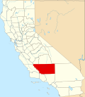
Casa Loma, Kern County, California

Last updated

Casa Loma
CDP
Casa Loma CDP
USA California location map.svg
Red pog.svg
Casa Loma
Coordinates: 35°20′31″N118°59′38″W / 35.342°N 118.994°W / 35.342; -118.994
Country United States
State California
County Kern County
County Subdivision Bakersfield CCD
Area
  Total1 km2 (0.4 sq mi)
Elevation
123 m (404 ft)
Population
 (2020)
  Total1,804
Time zone Pacific Time Zone

Casa Loma is a census-designated place (CDP) in Kern County, California. [1] Although it is designated by the census as its own place, it is functionally a neighborhood of Bakersfield. [2]

Contents

Geography

Casa Loma sits at an elevation of 404 feet (123 m). [3] Casa Loma is surrounded on 3 sides by the city of Bakersfield, but borders Cottonwood, California to the east. [4]

Demographics

The CDP was first listed in the 2020 census, at which it had 1,804 people in 546 households. [5]

Historical population
CensusPop.Note
2020 1,804
[6]

Related Research Articles

<span class="mw-page-title-main">Kern County, California</span> County in California, United States

Kern County is a county located in the U.S. state of California. As of the 2020 census, the population was 909,235. Its county seat is Bakersfield.

<span class="mw-page-title-main">Bakersfield, California</span> City in California, United States

Bakersfield is a city in Kern County, California, United States. It is the county seat and largest city of Kern County. The city covers about 151 sq mi (390 km2) near the southern end of the San Joaquin Valley and the Central Valley region. Bakersfield's population as of the 2020 census was 403,455, making it the 48th most populous city in the United States of America and the 9th most populous city in California. The Bakersfield–Delano Metropolitan Statistical Area, which includes all of Kern County, had a 2020 census population of 909,235, making it the 62nd largest metropolitan area in the United States. The urban area that includes Bakersfield and areas immediately around the city, such as East Bakersfield, Oildale, and Rosedale, has a population of 570,235.

<span class="mw-page-title-main">Kernville, California</span> Census-designated place in California, United States

Kernville is a census-designated place (CDP) in the southern Sierra Nevada, in Kern County, California, United States. Kernville is located 42 miles (68 km) northeast of Bakersfield, at an elevation of 2,667 feet (813 m). The population was 1,549 at the 2020 United States census, up from 1,395 at the 2010 census, but below the 2000 census total of 1,736.

<span class="mw-page-title-main">Lake of the Woods, California</span> Census-designated place in California, United States

Lake of the Woods is an unincorporated area and census-designated place (CDP) in southwestern Kern County, California. As of the 2020 census, the population was 790.

<span class="mw-page-title-main">Lebec, California</span> Census-designated place in California, United States

Lebec is an unincorporated community and census-designated place in southwestern Kern County, California. As of the 2010 census, the population was 1,468.

<span class="mw-page-title-main">Oildale, California</span> Census-designated place in California, United States

Oildale is a census-designated place (CDP) in Kern County, California, United States. Oildale is located 3.5 miles (5.6 km) north-northwest of downtown Bakersfield, at an elevation of 469 feet (143 m). The population was 32,684 at the 2010 census, up from 27,885 at the 2000 census. It is an unincorporated suburban town just north of Bakersfield across the Kern River, west of the Kern River Oil Field, and east of Highway 99.

<span class="mw-page-title-main">Randsburg, California</span> California Historical Landmark

Randsburg is a census-designated place (CDP) in Kern County, California, United States. Randsburg is located 17 miles (27 km) south of Ridgecrest, at an elevation of 3,504 feet (1,068 m). The population was 69 in the 2010 census, down from 77 in the 2000 census.

<span class="mw-page-title-main">Weedpatch, California</span> Census-designated place in California, United States

Weedpatch is an unincorporated community and census-designated place (CDP) in Kern County, California, United States. Weedpatch is 10 miles (16 km) south-southeast of Bakersfield. It is considered to be one of the poorest areas in Kern County. As of the 2010 census it had a population of 2,658.

<span class="mw-page-title-main">Loma, Montana</span> Census-designated place in Montana, United States

Loma is a census-designated place (CDP) in Chouteau County, Montana, United States. The population was 85 at the 2010 census.

Bakersfield Country Club is an 18-hole private golf course located in Bakersfield, California. The course is 6,819 yards on hilly terrain, designed by William P. Bell. Being located in the foothills of northeast Bakersfield makes this one of the few courses within Kern County that is naturally hilly. The club has reciprocating privileges to all private golf clubs in the Greater Bakersfield area. It is a championship course, which has hosted the Bakersfield Open Invitational between 1961 and 1962, which was a tournament on the PGA Tour.

<span class="mw-page-title-main">Cologne, New Jersey</span> Census-designated place in New Jersey, United States

Cologne is an unincorporated community and census-designated place (CDP) located within Galloway Township, in Atlantic County, in the U.S. state of New Jersey. Cologne is located on U.S. Route 30, about 2.5 miles (4.0 km) southeast of Egg Harbor City. Cologne has a post office with ZIP Code 08213.

Wautec is an unincorporated community and census-designated place (CDP) in Humboldt County, California, United States. It is located within the Yurok Indian Reservation, in the valley of the Klamath River 20 miles (32 km) northeast (downstream) of Weitchpec. It was first listed as a CDP prior to the 2020 census.

Orange Blossom is a census-designated place (CDP) in Stanislaus County, California, United States. It is located along Orange Blossom Road in the northern part of the county, on the north side of the Stanislaus River. It is bordered to the east by Knights Ferry and to the west by East Oakdale, and it is 7 miles (11 km) east of Oakdale, the nearest city. Orange Blossom was first listed as a CDP prior to the 2020 census.

Bakersfield is the primary village and a census-designated place (CDP) in the town of Bakersfield, Franklin County, Vermont, United States. As of the 2020 census it had a population of 347, out of 1,273 in the entire town of Bakersfield.

Olde Stockdale is a neighborhood and census-designated place in Kern County, California. The population was 568 at the 2020 census.

Benton Park is a census-designated place (CDP) in Kern County, California. Although it is designated by the census as its own place, it is functionally a neighborhood of Bakersfield.

Choctaw Valley is the name of multiple neighborhoods and a census-designated place (CDP) in Kern County, California.

Rivergrove is a census-designated place (CDP) in Kern County, California. Although it is designated by the census as its own place, it is functionally a neighborhood of Bakersfield.

References

  1. "Casa Loma Populated Place Profile / Kern County, California Data". california.hometownlocator.com. Retrieved February 22, 2023.
  2. "Casa Loma, Bakersfield, CA". realtor.com®. Retrieved February 21, 2023.
  3. "Casa Loma Census Designated Place". Geographic Names Information System . United States Geological Survey, United States Department of the Interior.
  4. "Casa Loma CDP, California" (Map). Explore Census Data. U.S. Census Bureau.
  5. "Casa Loma CDP, California". Explore Census Data. U.S. Census Bureau.
  6. "Casa Loma CDP, California". Explore Census Data. U.S. Census Bureau.