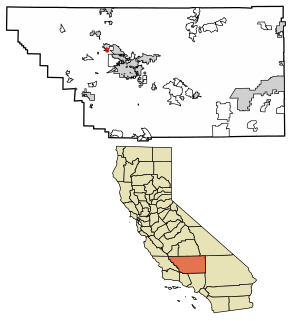
Cawelo, California

Last updated
Cawelo
Unincorporated community
California Locator Map with US.PNG
Red pog.svg
Cawelo
Location in California
Usa edcp location map.svg
Red pog.svg
Cawelo
Cawelo (the US)
Coordinates: 35°29′58″N119°09′56″W / 35.49944°N 119.16556°W / 35.49944; -119.16556 Coordinates: 35°29′58″N119°09′56″W / 35.49944°N 119.16556°W / 35.49944; -119.16556
Country United States
State California
County Kern County
Elevation [1] 427 ft (130 m)

Cawelo is an unincorporated community in Kern County, California. [1] It is located on the Southern Pacific Railroad at an elevation of 427 feet (130 m). [1] Cawelo is approximately 2 miles (3 km) east of Shafter-Minter Field, 6.5 miles (10 km) east of central Shafter, and 13 miles (21 km) northwest of Bakersfield. [2] Its ZIP Code is 93263.

Unincorporated area Region of land not governed by own local government

In law, an unincorporated area is a region of land that is not governed by a local municipal corporation; similarly an unincorporated community is a settlement that is not governed by its own local municipal corporation, but rather is administered as part of larger administrative divisions, such as a township, parish, borough, county, city, canton, state, province or country. Occasionally, municipalities dissolve or disincorporate, which may happen if they become fiscally insolvent, and services become the responsibility of a higher administration. Widespread unincorporated communities and areas are a distinguishing feature of the United States and Canada. In most other countries of the world, there are either no unincorporated areas at all, or these are very rare; typically remote, outlying, sparsely populated or uninhabited areas.

Kern County, California County in California, United States

Kern County is a county in the U.S. state of California. As of the 2010 census, the population was 839,631. Its county seat is Bakersfield.

California State of the United States of America

California is a state in the Pacific Region of the United States. With 39.6 million residents, California is the most populous U.S. state and the third-largest by area. The state capital is Sacramento. The Greater Los Angeles Area and the San Francisco Bay Area are the nation's second and fifth most populous urban regions, with 18.7 million and 8.8 million residents respectively. Los Angeles is California's most populous city, and the country's second most populous, after New York City. California also has the nation's most populous county, Los Angeles County, and its largest county by area, San Bernardino County. The City and County of San Francisco is both the country's second-most densely populated major city after New York City and the fifth-most densely populated county, behind only four of the five New York City boroughs.

The name recalls the initial letters of the partners in the agriculture interest that founded the place: Camp, West, and Lowe. [2]

Related Research Articles

Richland, California Former settlement in California, United States

Richland is a former settlement in Butte County, California. It was located 3.5 miles (5.6 km) east-southeast of Biggs, at an elevation of 102 feet. It still appeared at its prior location on maps as of 1912 but moved half a mile west by 1952.

Baker, Kern County, California Unincorporated community in California, United States

Baker is a former unincorporated community in Kern County, California. It was located in the Mojave Desert, 3 miles (4.8 km) north-northwest of Boron, at an elevation of 2503 feet. Baker was 1.25 miles (2 km) east of West Baker, California.

Calders Corner, California Unincorporated community in California, United States

Calders Corner is an unincorporated community in Kern County, California. It is located 8 miles (13 km) south of Shafter, at an elevation of 328 feet (100 m).

Cherokee Strip, California census-designated place in California, United States

Cherokee Strip is a census-designated place in Kern County, California. It is located 2.5 miles (4 km) south-southeast of Shafter, at an elevation of 331 feet (101 m). The population was 227 at the 2010 census.

Conner, California Unincorporated community in California, United States

Conner is an unincorporated community in Kern County, California. It is located on the Sunset Railroad 4.5 miles (7.2 km) east of Millux, at an elevation of 292 feet (89 m).

Gulf, California Unincorporated community in California, United States

Gulf is an unincorporated community in Kern County, California. It is located on the Sunset Railroad 2 miles (3.2 km) east of Millux, at an elevation of 292 feet (89 m).

Mayfair, Kern County, California Unincorporated community in California, United States

Mayfair is an unincorporated community in Kern County, California. It is located 5.5 miles (9 km) east-southeast of downtown Bakersfield, at an elevation of 436 feet.

Mexican Colony, California census-designated place in California, United States

Mexican Colony is a census-designated place in Kern County, California. It is located 2 miles (3.2 km) south of Shafter, at an elevation of 331 feet (101 m). The population was 281 at the 2010 census.

Millux, California Unincorporated community in California, United States

Millux is an unincorporated community in Kern County, California. It is located on the Sunset Railroad 15 miles (24 km) east-northeast of Taft, at an elevation of 292 feet (89 m).

Myricks Corner, California Unincorporated community in California, United States

Myricks Corner is an unincorporated community in Kern County, California. It is located 1.25 miles (2 km) northwest of Shafter, at an elevation of 351 feet.

North Shafter, California Unincorporated community in California, United States

North Shafter is an unincorporated community in Kern County, California. It is located 1 mile (1.6 km) north of Shafter, at an elevation of 351 feet.

Pentland, California Unincorporated community in California, United States

Pentland is an unincorporated community in Kern County, California. It is located on the Sunset Railroad 2.5 miles (4 km) east of Maricopa, at an elevation of 646 feet (197 m).

Rio Bravo, California Unincorporated community in California, United States

Rio Bravo is an unincorporated community in Kern County, California. It is located on the Southern Pacific Railroad 7.25 miles (12 km) south of Shafter, at an elevation of 318 feet (97 m).

San Emidio, California Unincorporated community in California, United States

San Emidio is an unincorporated community in Kern County, California. It is located on the Sunset Railroad 6 miles (9.7 km) east-northeast of Maricopa, at an elevation of 479 feet (146 m).

Smith Corner, California census-designated place in California, United States

Smith Corner is a census-designated place in Kern County, California. It is located 1.5 miles (2.4 km) south of Shafter, at an elevation of 331 feet (101 m). The population was 524 at the 2010 census.

Thomas Lane, California Unincorporated community in California, United States

Thomas Lane is an unincorporated community in Kern County, California. It is located 1.25 miles (2 km) south-southwest of Shafter, at an elevation of 335 feet.

Twin Lakes, Kern County, California Unincorporated community in California, United States

Twin Lakes is an unincorporated community in Kern County, California. It is located 4 miles (6.4 km) east-northeast of Liebre Twins, at an elevation of 5,171 feet (1,576 m).

Martendale is a former settlement in Kern County, California. It was located just south of Cawelo.

Glenbrook, Lake County, California Unincorporated community in California, United States

Glenbrook is an unincorporated community in Lake County, California. It is located 10 miles (16 km) south-southeast of Kelseyville, at an elevation of 2293 feet.

Shafter, Marin County, California Unincorporated community in California, United States

Shafter is an unincorporated community in Marin County, California. It is located on the Northwestern Pacific Railroad 10.5 miles (17 km) southwest of downtown Novato, at an elevation of 167 feet.

References

  1. 1 2 3 U.S. Geological Survey Geographic Names Information System: Cawelo, California
  2. 1 2 Durham, David L. (1998). California's Geographic Names: A Gazetteer of Historic and Modern Names of the State. Clovis, Calif.: Word Dancer Press. p. 1014. ISBN   1-884995-14-4.