Canebrake (former town), California

Last updated
Canebrake
Former settlement
USA California location map.svg
Red pog.svg
Canebrake
Location in California
Coordinates: 35°43′54″N118°04′43″W / 35.73167°N 118.07861°W / 35.73167; -118.07861 Coordinates: 35°43′54″N118°04′43″W / 35.73167°N 118.07861°W / 35.73167; -118.07861
Country United States
State California
County Kern County
Elevation [1] 3,930 ft (1,198 m)

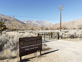
Canebrake is a former settlement in Kern County, California. [1] It was located 5.5 miles (8.9 km) north-northwest of Walker Pass, [2] along Canebrake Creek at an elevation of 3930 feet (1198 m). [1]

Kern County, California County in California, United States

Kern County is a county in the U.S. state of California. As of the 2010 census, the population was 839,631. Its county seat is Bakersfield.

California State of the United States of America

California is a state in the Pacific Region of the United States. With 39.6 million residents, California is the most populous U.S. state and the third-largest by area. The state capital is Sacramento. The Greater Los Angeles Area and the San Francisco Bay Area are the nation's second and fifth most populous urban regions, with 18.7 million and 8.8 million residents respectively. Los Angeles is California's most populous city, and the country's second most populous, after New York City. California also has the nation's most populous county, Los Angeles County, and its largest county by area, San Bernardino County. The City and County of San Francisco is both the country's second-most densely populated major city after New York City and the fifth-most densely populated county, behind only four of the five New York City boroughs.

Walker Pass

Walker Pass is a mountain pass by Lake Isabella in the southern Sierra Nevada. It is located in northeastern Kern County, approximately 53 mi (85 km) ENE of Bakersfield and 10 mi (16 km) WNW of Ridgecrest. The pass provides a route between the Kern River Valley and San Joaquin Valley on the west, and the Mojave Desert on the east.

Thomas Hooper Smith built a stage coach station there in the 1870s. Canebrake still appeared on maps as of 1908. [1] The present town of Canebrake developed about three miles west.

Canebrake, California Unincorporated community in California, United States

Canebrake is an unincorporated community in Kern County, California. It is located along California State Route 178 in the South Fork Valley, 5.3 miles (9 km) east-northeast of Onyx at an elevation of 3,031 feet (924 m).

Related Research Articles

Chloride City, California Ghost town in California, United States

Chloride City is a ghost town in Inyo County, California, United States. It is located 8.5 miles (14 km) north-northeast of Beatty Junction, at an elevation of 4,770 ft (1,450 m). The former settlement is now in Death Valley National Park.

Enterprise, Butte County, California Former settlement in California, United States

Enterprise is a former settlement in Butte County, California. It was located 5 miles (8.0 km) west-northwest of Forbestown on the South Fork of the Feather River, at an elevation of 902 feet. In 1968, it was inundated by Lake Oroville.

South Fork Kern River river in the United States of America

The South Fork Kern River is a tributary of the Kern River in the Sierra Nevada of the U.S. state of California. It is one of the southernmost rivers on the western slope of the mountains, and drains a high, relatively dry plateau country of 982 square miles (2,540 km2) along the Sierra Crest. The upper South Fork flows through a series of rugged canyons, but it also drains a flat, marshy valley before joining the Kern River at Lake Isabella.

Irishtown, California Former settlement in California, United States

Irishtown is a former settlement in Amador County, California. It was located 1.5 miles (2.4 km) south-southwest of Pine Grove, at an elevation of 1972 feet. The townsite lies within the boundaries of Pine Grove. Irishtown is a former Miwok settlement.

Hodson, California Former settlement in California, United States

Hodson is a former settlement in Calaveras County, California. It lay at an elevation of 971 feet, 2.5 miles (4.0 km) west-northwest of Copperopolis. A post office operated at Hodson from 1898 to 1906, and again from 1915 to 1917.

Evansville is a former settlement in Butte County, California, United States. It was located 5 miles (8.0 km) southwest of Forbestown. Evansville was founded in 1850.

Yankee Flat is a former settlement and mining town in Butte County, California, United States. It was located 5 miles (8.0 km) southeast of Enterprise.

Fornis, California Unincorporated community in California, United States

Fornis is an unincorporated community in El Dorado County, California. It is located 1.5 miles (2.4 km) southwest of Georgetown, at an elevation of 2379 feet.

Dogtown is a former settlement and mining camp in El Dorado County, California. It was located 0.5 miles (0.80 km) northeast of Newtown.

Ashford Mill, California Former settlement in California, United States

Ashford Mill is a former mining town settlement in Inyo County, California. It was located in Death Valley, at an elevation of 121 feet below sea level. The place is now protected ruins within Death Valley National Park.

Isabella, California Former settlement in California, United States

Isabella is a former settlement in Kern County, California. It was located 4.5 miles (7.2 km) north-northeast of Bodfish, at an elevation of 2516 feet. The site was inundated by Lake Isabella.

Terese, California Former settlement in California, United States

Terese is a former settlement in Kern County, California.

Omega, California Former settlement in California, United States

Omega was a former settlement in Nevada County, California, United States, first populated in 1850 by a single miner, J.A. Dixon, working a claim during the California Gold Rush. The town was located 3.25 miles (5.2 km) east-southeast of the present-day unincorporated town of Washington, California. A sister town, Alpha, located at what is now the site of the historical Omega Hydraulic Diggings, was about 1 mi (1.6 km) north of Omega. In the mid 1850s, following the introduction of hydraulic mining operations nearby, the town prospered. Omega had a post office, and needed to convert a residence into a jail in late 1858.

Big Blue Mill is a former settlement in Kern County, California. It was located 1 mile (1.6 km) north of Old Kernville and 2 miles (3.2 km) south of New Kernville. The town was named after the Big Blue Mine, where gold was discovered around 1861.

Christine is a former settlement in Mendocino County, California. It was located on a stage coach line 6.5 miles (10 km) northwest of Philo.

Docas, California Former settlement in California, United States

Docas is a former settlement in Monterey County, California. It was located on the Southern Pacific Railroad 5 miles (8 km) north-northwest of San Ardo, at an elevation of 404 feet. It still appeared on USGS maps as of 1943.

Vega, California Former settlement in California, United States

Vega is a former settlement in Monterey County, California. It was located on the Southern Pacific Railroad 2.5 miles (4 km) west-northwest of Aromas, at an elevation of 62 feet. Vega still appeared on USGS maps as of 1917.

Canebrake Ecological Reserve

Canebrake Ecological Reserve is a 6,700-acre (27 km2) nature reserve in the South Fork Valley of Kern County, 20 miles (32 km) east of Lake Isabella, California. It is located in the Southern Sierra Nevada region.

Bath, California Former settlement in California, United States

Bath is a former settlement in Placer County, California. Bath is located 1.5 miles (2.4 km) northeast of Foresthill. It lay at an elevation of 3442 feet.

References

  1. 1 2 3 4 U.S. Geological Survey Geographic Names Information System: Canebrake (former town), California
  2. Durham, David L. (1998). California's Geographic Names: A Gazetteer of Historic and Modern Names of the State. Clovis, Calif.: Word Dancer Press. p. 1012. ISBN   1-884995-14-4.