
Southern California is a geographic and cultural region that generally comprises California's southernmost counties, and is the second most populous urban agglomeration in the United States. The region is traditionally described as eight counties, based on demographics and economic ties: Imperial, Los Angeles, Orange, Riverside, San Bernardino, San Diego, Santa Barbara, and Ventura. The more extensive 10-county definition, which includes Kern and San Luis Obispo counties, is also used and is based on historical political divisions.
Riverview, California may refer to:

Havilah is an unincorporated community in Kern County, California. It is located in the mountains between Walker Basin and the Kern River Valley, 5 miles (8.0 km) south-southwest of Bodfish at an elevation of 3,136 feet (956 m).

South Lake is an unincorporated community in the Kern River Valley, in Kern County, California. It is located 4.5 miles (7.2 km) west-southwest of Weldon, at an elevation of 2,887 feet (880 m).

Riverview is an unincorporated community in Yolo County, California. It lies on the west bank of the Sacramento River, on the Sacramento Northern and the Oakland, Antioch and Eastern Railroads 5 miles (8.0 km) south-southwest of West Sacramento, at an elevation of 16 feet.

The Golden Trout Wilderness is a federally designated wilderness area in the Sierra Nevada, in Tulare County and Inyo County, California. It is located 40 miles (64 km) east of Porterville, California within Inyo National Forest and Sequoia National Forest.
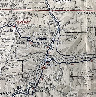
Kernville is a former settlement in the Kern River Valley of the Sierra Nevada, in Kern County, California.
Riverview is a former settlement in Fresno County, California. It lay at an elevation of 249 feet. It still appeared on maps as of 1923.
Baker is a former unincorporated community in Kern County, California. It was located in the Mojave Desert, 3 miles (4.8 km) north-northwest of Boron, at an elevation of 2503 feet. Baker was 1.25 miles (2 km) east of West Baker, California.
Camp Owens is an unincorporated community in the Kern River Valley of the Southern Sierra Nevada, in Kern County, California.
Kern Lake is an unincorporated community in the southern San Joaquin Valley, in Kern County, California.
Paloma is a former settlement in Kern County, California. It was located 2 miles (3.2 km) east-southeast of Millux, at an elevation of 289 feet.
Panama, formerly named Rio Bravo after the Spanish name for the Kern River, Rio Bravo de San Felipe, is an unincorporated community in Kern County, California. It is located 8 miles (13 km) south-southwest of Bakersfield, at an elevation of 351 feet (107 m) in the San Joaquin Valley.
Sand Canyon is an unincorporated community in Kern County, California. It is located on Cache Creek 7 miles (11 km) east of Tehachapi, at an elevation of 4,500 feet (1,400 m).
Miracle Hot Springs is an unincorporated community in the Kern River Valley, in Kern County, California. It is located on the Kern River 14 miles (23 km) southeast of Glennville, at an elevation of 2,382 feet (726 m).
Kern River Slough is a former settlement in Kern County, California.
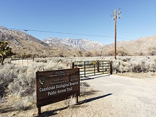
Canebrake Ecological Reserve is a 6,700-acre (27 km2) nature reserve in the South Fork Valley of Kern County, 20 miles (32 km) east of Lake Isabella, California. It is located in the Southern Sierra Nevada region.

NGC 169 is a barred spiral galaxy located in the constellation Andromeda. It was discovered on September 18, 1857 by R. J. Mitchell.


