Paloma is an unincorporated community in Calaveras County, California. It lies at an elevation of 1362 feet and is located at 38°15′34″N120°45′48″W. The community is in ZIP code 95252 and area code 209.

Havilah is an unincorporated community in Kern County, California. It is located in the mountains between Walker Basin and the Kern River Valley, 5 miles (8.0 km) south-southwest of Bodfish at an elevation of 3,136 feet (956 m).

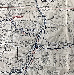
South Lake is an unincorporated community in the Kern River Valley, in Kern County, California. It is located 4.5 miles (7.2 km) west-southwest of Weldon, at an elevation of 2,887 feet (880 m).

Kernville is a former settlement in the Kern River Valley of the Sierra Nevada, in Kern County, California.

Actis is an unincorporated community in Kern County, California. It is located 6.5 miles (10 km) north of Rosamond, at an elevation of 2,562 feet (781 m). It is situated between Mojave and Rosamond at Backus Road and California State Route 14.

Aerial Acres is a fly-in unincorporated community in Kern County, California. It is located 5.5 miles (9 km) east-southeast of Castle Butte, at an elevation of 2,428 feet (740 m). It was noted as "a desert town at Clay Mine Road and Sequoia in Peerless Valley, California.

Baker is a former unincorporated community in Kern County, California. It was located in the Mojave Desert, 3 miles (4.8 km) north-northwest of Boron, at an elevation of 2503 feet. Baker was 1.25 miles (2 km) east of West Baker, California.

Five Points is an unincorporated community in Kern County, California. It is located 3.5 miles (6 km) east of Cummings Mountain, at an elevation of 6,709 feet (2,045 m).

Fluhr is a former settlement in Kern County, California. It was located on the Atchison, Topeka and Santa Fe Railroad 2 miles (3.2 km) north-northwest of Edwards, at an elevation of 2372 feet. Fluhr still appeared on maps as of 1942.

Fruitvale is an unincorporated community in Kern County, California. It is located 4.5 miles (7.2 km) west of Bakersfield, at an elevation of 397 feet.

Indian Wells is an unincorporated community in Kern County, California.

Kern Lake is an unincorporated community in the southern San Joaquin Valley, in Kern County, California.

Meridian is an unincorporated community in Kern County, California. It is located 4.5 miles (7.2 km) northeast of Mettler, at an elevation of 433 feet (132 m).

Scovern Hot Springs is a former settlement in the Kern River Valley of the Southern Sierra Nevada, in Kern County, California.

Sullivan is a former settlement in Kern County, California. It was located on the Southern Pacific Railroad 2.5 miles (4 km) east of Tehachapi, at an elevation of 4029 feet.

Summit is an unincorporated community in Kern County, California.

Twin Oaks is an unincorporated community in Kern County, California. It is located 1.5 miles (2.4 km) east-northeast of Loraine, at an elevation of 2,825 feet (861 m).

West Baker is a former settlement in Kern County, California.

Miracle Hot Springs is an unincorporated community in the Kern River Valley, in Kern County, California. It is located on the Kern River 14 miles (23 km) southeast of Glennville, at an elevation of 2,382 feet (726 m).


