
Cupertino is a U.S. city in Santa Clara County, California, directly west of San Jose on the western edge of the Santa Clara Valley with portions extending into the foothills of the Santa Cruz Mountains. The population was 58,302 as of the 2010 census.

The Geographic Names Information System (GNIS) is a database that contains name and locative information about more than two million physical and cultural features located throughout the United States of America and its territories. It is a type of gazetteer. GNIS was developed by the United States Geological Survey in cooperation with the United States Board on Geographic Names (BGN) to promote the standardization of feature names.
The Chemehuevi Indian Tribe of the Chemehuevi Reservation is a federally recognized tribe of Chemehuevi people, who are the southernmost branch of Southern Paiute people.

Mandalay State Beach is a protected beach in the city of Oxnard, California, United States. Managed by the California Department of Parks and Recreation, the park preserves an area of undeveloped sand dunes and wetlands that was once common along the 16.5-mile-long (26.6 km) coastline of the Oxnard Plain.

The Santa Ynez Valley is located in Santa Barbara County, California, between the Santa Ynez Mountains to the south and the San Rafael Mountains to the north. The Santa Ynez River flows through the valley from east to west. The Santa Ynez Valley is separated from the Los Alamos Valley, to the northwest, by the Purisima Hills, and from the Santa Maria Valley by the Solomon Hills. The Santa Rita Hills separate the Santa Ynez Valley from the Santa Rita and Lompoc Valleys to the west.

Stevens Creek is a creek in Santa Clara County, California. The creek originates in the Santa Cruz Mountains on the western flank of Black Mountain in the Monte Bello Open Space Preserve near the terminus of Page Mill Road at Skyline Boulevard. It flows southeasterly through the Stevens Creek County Park before turning northeast into Stevens Creek Reservoir. It then continues north for 12.5 miles through Cupertino, Los Altos, Sunnyvale and Mountain View before emptying into the San Francisco Bay at the Whisman Slough, near Google's main campus.

Black Mountain is a summit on Monte Bello Ridge in the Santa Cruz Mountains of west Santa Clara County, California, south of Los Altos and Los Altos Hills, and west of Cupertino; it is within the Palo Alto city limits though not near the developed part of the city. It is located on the border between Rancho San Antonio Open Space Preserve and Monte Bello Open Space Preserve, with the summit located in the former. Early Spanish explorers commonly named tree- or chaparral-covered summits which look black in the distance Loma Prieta, from the Spanish . The Spanish also called the middle portion of the Santa Cruz Mountains the Sierra Morena meaning, extending from Half Moon Bay Road south to a gap at Lexington Reservoir, and which includes a summit called Sierra Morena. There are over 100 "Black Mountains" in California.

Merrimac is an unincorporated community in Butte County, California located along Oroville-Quincy Road about 2.1 miles (3.4 km) south of the Plumas County line. It lies at an elevation of 3999 feet. While the location is shown as official in the National Geographic Names Database, it is not known if locals use this name to describe the place today. Nearby is Rogers Cow Camp, a campground in Lassen National Forest. The USGS feature ID for this populated place is 1659117. The US Postal Service does not show a ZIP Code for this community. The location is within area code 530.
Nelson is an unincorporated community in Butte County, California. It lies 6.5 miles (10.5 km) south-southeast of Durham, at an elevation of 121 feet. Nelson's first post office was established in 1873; its zip code is 95958. The place was founded in 1873 by the California and Oregon Railroad Company and named for an early settler, A.D. Nelson.

New Blinzing is a former settlement in Butte County, California, United States. It was located 5.25 miles north of Berry Creek and about 1 mile (1.6 km) northwest of Blinzing, on the Western Pacific Railroad, at an elevation of 942 feet. It still appeared on maps as of 1948.
Wicks Corner is an unincorporated community in Butte County, California, at the junction of California State Route 70 and California State Route 149. It lies at an elevation of 272 feet.
Goler Heights, also known simply as Goler, is an unincorporated community in Kern County, California. It is located 6.5 miles (10 km) northwest of Randsburg, at an elevation of 2,579 feet (786 m). The town is named after John Goller, a German immigrant who discovered a placer gold deposit that was later mined and named in his honor.
Isabella is a former settlement in Kern County, California. It was located 4.5 miles (7.2 km) north-northeast of Bodfish, at an elevation of 2516 feet. The site was inundated by Lake Isabella.

Old River is an unincorporated community in Kern County, California. It is located 9.5 miles (15 km) southwest of Bakersfield, at an elevation of 344 feet (105 m).
Glenblair is an unincorporated community in Mendocino County, California. It is located 15 miles (24 km) north-northwest of Comptche, at an elevation of 207 feet.
Permanente Creek is a 13.3-mile-long (21.4 km) stream originating on Black Mountain in Santa Clara County, California, United States. It is the namesake for the Kaiser Permanente health maintenance organization. Named by early Spanish explorers as Arroyo Permanente or Rio Permanente because of its perennial flow, the creek descends the east flank of Black Mountain then courses north through Los Altos and Mountain View culminating in southwest San Francisco Bay historically at the Charleston Slough but now diverted via the Permanente Creek Diversion Channel to Stevens Creek and the Mountain View Slough in San Francisco Bay.

Hale Creek is a short stream originating in the foothills of Los Altos Hills, California in Santa Clara County, California, United States. Its source is in the Rancho San Antonio Open Space Preserve upstream and east of Neary Quarry. The creek flows northeasterly 4.6 miles (7.4 km) through the cities of Los Altos Hills, Los Altos, and Mountain View before joining Permanente Creek.

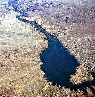
Calero Reservoir is an artificial lake in the Santa Teresa Hills south of San Jose, California, United States. A 4,471-acre (1,809 ha) county park surrounds the reservoir and provides limited fishing ("catch-and-release"), picnicking, hiking, and horseback riding activities. Although swimming is prohibited, boating, water-skiing and jet-skiing are permitted in the reservoir.

Iowa Hill is an unincorporated community in Placer County, California. The town is located 6.5 miles northwest of Foresthill 9 miles east of Colfax and 58 miles northeast of Sacramento. It lies at an elevation of 2861 feet. The community relies completely upon solar panels and generators for power. Population is around 200 people. Iowa Hill Road claims a small handful of lives every decade, and along with its "off grid" status, prevents the town from growing in population. The community boasts many hardcore cyclists and is appealing to visitors due to the abundance of recreational opportunities.

The 2018 California Attorney General election was held on November 6, 2018, to elect the Attorney General of California. 2014 election winner Kamala Harris was elected to the United States Senate during the 2016 Senate elections; incumbent Democratic Attorney General, Xavier Becerra won election to a full term.


