
Weedpatch is an unincorporated community and census-designated place (CDP) in Kern County, California, United States. Weedpatch is 10 miles (16 km) south-southeast of Bakersfield. It is considered to be one of the poorest areas in Kern County. As of the 2010 census it had a population of 2,658.

Mandalay State Beach is a protected beach in the city of Oxnard, California, United States. Managed by the California Department of Parks and Recreation, the park preserves an area of undeveloped sand dunes and wetlands that was once common along the 16.5-mile-long (26.6 km) coastline of the Oxnard Plain.
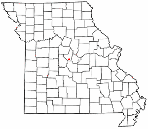
High Point is an unincorporated community in southern Moniteau County, Missouri, United States. It is located ten miles south of California, approximately one mile west of Route 87 on Missouri Route C.

Famoso is an unincorporated community in Kern County, California. It is located on Poso Creek 5.5 miles (8.9 km) south-southeast of McFarland, at an elevation of 427 feet (130 m).

Merrimac is an unincorporated community in Butte County, California located along Oroville-Quincy Road about 2.1 miles (3.4 km) south of the Plumas County line. It lies at an elevation of 3999 feet. While the location is shown as official in the National Geographic Names Database, it is not known if locals use this name to describe the place today. Nearby is Rogers Cow Camp, a campground in Lassen National Forest. The USGS feature ID for this populated place is 1659117. The US Postal Service does not show a ZIP Code for this community. The location is within area code 530.

Norden is a small unincorporated community in Nevada County, California, United States, about 9 miles (14 km) west of Truckee. The community is located on a former portion of U.S. Route 40 near Interstate 80 and lies along the historical First Transcontinental Railroad, 1.5 miles (2.4 km) west of Donner Pass.
Hallelujah Junction is an unincorporated community in Lassen County, California. It is located 4 miles (6.4 km) east-southeast of Beckwourth Pass, at an elevation of 5033 feet. It is located at the interchange with U.S. Route 395 and the eastern terminus of State Route 70.
Wicks Corner is an unincorporated community in Butte County, California, at the junction of California State Route 70 and California State Route 149. It lies at an elevation of 272 feet.
Burrel is an unincorporated community in Fresno County, California. It is located 30 miles (48 km) southwest of Fresno, at an elevation of 203 feet.
Evelyn is an unincorporated community in Inyo County, California. It is located on the Tonopah and Tidewater Railroad 5 miles (8 km) south-southeast of Eagle Mountain, at an elevation of 1880 feet.
Actis is an unincorporated community in Kern County, California. It is located 6.5 miles (10 km) north of Rosamond, at an elevation of 2,562 feet (781 m). It is situated between Mojave and Rosamond at Backus Road and California State Route 14.
Blackwells Corner is an unincorporated community in the Antelope Valley of Kern County, California. It is located 50 miles (80 km) west-northwest of Bakersfield, at an elevation of 650 feet. Blackwells Corner is at the intersection of California State Route 46 and California State Route 33, and was the last place James Dean was seen alive prior to his death in a car wreck.
Midoil is an unincorporated community in Kern County, California. It is located 2 miles (3.2 km) southeast of Fellows, at an elevation of 1,339 feet (408 m).
Missouri Triangle is an unincorporated community in Kern County, California. It is located 10 miles (16 km) north of McKittrick, at an elevation of 561 feet (171 m).

Mount Bullion is an unincorporated community in Mariposa County, California. It is located 6 miles (9.7 km) southeast of Bear Valley, at an elevation of 2152 feet.

Westport is an unincorporated community in Mendocino County, California. It is located on California State Route 1 near the Pacific Ocean 13 miles (21 km) north of Fort Bragg, at an elevation of 125 feet.
Camphora is an unincorporated community in Monterey County, California. It is located on U.S. Route 101 and the Southern Pacific Railroad line, 3 miles (4.8 km) northwest of Soledad, at an elevation of 171 feet.
Calgro is an unincorporated community in Tulare County, California, United States. Calgro is located on California State Route 63 and California State Route 201 11 miles (18 km) north of Visalia. The name of the community comes from an acronym for the California Growers Wineries.
Yuba Pass is a former settlement in Nevada County, California. Yuba Pass was located on the former Southern Pacific Railroad, 1 mile (1.6 km) east-northeast of Yuba Gap. It lay at an elevation of 5636 feet.
Hart is an unincorporated community in northwest McDonald County, in the U.S. state of Missouri. The community is located along Missouri Route 43, north of Tiff City and less than one-half mile east of the Missouri - Oklahoma border.


