Edwards, California

Last updated
Edwards
California Locator Map with US.PNG
Red pog.svg
Edwards
Location in California
Usa edcp location map.svg
Red pog.svg
Edwards
Edwards (the United States)
Coordinates: 34°55′34″N117°56′06″W / 34.92611°N 117.93500°W / 34.92611; -117.93500 Coordinates: 34°55′34″N117°56′06″W / 34.92611°N 117.93500°W / 34.92611; -117.93500
Country United States
State California
County Kern County
Elevation
[1]
2,356 ft (718 m)
ZIP code
93523 [2]

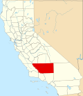
Edwards (formerly, Muroc and Wherry Housing) is an unincorporated community in Kern County, California. [1]

It is located 16 miles (26 km) east-southeast of Mojave, [3] about 22 miles (35 km) northeast of Lancaster, 15 miles (24 km) east of Rosamond, and 5.5 miles (8.9 km) south of California City at an elevation of 2,356 feet (718 m). [1]

The area was originally a housing site for the air force base that surrounds it. The place name changed to Edwards in 1951 (after the base was renamed and a post office transferred from Muroc was established). [3] It is part of the Edwards Air Force Base reservation.

Climate

According to the Köppen Climate Classification system, Edwards has a semi-arid climate, abbreviated "BSk" on climate maps. [4]

Related Research Articles

<span class="mw-page-title-main">Crockett, California</span> Census-designated place in California, United States

Crockett is a census-designated place (CDP) in Contra Costa County, in the East Bay sub-region of the San Francisco Bay Area, California. The population was 3,094 at the 2010 census. It is located 28 miles northeast of San Francisco. Other nearby communities include Port Costa, Martinez, Vallejo, Benicia, Rodeo, Hercules, Pinole and Richmond.

<span class="mw-page-title-main">Boron, California</span> Census-designated place in California, United States

Boron is a census-designated place (CDP) in Kern County, California, United States. Boron is 15 miles (24 km) southwest of Red Rock Mountain at an elevation of 2,467 feet (752 m). The population was 2,086 at the 2020 census, up from 2,025 at the 2000 census. Boron is named after the element boron and is the site of the world's largest source of the boron compound boric acid.

<span class="mw-page-title-main">Edwards Air Force Base</span> US Air Force base near Lancaster, California, United States (founded 1935)

Edwards Air Force Base (AFB) is a United States Air Force installation in California. Most of the base sits in Kern County, but its eastern end is in San Bernardino County and a southern arm is in Los Angeles County. The hub of the base is Edwards, California. The base was named after World War II USAAF veteran and test pilot Capt. Glen Edwards in 1950; prior to then the facility was named Muroc Air Force Base.

<span class="mw-page-title-main">Mojave, California</span> Unincorporated community in California, United States

Mojave is an unincorporated community in Kern County, California, United States. Mojave is located 50 miles (80 km) east of Bakersfield, and 100 miles (161 km) north of Los Angeles, at an elevation of 2,762 feet (842 m). The town is located in the western region of the Mojave Desert, below and east of Oak Creek Pass and the Tehachapi Mountains. Mojave is on the Pacific Crest Trail.

<span class="mw-page-title-main">North Edwards, California</span> Census-designated place in California, United States

North Edwards is a census-designated place (CDP) in Kern County, California. Situated in the Mojave Desert, North Edwards is located about 7.2 miles (11.6 km) north-east of Edwards Air Force Base, at an elevation of 2,293 feet (699 m). As of the 2010 census it had a population of 1,058.

<span class="mw-page-title-main">Rosamond, California</span> Unincorporated community in Kern County, California

Rosamond is a unincorporated community in Kern County, California, US, near the Los Angeles county line. Rosamond is part of Greater Los Angeles and is located in the Mojave Desert just north of Lancaster and Palmdale, two of the largest cities in Antelope Valley. As of the 2010 Census, Rosamond's population was 18,150. For statistical purposes, the United States Census Bureau has defined Rosamond as a census-designated place (CDP).

<span class="mw-page-title-main">Covelo, California</span> Census-designated place in California, United States

Covelo is a census-designated place (CDP) in Mendocino County, California, United States. Covelo is located 14 miles (23 km) as the crow flies east-northeast of Laytonville, at an elevation of 1,398 feet (426 m). The population was 1,394 at the 2020 census, up from 1,255 at the 2010 census. 405 acres (1.64 km2) of Covelo is part of the Round Valley Indian Reservation.

<span class="mw-page-title-main">Green River, Utah</span> City in Utah, United States

Green River is a city in Emery County, Utah. The population was 847 at the 2020 census.

<span class="mw-page-title-main">Antelope Valley</span> Valley in Southern California, United States

The Antelope Valley is located in northern Los Angeles County, California, and the southeast portion of Kern County, California, and constitutes the western tip of the Mojave Desert. It is situated between the Tehachapi, Sierra Pelona, and the San Gabriel Mountains. The valley was named for the pronghorns that roamed there until they were all but eliminated in the 1880s, mostly by hunting, or resettled in other areas. The principal cities in the Antelope Valley are Palmdale and Lancaster.

<span class="mw-page-title-main">Glen Edwards (pilot)</span> United States Air Force officer

Glen Walter Edwards was a test pilot for the United States Air Force, and is the namesake of Edwards Air Force Base.

<span class="mw-page-title-main">Air Force Test Center</span> US Air Force flight test center

The Air Force Test Center (AFTC) is a development and test organization of the United States Air Force. It conducts research, development, test, and evaluation of aerospace systems from concept to deployment. It has test flown every aircraft in the Army Air Force's and the Air Force's inventory since World War II. The center employs nearly 13,000 people, and controls the second largest base in the Air Force.

<span class="mw-page-title-main">Fish Camp, California</span> Census-designated place in California, United States

Fish Camp is a census-designated place in Mariposa County, California, United States. It is located 18 miles (29 km) east of Mariposa, at an elevation of 5,062 feet (1,543 m). The population was 49 at the 2020 census. The ZIP Code is 93623, and the community is inside area code 559.

<span class="mw-page-title-main">Rogers Dry Lake</span> Dry lake in the state of California, United States

Rogers Dry Lake is an endorheic desert salt pan in the Mojave Desert of Kern County, California. The lake derives its name from the Anglicization from the Spanish name, Rodriguez Dry Lake. It is the central part of Edwards Air Force Base as its hard surface provides a natural extension to the paved runways. It was formerly known as Muroc Dry Lake.

<span class="mw-page-title-main">Lockwood, Monterey County, California</span> Unincorporated community in California, United States

Lockwood is an unincorporated community and census-designated place (CDP) in Monterey County, California, United States. As of the 2020 census it had a population of 368.

Muroc Joint Unified School District is a public K-12 unified school system of approximately 2,000 students, located in the Mojave Desert approximately 110 miles (180 km) northeast of Los Angeles. It was founded as an elementary school in 1911 at Edwards. Boron students were bussed to the air base for their education. As the area became more populated, another school was established in 1929, in Boron. The schools became a unified district in 1953, encompassing 578 square miles (1,500 km2) in Kern and San Bernardino counties.

Muroc is a former settlement in Kern County, California in the Mojave Desert.

North Muroc is a former settlement in Kern County, California. It was located 8 miles (13 km) south-southeast of Castle Butte, at an elevation of 2290 feet. North Muroc still appeared on maps as of 1947.

Stevinson is an unincorporated community and census-designated place in Merced County, California. It is located 21 miles (34 km) west of Merced at an elevation of 85 feet (26 m). The population was 275 at the 2020 census, down from 313 at the 2010 census.

<span class="mw-page-title-main">Hi Vista, California</span> Unincorporated community in California, United States

Hi Vista is an unincorporated community in northeastern Los Angeles County, California, United States. Hi Vista is sometimes confused with Lancaster because both communities use the same ZIP code of 93535.

<span class="mw-page-title-main">United States Air Force Plant 42</span> US Air Force-owned aircraft manufacturing facility in Palmdale, California

United States Air Force Plant 42 is a classified aircraft manufacturing plant owned by the United States Air Force in the Antelope Valley, about 60 miles from downtown Los Angeles. It is also used by the National Aeronautics and Space Administration (NASA).

References

  1. 1 2 3 U.S. Geological Survey Geographic Names Information System: Edwards, California
  2. "Edwards ZIP Code". zipdatamaps.com. 2022. Retrieved December 13, 2022.
  3. 1 2 Durham, David L. (1998). California's Geographic Names: A Gazetteer of Historic and Modern Names of the State. Clovis, Calif.: Word Dancer Press. p. 1031. ISBN   1-884995-14-4.
  4. Climate Summary for Edwards, California