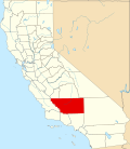
Ridgecrest Heights, California | |
---|---|
Coordinates: 35°36′6.84″N117°42′15.05″W / 35.6019000°N 117.7041806°W | |
Country | United States |
State | California |
County | Kern County |
Area | |
• Total | 0.604 sq mi (1.56 km2) |
• Land | 0.604 sq mi (1.56 km2) |
• Water | 0 sq mi (0 km2) |
Elevation | 2,428 ft (740 m) |
Population (2020) | |
• Total | 380 |
• Density | 630/sq mi (240/km2) |
Time zone | UTC-8 (Pacific) |
• Summer (DST) | UTC-7 (PDT) |
GNIS feature ID | 2804429 [2] |
Ridgecrest Heights is a census-designated place (CDP) in northeastern Kern County, California, United States, bordered in the north and east by Ridgecrest. The population of Ridgecrest Heights was 380 in the 2020 census. [3]
Ridgecrest Heights is located 2.34 mi (3.76 km) southwest of Ridgecrest, California in the Indian Wells Valley at an elevation of 2,428 ft (740 m). [4]
Census | Pop. | Note | %± |
---|---|---|---|
2020 | 10,528 | — | |
U.S. Decennial Census [5] 1850–1870 [6] [7] 1880-1890 [8] 1900 [9] 1910 [10] 1920 [11] 1930 [12] 1940 [13] 1950 [14] 1960 [15] 1970 [16] 1980 [17] 1990 [18] 2000 [19] 2010 [20] 2020 [3] |
Ridgecrest Heights first appeared as a census designated place in the 2020 U.S. Census. [21]
Race / Ethnicity (NH = Non-Hispanic) | Pop 2020 [3] | % 2020 |
---|---|---|
White alone (NH) | 245 | 64.47% |
Black or African American alone (NH) | 4 | 1.05% |
Native American or Alaska Native alone (NH) | 3 | 0.79% |
Asian alone (NH) | 0 | 0.00% |
Pacific Islander alone (NH) | 0 | 0.00% |
Other race alone (NH) | 1 | 0.26% |
Mixed race or Multiracial (NH) | 25 | 6.58% |
Hispanic or Latino (any race) | 102 | 26.84% |
Total | 380 | 100.00% |
Edison is an unincorporated community and census designated place (CDP) in the Tehachapi mountains of Kern County, California. It is located 7.5 miles (12 km) east-southeast of downtown Bakersfield, at an elevation of 571 feet (174 m).
Alta Sierra is an unincorporated community and census-designated place (CDP) in Kern County, California.
Di Giorgio is an unincorporated community and census designated place (CDP) in Kern County, California. It is located 6.5 miles (10 km) south of Edison, at an elevation of 495 feet (151 m).
Old River is an unincorporated community and census-designated place (CDP) in Kern County, California. It is located 9.5 miles (15 km) southwest of Bakersfield, at an elevation of 341 feet (104 m).
Pumpkin Center is an unincorporated community and census-designated place (CDP) in Kern County, California. It is located 7.5 miles (12 km) south-southwest of downtown Bakersfield, at an elevation of 351 feet (107 m).
Madeline is an unincorporated community and census-designated place (CDP) in Lassen County, California. It is located 45 miles (72 km) north-northeast of Susanville, at an elevation of 5325 feet. Its population is 21 as of the 2020 census.
Stones Landing is an unincorporated community and census-designated place (CDP) in Lassen County, California. It lies at an elevation of 5,118 feet. Its population is 86 as of the 2020 census.
Bonadelle Ranchos is an unincorporated community and census-designated place (CDP) in Madera County, California, United States. It lies at an elevation of 338 feet (103 m). As of the 2020 census, it had a population of 5,497. Prior to 2020, the community was part of the Bonadelle Ranchos-Madera Ranchos CDP.
Madera Ranchos is an unincorporated community and census-designated place (CDP) in Madera County, California, United States. It lies at an elevation of 341 feet (104 m). As of the 2020 census it had a population of 3,623. For statistical purposes, the United States Census Bureau has defined Madera Ranchos as a census-designated place (CDP).
Foresta is an unincorporated community and a census-designated place (CDP) in Mariposa County, California, within Yosemite National Park.
Happy Valley is an unincorporated community and census designated place (CDP) 11 miles (18 km) southwest of Redding, California. It lies at an elevation of roughly 850 feet. Its population is 4,949 as of the 2020 census. It is roughly divided into Cloverdale and Olinda across Happy Valley Road at Palm Rd. The United States Postal Service delivers mail to the residents of Happy Valley from nearby city Anderson, California. Happy Valley has a volunteer fire department.
Crestmore Heights is a former census-designated place in Riverside County, California, now part of the city of Jurupa Valley, California. Crestmore Heights sits at an elevation of 1,033 feet (315 m). The 2010 United States census reported Crestmore Heights's population was 384.
Sugarloaf Mountain Park is a former census-designated place (CDP) in Tulare County, California. Sugarloaf Mountain Park sits at an elevation of 5,991 feet (1,826 m). The CDP was first listed in the 2010 U.S. Census although with zero population. The CDP was deleted prior to the 2020 U.S. Census.
Sage is an unincorporated community and census-designated place (CDP) in Riverside County, California, United States. It has a population of 3,370 according to the 2020 census. Its elevation is 2,313 feet (705 m).
Millerton is an unincorporated community and census-designated place (CDP) in Fresno County, California, United States. It is located 3 miles (5 km) east of Friant and 23 miles (37 km) north-northeast of Fresno.
Wautec is an unincorporated community and census-designated place (CDP) in Humboldt County, California, United States. It is located within the Yurok Indian Reservation, in the valley of the Klamath River 20 miles (32 km) northeast (downstream) of Weitchpec.
Cedar Flat is a census-designated place (CDP) in eastern Placer County, California, United States. It is located on the northwest shore of Lake Tahoe, between Carnelian Bay to the northeast and Dollar Point to the southwest. It was first listed as a CDP prior to the 2020 census.
El Monte Mobile Village is an unincorporated community and census-designated place (CDP) comprising three census blocks in Tulare County, California, United States. It is on the north side of Avenue 416, 0.4 miles (0.64 km) west of the Dinuba city limits. The village was first listed as a CDP prior to the 2020 census.
Hypericum is an unincorporated community and census-designated place (CDP) in Tulare County, California, United States. It is on the north side of Avenue 256, 9 miles (14 km) southeast of Visalia, the county seat.
Jovista is an unincorporated community and census-designated place (CDP) in Tulare County, California, United States. It is on the southern border of the county, 5 miles (8 km) northeast of Delano, a city in Kern County. Jovista was first listed as a CDP prior to the 2020 census. It had a population of 41 at the 2020 census.