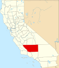
China Lake Acres, California

Last updated
China Lake Acres
Kern County California Incorporated and Unincorporated areas China Lake Acres Highlighted.svg
Location in Kern County and the state of California
Usa edcp location map.svg
Red pog.svg
China Lake Acres
Location in the United States
Coordinates: 35°38′26″N117°45′50″W / 35.64056°N 117.76389°W / 35.64056; -117.76389 Coordinates: 35°38′26″N117°45′50″W / 35.64056°N 117.76389°W / 35.64056; -117.76389
Country Flag of the United States.svg  United States
State Flag of California.svg  California
County Kern
Government
   State senator Shannon Grove (R) [1]
   Assemblymember Vince Fong (R) [1]
   U. S. rep. Kevin McCarthy (R) [2]
Area
[3]
  Total5.21 sq mi (13.49 km2)
  Land5.21 sq mi (13.49 km2)
  Water0.00 sq mi (0.00 km2)  0.019%
Elevation
[4]
2,431 ft (741 m)
Population
 (2020)
  Total1,757
  Density337.30/sq mi (130.23/km2)
Time zone UTC-8 (PST)
  Summer (DST) UTC-7 (PDT)
ZIP code
93555
Area codes 442/760
FIPS code 06-13157
GNIS feature ID1853382

China Lake Acres is a census-designated place (CDP) in Kern County, California, United States. The population was 1,876 at the 2010 census, up from 1,761 at the 2000 census.

Contents

Geography

Indian Wells Valley, showing Ridgecrest, California and the China Lake area. RidgecrestCA.JPG
Indian Wells Valley, showing Ridgecrest, California and the China Lake area.

China Lake Acres is located at 35°38′26″N117°45′50″W / 35.64056°N 117.76389°W / 35.64056; -117.76389 . [4]

According to the United States Census Bureau, this CDP (census-designated place), commonly referred to by local residents as The Acres, has a total area of 5.211 square miles (13.496 km2), over 99% land.

Demographics

Historical population
CensusPop.
2020 1,757
U.S. Decennial Census [5]

2010

At the 2010 census China Lake Acres had a population of 1,876. The population density was 360.0 inhabitants per square mile (139.0/km2). The racial makeup of China Lake Acres was 1,601 (85.3%) White, 35 (1.9%) African American, 29 (1.5%) Native American, 16 (0.9%) Asian, 7 (0.4%) Pacific Islander, 84 (4.5%) from other races, and 104 (5.5%) from two or more races. Hispanic or Latino of any race were 265 people (14.1%). [6]

The whole population lived in households, no one lived in non-institutionalized group quarters and no one was institutionalized.

There were 755 households, 219 (29.0%) had children under the age of 18 living in them, 376 (49.8%) were opposite-sex married couples living together, 87 (11.5%) had a female householder with no husband present, 48 (6.4%) had a male householder with no wife present. There were 49 (6.5%) unmarried opposite-sex partnerships, and 1 (0.1%) same-sex married couples or partnerships. 204 households (27.0%) were one person and 78 (10.3%) had someone living alone who was 65 or older. The average household size was 2.48. There were 511 families (67.7% of households); the average family size was 2.95.

The age distribution was 433 people (23.1%) under the age of 18, 127 people (6.8%) aged 18 to 24, 410 people (21.9%) aged 25 to 44, 593 people (31.6%) aged 45 to 64, and 313 people (16.7%) who were 65 or older. The median age was 44.0 years. For every 100 females, there were 102.2 males. For every 100 females age 18 and over, there were 103.2 males.

There were 855 housing units at an average density of 164.1 per square mile, of the occupied units 561 (74.3%) were owner-occupied and 194 (25.7%) were rented. The homeowner vacancy rate was 1.6%; the rental vacancy rate was 6.2%. 1,337 people (71.3% of the population) lived in owner-occupied housing units and 539 people (28.7%) lived in rental housing units.

2000

At the 2000 census there were 1,761 people, 702 households, and 497 families living in the CDP. The population density was 317.2 inhabitants per square mile (122.5/km2). There were 847 housing units at an average density of 152.6 per square mile (58.9/km2). The racial makeup of the CDP was 89.49% White, 1.25% Black or African American, 0.80% Native American, 0.85% Asian, 0.23% Pacific Islander, 3.86% from other races, and 3.52% from two or more races. 9.37% of the population were Hispanic or Latino of any race. [7] Of the 702 households 27.9% had children under the age of 18 living with them, 55.8% were married couples living together, 11.1% had a female householder with no husband present, and 29.1% were non-families. 23.6% of households were one person and 10.7% were one person aged 65 or older. The average household size was 2.51 and the average family size was 2.95.

The age distribution was 25.4% under the age of 18, 5.8% from 18 to 24, 25.2% from 25 to 44, 26.9% from 45 to 64, and 16.6% 65 or older. The median age was 41 years. For every 100 females, there were 100.8 males. For every 100 females age 18 and over, there were 96.6 males.

The median household income was $35,375 and the median family income was $39,408. Males had a median income of $39,643 versus $20,536 for females. The per capita income for the CDP was $17,146. About 10.5% of families and 17.2% of the population were below the poverty line, including 27.7% of those under age 18 and 6.0% of those age 65 or over.

Related Research Articles

Shaver Lake, California Census-designated place in California, United States

Shaver Lake is a census-designated place (CDP) in Fresno County, California, United States. The population was 634 at the 2010 census, down from 705 at the 2000 census. Shaver Lake is on the southwest end of the lake of the same name, 10 miles (16 km) east of New Auberry, at an elevation of 5,627 ft (1,715 m). The name honors C.B. Shaver, founder of the Fresno Flume and Irrigation Company that built the dam, creating the lake. The lake served as a mill pond for the Shaver Sawmill and the source for a flume that ran 42 miles (68 km) to Clovis, CA. The original town of Shaver was buried under the lake when the Thomas A. Edison Company purchased and enlarged the lake in 1919.

Derby Acres, California Census-designated place in California, United States

Derby Acres is a census-designated place (CDP) in Kern County, California, United States. Derby Acres is located 5.5 miles (8.9 km) north-northwest of Fellows, at an elevation of 1,375 feet (419 m). The population was 322 at the 2010 census, down from 376 at the 2000 census. The town is on State Route 33 at the northern extremity of the Midway-Sunset Oil Field, about five miles (8 km)five miles southeast of McKittrick.

Dustin Acres, California Census-designated place in California, United States

Dustin Acres is a census-designated place (CDP) in Kern County, California, United States. Dustin Acres is located 6.5 miles (10 km) north-northeast of Taft, at an elevation of 384 feet (117 m). The population was 652 at the 2010 census, up from 585 at the 2000 census.

Valley Acres, California Census-designated place in California, United States

Valley Acres is a census-designated place (CDP) in Kern County, California, United States. Valley Acres is located 5.2 miles (8.4 km) north-northeast of Taft, at an elevation of 420 feet (128.02 m). The population was 527 at the 2010 census, up from 512 at the 2000 census.

Wofford Heights, California Census-designated place in California, United States

Wofford Heights is a census-designated place (CDP) in the southern Sierra Nevada, in Kern County, California, United States. Wofford Heights is located in the west Kern River Valley, 3.5 miles (5.6 km) south-southwest of Kernville, at an elevation of 2,684 feet (818 m). The population was 2,200 at the 2010 census, down from 2,276 at the 2000 census.

Madera Acres, California Census-designated place in California, United States

Madera Acres is a census-designated place (CDP) in Madera County, California, United States. It is part of the Madera Metropolitan Statistical Area. The population was 9,162 at the 2020 census, virtually unchanged from 2010.

Dollar Point, California Census-designated place in California, United States

Dollar Point is a census-designated place (CDP) in Placer County, California, United States, along the northwest shore of Lake Tahoe. It is part of the Sacramento–Arden-Arcade–Roseville Metropolitan Statistical Area. The population was 1,215 at the 2010 census down from 1,539 at the 2000 census.

Lake Almanor Country Club, California Census-designated place in California, United States

Lake Almanor Country Club is a census-designated place (CDP) in Plumas County, California, United States. The population was 419 at the 2010 census, down from 847 at the 2000 census. The ZIP code for the CDP is 96137.

Lake Almanor Peninsula, California Census-designated place in California, United States

Lake Almanor Peninsula is a census-designated place (CDP) in Plumas County, California, United States. The population was 356 at the 2010 census, up from 336 at the 2000 census.

Lake Almanor West, California Census-designated place in California, United States

Lake Almanor West is a census-designated place (CDP) in Plumas County, California, United States. The population was 270 at the 2010 census, down from 329 at the 2000 census.

Mountain View Acres, California Census-designated place in California, United States

Mountain View Acres is a census-designated place (CDP) in the Victor Valley of the Mojave Desert, within San Bernardino County, California.

Garden Acres, California Census-designated place in California, United States

Garden Acres is a census-designated place (CDP) in San Joaquin County, California, United States. The population was 10,648 at the 2010 census, up from 9,747 at the 2000 census. It is the most populous CDP in San Joaquin County.

Crystal Lake, Connecticut Census-designated place in Connecticut, United States

Crystal Lake is a village census-designated place and part of the town of Ellington, in Tolland County, Connecticut, United States. The population was 1,945 at the 2010 census. The CDP includes an eponymous lake.

Lost Lake Woods, Michigan Census-designated place & unincorporated community in Michigan, United States

Lost Lake Woods is an unincorporated community and census-designated place (CDP) in Alcona County in the U.S. state of Michigan. The population was 367 at the 2020 census. It is located within Alcona Township.

Hickory Hills, Mississippi Former CDP in Mississippi, United States

Hickory Hill is a neighborhood in the city of Gautier in Jackson County, Mississippi, United States. Prior to 2010 it was an unincorporated area and recorded as a census-designated place, with a population of 3,046 at the 2000 census. At the 2010 census its population was included in the data for the city of Gautier. It is part of the Pascagoula Metropolitan Statistical Area.

Victory Lakes, New Jersey Census-designated place in New Jersey, United States

Victory Lakes is an unincorporated community and census-designated place (CDP) located within Monroe Township, in Gloucester County, New Jersey, United States. As of the 2010 United States Census, the CDP's population was 2,111.

Haviland, New York Census-designated place in New York, United States

Haviland is a community and census-designated place (CDP) in Dutchess County, New York, United States. The population was 3,634 at the 2010 census. It is part of the Poughkeepsie–Newburgh–Middletown, NY Metropolitan Statistical Area as well as the larger New York–Newark–Bridgeport, NY-NJ-CT-PA Combined Statistical Area.

Lavelle-Locustdale was a census-designated place (CDP) in Schuylkill County, Pennsylvania, United States. The population was 649 at the 2000 census. For the 2010 census the area was split into two CDPs, Lavelle and Locustdale.

Baring, Washington Census-designated place in Washington, United States

Baring is an unincorporated community and census-designated place (CDP) in King County, Washington, United States. The population was 220 at the 2010 United States Census. It is located on U.S. Highway 2 about 23 miles (37 km) west of Stevens Pass, along a very flat and straight three-mile section of highway that has been dubbed the "Baring Straight", since US-2 is otherwise hilly and curvy through the mountains. The settlement was first known as "Salmon", but by 1909 it was known as Baring.

Highland Lakes, New Jersey Census-designated place in New Jersey, United States

Highland Lakes is an unincorporated community and census-designated place (CDP) located within Vernon Township, in Sussex County, New Jersey, United States. As of the 2010 United States Census, the CDP's population was 4,933. Highland Lakes has its own Post Office with the ZIP code 07422.

References

  1. 1 2 "Statewide Database". Regents of the University of California. Archived from the original on February 1, 2015. Retrieved April 7, 2015.
  2. "California's 23rd Congressional District - Representatives & District Map". Civic Impulse, LLC.
  3. "2020 U.S. Gazetteer Files". United States Census Bureau. Retrieved October 30, 2021.
  4. 1 2 U.S. Geological Survey Geographic Names Information System: China Lake Acres, California
  5. "Census of Population and Housing". Census.gov. Retrieved June 4, 2016.
  6. "2010 Census Interactive Population Search: CA — China Lake Acres CDP". U.S. Census Bureau. Archived from the original on July 15, 2014. Retrieved July 12, 2014.
  7. "U.S. Census website". United States Census Bureau . Retrieved 2008-01-31.