Almanor is a census-designated place (CDP) in Plumas County, California, United States. The population was 0 at the 2010 Census, but as of 2020, the population was reported as 3. Almanor is located 7 miles (11.3 km) south-southeast of Chester.
El Macero is an unincorporated community and census-designated place (CDP) just outside the city limits of Davis, California, United States, in Yolo County. Until 2006 it had a separate ZIP Code, 95618. In 2006, eastern and southern parts of Davis were added to the 95618 zone. Formerly, a separate post office served El Macero; this is now closed. El Macero was named for Bruce Mace, on whose land it was built. The community is in area code 530. It lies at an elevation of 36 feet. A golf course is in the community.
Brooks is an unincorporated community and census-designated place (CDP) in Yolo County, California, located in the Capay Valley in the northwest of the county. Brooks' ZIP Code is 95606 and its area code 530. The Yocha Dehe Wintun Nation is headquartered in Brooks. The town is home to a large casino Cache Creek Casino Resort. It lies at an elevation of 341 feet.
Elfin Forest is an unincorporated foothill residential community and census-designated place (CDP) in San Diego County, California, United States. The community is southwest of Escondido and according to the USGS it is located in the Escondido ZIP code of 92029. It borders the rural, unincorporated town of Harmony Grove to the northeast, San Marcos to the north and west, Olivenhain to the southwest, and Rancho Santa Fe to the south. Elfin Forest is also located in the Rancho Santa Fe school district.
East Bakersfield is an unincorporated community and census-designated place (CDP) in Kern County, California.

Edison is an unincorporated community and census designated place (CDP) in the Tehachapi mountains of Kern County, California. It is located 7.5 miles (12 km) east-southeast of downtown Bakersfield, at an elevation of 571 feet (174 m).
Alta Sierra is an unincorporated community and census-designated place (CDP) in Kern County, California.
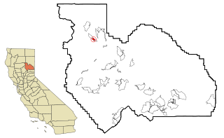
Di Giorgio is an unincorporated community and census designated place (CDP) in Kern County, California. It is located 6.5 miles (10 km) south of Edison, at an elevation of 495 feet (151 m).
Bonadelle Ranchos is an unincorporated community and census-designated place (CDP) in Madera County, California, United States. It lies at an elevation of 338 feet (103 m). As of the 2020 census, it had a population of 5,497. Prior to 2020, the community was part of the Bonadelle Ranchos-Madera Ranchos CDP.

Foresta is an unincorporated community and a census-designated place (CDP) in Mariposa County, California, within Yosemite National Park.
Centerville is an unincorporated community and census-designated place (CDP) in Shasta County, California, United States. Centerville is 6.5 miles (10.5 km) southwest of Redding.
Sugarloaf Mountain Park is a former census-designated place (CDP) in Tulare County, California. Sugarloaf Mountain Park sits at an elevation of 5,991 feet (1,826 m). The CDP was first listed in the 2010 U.S. Census although with zero population. The CDP was deleted prior to the 2020 U.S. Census.
Amador Pines is an unincorporated community and census-designated place (CDP) in Amador County, California, United States. It is located along California State Route 88, bordered to the south by Buckhorn and to the west by Lockwood. The Census Bureau first designated it as a CDP prior to the 2020 census for statistical purposes.
Cedar Flat is a census-designated place (CDP) in eastern Placer County, California, United States. It is located on the northwest shore of Lake Tahoe, between Carnelian Bay to the northeast and Dollar Point to the southwest. It was first listed as a CDP prior to the 2020 census.
Eastern Goleta Valley is an unincorporated community and census-designated place (CDP) in Santa Barbara County, California, United States. It is located between Goleta to the west, Santa Barbara to the east, the Pacific Ocean to the south, and the Santa Ynez Mountains to the north and includes the communities of Noleta and Hope Ranch. For statistical purposes, the United States Census Bureau designated the area as a census-designated place (CDP) prior to the 2020 census. Prior to the incorporation of Goleta in 2002 within a narrower set of boundaries, the area was included in the Goleta CDP.
El Monte Mobile Village is an unincorporated community and census-designated place (CDP) comprising three census blocks in Tulare County, California, United States. It is on the north side of Avenue 416, 0.4 miles (0.64 km) west of the Dinuba city limits. The village was first listed as a CDP prior to the 2020 census.
East Niles is an unincorporated community and census-designated place (CDP) in Kern County, California. The CDP is within the Bakersfield's census county division, and borders the city of Bakersfield to the north and the southwest, Bakersfield Country Club to the northwest, Hillcrest and Potomac Park to the west, and Fairfax to the south.
Cottonwood is an unincorporated community and census-designated place (CDP) in Kern County, California. The CDP is within the Bakersfield's census county division, and borders the city of Bakersfield on every side except the west, where it abuts Casa Loma.
Fairfax is an Unincorporated community and census-designated place (CDP) in Kern County, California. The CDP is within the Bakersfield's census county division, and borders the city of Bakersfield to the west and East Niles, California to the north.
Stebbins is an unincorporated community and census designated place (CDP) in Kern County, California, United States. Per the 2020 census, the population was 1,423.


