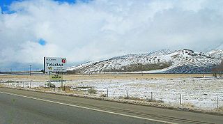
Tehachapi is a city in Kern County, California, in the Tehachapi Mountains, at an elevation of 3,970 feet (1,210 m) between the San Joaquin Valley and the Mojave Desert.

The Tehachapi Mountains are a mountain range in the Transverse Ranges system of California in the Western United States. The range extends for approximately 40 miles (64 km) in southern Kern County and northwestern Los Angeles County.

The Tehachapi Loop is a 0.73 miles (1.17 km) long spiral, or helix, on the Union Pacific Railroad Mojave Subdivision through Tehachapi Pass, of the Tehachapi Mountains in Kern County, south-central California. The line connects Bakersfield and the San Joaquin Valley to Mojave in the Mojave Desert.

Tehachapi Pass is a mountain pass crossing the Tehachapi Mountains in Kern County, California in the United States. Traditionally, the pass marks the northeast end of the Tehachapis and the south end of the Sierra Nevada range.

Caliente is an unincorporated community in Kern County, California. It is located 22 miles (35 km) east-southeast of Bakersfield, at an elevation of 1,312 feet (400 m).

The Tehachapi Pass wind farm is one of the first large-scale wind farms installed in the U.S., with around 700 MW capacity.

Cable is an unincorporated community in Kern County, California. It is located on the railroad 3 miles (4.8 km) north-northwest of Tehachapi, at an elevation of 3,570 feet (1,088.1 m)3570 feet.
Cameron is an unincorporated community in the Tehachapi Mountains, in Kern County, California. It is located on the Union Pacific Railroad 9 miles (14 km) east-southeast of Tehachapi, at an elevation of 3,802 feet (1,159 m).
Eric is a settlement in Kern County, California with a population of 14, as of the 2012 census. It is located on the railroad 7 miles (11 km) east of Tehachapi, at an elevation of 3924 feet.
Loraine is an unincorporated community in Kern County, California. It is located on the east bank of the mouth of Indian Creek where it enters Caliente Creek, 12 miles (19.3 km) north of Tehachapi, at an elevation of 2,671 feet (814 m).

Monolith is an unincorporated community in the Tehachapi Valley, in Kern County, California.
Sand Canyon is an unincorporated community in Kern County, California. It is located on Cache Creek 7 miles (11 km) east of Tehachapi, at an elevation of 4,500 feet (1,400 m).
Sullivan is a former settlement in Kern County, California. It was located on the Southern Pacific Railroad 2.5 miles (4 km) east of Tehachapi, at an elevation of 4029 feet.
Summit is an unincorporated community in Kern County, California.
Walong is an unincorporated community in Kern County, California. It is located on the railroad 2.25 miles (3.6 km) southeast of Keene, at an elevation of 3,058 feet (932 m).
Nadeau is a former settlement in the Tehachapi Mountains, in Kern County, California.
Tehichipa is a former settlement in Kern County, California. It was located on the railroad near Oak Creek Pass and Old Town.
Girard is a former settlement in Kern County, California. It was located on the railroad halfway between Tehachapi and Keene.
Water Station is a former settlement in Kern County, California.


