
San Pablo is a city in Contra Costa County, California, United States. The city of Richmond surrounds nearly the whole city. The population was 29,139 at the 2010 census. The current Mayor is Arturo Cruz. Currently, the City Council consists of Rich Kinney, Elizabeth Pabon-Alvarado, Rita Xavier and Abel Pineda. Pabon-Alvarado is the Vice Mayor, and Kinney, Xavier, and Pineda are Council Members. Patricia Ponce is the city Clerk. Viviana Toledo is the city Treasurer.

Rita Moreno is a Puerto Rican actress, dancer, and singer. Her career has spanned over 70 years; among her notable acting work are supporting roles in the musical films Singin' in the Rain (1952), The King and I (1956) and West Side Story (1961), as well as a 1971 to 1977 stint on the children's television series The Electric Company, and a supporting role as Sister Peter Marie Reimondo on the HBO series Oz from 1997 to 2003. Her other notable films include Popi (1969), Carnal Knowledge (1971), The Four Seasons (1981), I Like It Like That (1994) and the cult film Slums of Beverly Hills (1998). She voiced the titular role of Carmen Sandiego in Where on Earth Is Carmen Sandiego? from 1994 to 1999. For theater, she is best known for her role as Googie Gomez in The Ritz.
Coloma is a census-designated place in El Dorado County, California, US. It is approximately 36 miles (58 km) northeast of Sacramento, California. Coloma is most noted for being the site where James W. Marshall found gold in the Sierra Nevada foothills, at Sutter's Mill on January 24, 1848, leading to the California Gold Rush. Coloma's population is 529.

The Santa Ynez Valley is located in Santa Barbara County, California, between the Santa Ynez Mountains to the south and the San Rafael Mountains to the north. The Santa Ynez River flows through the valley from east to west. The Santa Ynez Valley is separated from the Los Alamos Valley, to the northwest, by the Purisima Hills, and from the Santa Maria Valley by the Solomon Hills. The Santa Rita Hills separate the Santa Ynez Valley from the Santa Rita and Lompoc Valleys to the west.

El Dorado, not to be confused with the nearby El Dorado Hills, is an unincorporated community in El Dorado County, California. It is located 4 miles (6.4 km) southwest of Placerville, at an elevation of 1608 feet. The population was 4,096 at the 2000 census. The town is registered as California Historical Landmark #486. The ZIP code is 95623. The community is inside area code 530.

Buckeye is an unincorporated community in El Dorado County, California. It is located 2.5 miles (4.0 km) east-northeast of Georgetown, at an elevation of 2949 feet.
Canyon is a former gold mining town in El Dorado County, California. It was located 5 miles (8.0 km) southeast of Shingle Springs on Big Canyon Creek.
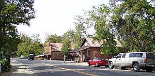
Gold Hill is an unincorporated community in El Dorado County, California. It is located 2.5 miles (4.0 km) south of Coloma, at an elevation of 1621 feet.
Greenwood is an unincorporated community in El Dorado County, California. It is located 4 miles (6.4 km) west of Georgetown, at an elevation of 1608 feet.
Spring Valley is an unincorporated community in El Dorado County, California. It is located 3 miles (4.8 km) east-northeast of Pollock Pines, at an elevation of 3779 feet.

El Prado is a former settlement in Fresno County, California. It was located at the junction of the San Joaquin and Eastern and the Southern Pacific Railroads 6 miles (9.7 km) north-northwest of Clovis, at an elevation of 377 feet. It still appeared on maps as of 1922.
Sageland is an unincorporated community in Kern County, California. It is located near Kelso Creek 3.5 miles (5.6 km) west-northwest at the base of the Piute Mountains, at an elevation of 4,026 feet (1,227 m).
El Roble is an unincorporated community in Mendocino County, California. It is located on the Northwestern Pacific Railroad 4.5 miles (7.2 km) south-southeast of Ukiah, at an elevation of 564 feet.
Santa Rita Park is an unincorporated community in Merced County, California. It is located 2.25 miles (4 km) east of Dos Palos Y, at an elevation of 118 feet.
Santa Rita is a neighborhood of Salinas in Monterey County, California. It is located north of downtown, at an elevation of 79 feet (24 m).
Santa Rita is a former settlement in Santa Barbara County, California. It was located in the Santa Rita Valley 7.5 miles (12 km) east of Lompoc.
Rancho El Alisal was a 8,912-acre (36.07 km2) Mexican land grant in present-day Monterey County, California, given in 1833 by Governor José Figueroa to the brothers Feliciano and Mariano Soberanes and to William Edward Petty Hartnell. Alisal means Alder tree (sycamore) in Spanish. The land is approximately four miles southeast of present-day Salinas.
Marsh Mill is an unincorporated community in Nevada County, California. It lies at an elevation of 5843 feet. Marsh Mill is located 2 miles (3.2 km) east of Graniteville.
Chuck and Jean Poe brought their cattle there every year for about 50 years. They kept the meadow open and the fire ring they built in the 40's is visible by satellite.
Cantua Creek, formerly in Spanish Arroyo de Cantúa, was named for José de Guadalupe Cantúa, a prominent Californio Ranchero in the 19th-century Mexican era of Alta California.

Rita Cetina Gutiérrez was a Mexican teacher, poet and feminist who promoted secular education in the nineteenth century in Mérida, Yucatán. She was one of the first feminists and influenced the generation of young women who fueled the first wave of feminism in Mexico.


