Coffee Creek, California

Last updated
Coffee Creek
Trinity County California Incorporated and Unincorporated areas Coffee Creek Highlighted 0614406.svg
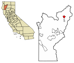
Location of Coffee Creek in Trinity County, California.
USA California location map.svg
Red pog.svg
Coffee Creek
Location in California
Coordinates: 41°5′1″N122°42′48″W / 41.08361°N 122.71333°W / 41.08361; -122.71333 Coordinates: 41°5′1″N122°42′48″W / 41.08361°N 122.71333°W / 41.08361; -122.71333
Country Flag of the United States.svg  United States
State Flag of California.svg  California
County Trinity County
Area
[1]
  Total11.54 sq mi (29.88 km2)
  Land11.52 sq mi (29.83 km2)
  Water0.02 sq mi (0.05 km2)  0.16%
Elevation
[2]
3,068 ft (935 m)
Population
 (2020)
  Total152
  Density13.20/sq mi (5.09/km2)
Time zone UTC-8 (Pacific (PST))
  Summer (DST) UTC-7 (PDT)
ZIP Code
96091
Area code(s) 530
FIPS code 06-14406
U.S. Geological Survey Geographic Names Information System: Coffee Creek, California

Coffee Creek is a census-designated place located within Trinity County in the U.S. state of California. [2] It is located just north of where Coffee Creek flows into the Trinity River along Highway 3 and is the most northern community in Trinity County. It contains the Coffee Creek elementary school. Coffee Creek Road originates at Highway 3 offering access to the interior of the Trinity Alps; the road is 20 miles long, dirt and only for high clearance vehicles. Coffee Creek sits at an elevation of 2,495 feet (760 m). [2] Its population is 152 as of the 2020 census, down from 217 from the 2010 census.

Contents

Geography

According to the United States Census Bureau, the CDP covers an area of 11.5 square miles (29.9 km2), 99.84% of it land and 0.16% of it water.

Demographics

Historical population
CensusPop.
2020 152
U.S. Decennial Census [3]

The 2010 United States Census [4] reported that Coffee Creek had a population of 217. The population density was 18.8 people per square mile (7.3/km2). The racial makeup of Coffee Creek was 198 (91.2%) White, 0 (0.0%) African American, 5 (2.3%) Native American, 5 (2.3%) Asian, 0 (0.0%) Pacific Islander, 3 (1.4%) from other races, and 6 (2.8%) from two or more races. Hispanic or Latino of any race were 16 persons (7.4%).

The Census reported that 186 people (85.7% of the population) lived in households, 31 (14.3%) lived in non-institutionalized group quarters, and 0 (0%) were institutionalized.

There were 85 households, out of which 16 (18.8%) had children under the age of 18 living in them, 48 (56.5%) were opposite-sex married couples living together, 3 (3.5%) had a female householder with no husband present, 4 (4.7%) had a male householder with no wife present. There were 3 (3.5%) unmarried opposite-sex partnerships, and 0 (0%) same-sex married couples or partnerships. 27 households (31.8%) were made up of individuals, and 14 (16.5%) had someone living alone who was 65 years of age or older. The average household size was 2.19. There were 55 families (64.7% of all households); the average family size was 2.75.

The population was spread out, with 32 people (14.7%) under the age of 18, 10 people (4.6%) aged 18 to 24, 37 people (17.1%) aged 25 to 44, 84 people (38.7%) aged 45 to 64, and 54 people (24.9%) who were 65 years of age or older. The median age was 50.2 years. For every 100 females, there were 102.8 males. For every 100 females age 18 and over, there were 117.6 males.

There were 152 housing units at an average density of 13.2 per square mile (5.1/km2), of which 67 (78.8%) were owner-occupied, and 18 (21.2%) were occupied by renters. The homeowner vacancy rate was 1.5%; the rental vacancy rate was 10.0%. 151 people (69.6% of the population) lived in owner-occupied housing units and 35 people (16.1%) lived in rental housing units.

Politics

In the state legislature, Coffee Creek is in the 2nd Senate District , represented by Democrat Mike McGuire, [5] and the 2nd Assembly District , represented by Democrat Jim Wood. [6]

Federally, Coffee Creek is in California's 2nd congressional district , represented by Democrat Jared Huffman. [7]

See also

Related Research Articles

Bertsch–Oceanview, California Census-designated place in California, United States

Bertsch–Oceanview is a census-designated place (CDP) in Del Norte County, California, United States. The community is located east of Crescent City, at an elevation of 20 feet (6.1 m), Bertsch–Oceanview has a total area of 5.9 square miles (15 km2) of which 5.5 square miles (14 km2) is land and 0.3 square miles (0.78 km2) is water. Its population is 2,520 as of the 2020 census, up from 2,436 from the 2010 census. The Elk Valley Rancheria Indian reservation is located within Bertsch–Oceanview.

Bayview, Humboldt County, California Census-designated place in California, United States

Bayview is a census-designated place (CDP) located adjacent to the City of Eureka in Humboldt County, California, United States. Its population is 2,619 as of the 2020 census, up from 2,510 from the 2010 census. Many locals consider this area as part of "Pine Hill."

Cutten, California Census-designated place in California, United States

Cutten, a census-designated place (CDP) in Humboldt County, California, United States, is an unincorporated community, which is part of Greater Eureka. The city was named for David Page Cutten and his family, who were prominent figures in the history of Humboldt County during the early 1850s. Cutten is located 2.5 miles (4 km) south-southeast of downtown Eureka, at an elevation of 200 feet. Its population is 3,223 as of the 2020 census, up from 3,108 from the 2010 census.

Myrtletown, California Census designated place in California, United States

Myrtletown is a census-designated place (CDP) in Humboldt County, California, United States. Myrtletown lies at an elevation of 112 feet. Myrtletown is a part of the Eureka, California metropolitan area. The population was 4,675 at the 2010 census, up from 4,459 at the 2000 census.

Willow Creek, California Census-designated place in California, United States

Willow Creek is a census-designated place (CDP) in Humboldt County, California, United States. The population was 1,710 at the 2010 census, down from 1,743 at the 2000 census. Residents of this small mountain town are commonly referred to as "Willow Creekers." The town is located around 30 miles (48 km) as the crow flies inland from county seat and harbor city Eureka, with the two places vastly differing in climate.

Dixon Lane-Meadow Creek, California Census-designated place in California, United States

Dixon Lane-Meadow Creek is a census-designated place (CDP) in Inyo County, California, United States. The population was 2,645 at the 2010 census, down from 2,702 at the 2000 census.

Citrus, California Census-designated place in California, United States

Citrus is a census-designated place (CDP) in Los Angeles County, California, United States. It is located in the San Gabriel Valley between Azusa to the north and west, Glendora to the east, and Covina to the south. Generally, this is referred to by locals as "unincorporated Covina" or "unincorporated Azusa". The population was 10,866 at the 2010 census, up from 10,581 at the 2000 census. Citrus is named after Citrus Avenue, which passes through the community.

Mayflower Village, California Census-designated place in California, United States

Mayflower Village is a census-designated place (CDP) in the San Gabriel Valley, in Los Angeles County, California, United States. The population was 5,515 at the 2010 census, up from 5,081 at the 2000 census. The ZIP Codes serving the community are 91006, which is served by Arcadia and 91016, which is served by Monrovia.

Laytonville, California Census-designated place in California, United States

Laytonville is a census-designated place (CDP) in Mendocino County, California, United States. Laytonville is located 20 miles (32 km) north-northwest of Willits, at an elevation of 1,670 feet (510 m). The population was 1,227 at the 2010 census, down from 1,301 at the 2000 census.

Goshen, California Census-designated place in California, United States

Goshen is a census-designated place (CDP) near Visalia, in Tulare County, California, United States. The population was 3,006 at the 2010 census, up from 2,394 at the 2000 census. Until the twentieth century, Goshen was an island in a marsh at the edge of Tulare Lake, formerly the largest freshwater lake west of the Great Lakes until drained.

Hyampom, California Census-designated place in California, United States

Hyampom is a census-designated place (CDP) in Trinity County, California.

Trinity Center, California Census-designated place in California, United States

Trinity Center is a census-designated place (CDP) in Trinity County, California. Trinity Center is located 29 miles (47 km) north of Weaverville. It is home to Trinity Lake, a popular summer tourist destination. It is home to a store, Trinity Center Airport, a marina, a community church, several campgrounds, and several small resorts.

Burnt Ranch, California Census-designated place in California, United States

Burnt Ranch is a census-designated place (CDP) in Trinity County, California. It has a school and a post office. Its ZIP Code is 95527, and it is in area code 530. Its elevation is 1,502 feet (458 m). Its population is 250 as of the 2020 census, down from 281 from the 2010 census.

Junction City, California Census-designated place in California, United States

Junction City is a census-designated place (CDP) in Trinity County, California. Junction City sits at an elevation of 1,909 feet (582 m). Its population is 658 as of the 2020 census, down from 680 from the 2010 census. Junction City is located 8 miles (13 km) west of Weaverville. The Trinity River (California) runs through the town and heads northwest from there. The ZIP Code is 96048. The community is inside area code 530.

Mad River, California Census-designated place in California, United States

Mad River is a census-designated place (CDP) in Trinity County, California. Mad River is located in the southern part of the county. Mad River sits at an elevation of 2,484 feet (757 m). The ZIP Code is 95552. Its population is 361 as of the 2020 census, down from 420 from the 2010 census.

Comptche, California Census-designated place in California, United States

Comptche is a rural village, in Mendocino County, California, United States. It is located within a census-designated place of the same name, 17 miles (27 km) southeast of Fort Bragg, at an elevation of 187 feet. There is a K–3 primary school serving the town, as well as a small store with gas pump; a post office, and a church. The population of the entire census designated place was 159 at the 2010 census; the population of the town itself was not recorded in the census.

Ruth, California Census-designated place in California, United States

Ruth is a census-designated place (CDP) in Trinity County, California. Ruth is located in the southern portion of the county. The community - and adjacent Ruth Lake - was named after Ruth McKnight, daughter of settlers. The ZIP code is 95526. The community is inside area code 707. It is located near the headwaters of the Mad River (California) and adjacent to the Yolla Bolly-Middle Eel Wilderness. Ruth sits at an elevation of 2,933 feet (894 m). Its population is 254 as of the 2020 census, up from 195 from the 2010 census.

Anchor Bay, California Census-designated place in California, United States

Anchor Bay is a census-designated place in Mendocino County, California. It is located 3.5 miles (5.6 km) northwest of Gualala, at an elevation of 105 feet. The population was 473 at the 2020 census.

Coronita, California Census-designated place in California, United States

Coronita is a census-designated place in Riverside County, California. Coronita sits at an elevation of 630 feet (190 m). The 2010 United States census reported Coronita's population was 2,608.

Trinity Village, California Census-designated place in California, United States

Trinity Village is a census-designated place (CDP) in Trinity County, California. Trinity Village sits at an elevation of 1,289 feet (393 m). Its population is 278 as of the 2020 census, down from 297 from the 2010 census.

References

  1. "2020 U.S. Gazetteer Files". United States Census Bureau. Retrieved October 30, 2021.
  2. 1 2 3 U.S. Geological Survey Geographic Names Information System: Coffee Creek, California
  3. "Census of Population and Housing". Census.gov. Retrieved June 4, 2016.
  4. "2010 Census Interactive Population Search: CA - Coffee Creek CDP". U.S. Census Bureau. Archived from the original on July 15, 2014. Retrieved July 12, 2014.
  5. "Senators". State of California. Retrieved March 10, 2013.
  6. "Members Assembly". State of California. Retrieved March 2, 2013.
  7. "California's 2nd Congressional District - Representatives & District Map". Civic Impulse, LLC. Retrieved March 1, 2013.