Camanche North Shore, California

Last updated

Camanche North Shore
Amador County California Incorporated and Unincorporated areas Camanche North Shore Highlighted 0610042.svg
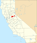
Location of Camanche North Shore in Amador County, California.
USA California location map.svg
Red pog.svg
Camanche North Shore
Position in California.
Coordinates: 38°14′40″N120°57′14″W / 38.24444°N 120.95389°W / 38.24444; -120.95389
Country Flag of the United States.svg  United States
State Flag of California.svg  California
County Amador
Area
[1]
  Total2.33 sq mi (6.04 km2)
  Land2.33 sq mi (6.04 km2)
  Water0.00 sq mi (0.00 km2)  0%
Elevation
[2]
308 ft (94 m)
Population
 (2020)
  Total1,070
  Density458.83/sq mi (177.18/km2)
Time zone UTC-8 (Pacific (PST))
  Summer (DST) UTC-7 (PDT)
GNIS feature ID 2582959
[3]

Camanche North Shore is a census-designated place in Amador County, California. Camanche North Shore sits at an elevation of 308 feet (94 m). The 2010 United States census reported Camanche North Shore's population was 979.

Demographics

Historical population
CensusPop.Note
2020 1,070
U.S. Decennial Census [4]

The 2010 United States Census [5] reported that Camanche North Shore had a population of 979. The population density was 424.5 inhabitants per square mile (163.9/km2). The racial makeup of Camanche North Shore was 860 (87.8%) White, 3 (0.3%) African American, 14 (1.4%) Native American, 12 (1.2%) Asian, 3 (0.3%) Pacific Islander, 38 (3.9%) from other races, and 49 (5.0%) from two or more races. Hispanic or Latino of any race were 150 persons (15.3%).

The Census reported that 979 people (100% of the population) lived in households, 0 (0%) lived in non-institutionalized group quarters, and 0 (0%) were institutionalized.

There were 391 households, out of which 125 (32.0%) had children under the age of 18 living in them, 217 (55.5%) were opposite-sex married couples living together, 39 (10.0%) had a female householder with no husband present, 21 (5.4%) had a male householder with no wife present. There were 31 (7.9%) unmarried opposite-sex partnerships, and 3 (0.8%) same-sex married couples or partnerships. 87 households (22.3%) were made up of individuals, and 30 (7.7%) had someone living alone who was 65 years of age or older. The average household size was 2.50. There were 277 families (70.8% of all households); the average family size was 2.86.

The population was spread out, with 230 people (23.5%) under the age of 18, 67 people (6.8%) aged 18 to 24, 204 people (20.8%) aged 25 to 44, 344 people (35.1%) aged 45 to 64, and 134 people (13.7%) who were 65 years of age or older. The median age was 44.1 years. For every 100 females, there were 105.7 males. For every 100 females age 18 and over, there were 107.5 males.

There were 480 housing units at an average density of 208.1 per square mile (80.3/km2), of which 391 were occupied, of which 305 (78.0%) were owner-occupied, and 86 (22.0%) were occupied by renters. The homeowner vacancy rate was 4.4%; the rental vacancy rate was 9.5%. 736 people (75.2% of the population) lived in owner-occupied housing units and 243 people (24.8%) lived in rental housing units.

Related Research Articles

<span class="mw-page-title-main">East Shore, California</span> Census-designated place in California, United States

East Shore is a census-designated place (CDP) in Plumas County, California, United States. The population was 156 at the 2010 census, down from 177 at the 2000 census.

<span class="mw-page-title-main">Hamilton Branch, California</span> Census-designated place in California, United States

Hamilton Branch is a census-designated place (CDP) in Plumas County, California, United States. The population was 587 at the 2000 census.

<span class="mw-page-title-main">El Granada, California</span> Census-designated place in California, United States

El Granada is a village and census-designated place (CDP) in the coastal area of northern San Mateo County, California, United States. The population was 5,481 at the 2020 census. The village is named for the city of Granada, Spain.

<span class="mw-page-title-main">Carnelian Bay, California</span> Census-designated place in California, United States

Carnelian Bay is an unincorporated community on the shore of Lake Tahoe in Placer County, California, United States. The Cornelian Bay post office operated from 1883 to 1887 and from 1891 to 1893. The Carnelian Bay post office opened in 1908.

<span class="mw-page-title-main">North Shore, California</span> Census-designated place in California, United States

North Shore is a census-designated place in southeastern Riverside County, so named because of its location along the northeast shore of the Salton Sea. It was once a popular vacation destination spot before ever-increasing salinity and pollution of the Salton Sea shut the tourist trade down. The population was 3,585 at the 2020 census, up from 3,477 at the 2010 census.

Grimes is a census-designated place in Colusa County, California on the Southern Pacific Railroad. It lies at an elevation of 46 feet. The two main roads that run through it are State Route 45 and Grimes-Arbuckle Road. Its ZIP code is 95950, and its area code is 530. Grimes's population was 391 at the 2020 census.

<span class="mw-page-title-main">Camanche Village, California</span> Census-designated place in California, United States

Rolling Hills is an unincorporated community and census-designated place (CDP) in Madera County, California, United States, north of Fresno on State Route 41. It lies at an elevation of 371 feet (113 m). The population was 793 at the 2020 census.

<span class="mw-page-title-main">Lindcove, California</span> Census-designated place in California, United States

Lindcove is a census-designated place in Tulare County, California, United States. The population was 406 at the 2010 census.

<span class="mw-page-title-main">Kelly Ridge, California</span> Census-designated place in California, United States

Kelly Ridge is a census-designated place in Butte County, northern California.

North Gate is a census-designated place in Contra Costa County, California. North Gate sits at an elevation of 253 feet (77 m). The 2010 United States census reported North Gate's population was 679.

El Sobrante is a census-designated place in Riverside County, California. El Sobrante sits at an elevation of 1,283 feet (391 m). The 2010 United States census reported El Sobrante's population was 12,723.

South Monrovia Island is a census-designated place in Los Angeles County, California. It sits at an elevation of 384 feet (117 m). It is bounded to the west and north by Monrovia, to the east by Duarte, and to the south by Irwindale. The 2010 United States census reported that South Monrovia Island's population was 6,777.

<span class="mw-page-title-main">Lake Don Pedro, California</span> Census-designated place in California, United States

Lake Don Pedro is a census-designated place (CDP) in Mariposa County, California. The community sits at an elevation of 1,122 feet (342 m). As of the 2020 United States census, the population was 1,765.

<span class="mw-page-title-main">Indio Hills, California</span> Census-designated place in California, United States

Indio Hills is a census-designated place in Riverside County, California. Indio Hills sits at an elevation of 1,017 feet (310 m). The 2010 United States census reported Indio Hills's population was 972.

<span class="mw-page-title-main">Lake Mathews, California</span> Census-designated place in California, United States

Lake Mathews is a census-designated place in Riverside County, California. Lake Mathews sits at an elevation of 1,775 feet (541 m). The 2010 United States census reported Lake Mathews's population was 5,890.

Oak Shores is a census-designated place in northern San Luis Obispo County, central California.

Pierpoint is a census-designated place (CDP) in Tulare County, California, United States. Pierpoint sits at an elevation of 4,610 feet (1,410 m). The 2010 United States census reported Pierpoint's population was 52.

Tonyville is a census-designated place (CDP) in Tulare County, California. Tonyville sits at an elevation of 361 feet (110 m). The 2010 United States census reported Tonyville's population was 316.

Idlewild is a census-designated place (CDP) in Tulare County, California. Idlewild sits at an elevation of 3,766 feet (1,148 m). The 2020 United States census reported Idlewild's population was 32, down from 43 at the 2010 census.

References

  1. "2020 U.S. Gazetteer Files". United States Census Bureau. Retrieved October 30, 2021.
  2. U.S. Geological Survey Geographic Names Information System: Camanche North Shore, California
  3. "Camanche North Shore Census Designated Place". Geographic Names Information System . United States Geological Survey, United States Department of the Interior.
  4. "Census of Population and Housing". Census.gov. Retrieved June 4, 2016.
  5. "2010 Census Interactive Population Search: CA - Camanche North Shore CDP". U.S. Census Bureau. Archived from the original on July 15, 2014. Retrieved July 12, 2014.