Plymouth, California

Last updated
Plymouth
Plymouth, CA Main Street.jpg
Main Street in Plymouth
Nickname: 
Gateway to Shenandoah Valley
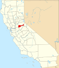
Amador County California Incorporated and Unincorporated areas Plymouth Highlighted 0657834.svg
USA California location map.svg
Red pog.svg
Plymouth
Location in California
Usa edcp location map.svg
Red pog.svg
Plymouth
Plymouth (the United States)
Coordinates: 38°28′55″N120°50′41″W / 38.48194°N 120.84472°W / 38.48194; -120.84472
Country Flag of the United States.svg  United States
State Flag of California.svg  California
County Amador
Settled1853
Incorporated February 8, 1917 [1]
Government
   Mayor Marianne Akerland
  Vice MayorDouglas Sim
  City ManagerMargaret Roberts
   State Senate
State Assembly
Angelique Ashby (D) [2]
Joe Patterson (R) [3]
   U. S. Congress Mike Thompson (D) [4]
Area
[5]
  Total2.60 sq mi (6.74 km2)
  Land2.59 sq mi (6.71 km2)
  Water0.01 sq mi (0.03 km2)  1.34%
Elevation
[6]
1,083 ft (330 m)
Population
 (2010)
  Total1,005
  Estimate 
(2019) [7]
1,076
  Density415.28/sq mi (160.31/km2)
Time zone UTC-8 (PST)
  Summer (DST) UTC-7 (PDT)
ZIP code
95669
Area code 209
FIPS code 06-57834
GNIS feature IDs 277579, 2411446
Website www.cityofplymouth.org

Plymouth (formerly, Puckerville, Pokerville, and Poker Camp) [8] is a city in Amador County, California, United States. The population was 1,005 at the 2010 census. [9] The town was originally named Pokerville, when it was settled during the time of the gold rush. Plymouth is commonly now known as a "Gateway to Shenandoah Valley", a popular wine-producing region in the Sierra foothills. The Ione Band of Miwok Indians, a federally recognized tribe of Miwok people, is headquartered in Plymouth. [10]

Contents

Geography

Plymouth is located at 38°28′55″N120°50′41″W / 38.48194°N 120.84472°W / 38.48194; -120.84472 [11]

According to the United States Census Bureau, the city has a total area of 0.9 square miles (2.3 square kilometers), of which 98.66 percent is land and 1.34 percent is water.

History

A post office was opened in 1871. [8] The city incorporated in 1917. [8]

Climate

According to the Köppen Climate Classification system, Plymouth has a warm-summer Mediterranean climate, abbreviated "Csa" on climate maps. [12]

Demographics

Historical population
CensusPop.Note
1880 740
1890 7683.8%
1920 657
1930 343−47.8%
1940 46034.1%
1950 382−17.0%
1960 48928.0%
1970 5012.5%
1980 69939.5%
1990 81116.0%
2000 98020.8%
2010 1,0052.6%
2019 (est.)1,076 [7] 7.1%
U.S. Decennial Census [13]

2010

At the 2010 census Plymouth had a population of 1,005. The population density was 1,065.2 inhabitants per square mile (411.3/km2). The racial makeup of Plymouth was 850 (84.6%) White, three (0.3%) African American, 18 (1.8%) Native American, six (0.6%) Asian, two (0.2%) Pacific Islander, 70 (7.0%) from other races, and 56 (5.6%) from two or more races. Hispanic or Latino of any race were 183 people (18.2%). [14]

The census reported that 996 people (99.1% of the population) lived in households, nine (0.9%) lived in non-institutionalized group quarters, and no one was institutionalized.

There were 403 households, 130 (32.3%) had children under the age of 18 living in them, 185 (45.9%) were opposite-sex married couples living together, 41 (10.2%) had a female householder with no husband present, 23 (5.7%) had a male householder with no wife present. There were 28 (6.9%) unmarried opposite-sex partnerships, and two (0.5%) same-sex married couples or partnerships. 119 households (29.5%) were one person and 56 (13.9%) had someone living alone who was 65 or older. The average household size was 2.47. There were 249 families (61.8% of households); the average family size was 3.14.

The age distribution was 238 people (23.7%) under the age of 18, 75 people (7.5%) aged 18 to 24, 247 people (24.6%) aged 25 to 44, 290 people (28.9%) aged 45 to 64, and 155 people (15.4%) who were 65 or older. The median age was 40.1 years. For every 100 females, there were 85.1 males. For every 100 females age 18 and over, there were 87.1 males.

There were 493 housing units at an average density of 522.5 per square mile (201.7/km2),of which 403 were occupied, 259 (64.3%) by the owners and 144 (35.7%) by renters. The homeowner vacancy rate was 4.0 percent; the rental vacancy rate was 12.0 percent. 634 people (63.1% of the population) lived in owner-occupied housing units and 362 people (36.0%) lived in rental housing units.

2000

At the 2000 census there were 980 people in 392 households, including 272 families, in the city. The population density was 1,060.6 inhabitants per square mile (409.5/km2). There were 457 housing units at an average density of 494.6 per square mile (191.0/km2). The racial makeup of the city was 90.51% White, 0.20% Black or African American, 2.24% Native American, 1.12% Asian, 1.43% from other races, and 4.49% from two or more races. 5.10% of the population were Hispanic or Latino of any race. [15] Of the 392 households 36.2% had children under the age of 18 living with them, 48.2% were married couples living together, 17.6% had a female householder with no husband present, and 30.6% were non-families. 25.8% of households were one person and 13.5% were one person aged 65 or older. The average household size was 2.50 and the average family size was 2.99.

The age distribution was 29.3% under the age of 18, 5.2% from 18 to 24, 26.2% from 25 to 44, 22.4% from 45 to 64, and 16.8% 65 or older. The median age was 39 years. For every 100 females, there were 84.2 males. For every 100 females age 18 and over, there were 78.1 males.

The median income for a household in the city was $37,262, and the median family income was $43,611. Males had a median income of $32,411 versus $23,875 for females. The per capita income for the city was $16,197. About 9.3% of families and 10.4% of the population were below the poverty line, including 14.5% of those under age 18 and 8.5% of those age 65 or over.

Related Research Articles

<span class="mw-page-title-main">Golden Hills, California</span> Census-designated place in California, United States

Golden Hills is a census-designated place (CDP) in the Tehachapi Mountains, in Kern County, California, United States. The population was 8,656 at the 2010 census, up from 7,434 at the 2000 census. Golden Hills adjoins the city of Tehachapi on the west.

<span class="mw-page-title-main">East San Gabriel, California</span> Census-designated place in California, United States

East San Gabriel is a census-designated place (CDP) in Los Angeles County, California, United States. The population was 14,874 at the 2010 census, up from 14,512 at the 2000 census.

<span class="mw-page-title-main">Parksdale, California</span> Census-designated place in California, United States

Parksdale is a census-designated place (CDP) in Madera County, California, United States. It is part of the Madera Metropolitan Statistical Area. The population was 3,234 at the 2020 census, up from 2,621 in 2010.

<span class="mw-page-title-main">Tomales, California</span> Census-designated place in California, United States

Tomales is a census-designated place (CDP) on State Route 1 in Marin County, California, United States. The population was 187 at the 2020 census.

<span class="mw-page-title-main">Seaside, California</span> City in California, United States

Seaside, formerly East Monterey, is a city in Monterey County, California, United States, with a population of 32,366 as of the 2020 census. It is located 2.25 miles (3.6 km) east-northeast of Monterey, at an elevation of 33 feet (10 m), and is the home of California State University, Monterey Bay (CSUMB), UC MBEST Center, and the Monterey College of Law, which are located on the site of the former military base Fort Ord. Also on the site are the Bayonet and Black Horse golf courses, now open to the public and host to PGA Tour events, including the 2012 PGA Professional National Championship. Seaside is the gateway to Fort Ord National Monument, created on April 20, 2012.

<span class="mw-page-title-main">La Palma, California</span> City in California, United States

La Palma is a city in Orange County, California, United States. The population was 15,568 at the 2010 Census, up from 15,408 at the 2000 census.

<span class="mw-page-title-main">North Auburn, California</span> Census-designated place in California, United States

North Auburn is a census-designated place (CDP) in Placer County, California, United States. It is part of the Sacramento–Arden-Arcade–Roseville Metropolitan Statistical Area. The population was 13,452 at the 2020 census.

<span class="mw-page-title-main">Tobin, California</span> Census-designated place in California, United States

Tobin is a census-designated place (CDP) in Plumas County, California, United States. The population was 12 at the 2010 census, up from 11 at the 2000 census.

<span class="mw-page-title-main">Big River, California</span> Census-designated place in California, United States

Big River is a census-designated place (CDP) in San Bernardino County, California, United States. The population was 1,327 at the 2010 census, up from 1,266 at the 2000 census.

<span class="mw-page-title-main">Mentone, California</span> Census-designated place in California, United States

Mentone is a census-designated place in San Bernardino County, California, United States. The population was 7,803 at the 2000 census and 8,720 at the 2010 census. It is located at 34°3′53″N117°7′13″W.

<span class="mw-page-title-main">La Presa, California</span> Census-designated place in California, United States

La Presa is a census-designated place (CDP) in the East County region of San Diego County, California, United States. The population was 34,169 at the 2010 census, up from 32,721 at the 2000 census.

<span class="mw-page-title-main">Temelec, California</span> Census-designated place in California, United States

Temelec is a census-designated place (CDP) in Sonoma County, California, United States. The population was 1,441 at the 2010 census.

<span class="mw-page-title-main">Mud Lake, Idaho</span> City in Idaho, United States

Mud Lake is a city in Jefferson County, Idaho, United States. It is part of the Idaho Falls, Idaho Metropolitan Statistical Area. The population was 358 at the 2010 census. Since then the population has grown to 419 as seen in the 2020 census as well as idaho demographics

<span class="mw-page-title-main">Plainfield, Iowa</span> City in Iowa, United States

Plainfield is a city in Bremer County, Iowa, United States. The population was 393 at the 2020 census, a decrease of 45, or 10.3%, from 438 in 2000. It is part of the Waterloo–Cedar Falls Metropolitan Statistical Area.

<span class="mw-page-title-main">Earlville, Iowa</span> City in Iowa, United States

Earlville is a city in Delaware County, Iowa, United States. The population was 716 at the time of the 2020 census.

<span class="mw-page-title-main">Plymouth, Nebraska</span> Village in Nebraska, United States

Plymouth is a village in Jefferson County, Nebraska, United States. The population was 363 at the 2020 census.

<span class="mw-page-title-main">Trenton, Ohio</span> City in Ohio, United States

Trenton is a city in northeastern Butler County, Ohio, United States, west of Middletown. The population was 13,021 at the 2020 census. It is part of the Cincinnati metropolitan area.

<span class="mw-page-title-main">Hoffman, Oklahoma</span> Town in Oklahoma, United States

Hoffman is a town in Okmulgee County, Oklahoma, United States. The population was 127 at the 2010 census, a decrease of 14.2 percent from the figure of 148 recorded in 2000.

<span class="mw-page-title-main">Elkview, West Virginia</span> Census-designated place in West Virginia, United States

Elkview is a census-designated place (CDP) in Kanawha County, West Virginia, United States. The population was 1,222 at the 2010 census. It is named after the Elk River, which flows into the Kanawha River.

<span class="mw-page-title-main">Plymouth, Juneau County, Wisconsin</span> Town in Wisconsin, United States

Plymouth is a town in Juneau County, Wisconsin, United States. The population was 639 at the 2000 census.

References

  1. "California Cities by Incorporation Date". California Association of Local Agency Formation Commissions. Archived from the original (Word) on November 3, 2014. Retrieved March 27, 2013.
  2. "Senators". State of California. Retrieved March 18, 2013.
  3. "Members Assembly". State of California. Retrieved March 18, 2013.
  4. "California's 4th Congressional District - Representatives & District Map". Civic Impulse, LLC. Retrieved March 1, 2013.
  5. "2019 U.S. Gazetteer Files". United States Census Bureau. Retrieved July 1, 2020.
  6. "Plymouth". Geographic Names Information System . United States Geological Survey, United States Department of the Interior . Retrieved 2007-05-24.
  7. 1 2 "Population and Housing Unit Estimates". United States Census Bureau. May 24, 2020. Retrieved May 27, 2020.
  8. 1 2 3 Durham, David L. (1998). California's Geographic Names: A Gazetteer of Historic and Modern Names of the State. Clovis, Calif.: Word Dancer Press. p. 540. ISBN   1-884995-14-4.
  9. "Geographic Identifiers: 2010 Demographic Profile Data (G001): Plymouth city, California". U.S. Census Bureau, American Factfinder. Archived from the original on February 12, 2020. Retrieved May 1, 2013.
  10. "Tribes: List by Area." National Congress of American Indians. Retrieved 30 May 2012.
  11. .U.S. Geological Survey Geographic Names Information System: Plymouth, California
  12. Climate Summary for Plymouth, California
  13. "Census of Population and Housing". Census.gov. Retrieved June 4, 2015.
  14. "2010 Census Interactive Population Search: CA - Plymouth city". U.S. Census Bureau. Archived from the original on July 15, 2014. Retrieved July 12, 2014.
  15. "U.S. Census website". United States Census Bureau . Retrieved 2008-01-31.