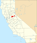
Butte City (Amador County) | |
|---|---|
 Butte Store, 2012 | |
| Coordinates: 38°19′33″N120°44′7″W / 38.32583°N 120.73528°W | |
| Country | United States |
| State | California |
| County | Amador County |
| Elevation | 1,036 ft (316 m) |
The Butte Store is the only structure [2] out of 100 [1] still standing of the original mining town of Butte City. It was built in 1857 by Enrico Bruni, an Italian stonemason, [1] [3] out of brick and fieldstone from Calaveras. It also has three doors made of iron. [3] Xavier Benoist used it as a store and bakery. [2] The building has also served as a post office and a general store called Ginocchio's. The Ginnochio family owned it for 50 years until its closure in the 1900s. [3] It is now a California Historical Landmark. [2]


