Amador Pines, California | |
|---|---|
 Amador Pines  Amador Pines | |
| Coordinates: 38°29′27″N120°31′55″W / 38.49083°N 120.53194°W | |
| Country | |
| State | |
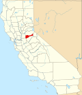
| County | Amador |
| Area | |
• Total | 4.85 sq mi (12.56 km2) |
| • Land | 4.85 sq mi (12.56 km2) |
| • Water | 0 sq mi (0.00 km2) 0% |
| Elevation | 3,668 ft (1,118 m) |
| Population (2020) | |
• Total | 1,118 |
| • Density | 230/sq mi (89/km2) |
| Time zone | UTC-8 (Pacific (PST)) |
| • Summer (DST) | UTC-7 (PDT) |
| ZIP Code | 95666 (Pioneer) |
| Area code | 209 |
| FIPS code | 06-01518 |
| GNIS feature ID | 2812655 [2] |
Amador Pines is an unincorporated community and census-designated place (CDP) in Amador County, California, United States. It is located along California State Route 88, bordered to the south by Buckhorn and to the west by Lockwood. The Census Bureau first designated it as a CDP prior to the 2020 census for statistical purposes.