Phoenix Lake-Cedar Ridge, California

Last updated
Phoenix Lake-Cedar Ridge
Tuolumne County California Incorporated and Unincorporated areas Phoenix Lake-Cedar Ridge Highlighted.svg
Location in Tuolumne County and the state of California
Coordinates: 38°1′10″N120°17′52″W / 38.01944°N 120.29778°W / 38.01944; -120.29778 Coordinates: 38°1′10″N120°17′52″W / 38.01944°N 120.29778°W / 38.01944; -120.29778
Country Flag of the United States.svg  United States
State Flag of California.svg  California
County Tuolumne
Area
  Total65.8 km2 (25.3 sq mi)
  Land65.4 km2 (25.2 sq mi)
  Water0.4 km2 (0.1 sq mi)
Population
 (2000)
  Total5'108
  Density77.9/km2 (202.5/sq mi)
Time zone UTC-8 (Pacific (PST))
  Summer (DST) UTC-7 (PDT)
ZIP code
95370
Area code(s) 209
FIPS code 06-56871

Phoenix Lake-Cedar Ridge is an unincorporated community and a former census-designated place (CDP) in Tuolumne County, California, United States. The population was 5,108 at the 2000 census.

Contents

It was abolished prior to the 2010 census, and Phoenix Lake and Cedar Ridge became CDPs.

Geography

Phoenix Lake-Cedar Ridge is located at 38°1′10″N120°17′52″W / 38.01944°N 120.29778°W / 38.01944; -120.29778 (38.019488, -120.297883). [1]

According to the United States Census Bureau, the CDP had a total area of 25.4 square miles (66 km2), of which, 25.2 square miles (65 km2) of it was land and 0.1 square miles (0.26 km2) of it (0.55%) was water.

Demographics

As of the census [2] of 2000, there were 5,123 people, 2,044 households, and 1,580 families residing in the CDP. The population density was 203.0 inhabitants per square mile (78.4/km2). There were 2,473 housing units at an average density of 98.0 per square mile (37.8/km2). The racial makeup of the CDP was 94.5% White, 0.4% African American, 1.1% Native American, 0.7% Asian, 0.2% Pacific Islander, 1.1% from other races, and 2.1% from two or more races. Hispanic or Latino of any race were 5.0% of the population.

There were 2,044 households, out of which 27.7% had children under the age of 18 living with them, 66.2% were married couples living together, 7.6% had a female householder with no husband present, and 22.7% were non-families. 18.2% of all households were made up of individuals, and 8.8% had someone living alone who was 65 years of age or older. The average household size was 2.51 and the average family size was 2.80.

In the CDP, the population was spread out, with 23.2% under the age of 18, 4.8% from 18 to 24, 19.6% from 25 to 44, 32.1% from 45 to 64, and 20.3% who were 65 years of age or older. The median age was 46 years. For every 100 females, there were 96.7 males. For every 100 females age 18 and over, there were 95.7 males.

The median income for a household in the CDP was $44,699, and the median income for a family was $47,807. Males had a median income of $41,136 versus $26,923 for females. The per capita income for the CDP was $22,853. About 4.0% of families and 7.5% of the population were below the poverty line, including 7.0% of those under age 18 and 3.4% of those age 65 or over.

Politics

In the state legislature Phoenix Lake-Cedar Ridge is located in the 14th Senate District, represented by Republican Tom Berryhill, and in the 25th Assembly District, represented by Republican Kristin Olsen.

In the United States House of Representatives, Phoenix Lake-Cedar Ridge is in California's 4th congressional district , represented by Republican Tom McClintock. [3]

Related Research Articles

Sun Lakes, Arizona CDP in Maricopa County, Arizona

Sun Lakes is an unincorporated community and census-designated place (CDP) in Maricopa County, Arizona, United States. The population was 14,868 at the 2020 census. Sun Lakes is an active adult community comprising five country club communities in three homeowner associations. These include the gated communities of Oakwood and IronWood (IronOaks), the gated and non-gated communities of Palo Verde and Cottonwood, and the non-gated community of Sun Lakes 1. Sun Lakes is a master-planned community developed by Robson Communities.

Desert Hills, Arizona CDP in Mohave County, Arizona

Desert Hills is an unincorporated community and census-designated place (CDP) in Mohave County, Arizona, United States. The population was 2,764 at the 2020 census, up from 2,245 at the 2010 census.

Queen Valley, Arizona CPD in Pinal County, Arizona

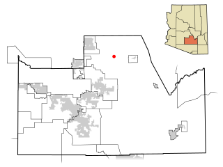
Queen Valley is a census-designated place (CDP) in north central Pinal County, Arizona, United States. The population was 820 at the 2000 census.

<span class="mw-page-title-main">Tahoe Vista, California</span> Census-designated place in California, United States

Tahoe Vista is a census-designated place located on the north shore of Lake Tahoe in Placer County, California. It is part of the Sacramento–Arden-Arcade–Roseville Metropolitan Statistical Area. The population was 1,433 at the 2010 census, down from 1,668 at the 2000 census.

La Porte, California Census-designated place in California, United States

La Porte is a census-designated place (CDP) in Plumas County, California, United States. The population was 26 at the 2010 census, down from 43 at the 2000 census.

Paisley, Florida Census-designated place in Florida

Paisley is an unincorporated community and census-designated place (CDP) in Lake County, Florida, United States. The population was 818 at the 2010 census, up from 734 at the 2000 census. It is part of the Orlando–Kissimmee Metropolitan Statistical Area.

North DeLand, Florida CDP in Florida, United States

North DeLand is a census-designated place (CDP) in Volusia County, Florida, United States. The population was 1,510 at the 2020 census.

Lake Dalecarlia, Indiana Census-designated place in Indiana, United States

Lake Dalecarlia is a census-designated place (CDP) in Lake County, Indiana, United States. The population was 1,355 at the 2010 census. The name comes from the English name of the Dalarna region of Sweden. The community is centered on the lake of the same name, which was completed in the 1920s.

Old Agency, Montana CDP in Montana, United States

Old Agency is a census-designated place (CDP) in Sanders County, Montana, United States. The population was 95 at the 2000 census.

Cedar Glen Lakes, New Jersey Census-designated place in New Jersey, United States

Cedar Glen Lakes is an unincorporated community and census-designated place (CDP) located within Manchester Township, in Ocean County, New Jersey, United States. As of the 2010 United States Census, the CDP's population was 1,421.

Silver Ridge, New Jersey Census-designated place in New Jersey, United States

Silver Ridge is an unincorporated community and census-designated place (CDP) located within Berkeley Township, in Ocean County, New Jersey, United States. As of the 2010 United States Census, the CDP's population was 1,133.

Conneaut Lakeshore, Pennsylvania Census-designated place in Pennsylvania, United States

Conneaut Lakeshore is a census-designated place (CDP) in Crawford County, Pennsylvania, United States. The population was 2,395 at the 2010 census.

East Sumter, South Carolina CDP in South Carolina, United States

East Sumter is a census-designated place (CDP) in Sumter County, South Carolina, United States. The population was 1,220 at the 2000 census. It is included in the Sumter, South Carolina Metropolitan Statistical Area.

Sandia, Texas Census-designated place in Texas, United States

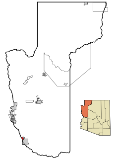
Sandia is an unincorporated community and census-designated place (CDP) in Jim Wells County, Texas, United States. The population was 379 at the 2010 census, down from 431 at the 2000 census.

Lake Ridge, Virginia Census-designated place in Virginia, United States

Lake Ridge is a census-designated place (CDP) in Prince William County, Virginia, United States. It is an annex of Woodbridge, Virginia. The population was 41,058 at the 2010 census, an increase of 35% from 2000.

Maple Heights-Lake Desire, Washington Census-designated place in Washington, United States

Maple Heights-Lake Desire is a census-designated place (CDP) in King County, Washington, United States. At the 2010 census, the population was 3,152.

Lake Wissota, Wisconsin CDP in Wisconsin, United States

Lake Wissota is a census-designated place (CDP) in the town of Lafayette in Chippewa County in the U.S. state of Wisconsin. The population was 2,738 at the 2010 census. The CDP, known locally as Lake Wissota Village, is located along the southern shores of Lake Wissota.

Tainter Lake, Wisconsin CDP in Wisconsin, United States

Tainter Lake is a census-designated place (CDP) in part of the Town of Tainter, Dunn County, Wisconsin, and part of the Town of Red Cedar, Dunn County, Wisconsin, United States. The population was 2,242 at the 2010 census.

Phoenix Lake is a census-designated place (CDP) in Tuolumne County, California. Phoenix Lake sits at an elevation of 2,431 feet (741 m). The 2010 United States census reported Phoenix Lake's population was 4,269. Phoenix lake was created a CDP for the 2010 census; previously, it was part of the Phoenix Lake-Cedar Ridge CDP.

Cedar Ridge is a census-designated place (CDP) in Tuolumne County, California. Cedar Ridge sits at an elevation of 3,760 feet (1,150 m). The 2010 United States census reported Cedar Ridge's population was 1,132.

References

  1. "US Gazetteer files: 2010, 2000, and 1990". United States Census Bureau. 2011-02-12. Retrieved 2011-04-23.
  2. "U.S. Census website". United States Census Bureau . Retrieved 2008-01-31.
  3. "California's 4th Congressional District - Representatives & District Map". Civic Impulse, LLC. Retrieved September 28, 2014.