Chinese Camp, California

Last updated
Chinese Camp
Chinese Camp Main Street.jpg
Main Street, Chinese Camp
Tuolumne County California Incorporated and Unincorporated areas Chinese Camp Highlighted.svg
Location in Tuolumne County and the state of California
Usa edcp location map.svg
Red pog.svg
Chinese Camp
Location in the United States
Coordinates: 37°52′13″N120°26′1″W / 37.87028°N 120.43361°W / 37.87028; -120.43361 Coordinates: 37°52′13″N120°26′1″W / 37.87028°N 120.43361°W / 37.87028; -120.43361
Country Flag of the United States.svg  United States
State Flag of California.svg  California
County Tuolumne
Area
[1]
  Total0.90 sq mi (2.33 km2)
  Land0.90 sq mi (2.33 km2)
  Water0.00 sq mi (0.01 km2)  0.28%
Elevation
1,273 ft (388 m)
Population
 (2020)
  Total90
  Density100.22/sq mi (38.70/km2)
Time zone UTC−08:00 (Pacific (PST))
  Summer (DST) UTC−07:00 (PDT)
ZIP Code
95309
Area code 209
FIPS code 06-13182
GNIS feature ID 233668
Reference no.423 [2]
Sierra Railroad excursion train starts upgrade out of Chinese Camp, September 1971 SRR 34 and 28 Chinese Hill Sept 71xRP - Flickr - drewj1946.jpg
Sierra Railroad excursion train starts upgrade out of Chinese Camp, September 1971

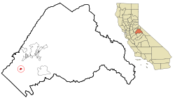
Chinese Camp is a census-designated place (CDP) in Tuolumne County, California, United States. The population was 126 at the 2010 census, down from 146 at the 2000 census. It lies in the grassy foothills of the Sierra Nevada near the southern end of California's Gold Country.

Contents

Chinese Camp is California Historical Landmark #423, since 1949.

Geography

Chinese Camp is located at 37°52′13″N120°26′1″W / 37.87028°N 120.43361°W / 37.87028; -120.43361 (37.870294, −120.433526). [3] According to the United States Census Bureau, the CDP has a total area of 0.9 square miles (2.3 km2), 99.72% of it land and 0.28% of it water.

Natural history

Wilderness near Chinese Camp is the location of the last remaining known population of the federally listed threatened plant species Brodiaea pallida , the Chinese Camp brodiaea. [4]

History

The site of the Old Crimea House. It was here where the First Tong War was fought. OldCrimeaHouseLocation.JPG
The site of the Old Crimea House. It was here where the First Tong War was fought.

Chinese Camp is the remnant of a notable California Gold Rush mining town. Between 1849 and 1882, thousands of Chinese immigrants arrived in the area to look for good fortune on the legendary “Gold Mountain.” [5]

The settlement was first known as "Camp Washington" or "Washingtonville" and one of the few remaining streets is Washington Street. Some of the very first Chinese laborers arriving in California in 1849 were driven from neighboring Camp Salvado and resettled here, and the area started to become known as "Chinee" or "Chinese Camp" or "Chinese Diggings". At one point, the town was home to an estimated 5,000 Chinese. [5]

Postmark from Chinese Camp, CA. Chinese Camp CA Postmark.jpg
Postmark from Chinese Camp, CA.

The Chinese Camp post office was established in the general store on April 18, 1854. This building is currently vacant, and a post office is in operation on a plot of land rented from a local resident.

An 1892 Tuolumne County history indicates that, in 1856, four of the six Chinese companies (protective associations) had agents here and that the first tong war (between the Sam Yap and Yan Woo tongs) was fought near here when the population of the area totaled several thousand. The actual location is several miles away, past the 'red hills', near the junction of Red Hills Road and J-59.

An 1860 diary says Chinese Camp was the metropolis for the mining district, with many urban comforts. While placer mining had played out in much of the Gold Country by the early 1860s, it was still active here as late as 1870. An 1899 mining bulletin listed the total gold production of the area as near US$2.5 million.

June 2014. The Chinese Camp, California Elementary School Chinese Camp Elementary School.jpg
June 2014. The Chinese Camp, California Elementary School

Chinese Camp is the location and subject of California Historical Landmark #423, dedicated on March 4, 1949. [5] [6] The Saint Francis Xavier Roman Catholic Church, established in 1855, [7] [8] making it the oldest church in the county. The church was renovated in 1949, [7] by John Nicolini but has since fallen into disrepair. The church itself is owned by the Stockton archdiocese.

The current Chinese Camp School is very distinctive, having been designed by Dolores Nicolini in the style of a Chinese pagoda. This school has been in operation since 1970. Previously, the school was in a building near the church. This building was lost in a fire on May 4, 2006.

Demographics

Historical population
CensusPop.
2020 90
U.S. Decennial Census [9]

2010

At the 2010 census Chinese Camp had a population of 126. The population density was 139.9 inhabitants per square mile (54.0/km2). The racial makeup of Chinese Camp was 92 (73%) White, 0 African American, 7 (6%) Native American, 0 Asian, 0 Pacific Islander, 16 (13%) from other races, and 11 (9%) from two or more races. Hispanic or Latino of any race were 25 people (20%). [10]

The whole population lived in households, no one lived in non-institutionalized group quarters and no one was institutionalized. 0 lived in non-institutionalized group quarters, and 0 were institutionalized.

There were 50 households, 15 (30%) had children under the age of 18 living in them, 23 (46%) were opposite-sex married couples living together, 2 (4%) had a female householder with no husband present, 6 (12%) had a male householder with no wife present. There were 5 (10%) unmarried opposite-sex partnerships, and 1 (2%) same-sex married couples or partnerships. 15 households (30%) were one person and 6 (12%) had someone living alone who was 65 or older. The average household size was 2.5. There were 31 families (62% of households); the average family size was 3.2.

The age distribution was 30 people (24%) under the age of 18, 11 people (9%) aged 18 to 24, 24 people (19%) aged 25 to 44, 46 people (37%) aged 45 to 64, and 15 people (12%) who were 65 or older. The median age was 43.5 years. For every 100 females, there were 106.6 males. For every 100 females age 18 and over, there were 108.7 males.

There were 60 housing units at an average density of 66.6 per square mile, of the occupied units 36 (72.0%) were owner-occupied and 14 (28.0%) were rented. The homeowner vacancy rate was 3%; the rental vacancy rate was 0%. 99 people (79% of the population) lived in owner-occupied housing units and 27 people (21%) lived in rental housing units.

2000

The old Catholic Church. There is a chain across the front to hold it up. ChineseCampCatholicChurch.JPG
The old Catholic Church. There is a chain across the front to hold it up.

At the 2000 census there were 146 people, 57 households, and 38 families in the CDP. The population density was 162.5 inhabitants per square mile (62.7/km2). There were 64 housing units at an average density of 71.2 per square mile (27.5/km2). The racial makeup of the CDP was 92% White, 1% African American, 3% Native American, 1% Asian, 1% from other races, and 2% from two or more races. Hispanic or Latino of any race were 12%. [11]

Of the 57 households 32% had children under the age of 18 living with them, 54% were married couples living together, 12% had a female householder with no husband present, and 32% were non-families. 30% of households were one person and 9% were one person aged 65 or older. The average household size was 2.6 and the average family size was 3.2.

The age distribution was 28% under the age of 18, 10% from 18 to 24, 32% from 25 to 44, 20% from 45 to 64, and 10% 65 or older. The median age was 35 years. For every 100 females, there were 117.9 males. For every 100 females age 18 and over, there were 110.0 males.

The median household income was $31,875 and the median family income was $35,833. Males had a median income of $25,833 versus $18,750 for females. The per capita income for the CDP was $11,501. There were 21% of families and 23% of the population living below the poverty line, including 36% of under eighteens and 14% of those over 64.

Government

In the California State Legislature, Chinese Camp is in the 8th Senate District , represented by Democrat Angelique Ashby, and the 5th Assembly District , represented by Republican Frank Bigelow. [12]

In the United States House of Representatives, Chinese Camp is in California's 4th congressional district , represented by Republican Tom McClintock. [13]

Montezuma

Montezuma just north of Chinese Camp is a California Historical Landmark. [14] The Montezuma is a current tungsten mine at an elevation of 9,439 feet.

A marker is on California State Route 49, the California Historical Landmark number 122 reads: [15]

NO. 122 MONTEZUMA - First record of Montezuma was June 1850 when partners Solomon Miller and Peter K. Aurand, proprietors of the 'Montezuma Tent,' were attacked and Aurand killed by a group of Mexicans during the foreign miners tax excitement of that period. Due to the lack of water, little mining occurred here until 1852 when a ditch and flume were completed bringing water for placer mining. Two types of mining were carried on, placer operations on the flats and tunnels extending under Table Mountain. The gravel produced 3-1/2 C. per pan in the mid 50s. The yield was from $5 to $10 per day. One placer nugget found in 1853 weighed 18 lbs. 8 oz. By late 1852 the population was about 800. At its zenith Montezuma City had four saloons, two hotels, Adams Express Co., post office, church, some homes, and many tents and cabins. The town was nearly destroyed by an incendiary fire which started in Clarks Hotel on June 29, 1866. [16]

See also

Related Research Articles

<span class="mw-page-title-main">Jackson, California</span> City in the state of California, United States

Jackson is a city in and the county seat of Amador County, California. The population was 4,651 at the 2010 census, up from 3,989 at the 2000 census. The city is accessible by both State Route 49 and State Route 88.

<span class="mw-page-title-main">Magalia, California</span> Unincorporated community in California, United States

Magalia is an unincorporated community and census-designated place (CDP) in Butte County, California, United States. The population was 11,310 at the 2010 census.

<span class="mw-page-title-main">San Andreas, California</span> Census-designated place in California, United States

San Andreas is an unincorporated census-designated place and the county seat of Calaveras County, California. The population was 2,783 at the 2010 census, up from 2,615 at the 2000 census. Like most towns in the region, it was founded during the California Gold Rush. The town is located on State Route 49 and is registered as California Historical Landmark #252.

<span class="mw-page-title-main">Vallecito, California</span> Census-designated place in California, United States

Vallecito is a census-designated place (CDP) in Calaveras County, California, United States. The population was 442 at the 2010 census, up from 427 at the 2000 census. The town is registered as California Historical Landmark #273. Nearby is Moaning Cavern, the largest cave chamber in California, which the Miwok Indians used as a burial ground.

<span class="mw-page-title-main">Georgetown, California</span> Census-designated place in California, United States

Georgetown is a census-designated place (CDP) in El Dorado County, California. It is the northeasternmost town in the California Mother Lode. The population was 2,367 at the 2010 census, up from 962 in 2000. The town is registered as California Historical Landmark #484.

<span class="mw-page-title-main">Shingle Springs, California</span> Census-designated place in California, United States

Shingle Springs is a census-designated place (CDP) in El Dorado County, California, United States. The population was 4,432 at the 2010 census, up from 2,643 at the 2000 census. It is located about 40 miles (64 km) from Sacramento in the Gold Country foothills and sits directly on Highway 50. The towns of Coloma and Placerville are less than 15 miles (24 km) away.

<span class="mw-page-title-main">Seeley, California</span> Census-designated place in California, United States

Seeley is a census-designated place (CDP) in Imperial County, California. Seeley is located 7.5 miles (12 km) west of El Centro. The population was 1,823 at the 2010 census, up from 1,624 in 2000. It is part of the El Centro Metropolitan Area.

<span class="mw-page-title-main">Randsburg, California</span> California Historical Landmark

Randsburg is a census-designated place (CDP) in Kern County, California, United States. Randsburg is located 17 miles (27 km) south of Ridgecrest, at an elevation of 3,504 feet (1,068 m). The population was 69 in the 2010 census, down from 77 in the 2000 census.

<span class="mw-page-title-main">Weldon, California</span> Census-designated place in California, United States

Weldon is a census-designated place (CDP) in Kern County, California, United States. It sits at the southeast tip of Lake Isabella. Weldon is located 9 miles (14 km) east-southeast of Wofford Heights, at an elevation of 2,654 feet (809 m). The population was 2,642 at the 2010 census, up from 2,387 at the 2000 census.

<span class="mw-page-title-main">Foresthill, California</span> Census-designated place in California, United States

Foresthill is a census-designated place (CDP) in Placer County, California, United States. It is part of the Sacramento–Arden-Arcade–Roseville Metropolitan Statistical Area. The population was 1,483 at the 2010 census, down from 1,791 at the 2000 census.

<span class="mw-page-title-main">La Porte, California</span> Census-designated place in California, United States

La Porte is a census-designated place (CDP) in Plumas County, California, United States. The population was 26 at the 2010 census, down from 43 at the 2000 census.

<span class="mw-page-title-main">French Gulch, California</span> Census-designated place in California, United States

French Gulch is a census-designated place (CDP) in Shasta County, California, United States. Its population is 373 as of the 2020 census, up from 346 from the 2010 census.

<span class="mw-page-title-main">Jamestown, California</span> Census-designated place in California, United States

Jamestown is a census-designated place (CDP) in Tuolumne County, California, United States. The population was 3,433 at the 2010 census, up from 3,017 at the 2000 census. Formerly a California Gold Rush town, Jamestown is now a California Historical Landmark. Jamestown is the home of Railtown 1897 State Historic Park and the Sierra Railway, which operates steam passenger trains.

<span class="mw-page-title-main">Sonora, California</span> City in the state of California, United States

Sonora is the county seat of Tuolumne County, California. Founded during the California Gold Rush by Mexican miners from Sonora, the city population was 5,226 during the 2020 Census, an increase of 221 from the 4,903 counted during the 2010 Census.

<span class="mw-page-title-main">Soulsbyville, California</span> Census-designated place in California, United States

Soulsbyville is an unincorporated census-designated place in Tuolumne County, California. The population was 2,215 at the time of the 2010 census, up from 1,729 at the time of the 2000 census. Formerly a California Gold Rush town, Soulsbyville is now registered as a California Historical Landmark.

<span class="mw-page-title-main">Tuolumne City, California</span> Census-designated place in California, United States

Tuolumne City is an unincorporated town in Tuolumne County, California. A census-designated place (CDP) officially known as Tuolumne also encompasses the town. The population of the CDP was 1,779 at the 2010 census, down from 1,865 at the 2000 census.

<span class="mw-page-title-main">Washington, California</span> Census-designated place in California, United States

Washington is a census-designated place located in Nevada County, California. Washington is located on the banks of the South Fork of the Yuba River and has a population of approximately two hundred people. There is a hotel/bar and restaurant, grocery store, a one-room schoolhouse that has educated students continuously for one hundred years, and two trailer park campgrounds. The elevation is 2,612 feet (796 m). The population was 185 at the 2010 census. According to the 2020 census, the population was 137 with a median age of 61.7.

<span class="mw-page-title-main">Tuttletown, California</span> Census-designated place in California, United States

Tuttletown is a census-designated place (CDP) in Tuolumne County, California. It is located on State Route 49 near the gold rush community of Columbia. Tuttletown sits at an elevation of 1,047 feet (319 m). The 2010 United States census reported Tuttletown's population was 668.

<span class="mw-page-title-main">Groveland, California</span> Census-designated place in California, United States

Groveland is a census-designated place (CDP) in Tuolumne County, California. Groveland sits at an elevation of 3,136 feet (956 m). The 2020 United States census reported Groveland's population was 540.

Strawberry is an unincorporated community and a census-designated place (CDP) in Tuolumne County, California. Strawberry is located on California State Route 108 10 miles (16 km) northeast of Long Barn. Strawberry has a post office with ZIP code 95375, which opened in 1949. Strawberry sits at an elevation of 5,325 feet (1,623 m). The 2010 United States census reported Strawberry's population was 68.

References

  1. "2020 U.S. Gazetteer Files". United States Census Bureau. Retrieved October 30, 2021.
  2. "Chinese Camp". Office of Historic Preservation, California State Parks. Retrieved 2012-10-18.
  3. "US Gazetteer files: 2010, 2000, and 1990". United States Census Bureau. 2011-02-12. Retrieved 2011-04-23.
  4. Flora of North America
  5. 1 2 3 Ichikawa, Nina F. (15 September 2021). "Looking for a Gold-Rush Town Named Chinese Camp". The New York Times. Retrieved 17 September 2021.
  6. "Chinese Camp". CA State Parks. Archived from the original on 1999-11-10. Retrieved 2021-10-11.
  7. 1 2 "California Historical Landmark #423: Chinese Camp in Tuolumne County". noehill.com. Retrieved 2021-10-11.
  8. "CHL # 423 Chinese Camp Tuolumne". California Historical Landmark. Archived from the original on 2020-08-04. Retrieved 2021-10-11.
  9. "Census of Population and Housing". Census.gov. Retrieved June 4, 2016.
  10. "2010 Census Interactive Population Search: CA – Chinese Camp CDP". U.S. Census Bureau. Archived from the original on July 15, 2014. Retrieved July 12, 2014.
  11. "U.S. Census website". United States Census Bureau . Retrieved 2008-01-31.
  12. "Statewide Database". Regents of the University of California. Archived from the original on February 1, 2015. Retrieved March 26, 2015.
  13. "California's 4th Congressional District - Representatives & District Map". Civic Impulse, LLC. Retrieved September 28, 2014.
  14. California Parks, California Historical Landmark
  15. Mark DataBase
  16. californiahistoricallandmarks.com Landmarks chl-122