Forbestown, California

Last updated
Forbestown
Shalkespeaare Mine Forbestown CA ca1860.jpg
Shakespeare Mining & Milling Co, headframe and miners, ca. 1860
Butte County California Incorporated and Unincorporated areas Forbestown Highlighted 0624750.svg
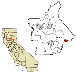
Location of Forbestown in Butte County, California.
USA California location map.svg
Red pog.svg
Forbestown
Location in California
Coordinates: 39°31′02″N121°16′02″W / 39.51722°N 121.26722°W / 39.51722; -121.26722
Country Flag of the United States.svg  United States
State Flag of California.svg  California
County Butte County
Area
[1]
  Total6.280 sq mi (16.265 km2)
  Land6.274 sq mi (16.250 km2)
  Water0.006 sq mi (0.015 km2)  0.09%
Elevation
[2]
2,772 ft (845 m)
Population
 (2020) [3]
  Total396
  Density63/sq mi (24/km2)
Time zone UTC-8 (Pacific (PST))
  Summer (DST) UTC-7 (PDT)
GNIS feature IDs1656023; 2612480
U.S. Geological Survey Geographic Names Information System: Forbestown, California, U.S. Geological Survey Geographic Names Information System: Forbestown, California

Forbestown (formerly, Boles Dry Diggins and Forbes Diggins) is a census-designated place [4] in Butte County, California. [2] It lies at an elevation of 2772 feet (845 m). [2] Its zip code is 95941 and its area code is 530. Forbestown had a population of 320 at the 2010 census.

Contents

Forbestown is named for B.F. Forbes, who opened a store there in 1850. [5] The post office was established in 1854, closed in 1925, and re-opened in 1936. [5]

Forbestown's heyday was the last half of the nineteenth century, when it was a large mining center. [6] By the late 1930s, it was nearly a ghost town. [6] The site has foundations and debris from its mining era. [6]

Demographics

Historical population
CensusPop.Note
U.S. Decennial Census [7]

The 2010 United States Census [8] reported that Forbestown had a population of 320. The population density was 51.0 inhabitants per square mile (19.7/km2). The racial makeup of Forbestown was 262 (81.9%) White, 4 (1.3%) African American, 15 (4.7%) Native American, 10 (3.1%) Asian, 0 (0.0%) Pacific Islander, 4 (1.3%) from other races, and 25 (7.8%) from two or more races. Hispanic or Latino of any race were 23 persons (7.2%).

The Census reported that 320 people (100% of the population) lived in households, 0 (0%) lived in non-institutionalized group quarters, and 0 (0%) were institutionalized.

There were 138 households, out of which 28 (20.3%) had children under the age of 18 living in them, 78 (56.5%) were opposite-sex married couples living together, 15 (10.9%) had a female householder with no husband present, 3 (2.2%) had a male householder with no wife present. There were 10 (7.2%) unmarried opposite-sex partnerships, and 0 (0%) same-sex married couples or partnerships. 32 households (23.2%) were made up of individuals, and 17 (12.3%) had someone living alone who was 65 years of age or older. The average household size was 2.32. There were 96 families (69.6% of all households); the average family size was 2.71.

The population was spread out, with 57 people (17.8%) under the age of 18, 16 people (5.0%) aged 18 to 24, 53 people (16.6%) aged 25 to 44, 119 people (37.2%) aged 45 to 64, and 75 people (23.4%) who were 65 years of age or older. The median age was 52.3 years. For every 100 females, there were 105.1 males. For every 100 females age 18 and over, there were 97.7 males.

There were 167 housing units at an average density of 26.6 per square mile (10.3/km2), of which 138 were occupied, of these 109 (79.0%) were owner-occupied, and 29 (21.0%) were occupied by renters. The homeowner vacancy rate was 5.2%; the rental vacancy rate was 0%. 246 people (76.9% of the population) lived in owner-occupied housing units and 74 people (23.1%) lived in rental housing units.

Government

In the California State Legislature, Forbestown is in the 4th Senate District , represented by Democrat Marie Alvarado-Gil, [9] and the 1st Assembly District , represented by Republican Megan Dahle. [10]

In the United States House of Representatives, Forbestown is in California's 1st congressional district , represented by Republican Doug LaMalfa. [11]

See also

Related Research Articles

<span class="mw-page-title-main">West Bishop, California</span> Census-designated place in California, United States

West Bishop is a census-designated place (CDP) in Inyo County, California, United States. The population was 2,607 at the 2010 census, down from 2,807 at the 2000 census.

<span class="mw-page-title-main">Ducor, California</span> Census-designated place in California, United States

Ducor is a census-designated place (CDP) in Tulare County, California, United States. The population was 616 at the 2020 census, up from 612 at the 2010 census. Ducor is an abbreviation of an earlier name, Dutch Corners, which was given because several early settler families were German. The word "Dutch" in this case derives from German deutsch "German".

Victor is a census-designated place and community in San Joaquin County, California, United States. The population was 215 at the 2020 census, which is lower than 293 at the 2010 census.

Nord is a census-designated place in Butte County, California. Its zip code is 95973 and its area code is 530. It lies at an elevation of 151 feet. Nord's population was 320 at the 2010 census.

<span class="mw-page-title-main">Alleghany, California</span> Census-designated place in California, United States

Alleghany is a small census-designated place in Sierra County, California, United States in the Sierra Nevada. It is situated in the Gold Country and continues to be a significant locale for gold mining. The Sixteen To One Mine has been in operation since the days of the California Gold Rush. The town is 20 miles (32 km) from the nearest highway and consists largely of a single main street. The town is home to a post office, a bar, and a mining museum. The population was 58 at the 2010 census.

Robinson Mill is a census-designated place in Butte County, California. It lies at an elevation of 2654 feet. Robinson Mill's population was 80 at the 2010 census.

Hiouchi is a census-designated place in Del Norte County, California. It is located on the Smith River 7.5 miles (12 km) east-northeast of Crescent City, at an elevation of 171 feet. Its population is 314 as of the 2020 census, up from 301 from the 2010 census.

<span class="mw-page-title-main">Big Lagoon, California</span> Census-designated place in California, United States

Big Lagoon is a census-designated place in Humboldt County, California. It is located 7 miles (11 km) north of Trinidad, at an elevation of 56 feet (17 m). Its population is 161 as of the 2020 census, up from 93 from the 2010 census.

<span class="mw-page-title-main">Indianola, California</span> Census-designated place in California, United States

Indianola is a census-designated place in Humboldt County, California. It is located 4 miles (6.4 km) south of Arcata, at an elevation of 46 feet. The place appears on the USGS Arcata South map. Addresses in this neighborhood are part of unincorporated Eureka, California, located entirely within the 95503 ZIP code. The population was 823 at the 2010 census.

<span class="mw-page-title-main">Cherokee Strip, California</span> Census-designated place in California, United States

Cherokee Strip is a census-designated place in Kern County, California. It is located 2.5 miles (4 km) south-southeast of Shafter, at an elevation of 331 feet (101 m). The population was 206 at the 2010 census.

<span class="mw-page-title-main">Edmundson Acres, California</span> Census-designated place in California, United States

Edmundson Acres is a census-designated place in Kern County, California. It is located 1.25 miles (2 km) north-northeast of Arvin, at an elevation of 486 feet (148 m). Edmundson Acres' ZIP code is 93203. The population was 279 at the 2010 census.

<span class="mw-page-title-main">Fuller Acres, California</span> Census-designated place in California, United States

Fuller Acres is a census-designated place in Kern County, California. It is located 7.25 miles (12 km) southeast of downtown Bakersfield, at an elevation of 420 feet (128.02 m). The population was 991 at the 2010 census.

Nubieber is a census-designated place in Lassen County, California. It was located at the common terminus of the Western Pacific Railroad and the Great Northern Railway Bieber Line 3 miles (4.8 km) southwest of Bieber, at an elevation of 4121 feet. Its population is 19 as of the 2020 census, down from 50 from the 2010 census.

<span class="mw-page-title-main">Aspen Springs, California</span> Census-designated place in California, United States

Aspen Springs is an unincorporated community and census-designated place (CDP) in Mono County, California, United States. It lies at an elevation of 7,109 feet (2,167 m). The population was 70 at the 2020 census.

Reliez Valley is a census-designated place in Contra Costa County, California. Reliez Valley sits at an elevation of 299 feet (91 m). The 2010 United States census reported Reliez Valley's population was 3,101.

El Sobrante is a census-designated place in Riverside County, California. El Sobrante sits at an elevation of 1,283 feet (391 m). The 2010 United States census reported El Sobrante's population was 12,723.

South Monrovia Island is a census-designated place in Los Angeles County, California. It sits at an elevation of 384 feet (117 m). It is bounded to the west and north by Monrovia, to the east by Duarte, and to the south by Irwindale. The 2010 United States census reported that South Monrovia Island's population was 6,777.

Moskowite Corner is a census-designated place in Napa County, California. Moskowite Corner sits at an elevation of 833 feet (254 m). The 2010 United States census reported Moskowite Corner's population was 211.

<span class="mw-page-title-main">Gold Mountain, California</span> Place in California, United States

Gold Mountain is an unincorporated community in Plumas County, California. Gold Mountain sits at an elevation of 5,341 feet (1,628 m). The 2010 United States census reported Gold Mountain's population was 80. For statistical purposes, the United States Census Bureau has defined Gold Mountain as a census-designated place (CDP).

Panorama Heights is a census-designated place (CDP) in Tulare County, California. Panorama Heights sits at an elevation of 5,043 feet (1,537 m). The 2020 United States census reported Panorama Heights's population was 44, up from 41 at the 2010 census.

References

  1. "2010 Census U.S. Gazetteer Files – Places – California". United States Census Bureau.
  2. 1 2 3 U.S. Geological Survey Geographic Names Information System: Forbestown, California
  3. "Explore Census Data". data.census.gov. Retrieved 29 June 2023.
  4. U.S. Geological Survey Geographic Names Information System: Forbestown, California
  5. 1 2 Durham, David L. (1998). California's Geographic Names: A Gazetteer of Historic and Modern Names of the State. Clovis, Calif.: Word Dancer Press. p. 236. ISBN   1-884995-14-4.
  6. 1 2 3 Miller, Donald C. (1978). Ghost Towns of California. Boulder, Colorado: Pruett Publishing Company. p. 65. ISBN   0871085178.
  7. "Census of Population and Housing". Census.gov. Retrieved June 4, 2016.
  8. "2010 Census Interactive Population Search: CA - Forbestown CDP". U.S. Census Bureau. Archived from the original on July 15, 2014. Retrieved July 12, 2014.
  9. "Senators". State of California. Retrieved March 20, 2013.
  10. "Members Assembly". State of California. Retrieved March 20, 2013.
  11. "California's 1st Congressional District - Representatives & District Map". Civic Impulse, LLC. Retrieved March 3, 2013.