DeSabla is an unincorporated community in Butte County, California. It lies at an elevation of 2762 feet. It was named after one of the Pacific Gas and Electric founders and is the site of Lake de Sabla reservoir and a powerhouse named for him. The community's ZIP code is 95954, and is shared with the community of Magalia. The area code is 530. NAD27 latitude and longitude for the community are 39°52′26″N121°36′06″W and official elevation is 2,780 feet (850 m) above mean sea level.

Feather Falls is a rural unincorporated community in Butte County, California north and east of Lake Oroville. It lies at an elevation of 2982 feet. It is home to Feather Falls Elementary School, a K-8 facility. It takes its name from the nearby 410-foot Feather Falls

Mayaro is an unincorporated community in Butte County, California. It lies at an elevation of 1522 feet and is located at 39°49′27″N121°25′20″W. A post office operated at Mayaro from 1930 to 1956.

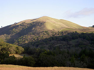
Bald Mountain is a name given to over fifty summits in California.

Eskini is a former Maidu settlement in Butte County, California. It lay at an elevation of 157 feet. Its location is now within the limits of Durham.

Hawk Ravine is a former settlement in Butte County, California. It lay at an elevation of 1266 feet. It still appeared on maps as of 1897.

Helltown is an unincorporated community in Butte County, California. It lies 4 miles (6.4 km) north-northwest of Paradise, at an elevation of 873 feet.

Irish Town is an unincorporated community in Butte County, California. It lies at an elevation of 2,270 feet.

Michopdo is a former Maidu settlement in Butte County, California. It lay at an elevation of 187 feet.

Moseley is a former settlement in Butte County, California. It lay at an elevation of 1811 feet.

Nelson Bar is a former settlement in Butte County, California. It was located 5.25 miles (8.45 km) southeast of Paradise on the West Branch of the Feather River, at an elevation of 974 feet. It is now under Lake Oroville.

Pipers is a former settlement in Butte County, California. It lay at an elevation of 1388 feet. It still appeared on maps as of 1897.

Quartz is a former settlement in Butte County, California. It lay at an elevation of 262 feet. It still appeared on maps as of 1947. The townsite has been flooded by the Lake Oroville reservoir since 1968.

Robinsons Corner is an unincorporated community in Butte County, California. It lies at an elevation of 105 feet.

Swedes Flat is a former settlement in Butte County, California. It lay at an elevation of 1375 feet. It still appeared on maps as of 1895.

Wagners is a former settlement in Butte County, California. It was located 9 miles (14 km) north-northwest of Clipper Mills, at an elevation of 4101 feet. It appears on maps as of 1897.

Midway is an unincorporated community in Alameda County, California, 6 miles (9.7 km) south-southeast of Altamont. It lies at an elevation of 358 feet. A post office operated in Midway from 1870 to 1918.

Klamath Glen is an unincorporated community in Del Norte County, California. It is located on the Klamath River 5 miles (8 km) from its mouth, at an elevation of 46 feet.

The Foss River is a stream in the U.S. state of Washington. It has two main forks, the East Fork Foss River and the West Fork Foss River. The main stem is formed by the confluence of the two forks. The river and its forks rise near in the Alpine Lakes Wilderness area of Mount Baker-Snoqualmie National Forest in the Cascade Mountains and flows generally north, joining the Tye River to form the South Fork Skykomish River. The Foss River's waters eventually empty into Puget Sound near Everett via the Skykomish River and Snohomish River.
Westfall is an unincorporated community in Pickaway County, in the U.S. state of Ohio.


