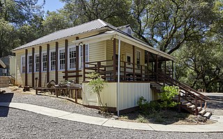
DeSabla is an unincorporated community in Butte County, California. It lies at an elevation of 2762 feet. It was named after one of the Pacific Gas and Electric founders and is the site of Lake de Sabla reservoir and a powerhouse named for him. The community's ZIP code is 95954, and is shared with the community of Magalia. The area code is 530. NAD27 latitude and longitude for the community are 39°52′26″N121°36′06″W and official elevation is 2,780 feet (850 m) above mean sea level.

Centerville is an unincorporated community in Butte County, California along Butte Creek. It was midway between Helltown and Diamondville. The area is about one and three quarters miles, straight-line distance, west of Paradise.
Feather Falls is a rural unincorporated community in Butte County, California north and east of Lake Oroville. It lies at an elevation of 2982 feet. It is home to Feather Falls Elementary School, a K-8 facility. It takes its name from the nearby 410-foot Feather Falls
Pulga is an unincorporated community in Butte County, California. It is located along the west slope of the Feather River canyon, at an elevation of 1,398 feet (426 m). A variant name for the community is Big Bar. Other nearby communities include Mayaro, Poe and Parkhill. The town hosts a Caltrans highway maintenance station along State Route 70 (SR70). The place is at the mouth of the Flea Valley Creek, which gives rise to the toponym.
Mayaro is an unincorporated community in Butte County, California. It lies at an elevation of 1522 feet and is located at 39°49′27″N121°25′20″W. A post office operated at Mayaro from 1930 to 1956.
Brush Creek is an unincorporated community near Oroville in Butte County, California, United States. It lies at the east end of State Route 162, just beyond the Lake Oroville State Recreation Area. It lies at an elevation of 3,540 feet. A post office operated at Brush Creek from 1856 until 1916, having moved once in 1902.
Enterprise is a former settlement in Butte County, California. It was located 5 miles (8.0 km) west-northwest of Forbestown on the South Fork of the Feather River, at an elevation of 902 feet. In 1968, it was inundated by Lake Oroville.
Dayton is an unincorporated town in Butte County, California. It lies south of Chico at an elevation of 141 feet.
Big Bend is an unincorporated community in Butte County, California, United States. It lies at an elevation of 2310 feet. A post office operated in Big Bend from 1883 to 1891.
East Gridley is an unincorporated community in Butte County, California. It lies at an elevation of 98 feet. The town was founded as Gridley Station on the Sacramento Northern Railroad.
Helltown is an unincorporated community in Butte County, California. It lies 4 miles (6.4 km) north-northwest of Paradise, at an elevation of 873 feet.
Isaiah is a ghost town in Butte County, California, United States. It was located 5.5 miles (8.9 km) north-northwest of Berry Creek, at an elevation of 984 feet. Part of the Bidwell Tract of 1876, It still appeared on maps as of 1948. Isaiah began as a mining community and later was used as a watering station for steam powered trains. Because of the construction of Oroville Dam (1961), the railroad was re-directed. This led to the inhabitants eventually selling their property. It is now privately owned.
Jonesville is an unincorporated community in Butte County, California. It is situated on Jones Creek, 5 miles (8.0 km) east-northeast of Butte Meadows, at an elevation of 5049 feet.
Lava Beds is a former settlement in Butte County, California. It lay at an elevation of 151 feet. It remained on maps as late as 1895. It was a community of Chinese miners, located near Pacific Heights, 2.5 miles (4.0 km) north-northwest of Palermo.
Lovelock is an unincorporated community in Butte County, California. It is located 2.5 miles (4.0 km) west-southwest of Stirling City and lies at an elevation of 3136 feet.
Nelson is an unincorporated community in Butte County, California. It lies 6.5 miles (10.5 km) south-southeast of Durham, at an elevation of 121 feet. Nelson's first post office was established in 1873; its zip code is 95958. The place was founded in 1873 by the California and Oregon Railroad Company and named for an early settler, A.D. Nelson.
Powellton was an unincorporated community in Butte County, California, USA. It lies at an elevation of 3,622 feet. The place is named for R.P. Powell who arrived in 1853. Originally Powell's Ranch, it was renamed when a post office was established in 1872; the office closed in 1906. It was a center of lumber production in its heyday, but nothing remains at the site.
South Fork is a former settlement in Butte County, California, USA. It lay at an elevation of 1375 feet. It still appeared on maps as of 1947, and was inundated by Lake Oroville. South Fork was located 1.25 miles (2 km) east-southeast of Bidwell's Bar on the Feather River.
Wagners is a former settlement in Butte County, California. It was located 9 miles (14 km) north-northwest of Clipper Mills, at an elevation of 4101 feet. It appears on maps as of 1897.
West Butte is an unincorporated community in Sutter County, California, 3.25 miles (5.23 km) north-northeast of Meridian. It lies at an elevation of 85 feet. A post office operated at West Butte from 1863 to 1930.


