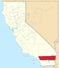
Mira Loma | |
---|---|
Coordinates: 33°59′05″N117°30′55″W / 33.98472°N 117.51528°W | |
Country | United States |
State | California |
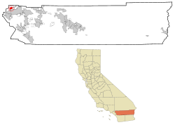
County | Riverside |
Incorporated into Jurupa Valley | July 1, 2011 |
Area | |
• Total | 8.149 sq mi (21.107 km2) |
• Land | 7.997 sq mi (20.712 km2) |
• Water | 0.152 sq mi (0.395 km2) 1.87% |
Elevation | 722 ft (220 m) |
Population (2010) | |
• Total | 21,930 |
• Density | 2,700/sq mi (1,000/km2) |
Time zone | UTC-8 (PST) |
• Summer (DST) | UTC-7 (PDT) |
ZIP code | 91752 |
Area code | 951 |
FIPS code | 06-47976 |
GNIS feature ID | 1656568 |
Mira Loma (Spanish for "Look Hill"), now officially part of Jurupa Valley, is a census-designated place (CDP) in Riverside County, California, United States. Its population was 21,930 in the 2010 census, up from 17,617 in the 2000 census.
Mira Loma was known as Wineville prior to 1930. The name was changed that year to help disassociate the community from the Wineville Chicken Coop murders.
In 2010, parts of Mira Loma became part of the newly incorporated city of Eastvale, California.
On July 1, 2011, parts of Mira Loma became part of the newly incorporated city of Jurupa Valley, California.
According to the United States Census Bureau, the CDP has a total area of 8.1 square miles (21 km2), of which, 8.0 square miles (21 km2) of it is land and 0.2 square miles (0.52 km2) of it (1.87%) is water.
Rancho Jurupa/Jurupa Valley was originally granted by the Mexican government to Sn. Dn. Juan Bandini, on September 28, 1838. [3]
Originally known as Wineville, it is located in the modern day "Jurupa" area of unincorporated Riverside County. It is separated from the city of Riverside by the Santa Ana River to the south, borders the Ontario/Fontana area of San Bernardino County to the north and west, and Pedley / Glen Avon to the east. The community officially changed its name from Wineville on November 1, 1930, due in large part to the negative publicity surrounding the Wineville Chicken Coop murders. [4]
On March 8, 2011, voters passed Measure A by a 54.03% YES vote, incorporating the areas of Mira Loma, Pedley, Rubidoux, Glen Avon, and Sunnyslope into the new city of Jurupa Valley. The effective date of incorporation was July 1, 2011. [5]
In the 2010 census Mira Loma had a population of 21,930. The population density was 2,691.0 inhabitants per square mile (1,039.0/km2). The racial makeup of Mira Loma was 12,577 (57.4%) White, 383 (1.7%) African American, 240 (1.1%) Native American, 465 (2.1%) Asian, 43 (0.2%) Pacific Islander, 7,250 (33.1%) from other races, and 972 (4.4%) from two or more races. Hispanic or Latino of any race were 14,846 persons (67.7%). [6]
The census reported that 21,882 people (99.8% of the population) lived in households, 28 (0.1%) lived in non-institutionalized group quarters, and 20 (0.1%) were institutionalized.
There were 5,277 households, 2,797 (53.0%) had children under the age of 18 living in them, 3,415 (64.7%) were opposite-sex married couples living together, 647 (12.3%) had a female householder with no husband present, 461 (8.7%) had a male householder with no wife present. There were 335 (6.3%) unmarried opposite-sex partnerships, and 31 (0.6%) same-sex married couples or partnerships. 527 households (10.0%) were one person and 164 (3.1%) had someone living alone who was 65 or older. The average household size was 4.15. There were 4,523 families (85.7% of households); the average family size was 4.30.
The age distribution was 6,618 people (30.2%) under the age of 18, 2,722 people (12.4%) aged 18 to 24, 5,848 people (26.7%) aged 25 to 44, 5,256 people (24.0%) aged 45 to 64, and 1,486 people (6.8%) who were 65 or older. The median age was 30.4 years. For every 100 females, there were 103.3 males. For every 100 females age 18 and over, there were 105.3 males.
There were 5,640 housing units at an average density of 692.1 per square mile, of the occupied units 3,902 (73.9%) were owner-occupied and 1,375 (26.1%) were rented. The homeowner vacancy rate was 2.6%; the rental vacancy rate was 3.6%. 15,806 people (72.1% of the population) lived in owner-occupied housing units and 6,076 people (27.7%) lived in rental housing units.
At the 2000 census there were 17,617 people, 4,556 households, and 3,863 families in the CDP. The population density was 2,733.9 inhabitants per square mile (1,055.6/km2). There were 4,684 housing units at an average density of 726.9 per square mile (280.7/km2). The racial makeup of the CDP was 62.7% White, 1.9% African American, 0.6% Native American, 2.2% Asian, <0.1% Pacific Islander, 28.3% from other races, and 2.3% from two or more races. Hispanic or Latino of any race were 62.1%. [7]
Of the 4,556 households 47.6% had children under the age of 18 living with them, 67.0% were married couples living together, 11.0% had a female householder with no husband present, and 15.2% were non-families. 10.1% of households were one person and 2.8% were one person aged 65 or older. The average household size was 3.84 and the average family size was 4.05.
The age distribution was 34.0% under the age of 18, 10.3% from 18 to 24, 28.9% from 25 to 44, 21.1% from 45 to 64, and 5.7% 65 or older. The median age was 30 years. For every 100 females, there were 105.3 males. For every 100 females age 18 and over, there were 105.6 males.
The median household income was $67,530 and the median family income was $68,834. Males had a median income of $33,356 versus $25,275 for females. The per capita income for the CDP was $20,655. About 9.5% of families and 14.0% of the population were below the poverty line, including 17.7% of those under age 18 and 13.2% of those age 65 or over.
In the California State Legislature, Mira Loma is in the 31st Senate District , represented by Democrat Richard Roth, and in the 60th Assembly District , represented by Democrat Corey Jackson. [8]
In the United States House of Representatives, Mira Loma is in California's 41st congressional district , represented by Republican Ken Calvert. [9]
Cherryland is an unincorporated community and census-designated place (CDP) in Alameda County, California, United States. Cherryland is located between Ashland to the north and the city of Hayward to the south. The population was 15,808 at the 2020 census.
Palo Verde is a census-designated place (CDP) in Imperial County, California. Its name comes from the native desert tree, Palo Verde, which in turn takes its name from the Spanish for stick (palo) and green (verde), sharing its name with the Palo Verde Valley, the valley it is located.
Las Lomas is an unincorporated community and census-designated place (CDP) in Monterey County, California, United States. Las Lomas is located 7 miles (11 km) north-northwest of Prunedale. The elevation is 43 feet (13 m). The population was 3,046 at the 2020 census.
Glen Avon is a neighborhood and former census-designated place (CDP) in Riverside County, California, United States. The population was 20,199 at the 2010 census, up from 14,853 at the 2000 census. On July 1, 2011, the CDP became part of the newly incorporated city of Jurupa Valley.
Home Gardens is a census-designated place (CDP) in Riverside County, California, United States. It is within the City of Corona's sphere of influence. The population was 11,203 at the 2020 census, down from 11,507 at the 2010 census.
Lakeview is a census-designated place (CDP) in Riverside County, California, United States. The population was 2,104 at the 2010 census, up from 1,619 at the 2000 census. The community is named for nearby Mystic Lake.
Nuevo is a rural community located east of Lake Perris and the city of Perris in Riverside County, California. The population of the census-designated place (CDP) is 7,033 according to the 2020 census, up from 6,447 at the 2010 census.
Pedley was a census-designated place (CDP) in Riverside County, California, United States. The population was 12,672 at the 2010 census, up from 11,207 at the 2000 census. On July 1, 2011, the CDP became part of the City of Jurupa Valley.
Rubidoux was a census-designated place and unincorporated community in Riverside County, California, until July 1, 2011, when it became a neighborhood of the newly formed city of Jurupa Valley. The city is located within Southern California's Inland Empire region, which is part of the Greater Los Angeles Area. Along with the rest of Jurupa Valley, Rubidoux has transformed from a rural area of quarries and dairy farms, in mid to late 20th century, to a suburb of the two larger regions. As of the 2010 census, the population was 34,280, up from 29,180 at the 2000 census.
Sunnyslope was a census-designated place (CDP) in Riverside County, California, United States. The population was 5,153 at the 2010 census, up from 4,437 at the 2000 census. On July 1, 2011, the CDP became part of the City of Jurupa Valley.
Valle Vista is a unincorporated area in Riverside County, California, United States and is located in the San Jacinto Valley. Valle Vista is adjacent to and east of the cities of San Jacinto and Hemet. The population was 11,036 at the 2010 census, up from 8,356 at the 2000 census. For statistical purposes, the United States Census Bureau has defined Valle Vista as a census-designated place (CDP).
Woodcrest is a census-designated place (CDP) in Riverside County, California, United States. The population was 14,347 at the 2010 census, up from 8,342 at the 2000 United States Census. The adjacent city of Riverside lists Woodcrest as an area for potential annexation.
Mira Monte is a rural community in Ventura County, California, United States. Mira Monte is located in between the communities of Oak View, Meiners Oaks, and southwest of the City of Ojai, California. For statistical purposes, the United States Census Bureau has defined Mira Monte as a census-designated place (CDP). The census definition of the area may not precisely correspond to local understanding of the area with the same name. According to the 2020 census, the population of Mira Monte is 6,618, down from 6,845 at the 2010 census.
Loma Rica is a census-designated place (CDP) in Yuba County, California, United States. The population was 2,368 at the 2010 census, up from 2,075 at the 2000 census. Loma Rica is located 15 miles (24 km) northeast of Marysville.
Lakeland Village is a census-designated place (CDP) in Riverside County, California, United States. The population was 11,541 at the 2010 census, more than double the 5,626 reported at the 2000 census.
Riverside is a hamlet and census-designated place (CDP) in Suffolk County, New York, United States. The population was 2,911 at the 2010 census.
Eastvale is a city located in northwestern Riverside County, California, in the Inland Empire region of Southern California. The area transitioned from a dairy farm enclave to a developed community starting in the 1990s and was incorporated on October 1, 2010. As of the 2020 census, the city had a population of 69,757. The city's name is derived from "East Vale" as a listed school district in 1893 by the Riverside County Board of Commissioners. The current mayor of Eastvale is Christian Dinco.
Jurupa Valley is a city in the northwest corner of Riverside County, California, United States. It was the location of one of the earliest non-native settlements in the county, Rancho Jurupa. The Rancho was initially an outpost of the Mission San Gabriel Arcángel, then a Mexican land grant in 1838. The name is derived from a Native American village that existed in the area prior to the arrival of Europeans.
French Valley is a census-designated place located in the French Valley of Riverside County, California. The 2020 United States census reported French Valley's population as 35,280, up from 23,067 at the 2010 census. It became the most populous CDP in Riverside County when Rubidoux was incorporated into Jurupa Valley.
Crestmore Heights is a former census-designated place in Riverside County, California, now part of the city of Jurupa Valley, California. Crestmore Heights sits at an elevation of 1,033 feet (315 m). The 2010 United States census reported Crestmore Heights's population was 384.